
Where Flight Simulation Enthusiasts Gather from Around the World!
AVSIM Library - Search Results

| Category: Flight Simulator 2004 - Scenery | |
| VFR of Lario, Area C3 - Como lake, Italy |

|
Images related to this file:
File Description:
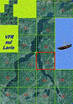
This is the twelfth scenery of the "VFR of Lario" project, made with
photorealistic terrain (multiseason & night) and with some 3D GMax realistic objects.
This scenery covers approximately an area of 7.5x6 kmt, from Limonta (NW) to the northern Grigna mountain (NE), from Onno (SW) to southern Grigna mountain (SE); some of specific buildings are included, as the small church and Museum of Cycling (Ghisallo), villa at pier (Limonta) and interruption of the freeway overpass (Mandello del Lario ... waiting for the next B3 scenery); are included five NLC piers (Limonta, Onno, Vassena, Lierna and Mandello del Lario) and two small motorboat (Ninfea and Giglio) of the NLC navigation; there are also included six sections of the freeway SS36 with its overpasses and tunnels. Some other minor boats and docks are placed alongside the lake coast.
Check video available here: http://youtu.be/q9I5B6oF4ZY
| Filename: | VFR_of_Lario_Area_C3__Como_lake_Italy.zip |
| License: | Freeware |
| Added: | 30th April 2013, 23:20:59 |
| Downloads: | 829 |
| Author: | Aldo Della Vedova, Daniele Lanfranchi, Gian Mario Verga |
| Size: | 22.95 MB |
| Category: Flight Simulator 2004 - AI Aircraft | |
| Forca Aerea Portuguesa Fiat/Aeritalia G.91 |
|
Images related to this file:
File Description:

Forca Aerea Portuguesa Fiat/Aeritalia G.91. I present a comprehensive AI traffic model package for this backbone of close air support in Europe during the Cold War years. The G.91 was built to suit a requirement for a NATO-compatible aircraft for close air support and light strike roles, able to operate from terrain as primitive as a flat grassy meadow (I found photos during research that support this). Going into production in 1961, this aircraft was manufactured for 19 years and served three European air forces for 35 years. The G.91 saw extensive combat service in Africa while operated by the Portuguese Air Force.
An original 7-LOD model brings this historic aircraft to the flightsim world. This package represents the G.91 in the service of the Forca Aerea Portuguesa ; with a total of 10 models and 56 repaints. Aircraft models covered are the G.91R3, G.91R4, and G.91T3. Aircraft, textures, and flight dynamics by Michael Pearson.
| Filename: | Forca_Aerea_Portuguesa_FiatAeritalia_G91.zip |
| License: | Freeware |
| Added: | 7th October 2013, 22:35:02 |
| Downloads: | 497 |
| Author: | Michael Pearson |
| Size: | 14.88 MB |
| Category: Flight Simulator 2004 - AI Aircraft | |
| Luftwaffe Fiat/Aeritalia G.91 |
|
Images related to this file:
File Description:

Luftwaffe Fiat/Aeritalia G.91. I present a comprehensive AI traffic model package for this backbone of close air support in Europe during the Cold War years. The G.91 was built to suit a requirement for a NATO-compatible aircraft for close air support and light strike roles, able to operate from terrain as primitive as a flat grassy meadow (I found photos during research that support this). Going into production in 1961, this aircraft was manufactured for 19 years and served three European air forces for 35 years. The G.91 saw extensive combat service in Africa while operated by the Portuguese Air Force.
An original 7-LOD model brings this historic aircraft to the flightsim world. This package represents the G.91 in the service of the Luftwaffe; with a total of 10 models and 86 repaints. Aircraft models covered are the G.91R3, G.91R4, and G.91T3. Aircraft, textures, and flight dynamics by Michael Pearson.
| Filename: | Luftwaffe_FiatAeritalia_G91.zip |
| License: | Freeware |
| Added: | 7th October 2013, 22:35:54 |
| Downloads: | 604 |
| Author: | Michael Pearson |
| Size: | 21.16 MB |
| Category: Flight Simulator X - Gauges | |
| Flypad Gauge |
|
Images related to this file:
File Description:

This gauge has been developed on Win7 for FSX Flight Simulator SP2 or SP1.It should also work with Acceleration, but this is not guaranteed by the author. The gauge is a little extra addon based on the design of a smart phone and provides 9 different displays which are different from all of the standard gauge displays on a regular aircraft panel. It is mainly helpful for the user flying small propeller aircraft, and old timer aircraft. However, the displays are as well attractive for sim pilots flying modern jet aircraft. Use it as if you just grabbed to your smart phone during a flight and check on the status of your aircraft,
or how the terrain awareness situation looks like, how the AI traffic on the radar is, while you proceed with your flight plan. Enjoy the new design of a simple aircraft attitude display during an ILS approach. For credits look at the pdf documentation inside the zip file. By Dietmar Loleit
| Filename: | Flypad_Gauge.zip |
| License: | Freeware |
| Added: | 6th June 2014, 20:59:12 |
| Downloads: | 396 |
| Author: | Dietmar Loleit |
| Size: | 3.82 MB |
| Category: Flight Simulator 2002 - Scenery | |
| The Bolzano Challenge |
|
File Description:
Bolzano LIPB scenery for FS2002. Bolzano airport is situated in the Dolomiti Alps of North Italy surrounded by steep rising hills. The dangerous approach for this airport is one of Europe's hardest. In the color IFR charts included you will find what it takes to do the standard landing approach for rwy 01, the standard missed approach and the standard istrument departure. In real, only authorised pilots by Italy CAA are allowed to fly this demanding approach. The approach is an offset LOCDME, with a track that maintains terrain clearance, requiring you to fly a steep descent of 5 degrees where there is no glideslope guidance. When I saw that this amazing airport is FS2002 has only a runway and tower, I decided to create this addon which is a simple enhancing scenery for an airport left out empty by MS. The scenery includes, lighted taxiways, aprons, lighted terminal and hangars, perimeter fence, extra trees and correct approach lighting. ASD Textures included.
| Filename: | The_Bolzano_Challenge.zip |
| License: | Freeware |
| Added: | 28th November 2002, 03:13:52 |
| Downloads: | 4,741 |
| Author: | Kyprianos Biris |
| Size: | 1.71 MB |
| Category: Flight Simulator 2004 - Flight Plans | |
| Leisure International Level D Flightplan |
|
File Description:
Using information gathered and sent to me by a wonderful individual off the LDS forums, I have compiled the flightplan to reenact the famous Leisure Intl trip from EGKK London Gatwick to KMCO Orlando Intl. This file is ready to fly, just need to input the other data such as your ZFW, etc. All waypoints and routes included INCLUDING the departure and arrival speed/altitude constraints as published in the official charts!!!! This is for the FMC of the Level D Simulation aircraft. I also recommend using the OSS Gatwick 2004 scenery and the Simflyers KMCO scenery, along with FSGenesis terrain meshes to give the best effect for this wonderful flight. Of course who would want to fly this without the awesome Leisure International repaint here in the AVSIM library? No readme included. The procedure is simple -- download it, unzip it and place it in your /Level-D Simulations\navdata\Flightplans folder. Enjoy!!!!!
| Filename: | Leisure_International_Level_D_Flightplan.zip |
| License: | Freeware |
| Added: | 28th April 2005, 13:15:58 |
| Downloads: | 2,004 |
| Author: | Christopher N. Dittmar |
| Size: | 3.77 KB |
| Category: Flight Simulator 2004 - Scenery Design | |
| Land Classification Visual Reference |
|
File Description:
Welcome to the visual reference for Land Classifications used with MSFS 2002 and 2004. This reference is not tested with MS Flight Simulator X, but I guess it could be very helpful there too.
You are able to see how a specific Land Classification Value will look in MSFS without building a .bgl file first. You can even compare different Values right away to make an easy decision of which one to use.
Since this reference is a PDF file, you don't need any other tool, but a PDF reader or editor of your choice.
The amount of the visual references is very complete, at least as far as the documentation of the SDK for Terrain Modeling is complete.
All the screenshots are taken at Ibiza, Spain at the exact same location, angle of view, season, date and time with identical weather conditions. This way it is easy to compare the different Land Classifications and get an idea of how they really look.
| Filename: | Land_Classification_Visual_Reference.zip |
| License: | Freeware |
| Added: | 23rd October 2006, 22:28:34 |
| Downloads: | 1,397 |
| Author: | Gerhard Scheuerecker |
| Size: | 18.2 MB |
| Category: Flight Simulator 2004 - Scenery | |
| Canadian and Northern USA Winter Flying |
|
File Description:
This is an expanded version of a previous post a year ago, and stretches from east of Quebec City through Quebec, Ontario, and Manitoba, and now also through Saskatchewan, and into Alberta (past Calgary). There is also a northern area roughly centered on Hudson Bay. The exact coverages are given in the notes. All rivers and lakes within the area will "freeze" and allow ski planes to land, or even wheeled planes come to that. And it is not permanent, when you want to go back to floats just "untick" it in the FS library, and it will melt. The area covered crosses into the US too, down to around 45 degrees north, so that means most of Montana, all of North Dakota, half of Minnesota, and some of Wisconsin, Michigan etc. It seemed silly to stop at the border. Ultimate Terrain is highly recommended, so that there will actually be the right lakes and rivers ready to freeze.
| Filename: | Canadian_and_Northern_USA_Winter_Flying.zip |
| License: | Freeware |
| Added: | 26th May 2008, 13:24:29 |
| Downloads: | 669 |
| Author: | Roger Wensley |
| Size: | 354.86 KB |
| Category: Flight Simulator 2004 - Scenery | |
| KSGU-Saint George, Utah |
|
File Description:
The 6600' long St. George airport in southwestern Utah sits high on a mesa! You grasp your armrest hoping that you will become airborne before you fall off the cliff...Or just after landing you are nervously waiting for the pilot to apply the brakes as the end of the runway rushes up to meet you before you fall into nothingness! Such is the fate that awaits the pilot or passenger that ventures to the Saint George, Utah airport.
Actually, it is a very safe and delightful airport to base your flights from. Visit Southern Utah and see the many sights that await the adventurous soul. Take a trip from KSGU to Moab-KCNY or KVEL and marvel at the diversity of the landscape. ( I upgraded those 2 airports also.)
While designed for use with Ultimate Terrain, this enhancement should work with the default FS2004 setting. Please unzip to a temporary folder and follow the simple installation instructions.
| Filename: | KSGUSaint_George_Utah.zip |
| License: | Freeware |
| Added: | 23rd August 2008, 09:49:58 |
| Downloads: | 1,411 |
| Author: | Alan C. Heiner |
| Size: | 664.81 KB |
| Category: Flight Simulator X - Scenery | |
| Terra Firma Ground Detail |
|
File Description:
Well, most of you probably have used a couple of different detail1.bmp textures either for FS9 or FSX. Many of those seemed to be aimed at achieving a grassy look. With this texture however I have tried to create a more alround yet more detailed look that will work on pretty much any terrain, whether you fly over mountains, farming fields or beautiful forests.
I've kept the texture size at 1024 x 1024 simply because I think it blends in better that way with the underlying default textures. And even with high quality addons I prefer this specific texture to enhance the underlying textures, I don't feel it should dominate it.
I'm an avid virtual bushflyer so I find myself flying over natural areas most of the time. So with that in mind I didn't try to create this texture for urban areas, however I don't think it looks that bad over cities.
| Filename: | Terra_Firma_Ground_Detail.zip |
| License: | Freeware |
| Added: | 12th April 2009, 22:33:33 |
| Downloads: | 4,457 |
| Author: | Erik Hardenbol |
| Size: | 557.86 KB |


© 2001-2026 AVSIM Online
All Rights Reserved
Privacy Policy |