
Where Flight Simulation Enthusiasts Gather from Around the World!
AVSIM Library - Search Results

| Category: Flight Simulator 2004 - Scenery | |
| Canlaon Volcano Eruption Scenery |

|
File Description:
Canlaon Volcano is located at the center of Negros Island,Philippines.The twin-peaked massif of Canlaon Volcano (aka Mt. Kanlaon) rises 2,465 meters above the island of Negros just 40-km southwest of the capital Bacolod.This file will add the crater to Canlaon Volcano and will enhance the Landclass surrounding the crater.The crater is real with water.This also adds Visual Effects such as steam,volcanic ashes and lava that will erupt every now and then.Ash falls will fall in the vulnerable surrounding villages of Pula, Malaiba, and Lumanao.The last volcanic activity of Canlaon Volcano recorded by Phivolcs was on June 1-18,2003.
Fly from Bacolod City(RPVB)to Tagbilaran City(RPVT)or Mactan(RPVM) and pass through the highest point of the Island of Negros and behold the beauty of the Canlaon Volcano eruption.
Special steam,ash,and lava effects are visible at daytime and at nighttime.The new Philippine Mesh by Jacques Marie is recommended for achieving realistic topography.You may find it here at avsim,too.
| Filename: | Canlaon_Volcano_Eruption_Scenery.zip |
| License: | Freeware |
| Added: | 10th December 2003, 22:41:38 |
| Downloads: | 3,879 |
| Author: | Ver Walter L. Gulfan |
| Size: | 5.04 KB |
| Category: Flight Simulator 2004 - Scenery | |
| Fascene Airport - Nosy Be Island, Madagascar |
|
Images related to this file:
File Description:

In Italy the poltical situation is very caotic! what is better of an exotic place for a time of relax? :-) With this scenery, I wanted to recreate as much as possible the area of the airport "Fascene" located in Nosy Be Island in Madagascar. To do it, i used the srtm mesh Madagsacar by Mr Jean laurent gabriel that you will find already in the scenery. If you have already installed these meshes need to remove them. The scenery, faithfully recreates the terminal, and therefore there is a generic airport using the Bgl Mr. Visan. for the rest, using the real video and real photo, I tried to recreate the atmosphere of the island, which is certainly very exciting to work with a landing jetliner. If so you're tired of the usual ILS landing in mega hub of Europe, a nice Visual land in Nosy Be, is for you!
Best regards from Italy by Fabio "Fafo Air" Ferrari
| Filename: | Fascene_Airport__Nosy_Be_Island_Madagascar.zip |
| License: | Freeware |
| Added: | 26th February 2013, 06:49:34 |
| Downloads: | 1,643 |
| Author: | Fabio Ferrari |
| Size: | 40.42 MB |
| Category: Flight Simulator X - Scenery | |
| 70 Colombia Airports |
|
File Description:
70 Colombia airports/airfields for FSX. Mainly based on GoogleEarth. Changes to default airports and many new airports added. Largely based on my formerr FS9 colombian airport sceneries. I am using the FreeMesh X Global 1.0 from https://www.avsim.com/forums/topic/467933-freemesh-x-global-10-release-announcement/ but most sceneries should work also with the default or any other mesh. All files start with the ICAO identifier of the airport; so you can take out what you don't like or use only what you like.
Airports included are: ACM (IATA Code), SK53,SKAG,SKAO (now SKMJ) SKAS, SKBC, SKBE, SKBM, SKBN, SKBQ, SKBS, SKBU, SKCA, SKCB, SKCI, SKCN, SKCR, SKCZ, SKEB, SKFE, SKFL, SKGA, SKGI, SKGY, SKHA, SKHC, SKIB, SKIM, SKIO, SKIR, SKLA, SKLB, SKLC, SKLP, SKLT, SKMF, SKMG, SKMO, SKMO, SKNA, SKNV, SKOE, SKOT, SKPA, SKPD, SKPI, SKPP, SKPV, SKPZ, SKQU, SKRI, SKSA, SKSF, SKSJ, SKSV, SKTB, SKTM, SKTQ, SKUA, SKUM, SKUR, SKVG,
SLVP, SQFR, SQOA, SQPS, SQUJ, SQVZ, Z09A
| Filename: | 70_Colombia_Airports.zip |
| License: | Freeware |
| Added: | 6th January 2019, 17:39:01 |
| Downloads: | 2,448 |
| Author: | Detkev J. Rohmer |
| Size: | 106.4 MB |
| Category: Flight Simulator 2004 - Scenery | |
| Airstrips of Poland |
|
Images related to this file:
File Description:
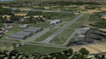
Expanding my horizons from Western Europe, herewith about 70 small airfields in Poland, many of which are not included in FS2004, each enhanced with taxiways, parking spaces, buildings etc. and aprons as appropriate, to further facilitate the generation of lightweight AI traffic in the area, without overloading the more major airfields.
Again, there's no photo-realism here, just a selection of basic 'generic' buildings, more or less accurately sized and placed to reflect the airfield layout as seen on on-line satellite imagery and aerial photography. These buildings have minimal effect on frame-rates, so are ideal for this kind of job. The airfields are aligned as well as possible with the roads etc. in UT Europe and the Genesis Europe mesh, but should mostly be fine in a default installation or other configuration.
Please read the rest of this "blurb" in the included text file. There may be some details of note or interest.
| Filename: | Airstrips_of_Poland.zip |
| License: | Freeware |
| Added: | 21st January 2025, 15:58:08 |
| Downloads: | 114 |
| Author: | Chris Eve |
| Size: | 650.89 KB |
| Category: Flight Simulator 2004 - Miscellaneous Files | |
| Map BMP Pack 1 |
|
Images related to this file:
File Description:
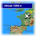
FeelThere Map! will display the track of your flight. In addition, a sequence of screens shows a variety of flight information such as elapsed and remaining time, distance, altitude, wind information, and temperature, this pack contains .bmp files for 220 airlines, incluiding airlines like Aeroflot, Aeromexico, Air Canada, Air China, Air Europa, Air France, Air New Zealand, Alitalia, All Nippon Airways, American Airlines, Asiana Airlines, Austrian Airlines, British Airways, Cathay Pacific Airways, China Eastern Airlines, China Southern Airlines, Delta Air Lines, EgyptAir, Finnair, Iberia, Japan Airlines, KLM, Korean Air, LAN, LOT, Lufthansa, Qantas, Royal Jordanian, S7 Airlines, Scandinavian Airlines, Singapore Airlines, South African Airways, Swiss International Airlines, TAM, TAP, Thai, Turkish Airlines, United Airlines and more, you need the FEELTHERE - MAP! to use these files.
**************************************
FeelThere Map! mostrara todo el trayecto de tu vuelo. Asi como tambien, una secuencia de pantallas que muestran informacion del vuelo como el tiempo transcurrido y el restante, la distancia, la altitud, informacion del viento y de la temperatura, este paquete contiene archivos .bmp para 220 aerolineas, entre ellas estan Aeroflot, Aeromexico, Air Canada, Air China, Air Europa, Air France, Air New Zealand, Alitalia, All Nippon Airways, American Airlines, Asiana Airlines, Austrian Airlines, British Airways, Cathay Pacific Airways, China Eastern Airlines, China Southern Airlines, Delta Air Lines, EgyptAir, Finnair, Iberia, Japan Airlines, KLM, Korean Air, LAN, LOT, Lufthansa, Qantas, Royal Jordanian, S7 Airlines, Scandinavian Airlines, Singapore Airlines, South African Airways, Swiss International Airlines, TAM, TAP, Thai, Turkish Airlines, United Airlines y muchas mas, necesitaras el FEELTHERE - MAP! para usar estos archivos.
| Filename: | Map_BMP_Pack_1.zip |
| License: | Freeware |
| Added: | 15th September 2011, 13:20:03 |
| Downloads: | 2,265 |
| Author: | Juan Rodriguez, AeroSimulaciones, FeelThere |
| Size: | 26.56 MB |
| Category: Flight Simulator X - Scenery | |
| Redtail Ridge Island Resort (AK94) |
|
File Description:
Redtail Ridge is a fictitious place in Alaska, but it's name is somewhat misleading as there is no ridges on the island. The airport boasts a 2300x45FT dirt runway, although it displays as a snow runway. There is also a 10000FT water runway, marked at each end with a red buoy. The airport is mainly intended as a place for the weary bush pilot to go and relax. There is a line of lakeside cabins to stay in, and there's even three little docks for floatplanes to tie up at. Also available are a selection of boats to rent, both sailboats and motorboats. For transportation around, there is a even a rental car angency. If the cabins are filled, stay in the hotel or sleep outdoors in the campsites. Go shopping at the mall or grab a bite to eat at the fast food joints. Anything you need to relax, you can find it here!
| Filename: | Redtail_Ridge_Island_Resort_AK94.zip |
| License: | Freeware |
| Added: | 2nd January 2008, 02:49:44 |
| Downloads: | 716 |
| Author: | Joe Brown |
| Size: | 5.2 KB |
| Category: Flight Simulator X - Missions | |
| Rescue Bill Bunyan |
|
File Description:
Jake, the Bold Airport (Alaska) manager just got a CB call from Bill Bunyan, master sasquatch tracker. Bill has hurt his right ankle quite seriously, and needs to by picked up by someone with a ski-equipped airplane. Your Maule is just such a plane. Bill isn't quite sure exactly where he is, but does know he's not too far from Bold Ridge. So you have one waypoint to work with. After that it's up to you. To help, Bill is burning a campfire. He says it's fairly flat at his location, but to watch out for bushes, small trees, and grizzly bears. As an experienced mountain flyer, you know that such rescues benefit from getting as much altitude as the weather allows, before getting into the mountains. Bill thinks he's in an area that's 4000 or more feet ASL, but it's snowing heavily. Don't forget to lower your skis before landing at Bill's location, and to raise them before landing back at the Airport.
| Filename: | Rescue_Bill_Bunyan.zip |
| License: | Freeware |
| Added: | 7th December 2014, 22:48:28 |
| Downloads: | 641 |
| Author: | Dan Cowan |
| Size: | 41.11 MB |
| Category: Flight Simulator 2004 - Scenery | |
| Misty Moorings DynaScene Scenario - 08/18/2005 |
|
File Description:
DynaScene scenario based scenery file for Misty Moorings members and other interested parties. (Misty Fjords Scenery from www.fsaddon.com required). Provides background text, photos, and scenery for a temporary scenario. Story as follows: NEWS FLASH! 08/18/2005 - BUSH PILOT GROUNDED PENDING INVESTIGATION - KETCHIKAN (APX) - The alaska wilderness is no stranger to strange tales. At least that's how it appears in the case of a local bush pilot, Randy Morgan, who had quite a large one to tell.
At 6 PM on the evening of the 16th, Randy and one passenger took off in a Cessna 182RG from Maloney's Tavern on his way back to Ketchikan. "The weather was good and I had no idea what was about to happen" said Randy Morgan. "We had planned our flight to pass over Raptor's Roost and Punchbowl Lake before heading into Ketchikan when I saw it." (full text in download) - Makes use of Rwy12 libraries by Seev Kahn and Glen Gordon (included in download).
| Filename: | Misty_Moorings_DynaScene_Scenario__08182005.zip |
| License: | Freeware |
| Added: | 22nd August 2005, 01:04:19 |
| Downloads: | 968 |
| Author: | Glen Gordon (Professor Khaos) |
| Size: | 4.76 MB |
| Category: Flight Simulator 2004 - AFCAD Files | |
| King County International (Boeing Field - KBFI) |
|
File Description:
King County International Airport is located 5 miles south of downtown Seattle and has the distinction of being the Boeing Company's final test site for the 737, 757, and 777 aircraft. Flight plans are included for 14 aircraft undergoing final tests prior to delivery to their respective airlines. Each aircraft will fly Monday through Friday for flights of approximately 3-1/2 hours. Since FS9 doesn't support flights that depart and arrive at the same airport, I've added a waypoint where the a/c can stop over for 15 minutes. The stopover is at Annette Island, Alaska, and I've included an AFCAD for an upgraded Annette Island "International" airport that, of course, doesn't really exist. If you wish to visit Annette Island International, there are runways equipped with the latest in ILS instrumentation. See the additional documentation I've included in the READ MEs. Commercial flights from Boeing Field are also provided by Helijet and San Juan Airlines.
| Filename: | King_County_International_Boeing_Field__KBFI.zip |
| License: | Freeware |
| Added: | 15th March 2004, 06:30:36 |
| Downloads: | 4,183 |
| Author: | Steve Lewis |
| Size: | 637.02 KB |
| Category: Flight Simulator 2004 - Scenery Design | |
| Land Classification Visual Reference |
|
File Description:
Welcome to the visual reference for Land Classifications used with MSFS 2002 and 2004. This reference is not tested with MS Flight Simulator X, but I guess it could be very helpful there too.
You are able to see how a specific Land Classification Value will look in MSFS without building a .bgl file first. You can even compare different Values right away to make an easy decision of which one to use.
Since this reference is a PDF file, you don't need any other tool, but a PDF reader or editor of your choice.
The amount of the visual references is very complete, at least as far as the documentation of the SDK for Terrain Modeling is complete.
All the screenshots are taken at Ibiza, Spain at the exact same location, angle of view, season, date and time with identical weather conditions. This way it is easy to compare the different Land Classifications and get an idea of how they really look.
| Filename: | Land_Classification_Visual_Reference.zip |
| License: | Freeware |
| Added: | 23rd October 2006, 22:28:34 |
| Downloads: | 1,397 |
| Author: | Gerhard Scheuerecker |
| Size: | 18.2 MB |


© 2001-2026 AVSIM Online
All Rights Reserved
Privacy Policy |