
Where Flight Simulation Enthusiasts Gather from Around the World!
AVSIM Library - Search Results

| Category: Flight Simulator 2004 - Scenery | |
| Armstrong Ontario; one airfield and two float bases |

|
File Description:
Armstrong CYYW airfield is 70 miles northeast of Thunder Bay, and close to Lake Nipigon. There isn't much of interest at the airfield by way of buildings (as there aren't many buildings!) and the only plane I saw was a fire fighting Canadaair CL 415. A basic airfield with one runway with lights and one without, and no maintenance. There is fuel, but it is locked up and not for sale.
The two float bases are 5 miles west (CJF6) and 10 miles southwest (CKN6) of Armstrong airfield. Lake Mackenzie is home to two companies, Armstrong Outposts (two Beavers) and Huron Air & Outfitters (an Otter and a Beaver) who both run fishing and hunting lodges. Wilderness North are further south on Lake Waweig, and I think they fly two Otters and a Beaver to their outpost camps. You need Ultimate Terrain, or there won't be any lakes!
| Filename: | Armstrong_Ontario_one_airfield_and_two_float_bases.zip |
| License: | Freeware |
| Added: | 24th February 2009, 00:51:42 |
| Downloads: | 894 |
| Author: | Roger Wensley |
| Size: | 7.03 MB |
| Category: Flight Simulator 2004 - Scenery | |
| Opa's Campground on Lake Texoma. |
|
Images related to this file:
File Description:
Opa's Campground. A ficticious campground located on the shores of beatiful Lake Texoma on the Texas-Oklahoma border. Created with the EZ and RWY12 Object placing programs, the scenery is packed with eye candy and some unusual features including AI Helicopter rides, an AI Windsurfer and AI boats moving about the lake plus fireworks on the 4th of July. There is a landing strip at the campground for those who arrive by air and start locations for seaplanes and automobiles. Lago sound files are included for those who have the Lago FSE program (optional). The scenery is designed to be used with the default FS2004 setup - it is not compatible with Ultimate Terrain - USA. If you are seeking a great place to "get away" for some fun, this is it. Please unzip (using folders option) to a temporary folder and follow the simple installation directions.
| Filename: | Opas_Campground_on_Lake_Texoma.zip |
| License: | Freeware |
| Added: | 10th December 2009, 14:58:21 |
| Downloads: | 776 |
| Author: | David "Opa" Marshall |
| Size: | 2.06 MB |
| Category: Flight Simulator X - Flight Plans | |
| Chas mod of Stearmandriver RNP RNAV Approach into PAJN Rwy 26 for 737NGX |
|
Images related to this file:
File Description:
Modded StearmanDriver(SD) RNP RNAV Rwy 26 into PAJN, Juneau, Alaska. SD gave us a cool little route that while not LATLONG nor Fixname accurate, it couldn't be without legal and occupational liabilities...and it worked, but if you look at his FixNames and the LATLONG from the PAJN.txt file for the 737 NGX...it did work pretty nicely...at least as nicely as the charted RNAV course into Rwy 8. So I created my own procedure LATLONG rightly or wrongly in a multi-step procedure as follows:
1. I took the raw info provided by SD and flew to each of his waypoints,(if you look, almost all of his FIXs were rounded off...to avoid company or legal problems) noting safe altitude, starting out at 7000ft, creating user waypoints in my GTN750, looking around for first, vertical, then horizontal safety...keeping in mind that Ultimately...I would not be using this data for my Duke, but for the Procedure page of my PMDG 737 NGX..which you already saw me fly with SD's fixes.
2. I took my Turbine Duke up and noted the REAL LATLONG as reported by slewing and world map...transposed those numbers into the format that PMDG's procedures needed DDD.mm fractional minutes. I converted using http://www.directionsmag.com/site/latlong-converter/
3.I created my own mid-point user waypoints from the west CHRTRN,and the NNE CHRTS so we could have approaches from those directions.
4. I put my Duke into autopilot, knowing the lateral info...my flightplan was correct, but I would have to handle the Vnav manually. Turns out its rather manageable with the following info: CHRTRN 5000FT - MARMN 3500FT - TRDWL 2500FT - SALMN 1500 - LEMNN 500 - PAJN5 50
My MOD OF SDs RNP RNAV PAJNRwy 26, will be up on Avsim as ChasModRNP RNAV PAJN Rwy 26.zip
Contact:[email protected] - Support: http://forum.avsim.net/topic/466094-any-interest-in-updated-se-alaska-rnav-rnp-approach-procedures-including-juneau/
| Filename: | Chas_mod_of_Stearmandriver_RNP_RNAV_Approach_into_.zip |
| License: | Freeware |
| Added: | 8th May 2015, 11:35:16 |
| Downloads: | 340 |
| Author: | Chas Reed |
| Size: | 144.78 KB |
| Category: Flight Simulator 2004 - Miscellaneous Files | |
| Map BMP Pack 1 |
|
Images related to this file:
File Description:
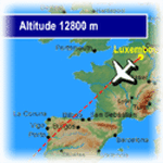
FeelThere Map! will display the track of your flight. In addition, a sequence of screens shows a variety of flight information such as elapsed and remaining time, distance, altitude, wind information, and temperature, this pack contains .bmp files for 220 airlines, incluiding airlines like Aeroflot, Aeromexico, Air Canada, Air China, Air Europa, Air France, Air New Zealand, Alitalia, All Nippon Airways, American Airlines, Asiana Airlines, Austrian Airlines, British Airways, Cathay Pacific Airways, China Eastern Airlines, China Southern Airlines, Delta Air Lines, EgyptAir, Finnair, Iberia, Japan Airlines, KLM, Korean Air, LAN, LOT, Lufthansa, Qantas, Royal Jordanian, S7 Airlines, Scandinavian Airlines, Singapore Airlines, South African Airways, Swiss International Airlines, TAM, TAP, Thai, Turkish Airlines, United Airlines and more, you need the FEELTHERE - MAP! to use these files.
**************************************
FeelThere Map! mostrara todo el trayecto de tu vuelo. Asi como tambien, una secuencia de pantallas que muestran informacion del vuelo como el tiempo transcurrido y el restante, la distancia, la altitud, informacion del viento y de la temperatura, este paquete contiene archivos .bmp para 220 aerolineas, entre ellas estan Aeroflot, Aeromexico, Air Canada, Air China, Air Europa, Air France, Air New Zealand, Alitalia, All Nippon Airways, American Airlines, Asiana Airlines, Austrian Airlines, British Airways, Cathay Pacific Airways, China Eastern Airlines, China Southern Airlines, Delta Air Lines, EgyptAir, Finnair, Iberia, Japan Airlines, KLM, Korean Air, LAN, LOT, Lufthansa, Qantas, Royal Jordanian, S7 Airlines, Scandinavian Airlines, Singapore Airlines, South African Airways, Swiss International Airlines, TAM, TAP, Thai, Turkish Airlines, United Airlines y muchas mas, necesitaras el FEELTHERE - MAP! para usar estos archivos.
| Filename: | Map_BMP_Pack_1.zip |
| License: | Freeware |
| Added: | 15th September 2011, 13:20:03 |
| Downloads: | 2,263 |
| Author: | Juan Rodriguez, AeroSimulaciones, FeelThere |
| Size: | 26.56 MB |
| Category: Flight Simulator X - AFCAD Files | |
| Malone Airport (NJ61), NJ |
|
File Description:
Located 02 miles E of Frenchtown, New Jersey on 45 acres of land, Malone is a private airport with two turf strips, the longest of which is 2400' in length. There are no services offered, although there is room next to the existing planes to park if you wish - collisions are disabled with the aircraft. Both runways have their hard surfaces removed so turn your mesh settings as high as possible. Both runways slope down from the hangar/house area. Airport is unlit and daytime VFR operations only are recommended.
Scenery constructed with use of satellite images/streetview/aerial photos - the author has not been there in person.
This scenery is meant to be used in conjunction with MegaScenery Earth New York 007. It is not required, but apron use is minimized to allow satellite scenery to show through as much as possible, and objects are placed based on the MSE textures - lack of it may make scenery look out of place.
| Filename: | Malone_Airport_NJ61_NJ.zip |
| License: | Freeware |
| Added: | 20th September 2011, 13:57:18 |
| Downloads: | 284 |
| Author: | Drew Sikora |
| Size: | 958.34 KB |
| Category: Flight Simulator 2004 - Scenery | |
| Airstrips east of the Alps |
|
File Description:
A collection of over 70 small airfields in Hungary, Slovakia, Slovenia and Croatia, many of which aren't featured in FS2004, each enhanced with taxiways, parking spaces, buildings etc. and aprons as appropriate, to fill in a few gaps to the north-east of Italy and to allow the generation of lightweight GA AI traffic in this area and into the adjacent countries.Again, there's no photo-realism here, just a selection of basic 'generic' buildings, more or less accurately sized and placed to reflect the airfield layout as seen on on-line satellite imagery and aerial photography. These buildings have minimal effect on frame-rates, so are ideal for this kind of job. The airfields are aligned as well as possible with the roads etc. in UT Europe, where applicable, and the Genesis Europe mesh, but should mostly be fine in a default installation or other configuration.
| Filename: | Airstrips_east_of_the_Alps.zip |
| License: | Freeware |
| Added: | 12th September 2025, 13:29:14 |
| Downloads: | 58 |
| Author: | Chris Eve |
| Size: | 785.49 KB |
| Category: Flight Simulator 2004 - Scenery | |
| Airstrips of Poland |
|
Images related to this file:
File Description:
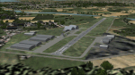
Expanding my horizons from Western Europe, herewith about 70 small airfields in Poland, many of which are not included in FS2004, each enhanced with taxiways, parking spaces, buildings etc. and aprons as appropriate, to further facilitate the generation of lightweight AI traffic in the area, without overloading the more major airfields.
Again, there's no photo-realism here, just a selection of basic 'generic' buildings, more or less accurately sized and placed to reflect the airfield layout as seen on on-line satellite imagery and aerial photography. These buildings have minimal effect on frame-rates, so are ideal for this kind of job. The airfields are aligned as well as possible with the roads etc. in UT Europe and the Genesis Europe mesh, but should mostly be fine in a default installation or other configuration.
Please read the rest of this "blurb" in the included text file. There may be some details of note or interest.
| Filename: | Airstrips_of_Poland.zip |
| License: | Freeware |
| Added: | 21st January 2025, 15:58:08 |
| Downloads: | 106 |
| Author: | Chris Eve |
| Size: | 650.89 KB |
| Category: Flight Simulator 2004 - Scenery | |
| Canlaon Volcano Eruption Scenery |
|
File Description:
Canlaon Volcano is located at the center of Negros Island,Philippines.The twin-peaked massif of Canlaon Volcano (aka Mt. Kanlaon) rises 2,465 meters above the island of Negros just 40-km southwest of the capital Bacolod.This file will add the crater to Canlaon Volcano and will enhance the Landclass surrounding the crater.The crater is real with water.This also adds Visual Effects such as steam,volcanic ashes and lava that will erupt every now and then.Ash falls will fall in the vulnerable surrounding villages of Pula, Malaiba, and Lumanao.The last volcanic activity of Canlaon Volcano recorded by Phivolcs was on June 1-18,2003.
Fly from Bacolod City(RPVB)to Tagbilaran City(RPVT)or Mactan(RPVM) and pass through the highest point of the Island of Negros and behold the beauty of the Canlaon Volcano eruption.
Special steam,ash,and lava effects are visible at daytime and at nighttime.The new Philippine Mesh by Jacques Marie is recommended for achieving realistic topography.You may find it here at avsim,too.
| Filename: | Canlaon_Volcano_Eruption_Scenery.zip |
| License: | Freeware |
| Added: | 10th December 2003, 22:41:38 |
| Downloads: | 3,877 |
| Author: | Ver Walter L. Gulfan |
| Size: | 5.04 KB |
| Category: Flight Simulator 2004 - Scenery | |
| Exploring Our World - Part 1. Canaima Park - Canaima Airport (SCVN) - Angel Falls, Venezuela |
|
Images related to this file:
File Description:

Exploring Our World - Part 1. Canaima Park - Canaima Airport (SCVN) - Angel Falls, Venezuela. Visit the worlds highest waterfall (16 times higher than Niagara) - one of the Natural Wonders of the World!
This new package features David Maldonado's excellent Mesh of Canaima Park in Venezuela and a very special "animated" depiction of Angel Falls by Ron Jeffers. The Canaima Airport has been enhanced using EZ Scenery libraries. There is also an optional Lago sound file created by Lou Frost. A brief history of Angel Falls along with a suggested tour of the area is included. You will also find a flight plan for use with the FSNavigator program. This is the first of a projected series exploring lesser known parts of our FS world. Please unzip (using folders option) to a temporary folder and follow the instructions very carefully.
This project was compiled for your flying enjoyment by David "Opa" Marshall.
| Filename: | Exploring_Our_World__Part_1_Canaima_Park__Canaima_.zip |
| License: | Freeware |
| Added: | 31st October 2009, 10:36:18 |
| Downloads: | 3,254 |
| Author: | David "Opa" Marshall |
| Size: | 3.22 MB |
| Category: Flight Simulator X - Scenery | |
| 70 Colombia Airports |
|
File Description:
70 Colombia airports/airfields for FSX. Mainly based on GoogleEarth. Changes to default airports and many new airports added. Largely based on my formerr FS9 colombian airport sceneries. I am using the FreeMesh X Global 1.0 from https://www.avsim.com/forums/topic/467933-freemesh-x-global-10-release-announcement/ but most sceneries should work also with the default or any other mesh. All files start with the ICAO identifier of the airport; so you can take out what you don't like or use only what you like.
Airports included are: ACM (IATA Code), SK53,SKAG,SKAO (now SKMJ) SKAS, SKBC, SKBE, SKBM, SKBN, SKBQ, SKBS, SKBU, SKCA, SKCB, SKCI, SKCN, SKCR, SKCZ, SKEB, SKFE, SKFL, SKGA, SKGI, SKGY, SKHA, SKHC, SKIB, SKIM, SKIO, SKIR, SKLA, SKLB, SKLC, SKLP, SKLT, SKMF, SKMG, SKMO, SKMO, SKNA, SKNV, SKOE, SKOT, SKPA, SKPD, SKPI, SKPP, SKPV, SKPZ, SKQU, SKRI, SKSA, SKSF, SKSJ, SKSV, SKTB, SKTM, SKTQ, SKUA, SKUM, SKUR, SKVG,
SLVP, SQFR, SQOA, SQPS, SQUJ, SQVZ, Z09A
| Filename: | 70_Colombia_Airports.zip |
| License: | Freeware |
| Added: | 6th January 2019, 17:39:01 |
| Downloads: | 2,420 |
| Author: | Detkev J. Rohmer |
| Size: | 106.4 MB |


© 2001-2026 AVSIM Online
All Rights Reserved
Privacy Policy |