
Where Flight Simulation Enthusiasts Gather from Around the World!
AVSIM Library - Search Results

| Category: Flight Simulator X - Utilities | |
| FS Earth 5.0 for Google Earth |

|
File Description:
This program acts as an interface between Flight Simulator X and Google Earth, letting to follow a flight in real time, over the satellite images generated by Google Earth. Flights can be saved, and many options are available for fine tuning the performance, as well as the map's style (zoom, tilt, orientation). Works on a single computer running FSX and Google Earth all together or, for best experience, can be used on two networked computers running respectively FSX (master) and Google Earth (slave). AI and Multiplayer traffic is also displayed in Google Earth, with course prediction and other information. Requires Flight Simulator X and Google Earth. The program running in trial mode works only around Anchorage, Alaska, (PANC / ANC) for a maximum of five minutes per flight session. Version 5.0 has improved compatibility with latest releases of Google Earth and several additional improvements. A version for FS2004 is available also.
| Filename: | FS_Earth_50_for_Google_Earth.zip |
| License: | Shareware, time limited |
| Added: | 19th July 2007, 00:46:27 |
| Downloads: | 1,104 |
| Author: | Luciano Napolitano |
| Size: | 2.44 MB |
| Category: Flight Simulator 2004 - Utilities | |
| FS Earth 5.2 for Google Earth and FS2004 |
|
File Description:
This program acts as a link between Flight Simulator 2004 and Google Earth, letting to follow a flight in real time, over the satellite images generated by Google Earth. Flights can be saved, and many options are available for fine tuning the performance, as well as the map's style (zoom, tilt, orientation). Works on a single computer running FS2004 and Google Earth all together or, for best experience, can be used on two networked computers running respectively FS2004 (master) and Google Earth (slave). AI and Multiplayer traffic is also displayed in Google Earth, with course prediction and other information. Requires Flight Simulator 2004 and Google Earth. The program running in trial mode works only around Anchorage, Alaska, (PANC / ANC) for a maximum of five minutes per flight session. Version 5.2 has new aircraft icons & labels and improves the compatibility with Windows Vista. A version for FSX is available also.
| Filename: | FS_Earth_52_for_Google_Earth_and_FS2004.zip |
| License: | Shareware, time limited |
| Added: | 4th September 2008, 19:11:30 |
| Downloads: | 1,241 |
| Author: | Luciano Napolitano |
| Size: | 3.59 MB |
| Category: Flight Simulator 2004 - Scenery | |
| Geneer AKR Stations A thru G v3.0 |
|
Images related to this file:
File Description:

Version 3.0! Seven fictional seaplane bases with helicopter support (three new from v2.0) located south of Juneau, Alaska. Scenery completely redesigned in Gmax for compatible use with Glacier Bay v2, Tongas Fjords, and Misty Fjords by Holger Sandman. All but one spot included one or more helipads, and are intended for cargo distribution and supplies, these seven AKR Stations were also intended to serve as tourism spots for hunting, fishing, skiing, camping, etc. Just fun little spots to hop in a floatplane. No AI traffic in this version, however afcads do accommodate for ai traffic.
All Objects fully designed and completely redone using higher resolution 32bit textures. Optional DXT textures included. Also includes new AFCAD files, animated hangar doors. No AI traffic tracks included with this release, but AFCAD designed to support AI. This v3.0 package is a Full Install (w/ effect file).
| Filename: | Geneer_AKR_Stations_A_thru_G_v30.zip |
| License: | Freeware, limited distribution |
| Added: | 15th June 2010, 22:28:01 |
| Downloads: | 818 |
| Author: | EdGeneer Cox |
| Size: | 45.66 MB |
| Category: Flight Simulator 2002 - Scenery | |
| Aleutian Islands Scenery Enhancement - Part I |
|
File Description:
This scenery enhances the Aleutian Islands in Alaska. Over 80 small, individual
scenery areas have been added to the Aleutians to provide VFR landmarks while
flying this area with World Aeronautical Charts. (WAC)
All cabin and building markers from WAC charts CE-12 and CE-13 are present in
the scenery. It consists mostly of cabins which are spread out through the Aleutians.
Unalaska has been completely enhanced, adding the city, ships, and docks to the default airport. Some floatbases (not covered by Dave's scenery) in the Aleutians now have corresponding cabins and wood docks around them.
This scenery is fully compatible with Dave Erickson's "Alaskan Docks 2" scenery,
and is HIGHLY recommended, as I did not touch any of the areas which are covered by that scenery, except for Unalaska, for which I used a city map to recreate and upgrade. Details in the readme.
| Filename: | Aleutian_Islands_Scenery_Enhancement__Part_I.zip |
| License: | Freeware |
| Added: | 18th November 2002, 04:06:24 |
| Downloads: | 2,912 |
| Author: | Jorge 'eko' Salas |
| Size: | 6.13 MB |
| Category: Flight Simulator X - Utilities | |
| FS Earth 5.2 for Google Earth and FSX |
|
Images related to this file:
File Description:
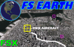
This program acts as a link between Flight Simulator X and Google Earth, letting to follow a flight in real time, over the satellite images generated by Google Earth. Flights can be saved, and many options are available for fine tuning the performance, as well as the map's style (zoom, tilt, orientation). Works on a single computer running FSX and Google Earth all together or, for best experience, can be used on two networked computers running respectively FSX (master) and Google Earth (slave). AI and Multiplayer traffic is also displayed in Google Earth, with course prediction and other information. Requires Flight Simulator X and Google Earth. The program running in trial mode works only around Anchorage, Alaska, (PANC / ANC) for a maximum of five minutes per flight session. Version 5.2 has new aircraft icons & labels and improves the compatibility with Windows Vista. A version for FS2004 is available also.
| Filename: | FS_Earth_52_for_Google_Earth_and_FSX.zip |
| License: | Shareware, time limited |
| Added: | 3rd May 2010, 07:38:23 |
| Downloads: | 2,703 |
| Author: | Luciano Napolitano |
| Size: | 3.46 MB |
| Category: Flight Simulator X - Utilities | |
| FS Earth 4.2 for Google Earth |
|
File Description:
This program acts as an interface between Flight Simulator X and Google Earth, letting to follow a flight in real time, over the satellite images generated by Google Earth. Flights can be saved, and many options are available for fine tuning the performance, as well as the map's style (zoom, tilt, orientation). Works on a single computer running FSX and Google Earth all together or, for best experience, can be used on two networked computers running respectively FSX (master) and Google Earth (slave). AI and Multiplayer traffic is also displayed in Google Earth, with course prediction and other information. Requires Flight Simulator X and Google Earth. The program running in trial mode works only around Anchorage, Alaska, (PANC / ANC) for a maximum of five minutes per flight session. Version 4.2 has improved compatibility with Windows Vista and minor bug fixes. A version for FS2004 is available also. By Luciano Napolitano.
| Filename: | FS_Earth_42_for_Google_Earth.zip |
| License: | Shareware, time limited |
| Added: | 9th March 2007, 13:39:05 |
| Downloads: | 2,214 |
| Author: | Luciano Napolitano |
| Size: | 2.44 MB |
| Category: Flight Simulator 2004 - Scenery | |
| Bethel Terminal Building correction |
|
Images related to this file:
File Description:
This is the correct substitute terminal building for Bethel PABE. Somehow, and I cannot now remember how it could possibly have happened, the wrong terminal building was included with the posting of an updated version of Bethel. I wrote at the time that the actual Bethel terminal building could not be made as it was too complicated to be made with the little information that was available. I then modified the Alaska terminal building from a previous scenery at Nome and included it in the Bethel scenery, as shown in the screenshots that were included with the posting of Bethel. But, somehow, the terminal from Barrow was wrongly included in the posting that is currently available. If you have the wrong terminal building (see the "wrong" screenshot) then substitute the attached bgl's for your existing ones and get the "correct" terminal as shown in the pic here.
| Filename: | Bethel_Terminal_Building_correction.zip |
| License: | Freeware, limited distribution |
| Added: | 30th July 2021, 04:29:00 |
| Downloads: | 135 |
| Author: | Roger Wensley |
| Size: | 2.16 MB |
| Category: Flight Simulator 2004 - AFCAD Files | |
| Yellowknife and Ekati with voice file. |
|
File Description:
FS2004 Afcad2 files to replace the default "CYZF", Yellowknife and "CYOA" Ekati Airfield, North West Territories, Canada. By default CYOA in FS9 has no facilities so the afcad has been produced with necessary tower frequency, large and small GA ramps, a small gate and one reduced radius cargo ramp. In addition we have included an "Ekati" voice file as FS9 refers to it just by the ICAO. Just in case anyone is interested, we created these afcads to allow our own and AI flight movements for a pair of Dash 7 freighters from Yellowknife to the Ekati and Diavik diamond region. As well as have facilities for larger associated cargo aircraft at Yellowknife. But everyone else is welcome to use them too. www.matva.org.uk
| Filename: | Yellowknife_and_Ekati_with_voice_file.zip |
| License: | Freeware, limited distribution |
| Added: | 31st August 2006, 02:55:57 |
| Downloads: | 737 |
| Author: | Louie Maclennan MATVA |
| Size: | 6.63 KB |
| Category: Flight Simulator 2004 - Scenery | |
| Port of Spain waterfront in Trinidad |
|
File Description:
Port of Spain is the capital of Trinidad and Tobago and happens to be where I am right now. As the flying down here is completely different to Canada (the only direction to go is north up the chain of islands, unless you want to be a suspected drug smuggler) and there aren't a whole bunch of airfields to model I turned my attention to the waterfront as a place where a floatplane would tie up. The result is here, and makes the harbour and some of the city more realistic. I had to use Lago for some of the buildings in the city itself but if you've never been to Trinidad then it won't make any diference to you if they're missing.
| Filename: | Port_of_Spain_waterfront_in_Trinidad.zip |
| License: | Freeware |
| Added: | 20th October 2007, 17:05:30 |
| Downloads: | 2,200 |
| Author: | Roger Wensley and Jim Turner |
| Size: | 1.29 MB |
| Category: Flight Simulator 2004 - Aircraft Repaints, Textures and Modifications | |
| US Airways Airbus A319-112 (N700UW) "STAR ALLIANCE" |
|
File Description:
I am proud to present this detailed, realistic repaint of the US Airways A319-112 in the STAR ALLIANCE livery, registration N700UW. This airframe was the first A319 for US Airways. It makes appearances at airports throughout the US, Canada and the Caribbean as a medium-haul workhorse for US Airways. I actaully flew on this very aircraft last week from KMDT to KCLT, which inspired me to repaint it. I did my fullest to pay attention to detail and realism in this repaint. This full installation package includes the Project Airbus A19 CFM model and air files. Most repainted textures are 32-bit with no mipmaps. Uses default 737-400 panel and sounds. Please see Readme.txt for installation details.
| Filename: | US_Airways_Airbus_A319112_N700UW_STAR_ALLIANCE.zip |
| License: | Freeware, limited distribution |
| Added: | 12th August 2008, 14:57:08 |
| Downloads: | 1,057 |
| Author: | Project Airbus, Jeffrey S. Bryner |
| Size: | 8.42 MB |


© 2001-2026 AVSIM Online
All Rights Reserved
Privacy Policy |