
Where Flight Simulation Enthusiasts Gather from Around the World!
AVSIM Library - Search Results

| Category: Flight Simulator 2002 - Scenery | |
| British Columbia Bush Scenery: Grant Narrows & Rambo's Hideout |

|
File Description:
The larger runway at Grant Narrows has a 15 degree bend, and the shorter runway is on a slope that involves an unconventional downhill landing & an uphill take-off (STOL planes only!). Both strips are bumpy, and require Holger Sandmann's mesh of the Lower Mainland of Southern British Columbia (bcmesh9c.zip) for the required effect. A dock is provided down on the lake shore for visitors on floats. The landing strips are fictional, set in an area of wilderness on the shores of Pitt Lake - but only 20 miles from downtown Vancouver. The first Rambo movie was filmed in the hills just to the east in the Golden Ears Provincial Park: if you fly north from Grant Narrows you'll find Rambo's airstrip hideout just a couple of miles past the end of the lake - the real life location of a popular fishing lodge. Also requires Gerrish Gray's trees (trees_v3.zip).
| Filename: | British_Columbia_Bush_Scenery_Grant_Narrows__Rambo.zip |
| License: | Freeware, limited distribution |
| Added: | 13th March 2003, 21:26:06 |
| Downloads: | 946 |
| Author: | James Belk |
| Size: | 1.74 MB |
| Category: Flight Simulator 2004 - Scenery Design | |
| ResampleTools V.095Beta |
|
File Description:
ResampleTools is a great little utility that helps you automate the import of Mesh or Photo Real scenery into
Flight Simulator 200x. The interface is a simple 4 or 6 step wizard depending
on what you are importing and the information you have about your source files.
FS Resample Tools can help you determine the extents of your bitmap source if
you don't already know them (all four corners in degrees) and will also
determine the CellX and CellY sample or pixel width from those corner extents among others.
This is a beta version and there will be no more updates as work on this tool stoped a while ago but the author has been kind enough to allow distribution to all who might enjoy using it,(note: this may have been replaced by Elronds "imagetool" also available soon in this library).
Works with FS2000/FS2002 and FS2004.
| Filename: | ResampleTools_V095Beta.zip |
| License: | Freeware, limited distribution |
| Added: | 21st September 2003, 18:50:03 |
| Downloads: | 1,621 |
| Author: | Elrond Elvish |
| Size: | 728.39 KB |
| Category: Flight Simulator 2004 - Scenery | |
| The Victoria Falls of the Zambezi River, Zambia/Zimbabwe |
|
File Description:
One of the main landmarks of Africa, the spectacular Victoria Falls of the Zambezi River are missing in out-of-the-box FS. With a local SRTM LOD9 mesh as a base (included) and the help of satellite imagery, maps, Ground2K4, and GMax, we did our best to model a realistic representation of the falls, the river, and the gorge, complete with custom waterfall and spray effects. The portion of the Zambezi covered in this project extends from E25 to E26.5 (more than 100km), with the falls at its center. Also included is a replacement landclass file for an area of about 20km on either side of the Zambezi River and an optional AI boat (by Lynn and Bill Lyons) cruising on the Zambezi above the falls. Tested with FS2004 only but most scenery enhancements (not the AI boat) should work just as well in FS2002.
| Filename: | The_Victoria_Falls_of_the_Zambezi_River_ZambiaZimb.zip |
| License: | Freeware, limited distribution |
| Added: | 8th May 2004, 02:45:30 |
| Downloads: | 19,142 |
| Author: | Holger Sandmann and Johan van Wyk, Aeroworx |
| Size: | 3.5 MB |
| Category: Flight Simulator 2004 - Scenery | |
| Revised East Vancouver Islands - compatible with vicenh05 |
|
File Description:
These files are a revision of the default Vancouver Island shorelines and landclass textures from Chemainus to Campbell River, British Columbia. Included are the islands from the Southern Gulf Islands to Texada Island and inland to Cowichan Lake. Most of the smaller lakes within 20 km of the shoreline have been redrawn as well. In this version shorelines have been revised to match Jon Patch & Holger Sandman's vicenh05.zip. As well major corrections for the shorelines in LOD5 area 117-114, Comox, have been made so that the shorelines now conform to the 38.2m mesh and to Vern Opperman's CFB - Comox version 042. Shoreline types are changed to look more like the Pacific Northwest courtesy of Holger Sandman's who made his shoreline textures for vicenh05 available. Also in this version no roads are included since complete British Columbia roads in bcroadsys.zip are now available.
| Filename: | Revised_East_Vancouver_Islands__compatible_with_vi.zip |
| License: | Freeware, limited distribution |
| Added: | 8th October 2005, 20:17:46 |
| Downloads: | 3,927 |
| Author: | Harvey Janszen |
| Size: | 346.85 KB |
| Category: Flight Simulator 2004 - Scenery | |
| Albian CAL4, Firebag CFG6, Horizon CYNR, Mildred Lake CER4, and Muskeg Tower CFW4 in Alberta Canada |
|
Images related to this file:
File Description:
All of these airfields are in or close to the Athabasca Tar Sands in Alberta, modelled here along with the airfields. The tar sands workings extend along the Athabasca River for over 60 miles north of Fort McMurray in northern Alberta, and the huge cleared areas, surface mining, tailings ponds, and refineries along the Athabasca are right up there as Alberta's biggest VFR landmark. One look at a tailings pond (sea? ocean?) makes it clear that someone was worried about public reaction to the size. As well as the surface mining there are also large areas where there is underground extraction with a grid of dirt tracks between equipment installations. There are four airfields associated with the tar sands. Horizon CYNR is a public service airport operated by Canadian Natural Reources Ltd. Mildred Lake CER4 is owned and operated by Syncrude. Albian CAL4 is owned and operated by Shell Canada, and Firebag CFG6 is owned and operated by Suncor Energy. The fifth airfield is the nearby Muskeg Tower CFW4, which is there solely to support folks during their fire watch in the 120 feet tall tower. There is also a sixth airfield east of Horizon across the river and still visible, Bitumount; this is no longer in use. There is Ai included involving Canadian North, North Cariboo, Wasaya, HTS, First Air, Suncor, etc.
| Filename: | Albian_CAL4_Firebag_CFG6_Horizon_CYNR_Mildred_Lake.zip |
| License: | Freeware, limited distribution |
| Added: | 4th October 2013, 22:12:42 |
| Downloads: | 938 |
| Author: | Roger Wensley |
| Size: | 16.75 MB |
| Category: Flight Simulator 2004 - AI Aircraft | |
| Air New Zealand Link/Air Nelson De Havilland Canada DHC-8-311Q Dash 8 'ZK-NEA' |
|
File Description:
A Repaint of the FSP Dash 8-Q300 model. A basic repaint for those simmers hanging out for this repaint.
| Filename: | Air_New_Zealand_LinkAir_Nelson_De_Havilland_Canada.zip |
| License: | Freeware |
| Added: | 5th October 2005, 14:50:12 |
| Downloads: | 1,810 |
| Author: | Cameron Bang |
| Size: | 227.36 KB |
| Category: Flight Simulator 2004 - Scenery | |
| Bethel Terminal Building correction |
|
Images related to this file:
File Description:
This is the correct substitute terminal building for Bethel PABE. Somehow, and I cannot now remember how it could possibly have happened, the wrong terminal building was included with the posting of an updated version of Bethel. I wrote at the time that the actual Bethel terminal building could not be made as it was too complicated to be made with the little information that was available. I then modified the Alaska terminal building from a previous scenery at Nome and included it in the Bethel scenery, as shown in the screenshots that were included with the posting of Bethel. But, somehow, the terminal from Barrow was wrongly included in the posting that is currently available. If you have the wrong terminal building (see the "wrong" screenshot) then substitute the attached bgl's for your existing ones and get the "correct" terminal as shown in the pic here.
| Filename: | Bethel_Terminal_Building_correction.zip |
| License: | Freeware, limited distribution |
| Added: | 30th July 2021, 04:29:00 |
| Downloads: | 134 |
| Author: | Roger Wensley |
| Size: | 2.16 MB |
| Category: Flight Simulator X - Utilities | |
| FS Earth 5.2 for Google Earth and FSX |
|
Images related to this file:
File Description:
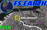
This program acts as a link between Flight Simulator X and Google Earth, letting to follow a flight in real time, over the satellite images generated by Google Earth. Flights can be saved, and many options are available for fine tuning the performance, as well as the map's style (zoom, tilt, orientation). Works on a single computer running FSX and Google Earth all together or, for best experience, can be used on two networked computers running respectively FSX (master) and Google Earth (slave). AI and Multiplayer traffic is also displayed in Google Earth, with course prediction and other information. Requires Flight Simulator X and Google Earth. The program running in trial mode works only around Anchorage, Alaska, (PANC / ANC) for a maximum of five minutes per flight session. Version 5.2 has new aircraft icons & labels and improves the compatibility with Windows Vista. A version for FS2004 is available also.
| Filename: | FS_Earth_52_for_Google_Earth_and_FSX.zip |
| License: | Shareware, time limited |
| Added: | 3rd May 2010, 07:38:23 |
| Downloads: | 2,701 |
| Author: | Luciano Napolitano |
| Size: | 3.46 MB |
| Category: Flight Simulator 2004 - Scenery | |
| Geneer AKR Stations A thru G v3.0 |
|
Images related to this file:
File Description:

Version 3.0! Seven fictional seaplane bases with helicopter support (three new from v2.0) located south of Juneau, Alaska. Scenery completely redesigned in Gmax for compatible use with Glacier Bay v2, Tongas Fjords, and Misty Fjords by Holger Sandman. All but one spot included one or more helipads, and are intended for cargo distribution and supplies, these seven AKR Stations were also intended to serve as tourism spots for hunting, fishing, skiing, camping, etc. Just fun little spots to hop in a floatplane. No AI traffic in this version, however afcads do accommodate for ai traffic.
All Objects fully designed and completely redone using higher resolution 32bit textures. Optional DXT textures included. Also includes new AFCAD files, animated hangar doors. No AI traffic tracks included with this release, but AFCAD designed to support AI. This v3.0 package is a Full Install (w/ effect file).
| Filename: | Geneer_AKR_Stations_A_thru_G_v30.zip |
| License: | Freeware, limited distribution |
| Added: | 15th June 2010, 22:28:01 |
| Downloads: | 816 |
| Author: | EdGeneer Cox |
| Size: | 45.66 MB |
| Category: Flight Simulator 2002 - Scenery | |
| Aleutian Islands Scenery Enhancement - Part I |
|
File Description:
This scenery enhances the Aleutian Islands in Alaska. Over 80 small, individual
scenery areas have been added to the Aleutians to provide VFR landmarks while
flying this area with World Aeronautical Charts. (WAC)
All cabin and building markers from WAC charts CE-12 and CE-13 are present in
the scenery. It consists mostly of cabins which are spread out through the Aleutians.
Unalaska has been completely enhanced, adding the city, ships, and docks to the default airport. Some floatbases (not covered by Dave's scenery) in the Aleutians now have corresponding cabins and wood docks around them.
This scenery is fully compatible with Dave Erickson's "Alaskan Docks 2" scenery,
and is HIGHLY recommended, as I did not touch any of the areas which are covered by that scenery, except for Unalaska, for which I used a city map to recreate and upgrade. Details in the readme.
| Filename: | Aleutian_Islands_Scenery_Enhancement__Part_I.zip |
| License: | Freeware |
| Added: | 18th November 2002, 04:06:24 |
| Downloads: | 2,911 |
| Author: | Jorge 'eko' Salas |
| Size: | 6.13 MB |


© 2001-2026 AVSIM Online
All Rights Reserved
Privacy Policy |