
Where Flight Simulation Enthusiasts Gather from Around the World!
AVSIM Library - Search Results

| Category: Flight Simulator 2002 - Scenery | |
| LightWeight Mesh Terrain for Europe and the Mediterranean (Part 3 of 4) |

|
File Description:
Framerate and download friendly mesh that covers all of the British Isles with the exception of the Shetlands, the northern tip of France, most of Belgium, all of the Netherlands, Denmark, Estonia, Latvia and Lithuania and parts of Norway, Sweden, Poland, the Czech Republic, Slovakia, Belarus and Russia (including Moscow). It is bounded by W20-E20-N60-N50.
| Filename: | LightWeight_Mesh_Terrain_for_Europe_and_the_Medite.zip |
| License: | Freeware |
| Added: | 25th July 2002, 16:25:27 |
| Downloads: | 10,633 |
| Author: | Svante Wendel |
| Size: | 13.17 MB |
| Category: Flight Simulator 2002 - Scenery | |
| Bar Harbor, Acadia National Park Region of the Maine Coast - Terrain Mesh |
|
File Description:
A beautiful section of the Maine coast, including Bar Harbor and Acadia National Park - the 9th most popular US National Park. (10m source data).
| Filename: | Bar_Harbor_Acadia_National_Park_Region_of_the_Main.zip |
| License: | Freeware, limited distribution |
| Added: | 2nd September 2002, 17:08:17 |
| Downloads: | 1,653 |
| Author: | Steve Greenwood |
| Size: | 3.41 MB |
| Category: Flight Simulator X - Scenery | |
| CSD3 Valleyfield, Quebec, Canada |
|
File Description:
This is the scenery CSD3( Valleyfield ) which represents the reality. Valleyfield is a town located on South bank of the St-Laurent river 30 miles west of Montreal, Quebec, Canada. This scenery is design with FSDS and it accepts Mesh of Gilles Gauthier.This scenery has the function for FS-2004 or FS-X.
| Filename: | CSD3_Valleyfield_Quebec_Canada.zip |
| License: | Freeware |
| Added: | 5th December 2009, 04:16:04 |
| Downloads: | 2,854 |
| Author: | Gerald Allaire |
| Size: | 1.73 MB |
| Category: Flight Simulator X - Scenery | |
| CTH3 Canada, Quebec, Les Grandes-Bergeronnes |
|
Images related to this file:
File Description:
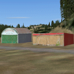
This is the scenery Les Grandes Bergeronnes ( CTH3 ) which represents the reality. Les Grandes Bergeronnes is a small village located on Northern bank of the St-Laurent river of Quebec at Canada. This scenery is design with FSDS and it accepts Mesh of Gilles Gauthier.This scenery has the function for FS-X.
| Filename: | CTH3_Canada_Quebec_Les_GrandesBergeronnes.zip |
| License: | Freeware |
| Added: | 31st December 2009, 04:53:04 |
| Downloads: | 568 |
| Author: | Regis Dassylva |
| Size: | 725.14 KB |
| Category: Flight Simulator X - Scenery | |
| CTH3 Canada, Quebec, Les Grandes-Bergeronnes |
|
Images related to this file:
File Description:
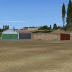
This is the scenery Les Grandes Bergeronnes ( CTH3 ) which represents the reality. Les Grandes Bergeronnes is a small village located on Northern bank of the St-Laurent river of Quebec at Canada. This scenery is design with FSDS and it accepts Mesh of Gilles Gauthier.This scenery has the function for FS-X.
| Filename: | CTH3_Canada_Quebec_Les_GrandesBergeronnes.zip |
| License: | Freeware |
| Added: | 2nd January 2010, 04:37:53 |
| Downloads: | 849 |
| Author: | Regis Dassylva |
| Size: | 1.62 MB |
| Category: Flight Simulator 2004 - Scenery | |
| Haines Junction CYHT in Yukon Territory Canada |
|
Images related to this file:
File Description:
Haines Junction is a village in the Yukon Territory, Canada, amid the Rocky Mountains and around 80 miles west of Whitehorse. It is sited at the junction of the Haines Highway and the Alaska Highway, hence the name. The village was established in 1942 when the Alaska Highway was under construction, and the Haines Highway was built over the Chilkat Pass to connect to the town of Haines on the Alaska coast.
The date of this scenery is, as usual, around 2010. At that time there was a regular service (not always a daily one, depending on the time of year) by Yukon Air North, and in this case it is by an ATR 42-300. There is a helicopter company based at the airfield, Trans North Helicopters, and there is also Kluane Glacier Air Tours, which, as the name suggests, takes you to a glacier so you can stroll around on ice. And then brings you back. The gravel runway is 5,000 feet long and aligned 04-22, and is lit, with PAPI at both ends. Right hand circuits are required for runway 04 as the terrain is not flat.
This post will be followed by two other airfields to the northwest, Silver City and Burwash, both of which are on or close to the Alaska Highway.
| Filename: | Haines_Junction_CYHT_in_Yukon_Territory_Canada.zip |
| License: | Freeware, limited distribution |
| Added: | 22nd January 2022, 21:53:16 |
| Downloads: | 119 |
| Author: | Roger Wensley |
| Size: | 20.46 MB |
| Category: Prepar3D V5 - Scenery | |
| CVX_ETM12m HPX for ANGOLA vers. 2.0 |
|
Images related to this file:
File Description:
Hydro Polys for lakes and river and coastline.It is imperative to have already installed the ETM12m v2 AO - Enhanced Terrain Mesh 12m v2 for ANGOLA vol.01/02/03/04/05/06/07/08/09/10/11/12. This is a work in progress. This release replace and delete the previous version 1.40 (Please remove it before install new version) .
| Filename: | CVX_ETM12m_HPX_for_ANGOLA_vers_20.zip |
| License: | Freeware |
| Added: | 16th February 2021, 19:59:39 |
| Downloads: | 116 |
| Author: | Giovanni Miduri |
| Size: | 11.82 MB |
| Category: Flight Simulator 2004 - Scenery | |
| Northern Venezuela SRTM Mesh part 2 |
|
File Description:
This terrain mesh scenery covers north of Venezuela (southern boundary is 8°48'N) and Dutch caribeans: Aruba, Curacao & Bonaire islands.
Based on SRTM Data (3 arcsec, 90m), generated with Matthew Styles's program "SRTM To BGL v1.04", sampled to LOD9 resolution (76m) with 5 interpolation passes.
This part contains Venezuela-NW.bgl. See venezuela_n_mesh_pt2-1.jpg for the .BGL files coverage.
| Filename: | Northern_Venezuela_SRTM_Mesh_part_2.zip |
| License: | Freeware |
| Added: | 7th October 2003, 18:19:24 |
| Downloads: | 8,633 |
| Author: | Yohann Baptiste |
| Size: | 14.31 MB |
| Category: Flight Simulator 2004 - AI Flight Plans | |
| Hawkair Canada Flightplans |
|
File Description:
AI Flightplans for Hawkair, a Terrace BC based airline operating 4 Dash8-100's.
Taken from their website for the Spring 2005 schedule.
| Filename: | Hawkair_Canada_Flightplans.zip |
| License: | Freeware, limited distribution |
| Added: | 26th March 2005, 14:35:47 |
| Downloads: | 473 |
| Author: | Dave Hazell |
| Size: | 7.79 KB |
| Category: Flight Simulator X - AFCAD Files | |
| CZBB Boundary Bay Airport, BC |
|
File Description:
This is a complete redo of the default FSX CZBB Boundary Airport, BC using ADE v1.37, Google Earth satellite image and the latest airport chart effective as of 31 July 2008. The airport center and boundary repositioned. Control tower moved and replaced. Runway 07/25 extended to 5606 ft from 3540 ft and new taxiway E added. VASI Added to Runway 07/25. Taxiway signs added and/or corrected. Airport aprons resized and added where necessary. Taxiways and roads added. Static airport library objects and vegetation added for an improved look. XWind runways activated. Airport views are from the roof of the control tower when in tower view. A fuel truck has been added - Shift-F will bring this truck to your aircraft for refueling and will automatically refuel AI aircraft after landing and before take off. Airport chart and history included.
| Filename: | CZBB_Boundary_Bay_Airport_BC.zip |
| License: | Freeware |
| Added: | 26th March 2009, 08:31:55 |
| Downloads: | 491 |
| Author: | Robert Catherall |
| Size: | 137.2 KB |


© 2001-2026 AVSIM Online
All Rights Reserved
Privacy Policy |