
Where Flight Simulation Enthusiasts Gather from Around the World!
AVSIM Library - Search Results

| Category: Flight Simulator 2004 - Scenery | |
| Glacier Bay National Park, Alaska |

|
File Description:
Add-on meshes can greatly improve the detail of the FS terrain but often conflict with the inaccurate placement of the other default FS landscape elements, particularly in coastal and mountainous areas. This project showcases new methods and software that allow for semi-automated development of FS landscapes from accurate source data. The files completely replace the default FS landscape of Southeast Alaska's Glacier Bay National Park and the adjacent Lynn Canal area between Juneau and Skagway (N58-60 W134-138), including shorelines, islands, and lakes, as well as glaciers, landclass, man-made features, and a LOD9 (76-m) terrain mesh. Optional AI floatplane traffic at four seaplane bases is included. A LOD10 (38-m) mesh of the same area is available as a separate optional download. FS2002 users please use fs8glbay.zip instead.
| Filename: | Glacier_Bay_National_Park_Alaska.zip |
| License: | Freeware, limited distribution |
| Added: | 16th February 2004, 03:40:31 |
| Downloads: | 17,199 |
| Author: | Holger Sandmann, Jim Keir |
| Size: | 10.43 MB |
| Category: Flight Simulator X - Scenery | |
| Bay James project |
|
Images related to this file:
File Description:
This set of files is intended to enhance the James Bay cree villages located on the North West part of Quebec. You must have Ultimate Terrain X Canada installed in order to have a fairly good mapping of the area. French and English instructions in the readme files.
| Filename: | Bay_James_project.zip |
| License: | Freeware |
| Added: | 26th November 2009, 01:43:59 |
| Downloads: | 768 |
| Author: | Pierre Fauteux |
| Size: | 24.68 KB |
| Category: Flight Simulator 2004 - Scenery | |
| Brevoort CWOB and BAF-3 radar plus Cartwright LAB-6 radar Canada |
|
Images related to this file:
File Description:
Brevoort airstrip and the BAF-3 radar it serves is on Brevoort Island, off one of the southeastern tips of Baffin Island and 140 miles east of Iqaluit. This scenery includes the BAF-3 buildings on the hilltop and those on the airstrip below, plus the roads connecting them and down to the beach landing area on the rocky coast. This scenery is made for the FSGenesis 76m terrain mesh for northern Canada, and there will be a repost of all my northern Canada airfields to suit this; I cannot think now why I never installed this mesh before. The AI reflects the use of civil airlines for resupply and transportation of personnel. Given the terrain the wind should be from the north so that ai lands using the 02 runway. Landing from the north will involve a terrain clash while take off towards the north will not as the climb out clears the hilltop. The video shows the 600 foot cliff at the runway threshold and an Air Tindi plane on the apron. Cartwright CYCA is on the Labrador coast and has been posted by Flight Ontario as part of their Goose Bay and Labrador Regional Airports sceneries. The nearby LAB-6 radar site is included here, connected to CYCA by an extended road. The site uses the same buildings as Brevoort and Saglek (posted recently) and although I have included them here as separate sceneries the contents can be placed in the same folders as Saglek with a saving in duplicated textures. The textures here are more accurate than Saglek so say yes to over-write; a downloader with personal experience of Brevoort noted that in reality they are lighter.
| Filename: | Brevoort_CWOB_and_BAF3_radar_plus_Cartwright_LAB6_.zip |
| License: | Freeware, limited distribution |
| Added: | 20th August 2017, 15:46:36 |
| Downloads: | 178 |
| Author: | Roger Wensley |
| Size: | 4.37 MB |
| Category: Flight Simulator 2004 - Flight Plans | |
| 1935 First Commercial Flight Across The Rockies |
|
File Description:
Retrace Grant McConachie's steps as he flies the first commercial flight over the Rocky Mountains, from Calgary to Vancouver in a Ford TriMotor. This package includes the flight, flight plan, and an optional weather setup. This flight is brought to you by the Ontario Northern Flying Club.
This flight uses the default fs2004 Trimotor and default scenery. You may want to download the BC Mesh files available here on avsim as well. FS2002 users may use any Ford Trimotor on AVSIM for this flight.
| Filename: | 1935_First_Commercial_Flight_Across_The_Rockies.zip |
| License: | Freeware, limited distribution |
| Added: | 27th October 2003, 18:10:04 |
| Downloads: | 2,275 |
| Author: | David Voogd |
| Size: | 83.37 KB |
| Category: Miscellaneous Files - Miscellaneous Files | |
| Al Pelletier's Round Robins - Calgary |
|
File Description:
This flight is based on a true route of Westjet and is based in western Canada. It actually lands at my home of Comox (twice daily) BC. Written in 2003 for Computer Pilot Magazine (pay them a visit at www.computerpilot.com). You’ll just need the basic 737 for this exercise. I used the great Dreamfleet 737 of that time for FS2002, and the PMDG 737 for FS2004 both in Westjet liveries. Lots of high resolution maps, approach plates etc..
| Filename: | Al_Pelletiers_Round_Robins__Calgary.zip |
| License: | Freeware, limited distribution |
| Added: | 18th December 2006, 01:02:35 |
| Downloads: | 727 |
| Author: | Al Pelletier |
| Size: | 61.88 MB |
| Category: Flight Simulator 2004 - Scenery | |
| AI Water "aircraft" for Lake Okanagan, BC. |
|
Images related to this file:
File Description:
AI Water "aircraft" for Lake Okanagan, BC. This package features an AI Sternwheeler ship, an AI Waco Bi-wing plane and AI Cabin Cruisers set on Lake Okanagan, near Penticton and Kelowna, BC, Canada. Offerred as an interesting scenery enhancement, it also demonstrates the use of the "forward departure" (no push-back) technique as applied to water based aircraft. A few EZ objects have also been used to decorate the dock areas where the AI "craft" will be seen. This enhancement has been tested with the default FS2004 scenery only and may not work with other enhancements (such as UT-Canada) which alter the shorelines of Lake Okanagan. Other downloads may be required or are recommended. Complete details about these will be found in the instructions. Please unzip to a temporary folder and follow the easy installation instructions. Compiled for your flying enjoyment by David "Opa" Marshall.
-
NOTE: This package replaces the one which is missing due to the May hack on Avsim. Nothing new has been added.
| Filename: | AI_Water_aircraft_for_Lake_Okanagan_BC.zip |
| License: | Freeware |
| Added: | 29th January 2010, 21:28:38 |
| Downloads: | 1,464 |
| Author: | David "Opa" Marshall |
| Size: | 1.8 MB |
| Category: Flight Simulator 2004 - Scenery | |
| Flattens for use at PANC Anchorage, Alaska Airport |
|
Images related to this file:
File Description:
Flattens for use at PANC Anchorage, Alaska Airport - for FS2004 only.
While flying into PANC recently, I noticed the water was encroaching on the land near Runways 14 and 6 in a most unrealistic manner. This package provides two flattens which will eliminate that problem. Tested with the default scenery and with the Frame Rate Friendly Studio version of PANC. It has not been tested with any terrain enhancement such as Ultimate Terrain. Please unzip to a temporary folder and follow the very simple installation instructions. Compiled for your flying enjoyment by David "Opa" Marshall.
| Filename: | Flattens_for_use_at_PANC_Anchorage_Alaska_Airport.zip |
| License: | Freeware |
| Added: | 20th June 2010, 02:16:27 |
| Downloads: | 1,937 |
| Author: | David "Opa" Marshall |
| Size: | 765.25 KB |
| Category: Flight Simulator 2004 - Scenery | |
| Quebec sceneries Enhancements |
|
File Description:
The files in this package contain enhanced sceneries of the province of Quebec, Canada (for FS2004 only). It's update for some islands of St.Lawrence river with much more new enhanced sceneries (see file list in Files_List.txt). Must be used with new terrain mesh for parts of the province of Quebec : QC09_2k4a.zip to QC09_2k4d.zip in AVSIM library.
Les fichiers contenus dans cette archive sont une mise � jour des sc�¨nes des �®les du fleuve Saint-Laurent avec un ajout important de nouvelles sc�¨nes. Vous en trouverez la liste compl�¨te dans le fichier �«Liste_fichiers.txt�». Pour ces sc�¨nes, l'utilisation du nouveau mesh du Qu�©bec pour FS2004 est indispensable. Vous les trouverez dans la biblioth�¨que d'AVSIM. Ils sont archiv�©s en quatre (4) parties : QC09_2k4a.zip � QC09_2k4d.zip.
| Filename: | Quebec_sceneries_Enhancements.zip |
| License: | Freeware, limited distribution |
| Added: | 1st November 2009, 06:48:12 |
| Downloads: | 4,962 |
| Author: | Gilles Gauthier |
| Size: | 4.15 MB |
| Category: Flight Simulator X - Scenery | |
| California Central Coast Scenery for FSX with Megascenery Earth (Default Mesh Terrain) |
|
Images related to this file:
File Description:
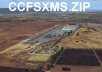
Revised 1/7/10 for upload to Avsim.COM. CCFSXMSFix is incorporated so not required.
This is an earlier version of CCC Megascenery Earth scenery that doesn't require FSGenesis Mesh Terrain. See CCFSXMSG.ZIP for the FSGenesis Mesh version.
This scenery covers the California coastal region from N36���°10' (Coalinga) to N34���°25' (Santa Barbara) and from the coast East to W119���°40'. It is a version of my previous California Central Coast scenery redesigned and expanded to work with MegaScenery Earth from PC Aviator Inc. Many airstrips in the area covered by this scenery have been added or enhanced for a total of 27 airports/airstrips in the area. Several areas of interest such as the Santa Barbara marina, Morro Bay, etc. are also included for a total of 41 points of interest. All airports/airstrips and related structures have been adjusted and realigned to conform to actual positions and dimensions as indicated by the MegaScenery satellite textures. In addition, there are 6 invisible water runways for use by AI floatplane traffic. MegaScenery California-13, -14 and -15 are required for this scenery to make sense. I also used California-12, -28 and -29 when constructing the scenery but they could be considered optional.
| Filename: | California_Central_Coast_Scenery_for_FSX_with_Mega.zip |
| License: | Freeware |
| Added: | 7th January 2010, 21:28:45 |
| Downloads: | 1,560 |
| Author: | Al Wheeler |
| Size: | 8.12 MB |
| Category: Flight Simulator 2002 - Scenery | |
| LightWeight Mesh terrain for Europe and the Mediterranean (Part 2 of 4) |
|
File Description:
Framerate and download friendly mesh that covers the northern half of Portugal and Spain, all but the northern tip of France, most of Italy, all of Switzerland, Austria, the former Yugoslavia, Hungary, Romania and Bulgaria and parts of Belgium, Luxemburg, Germany, the Czech Republic, Slovakia, Poland, the Ukraine, Russia, Greece and Turkey. It is bounded by W20-E40-N50-N40.
| Filename: | LightWeight_Mesh_terrain_for_Europe_and_the_Medite.zip |
| License: | Freeware |
| Added: | 25th July 2002, 16:24:31 |
| Downloads: | 12,309 |
| Author: | Svante Wendel |
| Size: | 22.27 MB |


© 2001-2026 AVSIM Online
All Rights Reserved
Privacy Policy |