
Where Flight Simulation Enthusiasts Gather from Around the World!
AVSIM Library - Search Results

| Category: Flight Simulator 2004 - Aircraft Repaints, Textures and Modifications | |
| Alaska Airlines Airbus A329 - N624VA |

|
Images related to this file:
File Description:
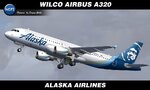
FS9/FSX Wilco Airbus A320 in Alaska Airlines livery. Textures for payware FeelThere Wilco model. Description and instruction in the archive. Repaint by Sergey Gleba. Paint kit by Denis Minaev. Link to my products on SimMarket: https://secure.simmarket.com/simlivery.mhtml
| Filename: | Alaska_Airlines_Airbus_A329__N624VA.zip |
| License: | Freeware |
| Added: | 25th May 2026, 21:54:29 |
| Downloads: | 27 |
| Author: | Sergey Gleba | SimLivery |
| Size: | 14.68 MB |
| Category: Flight Simulator 2004 - AFCAD Files | |
| PAKT Ketchikan International, Alaska, USA |
|
Images related to this file:
File Description:
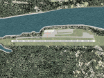
Googlyafcad A&F Data file for Ketchikan International based on Google Earth satellite
data - a small but relatively busy airport located in one of the wettest parts of
Alaska, USA. Ketchikan is Alaska's fifth largest city, with its economy based on
salmon fishing.
For some curious reason the facilities provided in Flight Simulator 2004 omit a crucial
taxiway at the west end of the airport, causing all traffic to taxi from the opposite
end. These files redress this issue, and also provide realistic levels of parking for
commercial and general aviation traffic, allowing you and your "AI" traffic to land,
taxi, park and take off in a realistic manner. The layout has been cunningly designed
to fit both with the Flight Simulator default scenery and version 2 of Alan Wright's
enhanced scenery (paktv2.zip on AVSIM) and is compatible with both in every respect.
Apart from conventional and water-based general aviation aircraft Ketchikan International
is regularly served by commercial flights of Alaska Airlines and by smaller operators
such as Alaska Central Express, Everts Air Alaska and LAB Flying Service. [File re-uploaded at request of AVSIM]
| Filename: | PAKT_Ketchikan_International_Alaska_USA.zip |
| License: | Freeware |
| Added: | 29th May 2010, 09:28:41 |
| Downloads: | 1,267 |
| Author: | John Hinson |
| Size: | 206.01 KB |
| Category: Flight Simulator X - Scenery | |
| IGT - Nightmute Airport - Alaska, USA |
|
Images related to this file:
File Description:
The airport islocated southeast of the central business district of the vellage of Nightmute.Nightmute is located on Nelson Island near Toksook Bay. The two villages connect by snowmachine trail in winter.
Runway 2/20 was changed to 3/21. Changed the length of Runway 3/21 from 50 feet wide and a legth of 1,600 feet to 75 feet wide and 3,200 feet long.Added Runway 11/29 along with custom models.Changes are based on construction plans dated 2005.
Created with Airport Design Editor by ScruffyDuck Software using current FAA documentation and Google Earth's measurements, this package offers a replacement for FSX's stock airport. All these enhancements are as close to the real airport as I can get with stock library objects and custom buildings.
| Filename: | IGT__Nightmute_Airport__Alaska_USA.zip |
| License: | Freeware |
| Added: | 3rd February 2015, 09:12:14 |
| Downloads: | 671 |
| Author: | Wayne Roberts |
| Size: | 197.17 KB |
| Category: Flight Simulator X - Scenery | |
| PACK - Chefornak Airport - Alaska, USA |
|
Images related to this file:
File Description:
Chefornak Airport (IATA: CYF, ICAO: PACK, FAA LID: CFK) is a state-owned public-use airport in Chefornak,a city in the Bethel Census Area of the U.S. state of Alaska. The airport is on the Kinia River.
A new airstrip has been built further out from the village due to concerns with the current airstrip being near the school and pedestrian traffic, however, the runway must settle for several years before it is ready to be used. A new runway designated 5/23 was added.
| Filename: | PACK__Chefornak_Airport___Alaska_USA.zip |
| License: | Freeware |
| Added: | 17th October 2014, 01:26:08 |
| Downloads: | 662 |
| Author: | Wayne Roberts |
| Size: | 451.25 KB |
| Category: Flight Simulator X - Scenery | |
| A85 - Kwigillingok Airport - Alaska, USA |
|
Images related to this file:
File Description:
Kwigillingok Airport (IATA: KWK, ICAO: PAGG, FAA LID: GGV, formerly A85) is owned by the Native Village of Kwigillingok and is a public-use airport located one mile (two kilometres) northwest of the central business district of Kwigillingok, in the Bethel Census Area of the U.S. state of Alaska. There is also a nearby seaplane landing area known as Kwigillingok Seaplane Base (FAA LID: KWK).Runway 15/33 was increased from 1,835 feet and 40 feet wide to 3,300 feet and 60 feet wide. Runway 4/22 was added along with custom models. All changes were made based on the 2014 construction plans.
Created with Airport Design Editor 9x by ScruffyDuck Software using current FAA documentation and Google Earth measurements, this package offers a replacement for FSX's stock airport. All these enhancements are as close to the real airport as I can get with stock library objects and custom buildings.
| Filename: | A85__Kwigillingok_Airport__Alaska_USA.zip |
| License: | Freeware |
| Added: | 5th January 2015, 00:26:44 |
| Downloads: | 709 |
| Author: | Wayne Roberts |
| Size: | 358.61 KB |
| Category: Flight Simulator X - Aircraft Repaints, Textures and Modifications | |
| Alaska Airlines BAe ATP (N221AS) |
|
Images related to this file:
File Description:
FSX BAe ATP repaint textures for Alaska Airlines N221AS. For the Enigma
Simulations BAe ATP (enigma_atp_basepack.zip). Also includes FSX engine
smoke [SMOKESYSTEM] coordinates for your 'aircraft.cfg' file if you wish.
Repaint by Tom Tiedman.
| Filename: | Alaska_Airlines_BAe_ATP_N221AS.zip |
| License: | Freeware |
| Added: | 28th April 2014, 07:02:29 |
| Downloads: | 303 |
| Author: | Enigma Simulations / Tom Tiedman |
| Size: | 8.5 MB |
| Category: Flight Simulator 2002 - Miscellaneous Files | |
| FSGarmin/FSFlightMax - TERRAIN ELEVATION MAP - THE ALPS AND ITALLY |
|
File Description:
This is an elevation map that approximately covers the area between N49, E4.5 and N36.5, E19 to be used with FSGarmin/FSFlightMax.
| Filename: | FSGarminFSFlightMax__TERRAIN_ELEVATION_MAP___THE_A.zip |
| License: | Check within download |
| Added: | 14th October 2003, 22:42:21 |
| Downloads: | 726 |
| Author: | Aleksey Sudakov |
| Size: | 7.46 MB |
| Category: Strike Fighters: Project 1 - Mods, Utilities and Patches | |
| Enhanced Planning Maps for Gepard's Israel Terrain, Version 1.0 |
|
File Description:
This is a very basic supplement to make it easier to design Israel missions.
Paint Shop Pro 8 was used to combine Gepard's planningmap3.bmp with an overlay.
The overlay is a map from a book:
p.144 of AIR WARFARE IN THE MISSILE AGE by Lon O. Nordeen, Jr.
| Filename: | Enhanced_Planning_Maps_for_Gepards_Israel_Terrain_.zip |
| License: | Freeware |
| Added: | 15th August 2004, 17:24:05 |
| Downloads: | 483 |
| Author: | Stephen Lynn Flores |
| Size: | 2.27 MB |
| Category: Strike Fighters: Project 1 - Mods, Utilities and Patches | |
| Enhanced Planning Maps for KillerBee's SEA Terrain, Version 2.0 |
|
File Description:
This is a very basic supplement to make it easier to design SEA missions.
Paint Shop Pro 8 was used to combine KB's planningmap3.bmp with an overlay.
The overlay is a map from a book:
p.142 of JET FIGHTER PERFORMANCE KOREA TO VIETNAM by Mike Spick.
Version 2 solves a problem with the white text making target names unreadable in Kreelin's SFPQMD.
The text is now 50% transparent, which makes it a light gray tone.
I apologize for any inconvenience this may have caused anyone.
| Filename: | Enhanced_Planning_Maps_for_KillerBees_SEA_Terrain_.zip |
| License: | Freeware |
| Added: | 15th August 2004, 17:27:30 |
| Downloads: | 654 |
| Author: | Stephen Lynn Flores |
| Size: | 3.24 MB |
| Category: Flight Simulator 2004 - Scenery | |
| California Lighthouse and San Pedro harbor for Ultimate Terrain |
|
File Description:
This is a revision of my prior California Lighthouse scenery, adjusted to work with Ultimate Terrain. A licensed install of Ultimate Terrain USA is required to display properly.
Aside from placing 22 lighthouses on the coast of California, there are also many changes made to San Pedro Bay (Los Angeles harbor and Long Beach harbor). I moved misplaced objects (shipping cranes, container ships, etc) to where they belong and added marinas and custom bridges that follow the roads. I also added the breakwaters at the harbor.
The major bridges and offshore rocks are landable.
| Filename: | California_Lighthouse_and_San_Pedro_harbor_for_Ult.zip |
| License: | Freeware |
| Added: | 17th January 2006, 03:49:19 |
| Downloads: | 1,886 |
| Author: | Larry Silsbee |
| Size: | 3.39 MB |


© 2001-2026 AVSIM Online
All Rights Reserved
Privacy Policy |