
Where Flight Simulation Enthusiasts Gather from Around the World!
AVSIM Library - Search Results

| Category: Flight Simulator 2004 - Scenery | |
| Guelph Air Park CNC4 |

|
File Description:
This is another "must Have" for the General Aviation VFR flyer in Ontario, Canada. Guelph Air Park CNC4 is a Pilot Tranining airport and situated close to Kitchener-Waterloo(CYKF), Toronto Pearson(CYYZ) and Hamilton International(CYHM).
Guelph is also the home of the "TIGER BOYS", vintage aircraft restorers and pilots. A great history document by resident pilot Glenn Norman is included in the download.
This scenery is set to line up with Ultimate Terrain Canada/Alaska or Joel's Roads but neither of these is an absolute necessity.
| Filename: | Guelph_Air_Park_CNC4.zip |
| License: | Freeware, limited distribution |
| Added: | 20th January 2006, 05:31:02 |
| Downloads: | 4,103 |
| Author: | Al Gay - Flight Ontario |
| Size: | 12.65 MB |
| Category: Flight Simulator X - Scenery | |
| NWT Landscape - Canada |
|
File Description:
Elevation data (mesh-Lod10 - 38m), land cover, water polygons, rivers, stream lines, lanes and shorelines around airports of Northwest Territories, Canada.
| Filename: | NWT_Landscape__Canada.zip |
| License: | Freeware, limited distribution |
| Added: | 9th February 2011, 17:43:21 |
| Downloads: | 3,354 |
| Author: | Gilles Gauthier |
| Size: | 89.42 MB |
| Category: Flight Simulator X - AFCAD Files | |
| CFQ5 - Silver City (Kluane Lake) - Yukon, Canada |
|
Images related to this file:
File Description:
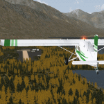
This is a patch that should correct and brush-up the airport Silver City (CFQ5) in Yukon, Canada and furthermore some severe scenery discrepancies around the south-western shore of Kluane Lake close to it that are caused by elevation differences of the surface on both sides of Latitude N61.0 in the context with UTX Canada in combination with high resolution mesh like "FSGenesis" (tested by myself) or "FS Global Ultimate" (as reported by others). It may work in other configurations, too. However, the Microsoft standard scenery will likely be disturbed as the corrected shorelines are depending on Scenery Solutions Ultimate Terrain Canada X" (payware).
| Filename: | CFQ5__Silver_City_Kluane_Lake__Yukon_Canada.zip |
| License: | Freeware |
| Added: | 25th September 2013, 21:35:59 |
| Downloads: | 199 |
| Author: | Axel Birsul |
| Size: | 682.43 KB |
| Category: Flight Simulator 2004 - Scenery | |
| Phoenix, Arizona 30 Meter Terrain Mesh Scenery |
|
File Description:
Mesh Scenery for Microsoft Flight Simulator 2004 and 2002.USGS NED 30 meter (1 arc-second), resampled to LOD10 (38.2 meters). This terrain mesh is centered at Phoenix, Arizona. Coverage area: From about West 111° to West 113° and North 33° to North 34°.
| Filename: | Phoenix_Arizona_30_Meter_Terrain_Mesh_Scenery.zip |
| License: | Freeware |
| Added: | 3rd January 2004, 19:53:36 |
| Downloads: | 3,719 |
| Author: | Phil Cruikshank |
| Size: | 4.66 MB |
| Category: Flight Simulator 2004 - Scenery | |
| Jamaica SRTM Mesh |
|
File Description:
This is a terrain mesh scenery for Jamaica.
Based on SRTM Data (3 arc/sec), generated with Matthew Styles's program "SRTM To BGL v1.04", sampled to LOD9 resolution (76m) with 4 interpolation passes. While tested under Fs2004, this mesh should also run in FS2002.
| Filename: | Jamaica_SRTM_Mesh.zip |
| License: | Freeware |
| Added: | 26th September 2003, 23:29:31 |
| Downloads: | 5,696 |
| Author: | Yohann Baptiste |
| Size: | 2.34 MB |
| Category: Flight Simulator 2004 - Scenery | |
| Spain and Portugal SRTM Scenery Mesh |
|
File Description:
This is a terrain mesh scenery for Spain (with Balearic Islands) and Portugal.
Based on SRTM Data (3 arc/ sec), generated with Matthew Styles's program "SRTM To BGL v1.04", sampled to LOD9 resolution (76m).
While tested under Fs2004, this mesh should also run in FS2002.
| Filename: | Spain_and_Portugal_SRTM_Scenery_Mesh.zip |
| License: | Freeware |
| Added: | 5th November 2003, 19:58:55 |
| Downloads: | 7,012 |
| Author: | Ricard Alvarez |
| Size: | 91.24 MB |
| Category: Flight Simulator X - Scenery | |
| CKG8 Kakabeka Falls |
|
Images related to this file:
File Description:
Kakabeka Falls in Ontario, Canada is a VFR airfield with a seaplane base on the Kaministiquia River and is home to the Kakabeka Falls Flying Club and the Lakehead Gliding Club. Located to the west of Thunder Bay, this airport was designed for use with Ultimate Terrain X - Canada (recommended), but a version for default terrain is also included.
| Filename: | CKG8_Kakabeka_Falls.zip |
| License: | Freeware, limited distribution |
| Added: | 13th January 2013, 01:00:07 |
| Downloads: | 857 |
| Author: | Robert Graf |
| Size: | 502.11 KB |
| Category: Flight Simulator 2002 - Scenery | |
| Amos Lakes |
|
File Description:
FS2002 Scenery - Amos Lakes, Alaska.
Located on the North side of the Alaska
Range with a nice view of Mt. McKinley.
This is a fairley remote part of Alaska, but
there is lots of interesting terrain and a
couple of mountain passes near-by to explore.
Sound files for Lago's FSSoundScape are
also included.
by Tom Fica
| Filename: | Amos_Lakes.zip |
| License: | Freeware, limited distribution |
| Added: | 14th December 2002, 23:49:37 |
| Downloads: | 1,486 |
| Author: | Tom Fica |
| Size: | 3.46 MB |
| Category: Flight Simulator 2004 - Scenery | |
| Atlas Mountains, Morocco 76m SRTM Terrain Mesh |
|
File Description:
USGS SRTM 3 arc-second, resampled to LOD9 (76 meters). This is a terrain mesh scenery of the Atlas Mountains in Morocco, Africa. It includes the High Atlas, the cities of Agadir & Marrakech and northwestern parts of the Sahara Desert.
| Filename: | Atlas_Mountains_Morocco_76m_SRTM_Terrain_Mesh.zip |
| License: | Freeware |
| Added: | 4th April 2004, 19:46:58 |
| Downloads: | 15,261 |
| Author: | Andreas Trawny |
| Size: | 15.95 MB |
| Category: Flight Simulator 2004 - Scenery | |
| Cape Farvel, Greenland 76m SRTM Terrain Mesh |
|
File Description:
USGS SRTM 3 arc-second, resampled to LOD9 (76 meters). This is a terrain mesh scenery of Cape Farvel in southern Greenland. Coverage area: From West 45.6° to West 42.8° and North 59.6° to North 60.4°. (Cape Farvel is the only part of Greenland available as SRTM elevation model)
| Filename: | Cape_Farvel_Greenland_76m_SRTM_Terrain_Mesh.zip |
| License: | Freeware, limited distribution |
| Added: | 17th April 2004, 23:35:14 |
| Downloads: | 4,184 |
| Author: | Andreas Trawny |
| Size: | 1.55 MB |


© 2001-2026 AVSIM Online
All Rights Reserved
Privacy Policy |