
Where Flight Simulation Enthusiasts Gather from Around the World!
AVSIM Library - Search Results

| Category: Flight Simulator 2004 - Scenery | |
| Bridges, Tressels & Trains - Custom-Made and Individually Placed for Ultimate Terrain USA |

|
File Description:
Bridges, Tressels & Trains - custom-made and individually placed for Ultimate Terrain USA
Vol. 1 - California Coast, Monterey County to San Francisco bay area
Compatible with Ultimate Terrain USA, verified with Google Earth.
Requires Ultimate Terrain USA and 38m mesh. See Settings Note.
For FS9 use only. GMAX with DXT1 textures.
| Filename: | Bridges_Tressels__Trains__CustomMade_and_Individually_Placed_for_Ultimate_Terrain_USA.zip |
| License: | Freeware |
| Added: | 25th November 2005, 05:06:21 |
| Downloads: | 1,969 |
| Author: | Lou Frost |
| Size: | 1.01 MB |
| Category: Flight Simulator 2002 - Scenery | |
| New 300-m (LOD7) Terrain Mesh of British Columbia and Southeast Alaska #4 |
|
File Description:
Mid-resolution (300-m) terrain mesh for the entire province of British Columbia (950,000 square km) and the Alaska panhandle southeast of N60 W139. Made from 250m-resolution source data without oversampling. Easy on frame rates and hard drive space. It transforms the rounded mountains of the default terrain mesh into a much more realistic representation of the diverse topography of this beautiful corner of the world. Experience the spectacular scenery between Vancouver and Atlin, Juneau and Fort St. John, and Mount Robson to Clayoquot Sound. Fourteen independent mesh tiles allow you to select the region(s) you like best. Several high-resolution add-on meshes will be uploaded separately. By Holger Sandmann. Part 4 of 4: All areas between 48 and 51 degrees North. Note: this part contains updated read-me.txt and .pdf files - please use these instead of the ones distributed with the first three parts!
| Filename: | New_300m_LOD7_Terrain_Mesh_of_British_Columbia_and.zip |
| License: | Freeware, limited distribution |
| Added: | 17th January 2003, 20:22:07 |
| Downloads: | 3,677 |
| Author: | Holger Sandmann |
| Size: | 6.34 MB |
| Category: Flight Simulator 2004 - Scenery | |
| KPDX Plateau Flatten |
|
File Description:
This small file will improve the elevation problem between the Columbia River and KPDX for users of FSGenesis 38m mesh and Ultimate Terrain USA.
| Filename: | KPDX_Plateau_Flatten.zip |
| License: | Freeware, limited distribution |
| Added: | 2nd September 2005, 08:17:10 |
| Downloads: | 1,407 |
| Author: | Dan Reynolds |
| Size: | 1.21 KB |
| Category: Flight Simulator X - Scenery | |
| Nunavut Landscape - Canada |
|
File Description:
Elevation data (mesh-Lod10), land cover, water polygons, rivers, stream lines, lanes and shorelines around airports of Nunavut, Canada
| Filename: | Nunavut_Landscape__Canada.zip |
| License: | Freeware, limited distribution |
| Added: | 20th November 2010, 00:10:27 |
| Downloads: | 2,512 |
| Author: | Gilles Gauthier |
| Size: | 49.62 MB |
| Category: Flight Simulator 2002 - Scenery | |
| Patches for LOD7/LOD9 Terrain Meshes of British Columbia and Southeast Alaska |
|
File Description:
Patches (flatten files) for 108 lakes in British Columbia and Southeast Alaska that were either sunken below or raised above the terrain surface due to discrepancies between my add-on LOD7 and LOD9 mesh files and FS2002's default scenery. In some areas, such as the Prince George/Burns Lake region, the effect of the patches is obvious even from a great distance; in other areas, you'll have to be close to the lake to notice the difference. Also included are flatten files for nine airfields that had problems with sloping terrain or texture "bleed-through".
| Filename: | Patches_for_LOD7LOD9_Terrain_Meshes_of_British_Col.zip |
| License: | Freeware, limited distribution |
| Added: | 18th February 2003, 22:28:49 |
| Downloads: | 2,831 |
| Author: | Holger Sandmann |
| Size: | 613.45 KB |
| Category: Flight Simulator X - Scenery | |
| Yukon Landscape - Canada |
|
File Description:
Elevation data (mesh-Lod10 - 38m), land cover, water polygons, rivers, stream lines, lanes and shorelines around airports of Yukon, Canada.
| Filename: | Yukon_Landscape__Canada.zip |
| License: | Freeware, limited distribution |
| Added: | 17th March 2011, 13:45:13 |
| Downloads: | 2,603 |
| Author: | Gilles Gauthier |
| Size: | 128.81 MB |
| Category: Flight Simulator X - Scenery | |
| Unalakleet Alaska V3.0 |
|
Images related to this file:
File Description:
Made famous on the Discovery Channel in the program Flying Wild Alaska , this is Unalakleet airport.Completely custom built with animated smoke and a reworked AFCAD.Works best with FSX SP2 or Acceleration installed.This airport works with ultimate terrain Alaska and the default FSX scenery.If you have Ultimate Terrain Alaska installed put this airport higher up in your priority list.More parking for traffic and beacon was upgraded.Thanks to jim Dhaenens for the beacon.No more crash if you got crash detection on,fix and working,sorry for that.
| Filename: | Unalakleet_Alaska_V30.zip |
| License: | Freeware |
| Added: | 19th May 2011, 01:13:42 |
| Downloads: | 4,670 |
| Author: | Frits Beyer and Jacques Botha |
| Size: | 2.37 MB |
| Category: Flight Simulator X - Flight Plans | |
| Eastern Canada VFR Flights |
|
Images related to this file:
File Description:

Contains 9 GPS routes in sequence over interesting and rough terrain in Eastern Canada. The routes are VFR for site seeing. Low flight altitudes will give nice terrain views, on shapes and vastness around.
| Filename: | Eastern_Canada_VFR_Flights.zip |
| License: | Freeware |
| Added: | 4th April 2012, 20:49:48 |
| Downloads: | 918 |
| Author: | Tim van Ringen |
| Size: | 86.36 KB |
| Category: Flight Simulator X - AFCAD Files | |
| Cali SKCL |
|
Images related to this file:
File Description:
For those of you who are using accurate terrain mesh this is a fix for Cali airport in Colombia. FSX has the airport about 800 feet lower than it should be. So if you use terrain mesh it looks like the airport is in a giant sinkhole. This fixes that plus I've added the terminal and the correct number of gates, so it loosk better than the default.
| Filename: | Cali_SKCL.zip |
| License: | Freeware |
| Added: | 24th April 2012, 02:09:43 |
| Downloads: | 1,176 |
| Author: | Eric Thornton |
| Size: | 6.33 KB |
| Category: Flight Simulator X - Scenery | |
| British Columbia Floatbases |
|
Images related to this file:
File Description:
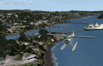
This is a collection of floatbases around the coast of British Columbia made with default scenery objects, and derived from Google Earth and the Canada Waterdrome Supplement. This scenery is designed to complement the work of others and therefore doesn't include waterdromes made by others such as Sidney Schwartz's CYYJ, Ganges Harbour and BCPNW Float Bases which covers an area around the Gulf Islands. You must have Ultimate Terrain Canada for these sceneries to work and in areas away from the immediate coast (Fraser River), a SRTM mesh for the correct elevations.
| Filename: | British_Columbia_Floatbases.zip |
| License: | Freeware |
| Added: | 16th May 2012, 14:02:09 |
| Downloads: | 1,540 |
| Author: | Chris Peschke |
| Size: | 183.32 KB |


© 2001-2026 AVSIM Online
All Rights Reserved
Privacy Policy |