
Where Flight Simulation Enthusiasts Gather from Around the World!
AVSIM Library - Search Results

| Category: Flight Simulator 2004 - Aircraft Repaints, Textures and Modifications | |
| MedJet Beechcraft 400A - two versions |

|
File Description:
MedJet (not sure if they fly the Beech 400 - in fact not usre that they actually have any aircraft... Websearch kept directing me to a world wide medical insurance plan... so they may use member ambulance services... but did see a couple of photos with Medjet on he side of Lears)
Two aircraft- one is an air ambulance the other for medical charter. In case you are like me and use panels with cockpit views, have included two "rear" views of a Beech interior... a rather "business like interior... non-posh ... found a picture of an aircraft interior that was an air ambulance - not a beech - "lifted the Air Stretcher out of the photo and trimed and pasted it to the beech interior to distinguish the two.. so if you choose you can do same for your panel.. I use the same panel for both with the different "rear" view ... just copy the panel and rename it .... in my case... I have panel and panel.1 - with one for charter the other for air ambulance... just make the change in the conifg file... texture= (for the panel) and texture=1 for the the second panel... takes up a bit more space on your HD... but not all that much.. depending on your panel size. If you have any questions or comments.. please do drop me a line
[email protected]
| Filename: | MedJet_Beechcraft_400A__two_versions.zip |
| License: | Freeware |
| Added: | 31st December 2004, 18:20:34 |
| Downloads: | 585 |
| Author: | Henry Tomkiewicz, Dale Caruso |
| Size: | 3.8 MB |
| Category: Flight Simulator X - Scenery | |
| TNCB - Flamingo Airport (Bonaire) |
|
File Description:
Welcome to one of the 3 ABC's beautifull dutch island, Bonaire.
Flamingo Intl. is an international airport located at Kralendijk, Bonaire, Netherlands Antilles. Flamingo Airport serves as a connecting
point for flights of KLM to some destinations in South America. It once served as a hub for BonaireExel, BonaireExpress,CuraçaoExel,
CuraçaoExpress and now serves Dutch Antilles Express as it's secondary hub & also "EZAir" serves Bonaire as its main airline, although
the airline itself is based at Curaçao.
It is the 3rd largest airport in the Netherlands Antilles behind St.Maarten's Princess Juliana International Airport & Curaçao's Hato
International Airport and is the 4th largest between the islands of the Dutch Kingdom behind the already mention St. Maarten,
Curaçao & Aruba's Queen Beatrix International Airport. Arkefly, Continental, Delta & KLM are currently the largest airline operators
that operate flights to Bonaire.
The airport is large enough to accommodate most international widebody airliners such as the Boeing 747, the Boeing 777 and the
Airbus A340, although the largest widebody type to operate to Bonaire today is the MD11. It can also accommodate medium sized
aircraft such as the Boeing 737 and Airbus A310 as well as small aircraft such as the de Havilland Dash 8, ATR 42 and other such
turboprop aircraft.
| Filename: | TNCB__Flamingo_Airport__Bonaire.zip |
| License: | Freeware |
| Added: | 13th April 2009, 08:00:18 |
| Downloads: | 2,343 |
| Author: | Daniel Louvet |
| Size: | 1.01 MB |
| Category: Flight Simulator 2004 - Scenery | |
| LFBT Tarbes/Lourdes-Pyrenees, France |
|
Images related to this file:
File Description:
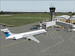
Googly scenery for LFBT Tarbes - a normally quiet airport that just sees a few
domestic flights a day but bursts into life for those of the the Catholic faith to
participate in the pilgrimage to Lourdes. At these times it is served by a
regular stream of charter flights and the airport can handle aircraft as large
as the Boeing 747. The only scheduled flights are between here and Paris, normally operated by Canadair CRJ700 craft worked by Brittany Air International on behalf of Air France, but a huge range of charter operators - mostly from Italy, Ireland, Belgium, the
United Kingdom and Germany - may be seen here at times and although seasonal this
traffic represents 80% of the airport's entire annual activity.
The scenery does not purport to be ultra-accurate. Based on less-than-perfect
satellite imagery from Google Earth, the layout is proportionally correct but the
added airport features, such as buildings, are built from default Microsoft objects
and add-on libraries so will not look exactly like the real thing. You are not obliged to download and install any additional scenery libraries, but to enjoy this scenery in its entirety, you may wish to. It will work fine, with or without.
[File re-uploaded at the request of AVSIM]
| Filename: | LFBT_TarbesLourdesPyrenees_France.zip |
| License: | Freeware |
| Added: | 4th May 2010, 15:02:30 |
| Downloads: | 7,813 |
| Author: | John Hinson |
| Size: | 73 KB |
| Category: Flight Simulator X - Scenery | |
| Kiwi360 (KiwiFruit Country)- Custom buildings, helipad, Hi Res photoreal, Aerius R22 Repaint. Te Puke, New Zealand |
|
File Description:
Kiwi360 (formally know as Kiwifruit Country) is a theme park based around the Kiwifruit (AK.A Chinese Gooseberry or Zespri- The trade name) which is a major export of New Zealand grown predominately in the Bay of Plenty Region. The park is situated about midway between Tauranga and Whakatane, about 5km east of the township of Te Puke.
The Bay of Plentys sunny climate ensures good growing conditions for the delicious fruit and has also spawned a mini tourist industry of tours of the orchards and sorting/packing/coolstores. These include tourist flights by Aerius (http://www.aerius.co.nz ) using a Robinson R44 helicopter.
This scenery was made after a visit when carrying out a GPS survey: I took a few photos and whacked it up. It isn't perfect but will be useful for flights in small helos (I.e. Robinson R22, R44 or Hughes 300/269).
It includes the famous giant Kiwifruit slice, the helipad next to it; the main Kiwi 360 building; a large coolstore/packhouse and the backpackers next to the park. It also includes a lot of library objects (especially trees- If these are adversely affecting performance, you can disable this bgl)
This is placed on a high resolution aerial photo provided by Environment Bay of Plenty.
The scenery also has reflection maps and night maps for those who like getting up at the crack of dawn or simulating frost protection work (although I don't believe the pad is certified for night operations in real life).
The download also includes a repaint of the default Robinson R22 in the colours of ZK-HJZ (in actual fact an R44) kindly provided by James Eden from the ARNZ Forums (see the readme for the .cfg entry to add this repaint)
This helipad isn't in controlled airspace but Tauranga Tower is nearby and will need to be called before entering their airspace (above 2500ft LL for the CTA or within about 10nm of Tauranga for the CTZ) Radio procedures are carried out on Christchurch Information 125.5 for flight following/planning.
| Filename: | Kiwi360_KiwiFruit_Country_Custom_buildings_helipad.zip |
| License: | Freeware, limited distribution |
| Added: | 29th June 2008, 06:05:29 |
| Downloads: | 2,455 |
| Author: | Tim Barnes, James Eden |
| Size: | 11.63 MB |
| Category: Prepar3D V1-4 - Utilities | |
| GENav pro Navigation |
|
Images related to this file:
File Description:

Previous payware product at SimMarket, now 100% free.
With GENav pro you will view all AIRAC navigation data and terminal procedures inside Google Earth. GENav pro run under Windows and require only Google Earth for displaying. You can also edit your own routes or just copy routes into GENav to view in Google Earth. You can search for example an airport or a fix by short or long name, Google Earth will take you there.
You can connect to Microsoft Flight Simulator to view your aircraft. Moving map and heading is available.
GENav pro is highly optimized for best performance and clear views without clutter. There are smart filters to select relevant data to display, all AIRAC items are available. You will find all data such as nav-aid frequencies, airport runways with ILS frequencies by click the displayed icons in Google Earth.
You can edit routes visual direct inside Google Earth by click. The database can always be updated with Navigraph's latest AIRAC data.
With GENav you can easy build valid routes. Unlike other common autorouting program, GENav is the tool for you to build routes with correct airway direction and correct connected to SID/STAR's. You will easy draw your routes most stright and correct to destination. It is also excellent for visual and instrument navigation flights.
FEATURES:
*** Display airports, nav aids, waypoints
*** Display High/Low airways and airways direction
*** Display SID/STAR, Approaches and Transitions
*** Display ARTCC/FIR border
*** AIRAC data available by click
*** Search airport and fixes
*** AIRAC data compatible Navigraph data
*** Visual editable routes
*** VOR to VOR route navigation data
*** Display your aircraft
BASIC SYSTEM REQUIREMENTS:
*** Windows with Google Earth installed
( Notice, no flightsim program required )
OPTIONALLY REQUIREMENTS:
*** SID/STAR require the Navigraph purchase or an alternative free source
*** Airways direction & high/low info require the Navigraph purchase
*** To display aircraft, Microsoft Flight Simulator or Prepare3D v1/v2, with free FSUIPC is required.
*** To display aircraft at a separate computer, also the payware WideFS is required.
| Filename: | GENav_pro_Navigation.zip |
| License: | Freeware |
| Added: | 25th May 2016, 11:24:52 |
| Downloads: | 654 |
| Author: | Lennart Vedin |
| Size: | 4.5 MB |
| Category: Flight Simulator X - Aircraft Repaints, Textures and Modifications | |
| Aeritalia G91Y 8 Stormo |
|
Images related to this file:
File Description:
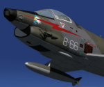
The Fiat G91Y was a reconnaissance and ground-attack aircraft produced by Italian company FIAT as an evolution of Fiat G91. The first flight took place in 1966. It was a complete redesign, but the major difference was that G91Y installed 2 engines, in order to increase the power and the capability to survive to damages during war operations. The single Bristol Orpheus turbojet engine of G91 was then replaced by two afterburning General Electric J85 turbojets which increased thrust by 60% over the single-engined variant.
Structural modifications to reduce airframe weight increased performance further and an additional fuel tank occupying the space of the G.91T's rear seat provided extra range. Combat manoeuvrability was improved with the addition of automatic leading edge slats.
Flight testing of three pre-production aircraft was successful, with one aircraft reaching a maximum speed of Mach 0.98.
Airframe buffeting was noted and was rectified in production aircraft by raising the position of the tailplane slightly.
An initial order of 55 aircraft for the Italian Air Force was completed by Fiat in March 1971.
The order was increased to 75 aircraft with 67 eventually being delivered.
The first pre-series 'Yankee' (the nickname of the new aircraft) flew in July 1968.
AMI (Italian Air Force) placed orders for two batches, 35 fighters followed by another 20, later cut to ten.
The last one was delivered around mid 1976, so the total was two prototypes, 20 pre-series and 45 series aircraft.
No export success followed.
These aircraft served with 101° Gruppo/8° Stormo (Cervia-S.Giorgio) from 1970, and later, from 1974, they served with
the 13° Gruppo/32° Stormo (Brindisi) until the early '90s, as the only ones equipped with the 'Yankee', using them as attack/recce machines, both over ground and sea, until the AMX replaced them.
HD textures in 4096 x 4096.
complete resize and paint 32bit HD.
Virtual cockpit HD.
Native model for FSX & P3D
| Filename: | Aeritalia_G91Y_8_Stormo.zip |
| License: | Freeware |
| Added: | 15th April 2017, 19:09:42 |
| Downloads: | 1,655 |
| Author: | Massimo Grassi |
| Size: | 109.01 MB |
| Category: Flight Simulator 2004 - Utilities | |
| GENav pro Navigation |
|
Images related to this file:
File Description:

Previous payware product at SimMarket, now 100% free.
With GENav pro you will view all AIRAC navigation data and terminal procedures inside Google Earth. GENav pro run under Windows and require only Google Earth for displaying. You can also edit your own routes or just copy routes into GENav to view in Google Earth. You can search for example an airport or a fix by short or long name, Google Earth will take you there.
You can connect to Microsoft Flight Simulator to view your aircraft. Moving map and heading is available.
GENav pro is highly optimized for best performance and clear views without clutter. There are smart filters to select relevant data to display, all AIRAC items are available. You will find all data such as nav-aid frequencies, airport runways with ILS frequencies by click the displayed icons in Google Earth.
You can edit routes visual direct inside Google Earth by click. The database can always be updated with Navigraph's latest AIRAC data.
With GENav you can easy build valid routes. Unlike other common autorouting program, GENav is the tool for you to build routes with correct airway direction and correct connected to SID/STAR's. You will easy draw your routes most stright and correct to destination. It is also excellent for visual and instrument navigation flights.
FEATURES:
*** Display airports, nav aids, waypoints
*** Display High/Low airways and airways direction
*** Display SID/STAR, Approaches and Transitions
*** Display ARTCC/FIR border
*** AIRAC data available by click
*** Search airport and fixes
*** AIRAC data compatible Navigraph data
*** Visual editable routes
*** VOR to VOR route navigation data
*** Display your aircraft
BASIC SYSTEM REQUIREMENTS:
*** Windows with Google Earth installed
( Notice, no flightsim program required )
OPTIONALLY REQUIREMENTS:
*** SID/STAR require the Navigraph purchase or an alternative free source
*** Airways direction & high/low info require the Navigraph purchase
*** To display aircraft, Microsoft Flight Simulator or Prepare3D v1/v2, with free FSUIPC is required.
*** To display aircraft at a separate computer, also the payware WideFS is required.
| Filename: | GENav_pro_Navigation.zip |
| License: | Freeware |
| Added: | 25th May 2016, 11:24:32 |
| Downloads: | 531 |
| Author: | Lennart Vedin |
| Size: | 4.5 MB |
| Category: Flight Simulator 2004 - Aircraft Repaints, Textures and Modifications | |
| US Airways OC Airbus A320-214 (N124US) with Lighting Effects and Updated FDE |
|
File Description:
I am proud to present this highly detailed repaint of US Airways A320-214, registration N124US, in their old livery. US Airways was founded in my home state of Pennsylvania by the DuPont family in 1939 as a mail courier service, and became a passenger carrier in 1949. US Airways has changed its name 4 times until taking the current name. This airframe was delivered to US Airways from Airbus in November of 2000 and is the last CFM equipped 214 model purchased by US Airways. Subsequent to this, US Airways has been purchasing the IAE equipped 231 and 232 models. US Airways operates 66 A320's, using them to provide domestic service throughout the US and international service to the Caribbean, Canada and Mexico. I paid attention to detail and realism as much as possible. I added some dirt and grime to the airframe in parts where it showed in photos of this aircraft. I also distressed the Vstab lines as this part of these aircraft from US Airways always look the worst. I think these details have added a realistic touch without being overdone. This full installation package includes the Project Airbus A320 CFM V2 model and air files, a modified FDE (with permission from Peter Binamira of Project Airbus), A320 lighting enhancements and 32-bit textures. Uses default 737-400 panel and sounds. Please see Install.txt for installation details.
| Filename: | US_Airways_OC_Airbus_A320214_N124US_with_Lighting_.zip |
| License: | Freeware, limited distribution |
| Added: | 21st August 2007, 21:44:34 |
| Downloads: | 2,246 |
| Author: | Project Airbus, Jeffrey S. Bryner, Grayson Ottaway |
| Size: | 6.68 MB |
| Category: Flight Simulator 2004 - Original Aircraft | |
| Luftwaffe, D.F.S.-230 , Assault Glider, v.01 |
|
Images related to this file:
File Description:
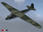
At 4:30 A.M. on May 10, 1940, three Junkers Ju 52's took off from the Cologne airfields of Ostheim and Butzweilerhof, towing behind them three other aircraft that lacked motors. The first front service of a new weapon, the freight glider, developed by the DFS (Deutsche Forschungsanstalt fur Segelflug / German Research Institute for Sailplane Flight), had begun. A total of 41 DFS-230 freight gliders with 400 paratroopers were launched for this mission. It was their task to take the Belgian Fort Eben Emael near Maastrich. With this successful operation the crossing of the Albert Canal was secured and the cornerstone of Belgian defense fell in German hands.
These assault gliders were also used during the Krete invasion (1941). The DFS 230's last significant use was during the 'Eichen' operation: 10 assault gliders were used to deliver the group of hand picked commandos led by Otto Skorzeny against the Gran Sasso mountain-top hotel that was used to hold Mussolini. The Royal Italian Air Force (Regia Aeronautica) received from Luftwaffe, during 1941, almost 20 DFS-230 and 4 Gotha Go-242 assault gliders. These aircrafts were used only for pilot training until 09/1943.
Complete aircraft. Original GMAX hi-res model, features the usual moving parts, such as all flight controls, canopy, doors and so on (5 different versions); Five different liveries (4 'Luftwaffe' +1 "Regia Aeronautica'); multiview 2D panel (NO VC). Created by Manuele Villa.
| Filename: | Luftwaffe_DFS230__Assault_Glider_v01.zip |
| License: | Freeware |
| Added: | 7th June 2010, 11:07:00 |
| Downloads: | 2,141 |
| Author: | Manuele Villa |
| Size: | 17.37 MB |
| Category: Flight Simulator 2004 - Scenery | |
| Ulukhaktok (Holman) CYHI in the Northwest Territories, Canada |
|
Images related to this file:
File Description:
Ulukhaktok (Holman) is an airfield on the west side of Victoria Island, off the northern coast of Canada. It is 320 miles west of Cambridge Bay (and you should download and install the recent post of CYCB by Sid and Pete, as I use it for the AI included in this post) and around 400 miles east of Inuvik (my post of a few months ago). It has been officially called Ulukhaktok since 2006, and before that it's name was Holman.
The village of Ulukhaktok has been placed around the bay and is approximately the right shape; it houses some 460 people who used to rely solely on hunting and fishing. The village is close to 71 degrees north, and there are only four months of the year when the average high is above zero centigrade. The photograph with snow (and of course a frozen sea) is typical; for the frozen sea download my Frozen Rivers & Lakes post which will provide this. The buildings on the field have been modelled specifically for this scenery, and as in real life there is only JetA available. The AI visiting aircraft are an Aklak Air DC3 (based in Inuvik and operated by Kenn Borek Air) and a Canadian North Dash 8-100. Note that the runways are signed as "true" headings instead of magnetic; in the Canadian Northern Domestic Airspace all headings are given as true. Unfortunately FS9 doesn't accommodate this in ATC.
| Filename: | Ulukhaktok_Holman_CYHI_in_the_Northwest_Territorie.zip |
| License: | Freeware, limited distribution |
| Added: | 24th May 2011, 20:05:47 |
| Downloads: | 454 |
| Author: | Roger Wensley |
| Size: | 2.3 MB |


© 2001-2026 AVSIM Online
All Rights Reserved
Privacy Policy |