
Where Flight Simulation Enthusiasts Gather from Around the World!
AVSIM Library - Search Results

| Category: Flight Simulator X - Scenery | |
| YDVE Dale River Skydiving (closed - historic site) |

|
File Description:
YDVE Dale River Skydiving - this site is now closed but still looks the same. For all those who remember jumping out of a very good plane and occasionally breaking a few bones, here it is. Get yourself a Pilatus Porter for this one, climb to 10,000 feet and then dive at 200kph to get on the ground before the parachutes! (YDVE = Y DiVE?).
REQUIRES blencowe_librarykit_309494.zip (Available HERE)
| Filename: | YDVE_Dale_River_Skydiving_closed__historic_site.zip |
| License: | Freeware |
| Added: | 25th February 2013, 23:46:09 |
| Downloads: | 218 |
| Author: | Alan Blencowe |
| Size: | 2.48 MB |
| Category: Flight Simulator X - Scenery | |
| YDWU Dalwallinu, Western Australia - Nugadong Airport |
|
File Description:
YDWU Dalwallinu - Nugadong Airport. This represents the newly updated airfield.
"10-03-2011 - March update for Nugadong Airport RedevelopmentWe are pleased to announce that the project to redevelop the Nugadong Airport is progressing well. Originally there were three areas that required upgrade; Airstrip Reseal, Installation of Animal Proof Fencing, and the construction of a Patient Transfer Facility. However, after successful negotiations with funding bodies we were abile to restructure the project to include the installation of a Taxiway & Apron. We are also pleased to announce that the project is on track to achieve it's May deadline. This is an exciting upgrade to existing community infrastructure and please feel free to visit the facility to have a look at the changes for yourself. Further updates on this, and other projects, will be released in the coming weeks and on completion." www.dalwallinu.wa.gov.au/news/PROJECT%20UPDATE.
REQUIRES blencowe_librarykit_309494.zip (Available HERE)
| Filename: | YDWU_Dalwallinu_Western_Australia__Nugadong_Airpor.zip |
| License: | Freeware |
| Added: | 25th February 2013, 23:47:28 |
| Downloads: | 251 |
| Author: | Alan Blencowe |
| Size: | 2.33 MB |
| Category: Flight Simulator X - Scenery | |
| YEEB Eneabba, Western Australia strip and townsite |
|
File Description:
YEEB Eneabba strip and townsite
Sand mining town in heart of wildflower area Located 278 km north from Perth via the Brand Highway, Eneabba is basically a sand mining town surrounded by some of the most extensive and spectacular wild flower displays anywhere in Western Australia. The town itself is, to be fair, a real non-event with dreary modern housing (with more than a hint of construction town design), a small shopping centre and a service station all of which look as though they have sprung up in the last 20-30 years. The wealth of the area is based on the rutile sands which lie to the south of the town as well as farming, particularly cattle grazing. With an estimated 80 per cent of the world's known rutile supplies the town can boast that it has the biggest deposits of rutile in both Australia and the world. The major mining company in the area is Iluka Resources Ltd. Eneabba is basically a service town for the mines but some of the miners, realising that Eneabba is hardly a paradise, have opted for commuting and live on the coast at Leeman and drive to work preferring the beach to the dry inland.
REQUIRES blencowe_librarykit_309494.zip (Available HERE)
| Filename: | YEEB_Eneabba_Western_Australia_strip_and_townsite.zip |
| License: | Freeware |
| Added: | 25th February 2013, 23:48:24 |
| Downloads: | 255 |
| Author: | Alan Blencowe |
| Size: | 3.59 MB |
| Category: Flight Simulator X - Scenery | |
| YFOR Fortnum Gold Mine and airstrip (in care and maintenance) |
|
File Description:
YFOR The Fortnum mine closed in April 2007, having only reopened in July 2006, when the then-owner Gleneagle Gold Limited went into receivership. It was sold to Eagle Gold Mines Limited in 13 December 2007, which, in turn, went into receivership in 2009, now renamed Grosvenor Gold Pty. Limited. The future of the mine remains uncertain. Approximate figure for the period from July 2006 to April 2007, calculated from gold sales of A$21,000,000 at an average of A$800 per ounce in this time.
REQUIRES blencowe_librarykit_309494.zip (Available HERE)
| Filename: | YFOR_Fortnum_Gold_Mine_and_airstrip_in_care_and_ma.zip |
| License: | Freeware |
| Added: | 25th February 2013, 23:49:17 |
| Downloads: | 217 |
| Author: | Alan Blencowe |
| Size: | 3.8 MB |
| Category: Flight Simulator X - Scenery | |
| YFRK Frankland River Grazing Company (Westfield), Western Australia |
|
File Description:
YFRK Frankland River Grazing Company (Westfield), home of Bobtail Ridge Wines, Merino Sheep and Simmental Cattle.
REQUIRES blencowe_librarykit_309494.zip (Available HERE)
| Filename: | YFRK_Frankland_River_Grazing_Company_Westfield_Wes.zip |
| License: | Freeware |
| Added: | 25th February 2013, 23:51:39 |
| Downloads: | 249 |
| Author: | Alan Blencowe |
| Size: | 6.75 MB |
| Category: Flight Simulator X - Scenery | |
| Alf's UK airfields volume 26-Lashenden v2 |
|
Images related to this file:
File Description:
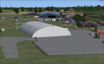
Lashenden EGKH is a grass airfield just SE of Headcorn in Kent. Both light aircraft movements and freefall parachuting take place and there is a museum on site. This is a new version of the one I did some years ago and uses photo textures on the buildings and includes the new large hangar.
| Filename: | Alfs_UK_airfields_volume_26Lashenden_v2.zip |
| License: | Freeware |
| Added: | 26th February 2013, 20:39:16 |
| Downloads: | 1,219 |
| Author: | Alf Denham |
| Size: | 13.76 MB |
| Category: Flight Simulator X - Scenery | |
| Alf's UK airfields 26-Additional ReadMe |
|
Images related to this file:
File Description:

An additional ReadMe concerning taxying from the parking in the Old Hangar.
| Filename: | Alfs_UK_airfields_26Additional_ReadMe.zip |
| License: | Freeware |
| Added: | 27th February 2013, 14:22:07 |
| Downloads: | 647 |
| Author: | Alf Denham |
| Size: | 124.72 KB |
| Category: Flight Simulator X - Scenery | |
| YFRV Oombugurri Community, Western Australia (Town closed 2011) |
|
File Description:
YFRV Oombugurri Community, Western Australia, formerly Forrest River Mission. Features extensive flattening of Forrest River which runs uphill. Take a flight there before installing the scenery.
Oombulgurri, was an Aboriginal community in the eastern Kimberley, 45 kilometres southeast of Wyndham.
The Anglican Forrest River Mission for Aborigines was founded in 1896���¢������97 by Harold Hale (Later Bishop of Prth) but was abandoned after a few months. A permanent mission, known as the Forrest River Mission, was established on the site in 1913 by the bishop of the north west, the Rt. Rev. Gerard Trower. In December 1913, Anglican priest Ernest Gribble took charge, three years after he was forced to resign as superintendent at Yarrabah. Gribble remained as superintendent until the early 1930s.
In 1926 the mission was plagued by an influenza epidemic and impacted by the Forrest River massacre where police killed a number of Aboriginal people. This event remains controversial.
The mission was closed in 1969, after the 1967 Aboriginal referendum.
In 1973, fifty Aboriginal people decided to resettle their abandoned tribal land and rename it Oombulgurri. Within a year, the population had grown to 200. Infrastructure and welfare programs were set up in the 1970s and 1980s to provide the residents with basic amenities and to allow the town to become self-sufficient.
In 2007 a Coronial Inquiry began into Aboriginal deaths in the Kimberley, including five in Oombulgurri. It revealed high levels of alcohol abuse, suicide and child neglect in Oombulgurri. Some time after the inquest, alcohol was banned there and the population began to move away to areas where alcohol was available.
It had a population of 107 as of the 2006 census. In 2011, the government of Western Australia encouraged residents of Oombulgurri to move elsewhere as it considered the community "unviable". The last residents from Oombulgurri were relocated to Wyndham just before Christmas 2011. REQUIRES Blencowe_LibraryKit.zip
REQUIRES blencowe_librarykit_309494.zip (Available HERE)
| Filename: | YFRV_Oombugurri_Community_Western_Australia_Town_c.zip |
| License: | Freeware |
| Added: | 28th February 2013, 02:37:06 |
| Downloads: | 229 |
| Author: | Alan Blencowe |
| Size: | 2.97 MB |
| Category: Flight Simulator X - Scenery | |
| YKEB Kellerberrin, Western Australia |
|
File Description:
YKEB Kellerberrin was modelled at the request of Councillor Cole. In this updated version, the silos have been added and the landclass for the town south of the highway has been masked giving a more realistic impression from the air. Kellerberrin is a town in the Wheatbelt region of Western Australia, 205 kilometres east of Perth on the Great Eastern Highway. The railway line from Northam to Southern Cross was constructed through here in 1893-94, and this section opened for traffic in 1895. Kellerberrin was one of the original stations when the line opened. By 1898 there was a demand for small blocks of land in the area, and the government surveyed a number of 20-acre lots the same year. The area was gazetted as Kellerberrin townsite in 1901, and the government soon made more land available for settlers. Early settlers from 1890 to 1910 from Ireland settled in the area of Kellerberrin and Wittem. Their family name
was English. A road was named after this family. The name Kellerberrin is Aboriginal, and is derived from the name of a nearby hill. The hill was first recorded as "Killaburing Hill" by an explorer in 1861, but in 1864 the explorer Charles Hunt recorded it as Kellerberrin Hill. One source claims that Kellerberrin is the name for the fierce ants that are found in the area, while another gives it as meaning "camping place near where rainbow birds are found" - kalla means camping place or place of, and berrin berrin is the rainbow bird. (repeating the name makes it plural) It also serves as a stop on the Prospector and Avonlink rural train services. REQUIRES Blencowe_LibraryKit.zip
REQUIRES blencowe_librarykit_309494.zip (Available HERE)
| Filename: | YKEB_Kellerberrin_Western_Australia.zip |
| License: | Freeware |
| Added: | 28th February 2013, 13:52:02 |
| Downloads: | 246 |
| Author: | Alan Blencowe |
| Size: | 2.69 MB |
| Category: Flight Simulator X - Scenery | |
| YKLN Kulin Town and YJLN Kulin, Jilakin Rock, Western Australia |
|
File Description:
YKLN Kulin Town and YJLN Kulin, Jilakin Rock. Kulin is located in the upper great southern Wheatbelt of Western Australia, the Shire of Kulin covers an area of 4,790 square kilometres. It encompasses the towns of Kulin, Pingaring, Dudinin, Jitarning, and Holt Rock. The Kulin economy is based on agriculture and was settled by pastoralists in 1905. The crosswind runway is actually 7 miles to the east at Jilakin Rock and slopes uphill to the east. For convenience, I have used fictitious YJLN. Jilakin Downs is a Dorper sheep stud farm and the home of the Kulin Bush Races. Dorpers are currently under a cloud in Western Australia as the local abatoirs claim their hair is contaminating the meat and won't accept them. "We welcome air traffic to our 2012 Kulin Bush Races Weekend. A crosswind airstrip is available, with a shuttle bus service to the Jilakin Track. GPS position is S32-39-95 E118-18-71 and the elevation is 950 feet. The strip is 7 nautical miles east of the town of Kulin. Camping and toilets are close to the strip so that you can camp near your plane.
Kulin airstrip is also available for landing and takeoff during the weekend, a shuttle bus is available to take you out to the race track. If this option is chosen please contact Barry West. Please contact Barry West for flying information on 9880 9021" www.kulin.wa.gov.au/tourism_and_local_events/kulin_bush_races/flying_visit.html REQUIRES Blencowe_LibraryKit.zip
REQUIRES blencowe_librarykit_309494.zip (Available HERE)
| Filename: | YKLN_Kulin_Town_and_YJLN_Kulin_Jilakin_Rock_Wester.zip |
| License: | Freeware |
| Added: | 28th February 2013, 13:52:31 |
| Downloads: | 225 |
| Author: | Alan Blencowe |
| Size: | 5.73 MB |


© 2001-2026 AVSIM Online
All Rights Reserved
Privacy Policy |