
Where Flight Simulation Enthusiasts Gather from Around the World!
AVSIM Library - Search Results

| Category: Flight Simulator 2004 - Scenery | |
| Medicine Hat CYXH in Alberta Canada |

|
Images related to this file:
File Description:
Medicine Hat is a town in south Alberta, beside the South Saskatchewan River, and around 180 miles southeast of Calgary. Originally a railroad town, and in fact still served by the railway and now also by the Trans-Canada Highway, it is currently mainly known for the large natural gas fields in the area. As Rudyard Kipling said, Medicine Hat has "all hell for a basement". The name of the city is a translation of the Blackfoot tribal name for the eagle tail feather headdress worn by tribal medicine men, and it was curiosity about the name that first got my attention.
The date of this scenery is not 2010, as is usual for my scenery; it is more like 2015. The terminal building has been extended and improved, the apron around the two large southern hangars and the large rental hangars behind them is still visibly new, and the tie-down parking places on the grass accessed off one side of the old taxiway are in place and in use. The airport is now (2015) not in the busy usage that it experienced in the second half of the 1900's and old taxiways and a runway have been left to decay and large old hangars have been demolished. Hence the visible remains. The current runways were rebuilt (on top of the existing as foundations) and are 03-21 with 4,990 feet of lit asphalt 150 feet wide with PAPI at both ends, and 09-27 with 2,885 feet of lit asphalt 100 feet wide.
The two newish hangars to the south are a helicopter operating and maintenance company with a flight training school based in the adjoining offices (light grey buildings) and an FBO in hangar and offices (dark grey). Further buildings have been erected since then, and some existing ones have been reclad (eg. light grey now, in 2021, has a light blue roof).
I have cheated in one respect. In reality, the edges of the airport have been gradually utilised for various purposes, such as workshops, storage sheds, factories, etc, with access from the surrounding urban roads. As I have almost no information regarding their appearance I decided to leave the airport area as it was originally built, rather than incorporating buildings that I know are false. I admit that this was also the laziest solution.
The scenery includes a grass strip 3 miles to the south of Medicine Hat, namely Schlenker CFZ3. It is the only airfield I have come across where the fences are not around the edge of the airfield, they are instead around the runways and apron. I presume this is so animals can be left to feed off the grass in summer.
The AI includes flights by Air Canada Jazz.
| Filename: | Medicine_Hat_CYXH_in_Alberta_Canada.zip |
| License: | Freeware, limited distribution |
| Added: | 23rd January 2022, 20:11:10 |
| Downloads: | 146 |
| Author: | Roger Wensley |
| Size: | 19.15 MB |
| Category: Flight Simulator 2004 - Scenery | |
| Landclass, Springbank Airport ,Calgary, Alberta, Canada |
|
File Description:
Modificatin of the landscape around CYBW Springbank airport in Calgary, Alberta, Canada using EZ Landclass.
| Filename: | Landclass_Springbank_Airport_Calgary_Alberta_Canad.zip |
| License: | Freeware |
| Added: | 27th December 2003, 19:58:18 |
| Downloads: | 2,255 |
| Author: | Andy Thomas |
| Size: | 1.7 KB |
| Category: Flight Simulator 2004 - Scenery | |
| Calgary Saddledome, Alberta, Canada |
|
File Description:
The Calgary Saddledome for FS2004. Highly detailed and structured FSDS 3D Model, located exactly at its real world coordinates. The bulding is also orientated the same as its real world counterpart. Close attention to detail to make this model as realistic as possible. Complex building structure including a full size NHL hockey arena inside the building. Home of the Flames. The Calgary Alberta skyline has never looked better. Enjoy.
| Filename: | Calgary_Saddledome_Alberta_Canada.zip |
| License: | Freeware, limited distribution |
| Added: | 13th February 2006, 03:33:27 |
| Downloads: | 3,845 |
| Author: | Rick Milne |
| Size: | 1.05 MB |
| Category: Flight Simulator 2004 - Scenery | |
| Ouadi Doum AFB v1.0 |
|
File Description:
This air base is located in the north of Chad and was built by the Libyan Air Force in 1985 to maintain a Military Air Power in the Libya - Chad War.
Actually is operated by the Chad Air Force in joint with the French Goverment and French Air Force.
This is a SEMARV scenery design.
| Filename: | Ouadi_Doum_AFB_v10.zip |
| License: | Freeware, limited distribution |
| Added: | 27th March 2011, 02:59:38 |
| Downloads: | 609 |
| Author: | Omar Herrera |
| Size: | 3.4 MB |
| Category: Flight Simulator 2004 - Scenery | |
| LFSB EuroAirport Basel Mulhouse Freiburg (EAP), Release 01 |
|
File Description:
The Euroairport Basel Mulhouse Freiburg LFSB, Release 01.
Finished 14.01.2006, tested with Win XP on FS2004.
This is the first Final-Release of the EAP LFSB after the Pre-Release in 2004.
This is a Swiss/French Airport at the border of Germany, France and Switzerland on French territoriy. Includes Y-Terminal, General Aviation Area, Freight Area and new Swiss- /Novartis Hangars. Even some buildings are not designed in GMAX, framerates are good. Happy Landing.
| Filename: | LFSB_EuroAirport_Basel_Mulhouse_Freiburg_EAP_Relea.zip |
| License: | Freeware |
| Added: | 15th January 2006, 20:34:21 |
| Downloads: | 39,536 |
| Author: | Joerg Unglaub |
| Size: | 6.5 MB |
| Category: Flight Simulator 2004 - Scenery | |
| CYQR 2015 - Regina International Airport - Groome Field **Season Adjustment Option** |
|
Images related to this file:
File Description:

This is an update option for CYQR 2015 - Regina International Airport - Groome Field scenery.
The CYQR 2015 scenery was designed to match the more accurate North American winter season changes developed by Scott Smart, which is available in the AVSIM file library. Seasons in the scenery are mismatched if the North American Season Zones Adjustment is not installed. This update provides users with an option to adjust CYQR 2015 to the default seasons.
| Filename: | CYQR_2015__Regina_International_Airport__Groome_Fi.zip |
| License: | Freeware, limited distribution |
| Added: | 11th November 2015, 08:46:27 |
| Downloads: | 1,235 |
| Author: | Gregory Putz |
| Size: | 789.39 KB |
| Category: Flight Simulator 2004 - Scenery | |
| Tokyo Bay 2005 |
|
Images related to this file:
File Description:
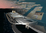
FS2004 Scenery Tokyo Bay Scenery 2005 Ver. 5.0
This add-on scenery improves specific scenerys (Tokyo Bay, Japan) of FS2004.
There are a lot of reclaimed land in Tokyo Bay.
They form an artificial peculiar coastline. This scenery reproduces these coastlines precisely.
And, this scenery reproduces the Keihin industrial area and the Keiyo industrial area in Tokyo Bay located west and east. In this scenery design, the coastline was reproduced as exactly as possible, following the specification of FS2004.
Moreover, 90m mesh geographical data is reproduced by using SRTM 3arc/sec.
The range of detailed coastline and 90m digital elevation data is as follows:
** [detailed coastline] N33:45 E138:45 to N36:55 E141:05 (included Izu Islands)
** [90m digital elevation data] N33:00 E138:00 to N37:00 E141:00 --
The Tokyo Wan AquaLine is arranged in the exact location. By Kazuo Kawamura
| Filename: | Tokyo_Bay_2005.zip |
| License: | Freeware, limited distribution |
| Added: | 3rd December 2011, 23:51:31 |
| Downloads: | 11,798 |
| Author: | Kazuo Kawamura |
| Size: | 9.74 MB |
| Category: Flight Simulator 2004 - Scenery | |
| RJTT - Tokyo (Haneda) International Airport - Tokyo, Japan - **FIX** |
|
Images related to this file:
File Description:

Fix for FS2004 Scenery Haneda Airport (RJTT). Thanks to the many people who reported missing textures for this scenery which may have caused a failure to load or crashing of the sim! Here are the missing textures files needed. Just place them in your X:\FS9\Scenery\World\Scenery folder and you should be good to go. My apologies for the mispackaging and any frustration this has caused. Also for the delay in posting due to my many errors when uploading this patch.
| Filename: | RJTT__Tokyo_Haneda_International_Airport__Tokyo_Ja.zip |
| License: | Freeware, limited distribution |
| Added: | 20th March 2015, 01:55:18 |
| Downloads: | 3,101 |
| Author: | John Stinstrom |
| Size: | 111.73 KB |
| Category: Flight Simulator 2004 - Scenery | |
| New Terrain Mesh of the Province of Quebec in LOD09 (2/4) |
|
File Description:
The files in this package contain terrain mesh files of the province of Quebec (N45 to N53) to be used with my Quebec enhanced sceneries for FS2004 (Scenes_du_Quebec_2k4.zip). The public data sources are the Shuttle Radar Topography Mission (SRTM-3, 90m) and the Canadian Digital Elevation Data (CDED - 0.75s/arc - 23m). (QC09_2k4a.zip to QC09_2k4d.zip - 4 parts)
***********************
Les fichiers de ces archives contiennent les donnees d'elevation de terrain (mesh files - lod09), pour FS2004, du territoire de la province de Quebec sous le 53ieme degre de latitude nord. Ils ont ete crees pour etre utilises avec mes nouvelles scenes du Quebec contenues dans Scenes_du_Quebec_2k4.zip. Les donnees sources sont du domaine public et proviennent de la Shuttle Radar Topography Mission (SRTM-3, 90m) et des donnees numerique d'elevation du Canada (DNEC - 0.75s/arc -23 m). (QC09_2k4a.zip to QC09_2k4d.zip - 4 parties)
| Filename: | New_Terrain_Mesh_of_the_Province_of_Quebec_in_LOD0.zip |
| License: | Freeware, limited distribution |
| Added: | 1st November 2009, 06:47:09 |
| Downloads: | 4,632 |
| Author: | Gilles Gauthier |
| Size: | 27.78 MB |
| Category: Flight Simulator 2004 - Scenery | |
| New Terrain Mesh of the Province of Quebec in LOD09 (1/4) |
|
File Description:
The files in this package contain terrain mesh files of the province of Quebec (N45 to N53) to be used with my Quebec enhanced sceneries for FS2004 (Scenes_du_Quebec_2k4.zip). The public data sources are the Shuttle Radar Topography Mission (SRTM-3, 90m) and the Canadian Digital Elevation Data (CDED - 0.75s/arc - 23m). (QC09_2k4a.zip to QC09_2k4d.zip - 4 parts)
***********************
Les fichiers de ces archives contiennent les donnees d'elevation de terrain (mesh files - lod09), pour FS2004, du territoire de la province de Quebec sous le 53ieme degre de latitude nord. Ils ont ete crees pour etre utilises avec mes nouvelles scenes du Quebec contenues dans Scenes_du_Quebec_2k4.zip. Les donnees sources sont du domaine public et proviennent de la Shuttle Radar Topography Mission (SRTM-3, 90m) et des donnees numerique d'elevation du Canada (DNEC - 0.75s/arc -23 m). (QC09_2k4a.zip to QC09_2k4d.zip - 4 parties)
| Filename: | New_Terrain_Mesh_of_the_Province_of_Quebec_in_LOD09_14.zip |
| License: | Freeware, limited distribution |
| Added: | 27th January 2010, 18:10:18 |
| Downloads: | 8,920 |
| Author: | Gilles Gauthier |
| Size: | 23.76 MB |


© 2001-2026 AVSIM Online
All Rights Reserved
Privacy Policy |