
Where Flight Simulation Enthusiasts Gather from Around the World!
AVSIM Library - Search Results

| Category: Flight Simulator 2004 - Scenery | |
| New Terrain Mesh of the Province of Quebec in LOD09 (4/4) |

|
File Description:
The files in this package contain terrain mesh files of the province of Quebec (N45 to N53) to be used with my Quebec enhanced sceneries for FS2004 (Scenes_du_Quebec_2k4.zip). The public data sources are the Shuttle Radar Topography Mission (SRTM-3, 90m) and the Canadian Digital Elevation Data (CDED - 0.75s/arc - 23m). (QC09_2k4a.zip to QC09_2k4d.zip - 4 parts)
***********************
Les fichiers de ces archives contiennent les donnees d'elevation de terrain (mesh files - lod09), pour FS2004, du territoire de la province de Quebec sous le 53ieme degre de latitude nord. Ils ont ete crees pour etre utilises avec mes nouvelles scenes du Quebec contenues dans Scenes_du_Quebec_2k4.zip. Les donnees sources sont du domaine public et proviennent de la Shuttle Radar Topography Mission (SRTM-3, 90m) et des donnees numerique d'elevation du Canada (DNEC - 0.75s/arc -23 m). (QC09_2k4a.zip to QC09_2k4d.zip - 4 parties)
| Filename: | New_Terrain_Mesh_of_the_Province_of_Quebec_in_LOD0.zip |
| License: | Freeware, limited distribution |
| Added: | 27th January 2010, 18:17:08 |
| Downloads: | 7,859 |
| Author: | Gilles Gauthier |
| Size: | 20.94 MB |
| Category: Flight Simulator 2004 - Scenery | |
| Removal of Nuclear Plant in Nova Scotia, Canada |
|
File Description:
The file "nuclear plant removal.bgl" excludes the nuclear plant that was placed by mistake in the default scenery next to the Halifax/Shearwater ( CYAW ) airport in Nova Scotia, Canada. The only nuclear plant in the Maritimes is located in Pointe-Lepreau in New Brunswick. It is a CANDU 6.
| Filename: | Removal_of_Nuclear_Plant_in_Nova_Scotia_Canada.zip |
| License: | Freeware |
| Added: | 18th July 2004, 17:03:39 |
| Downloads: | 1,648 |
| Author: | Marc Renaud |
| Size: | 558.7 KB |
| Category: Flight Simulator 2004 - Scenery | |
| RAF Fairford 2007 |
|
File Description:
RAF Fairford 2007. Add-on scenery for the default FS2004 scenery - not tested with UK2000 or VFR scenery. This isn't photorealistic by any means but provides an accurate as possible representation of RAF Fairford, the home of the Royal International Air Tattoo. Zip file c6MB. Readme file contains instructions and recommended addon files.Readme recommends users download RWY12 package, Novagold textures and 4 other freeware object libraries.
| Filename: | RAF_Fairford_2007.zip |
| License: | Freeware, limited distribution |
| Added: | 6th September 2007, 23:34:12 |
| Downloads: | 2,571 |
| Author: | Dave Morgan |
| Size: | 6.05 MB |
| Category: Flight Simulator 2004 - Scenery | |
| LTBQ - Cengiz Topel Naval Air Station Scenery |
|
Images related to this file:
File Description:
LTBQ - Cengiz Topel Naval Air Station Scenery created with ADE9 v.1.79 and static objects libraries with using the latest satellite images available from Google Earth.
| Filename: | LTBQ__Cengiz_Topel_Naval_Air_Station_Scenery.zip |
| License: | Freeware |
| Added: | 27th May 2023, 00:48:20 |
| Downloads: | 232 |
| Author: | Taner Akol |
| Size: | 8.57 MB |
| Category: Flight Simulator 2004 - Scenery | |
| Ría de Vigo (Bay of Vigo) |
|
File Description:
Comprehensive revision of the area surroinding the Bay of Vigo, near the Vigo Airport (LEVX, aprox. at 42º18'N 8º38'W), in Galicia, Spain, including a more accurate coastline, from the Ría de Aldán until Toralla Island, plus the San Simon Island and other minor islands, detailed piers in Vigo and Cangas, several beaches, and a lot of 3D VFR references (more than 180 macros added), such as buildings (the City Hall, the Hospital Xeral, the Balaídos Stadium, the Castro stronghold...), working lighthouses, several monuments and statues, some main streets redrawn, a new version of my Rande Bridge, now with collision detection and landable surface, and a handfull of eye-candies I can't even remember! -
Completa revisión da costa da Ría de Vigo, dende a Ría de Aldán ata pasada a Illa de Toralla, incluíndo, por suposto, á Illa de San Simón e outros pequenos illotes, praias (Samil, Nerga...), os peiraos de Cangas e de Vigo, dende o Areal ata Bouzas, unha morea de novas referencias visuais (máis de 180 macros), con edificios (o Concello, o Hospital Xeral, o estadio de Balaídos, o castelo do Castro, o lazareto de San Simón...), faros (nas Cíes e na costa...), algún que outro monumento, unha revisión do trazado dalgunhas das vías principais, unha nova versión da miña Ponte de Rande, con detección de colisións e superficie "aterrable", e moitas cousas máis que xa nin eu mesmo lembro. -
Completa revisión de la costa de la Ría de Vigo (Galicia, España, aprox. en 42º18'N 8º38'O), desde la Ría de Aldán hasta pasada la Isla de Toralla, incluyendo la Isla de San Simón y otros pequeños islotes, playas (Samil, Nerga...), los muelles de Cangas y de Vigo, desde el Areal hasta Bouzas, un montón de nuevas referencias visuales (más de 180 macros), con edificios (el Ayuntamiento, el Hospital Xeral, el estadio de Balaídos, el castillo del Castro, el lazareto de San Simón...), faros (en las Cíes y en la costa...), algún que otro monumento, una revisión del trazado de algunas de las vías principales, una nueva versión de mi Puente de Rande, con detección de colisiones y superficie "aterrizable", y muchas cosas más de las que ni yo mismo me acuerdo.
| Filename: | Ra_de_Vigo_Bay_of_Vigo.zip |
| License: | Freeware |
| Added: | 16th May 2004, 23:48:38 |
| Downloads: | 4,480 |
| Author: | Rubén Castiñeiras |
| Size: | 366.85 KB |
| Category: Flight Simulator 2004 - Scenery | |
| CYCE - James T. Field Memorial at Centralia, Ontario, Canada V1 updated |
|
Images related to this file:
File Description:
This is an updated version of the original post, revising and adding to AI, parking, rear fences, paths from apron to hangar doors, etc. The Lockheed Constellation was downloaded from the web site California Classics, and with the knowledge and permission of Tom Gibson the modified plane is included here complete with its Air Alaska textures and a modified .cfg file so that it will imitate a lightly loaded plane and squeeze the landing run to suit the runway length of 10-28. The airfield is in southern Ontario, 55 miles west of Kitchener and 25 miles northwest of London, close to the shore of Lake Huron. The airfield is ex-military and was previously listed as Huron Airpark before being officially named the James T. Field Memorial; for me it will always be Huron Airpark. The field is owned by Goderich Aircraft Inc, a company that fits out aircraft with new interiors including instrumentation, seating, and paint schemes. Their main customers are business jet owners, which is why the AI here is oriented towards Lear etc. There are now two runways in use, the third being closed and marked as such (though still listed in the AI for you to select one to land on). The main runway is 10-28 and just over 5,000 feet. The second runway is 16-34 and 4,400 feet, with only identification numbers and centreline markings. There appear to be no apron lights, taxiway lights or runway signage currently installed. There is a small club hangar (and club room) adjacent to the main apron at the southern end, with GA parking, and there are two large hangars (one new) used by Goderich at the northern end. The remainder of the original large hangars are now in use as light industrial units unrelated to aviation, the most obvious of which is a garbage collection company with numerous parked garbage trucks. One of the hangars adjacent to the apron does incorporate what appears to be a new set of hangar doors (the red one) but it is unclear if this is actually in use for a plane. The control tower is no longer in use, and there is only limited snow clearance in the winter by Goderich; presumably they only clear it when they need to use it themselves.
| Filename: | CYCE__James_T_Field_Memorial_at_Centralia_Ontario_.zip |
| License: | Freeware, limited distribution |
| Added: | 24th November 2016, 22:20:37 |
| Downloads: | 326 |
| Author: | Roger Wensley |
| Size: | 13.92 MB |
| Category: Flight Simulator 2004 - Scenery | |
| Schefferville CYKL & Squaw Lake CSZ9 in Quebec Canada |
|
Images related to this file:
File Description:
Schefferville is a town in an area of Quebec that is surrounded by Labrador, the border taking an unusual wriggly course instead of the normal Canadian straight line. One has to presume that there was a lot of political negotiation involved. Take a look at Google Earth to see what I mean. The town was established in 1954 (initially at a site a bit north of the present location, and with a different name) to support newly established iron ore mining. To assist with the exploration for further iron ore and the construction of the railway it seems that there was a forced relocation of native population. Although iron ore mining around Schefferville in its current location flourished through the late 1960's these relocated folk were neglected and suffered "destitute poverty". Through the 1970's iron ore mining declined and ceased in Schefferville in 1982, when most of the 4,000 or so non-native residents left. Since the year 2000 there have been moves to reopen mining in the area and production restarted in 2011, the approximate date of this scenery. The main reason why iron ore mining started again in Schefferville as opposed to any other area in Quebec or Labrador is the existing railway, used for ore transportation. There is no road connection and the airport is the only other means of access for the 250(?) town inhabitants. This population figure is somewhat of a guess, and the town inhabitants are largely company officers who change and move in and out as required by their work. Schefferville airport is to the east of the town. It has a single lit asphalt runway that is aligned 18-36 and is 4,975 feet long and 150 feet wide, with PAPI at both ends. Air Inuit flights connect with Kuujjuaq to the north and Sept-Isles to the south with onward connections to all parts of Canada. There are other charter flights for company personnel. The terminal building has been renovated and the photos show just how dilapidated it had become before this was done. I like it. This scenery also includes Squaw Lake, a float base that is used by Air Saguenay. Or was, as the company was closed in 2019 after an accident involving several deaths. The reason for Air Saguenay establishing a float base here was, once again, the railway, which allowed people to reach Schefferville for a reasonable cost. They could then use the float planes for a shorter distance and reasonable price to reach fishing lodges on the lakes to the north. If you find an error email me please, and note that my email address has been changed to rogwens at Gmail dot com.
| Filename: | Schefferville_CYKL__Squaw_Lake_CSZ9_in_Quebec_Cana.zip |
| License: | Freeware, limited distribution |
| Added: | 1st August 2021, 16:10:32 |
| Downloads: | 129 |
| Author: | Roger Wensley |
| Size: | 16.63 MB |
| Category: Flight Simulator 2004 - Scenery | |
| Umiujaq CYMU in Northern Quebec, Canada |
|
Images related to this file:
File Description:
Umiujaq is a small village on the east coast of Hudson Bay, in Quebec, around 140 miles south of Inukjuak and 100 miles north of Kuujjuarapik; the latter is where some 500 inhabitants moved from in 1986 to avoid the effects of a hydroelectric dam project and founded Umiujaq. The airfield is a mile and a half inland and southeast of the village, and the 3,520 feet of gravel runway is aligned 03/21, and these are magnetic bearings as Inukjuak is not in the Northern Domestic Airspace zone. There is no fuel available, unless there is some 100LL in drums. The visiting AI airline is Air Inuit from Montreal.
| Filename: | Umiujaq_CYMU_in_Northern_Quebec_Canada.zip |
| License: | Freeware, limited distribution |
| Added: | 22nd December 2011, 01:00:20 |
| Downloads: | 635 |
| Author: | Roger Wensley |
| Size: | 1.95 MB |
| Category: Flight Simulator 2004 - Scenery | |
| General Atomics Flight Test Facilites |
|
Images related to this file:
File Description:
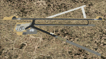
Sceneries of El Mirage (L69) and Gray Butte Field (04CA). These fields are owned by General Atomics and serve as the flight test facilites for the Predator and Reaper UAS/UAV/Drone (however you wish to call them). This scenery requries 2 extra files:
1. MAIW Hill AFB Package
2. MAIW Lemoore Hornets or MAIW Special Use Mentors Packages
| Filename: | General_Atomics_Flight_Test_Facilites.zip |
| License: | Freeware, limited distribution |
| Added: | 20th May 2010, 01:37:00 |
| Downloads: | 493 |
| Author: | Matthew Donica |
| Size: | 275.49 KB |
| Category: Flight Simulator 2004 - Scenery | |
| RAF Akrotiri |
|
Images related to this file:
File Description:
Scenery & afcad for RAF Akrotiri, Cyprus. You'll need some packages from MAIW to see the buildings, please read the readme for details.
| Filename: | RAF_Akrotiri.zip |
| License: | Freeware |
| Added: | 7th July 2011, 00:03:57 |
| Downloads: | 1,396 |
| Author: | Daniel Reeves |
| Size: | 41.15 KB |


© 2001-2026 AVSIM Online
All Rights Reserved
Privacy Policy |