
Where Flight Simulation Enthusiasts Gather from Around the World!
AVSIM Library - Search Results

| Category: Flight Simulator 2004 - Miscellaneous Files | |
| Go To any Airport Version 3 |

|
File Description:
Go To Any Airport Version 3.- Now 3 Airports Included.
Always wanted to return to your favourite local Airport from anywhere in the world? simply - with no fuss? Look no Further.
Start at your Designated Airport, [in this case London Gatwick or Innsbruck or Dublin in a 737], then Goto any Airport! - via the FS9 World menu and return to the Original Designated Airport - every time! - By Just turning the GPS/nav switch to GPS and Flight Director and autothrottle on whilst still on the ground.Click on the Autopilot and Nav Hold switch once above 1000ft - thats it !! . Set Weather and Altitude as required and Speed in autopilot and away you go. Use the FS9 ATC as You Travel, call into designated Airport when close and receive the curent ATIS and Runway approach in use.
HAVE FUN.
(This is different to the great circle direct routes that you can programme into the very good FS9 GPS - each and every time you start from a new airport).
| Filename: | Go_To_any_Airport_Version_3.zip |
| License: | Freeware |
| Added: | 7th March 2004, 17:42:32 |
| Downloads: | 433 |
| Author: | Alan Trussell |
| Size: | 26.95 KB |
| Category: Flight Simulator 2004 - Aircraft Repaints, Textures and Modifications | |
| Iran Air Airbus A380 |
|
File Description:
This is a repaint of Mike Stone's great Airbus A380 in Iran Air imaginary livery. These are the texture files only
So you need to download the original file named sa380.zip from the avsim.com (base textures are also included in that file).
I have named this "giant" IR aircraft Alborz which is the name of the mountains located in the north of Iran to the north of
Tehran and is the home to the extinct volcano Damavand, the highest peak/point in Iran(5671m).If you are thinking that Alborz is an Arabic name because of that Al in front of it I should say you are totally wrong for if Albert is an Arabic name then Alborz is too!! Besides, I am sure that you do know well that Iranians are of Aryan ancestory and they speak Persian not Arabic(am I teaching linguistics or history here?!! @;)
Alpha layers are used and textures are formatted in DXT3 so no blurring will appear on the fuselage.
| Filename: | Iran_Air_Airbus_A380.zip |
| License: | Freeware |
| Added: | 9th March 2004, 13:35:59 |
| Downloads: | 1,013 |
| Author: | Pantee Farhangi / Mike Stone |
| Size: | 160.92 KB |
| Category: Flight Simulator 2004 - Miscellaneous Files | |
| GoTo Any Airport |
|
File Description:
GoTo Any Airport.
Inclued here Heathrow and London Luton. Always wanted to return to your favourite local Airport from anywhere in the world? simply - with no fuss? Look no Further.
Start at these Designated Airports,then Goto any Airport! - via the FS9 World menu and return to the Original Airport - every time! - By Just turning the GPS/nav switch to GPS and Flight Director and autothrottle on whilst still on the ground.Click on the Autopilot, IAS, ALT and Nav Hold switches once above 1000ft - thats it !! . Set Weather and Altitude as required and Speed in autopilot and away you go. Use the FS9 ATC as You Travel, call into Airport when close and receive the curent ATIS and Runway approach in use.
The added circuit flights are on Autopilot and allow you to observe the airport befor landing.They make good moving screen savers - but make sure you have plenty of fuel!compatible with UK2000 Airports & VFR scenery for UK.
| Filename: | GoTo_Any_Airport.zip |
| License: | Freeware |
| Added: | 19th June 2004, 07:12:30 |
| Downloads: | 690 |
| Author: | Alan Trussell |
| Size: | 38.37 KB |
| Category: Flight Simulator X - Missions | |
| The Most Dangerous Airports: Lukla V2 |
|
Images related to this file:
File Description:
Approach to Lukla V2 (Totally New Mission)
You are a very experienced pilot flying the Twin Otter for Yeti Airlines on an imaginary flight to and from Lukla. Take-off from Biratnagar airport VNVT climb to at least 13500 ft to WP1 Turn to Lukla. From WP1 carefully descent to 10000 ft (there should be cloud to make it more difficult, if you have some sort of weather add-on running) to WP2 Approach to VNLK, after passing through the gate turn sharp right and land at Lukla airport, remember that the runway has an incline of several degrees. Turn around and take-off again, stay on the runway and rotate just before the end of the runway. Follow the valley back to the south until you are able to track the VOR 112.30 at roughly 276�°, till you reach Kathmandu Intl Airport and land. Yes, it sounds easy, butâ�¦ find out for yourself.
| Filename: | The_Most_Dangerous_Airports_Lukla_V2.zip |
| License: | Freeware |
| Added: | 9th June 2010, 02:40:12 |
| Downloads: | 1,679 |
| Author: | Robbie Albers |
| Size: | 2.17 MB |
| Category: Miscellaneous Files - General Utilities | |
| My Destination Chooser V4 - DEMO weather & charts part (v1.00) |
|
Images related to this file:
File Description:

Following delays over the initial My Destination Chooser v4 schedule, we have decided to make this small demonstration.
The aim is to show you some functions that will be included in MDCv4: the Weather and Charts part.
Weather Feature: Seach by ICAO code (METAR/TAF) ; Integrated METAR decoder ; Advanced Weather Chart display (Available sources : JEPPESEN, Eurocockpit, IVAO)
Charts Feature : Charts page (See the aiports charts of various airport spread all over the world!)
The Weather function available on MDCv4 is one of the most complete and integrated one available on any free pre flight planner tool. You can also easily find the most airport chart in the world thanks to this software.
Please, remember that is only a part of the futur addon: My Destination Chooser V4
This soft can be used for all you flight, and add a step forward for you flight preparation.
WARNING: Framework 4 required (link in the manuel).
Made by AirTimSimulation Team
| Filename: | My_Destination_Chooser_V4__DEMO_weather__charts_pa.zip |
| License: | Freeware, limited distribution |
| Added: | 13th November 2010, 14:58:44 |
| Downloads: | 569 |
| Author: | "AirTimSimulation" |
| Size: | 1.72 MB |
| Category: Flight Simulator 2004 - Sounds | |
| CFM56-7B engine sounds for Payware Boeing 737 family ONLY |
|
Images related to this file:
File Description:

Here I am again with another CFM56-7B sound package but at this time for the PMDG's 737 family ONLY. After the great and successful Emil Serafino's package I bring to you my 4th version of this engine sound set. In the latest version some sounds were not saved in a good quality by that I decided to make a new package with improved sounds which can provide more realism to you flight.
This is a new level of sound set with a truelly immersive sensation. Improved idle sound, full power roar, a whole new start up sound, gear up and down, touchdown sounds mixed with the speedbrake deploying sound to improve realism (optional) and also an amaaazing and WHOLE NEW SPOOL UP SOUND. So, after the success of package version 3, I bring to you this new one and I really hope you like it. HAVE FUN!
** TOTALLY COMPATIBLE WITH FSX AND ANY OTHER VERSION IS NEEDED !! **
| Filename: | CFM567B_engine_sounds_for_Payware_Boeing_737_famil.zip |
| License: | Freeware |
| Added: | 7th March 2010, 01:06:17 |
| Downloads: | 5,197 |
| Author: | Patrick Cramer |
| Size: | 23.21 MB |
| Category: Flight Simulator X - Scenery | |
| LFMI - Istres/Le Tube |
|
File Description:
Welcome to Istres Air Base/BA 125.
Istres is an Air Base use by the French Air Force and is also a base for the helicopter squadron. It has a large repair and is a large training facility.
It's common to see the Alpha jet visiting the BA 125 during their training. Alpha Jet used by the Patrouille de France.
The Air base is large enough to accomodate all type of aircrafts and even up to the B747. It has 1 major Rwy 15/33 of 12303 Ft /3750 m.
I have included the 15C/33C grass rwy for use by ligth G.A aircraft and other Gliders. Put up on a nice landing and Hot dog will be waiting for you down there! ;)
I have developped all aprons, included the ILS rwy 15 and developped the Tower area, increased the amount of parking due to the space available.
Istres has a tremendous amount of parking spot. I have included the chart as well for VFR traffic.
2 Parallel Rwy to the active one, these are closed! do not mistake them with the grass one! ;)
Have fun!
| Filename: | LFMI__IstresLe_Tube.zip |
| License: | Freeware |
| Added: | 12th May 2009, 10:30:16 |
| Downloads: | 2,741 |
| Author: | Daniel Louvet |
| Size: | 4.13 MB |
| Category: Flight Simulator 2004 - Scenery | |
| Airstrips East of the Adriatic |
|
Images related to this file:
File Description:
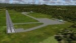
A collection of about 60 small airfields in Albania, Bosnia & Herzegovina, Kosovo, North Macedonia and Serbia & Montenegro, many of which aren't featured in FS2004, each enhanced with taxiways, parking spaces, buildings etc. and aprons as appropriate, to fill in a few gaps to the east of Italy. Most of these airfields are relatively "rural", often little more than a shed and a grass runway in a field, but they allow the generation of lightweight GA AI traffic in this area and into the adjacent countries.Again, there's no photo-realism here, just a selection of basic 'generic' buildings, more or less accurately sized and placed to reflect the airfield layout as seen on on-line satellite imagery and aerial photography. These buildings have minimal effect on frame-rates, so are ideal for this kind of job. The airfields are aligned as well as possible with the default roads etc. and the Genesis Europe mesh, but should mostly be fine in a default installation or other configuration.As before, the files for each airfield can be easily identified by the ICAO code, even if the airfield names vary slightly, so you can pick and choose and mix and match to suit any sceneries you already have, should you so wish. There is no requirement for any other download. Each airfield will exist as a stand-alone entity should you only want a few of them. A few default airfields have had new ICAO codes allocated, in these instances I've provided files to remove the default scenery from the landscape, though the original airfield will still appear on the maps and menu.
| Filename: | Airstrips_East_of_the_Adriatic.zip |
| License: | Freeware |
| Added: | 20th October 2025, 11:48:25 |
| Downloads: | 57 |
| Author: | Chris Eve |
| Size: | 525.71 KB |
| Category: Flight Simulator 2004 - Scenery | |
| CZNL - Nelson - Nelson, British Columbia, Canada |
|
Images related to this file:
File Description:
Nelson is a town with a population of around 10,000, located 250 miles or so east of Vancouver on the southern shore of an east-west offshoot of Kootenay Lake. The surrounding landscape can be described as "steep" without fear of contradiction, and the diagram of arrival and departure routes (included here) shows that straight finals to either end of the runway are non-existant. The airport is right beside the water, with a single runway 3,100 feet long and 75 feet wide, aligned 04/22. The apron is at the western end. There are a number (3?) of helicopter companies based at the western end of the apron, and there is also a terminal building, though there are in fact no regular scheduled flights; there are occasional charters to cater for town events during the summer tourist season. There is no runway lighting, or taxiway or apron lights, so usage is effectively restricted to daylight hours (though not legally stated as such). All circuits are over the water and not the town, though even this means you climb quickly and dog-leg to follow the water until you have gained enough altitude to turn. Winter maintenance is limited. And if all this is not enough you are advised to "watch for wildlife on the rwy". The nature of the surrounding terrain makes AI hit-and-miss; mostly hit. AI Planes will taxi out and then take off, and provided you don't follow them until they fly into a mountain it will all appear normal. Planes that are arriving will appear by magic on their parking spots, as they have crashed before they arrive. To avoid repetitive unrealistic arrivals I have limited the AI to only 3 planes. The scenery includes some of the nearby buidings and landmarks, as shown in the screenshots.
| Filename: | CZNL__Nelson__Nelson_British_Columbia_Canada.zip |
| License: | Freeware, limited distribution |
| Added: | 7th June 2015, 10:23:49 |
| Downloads: | 425 |
| Author: | Roger Wensley |
| Size: | 17.84 MB |
| Category: Flight Simulator X - AFCAD Files | |
| Active ILS Innsbruck, Austria (LOWI) |
|
File Description:
This FSX Airport is more then just a AFX style Airport. As most know the Approach and Final (VMC) for AI Traffic in FSX is a straight in type landing and does not always consider high terrain at airports. This is due to the way that the coding is written in FSX and it puts limits on IFR arriving aircraft. At certain airports the AI Traffic will fly directly through a mountain once it is established on Final for a runway. What you will see with my files is a different type approach used for both the way I control AI and User Airplane Traffic in FSX. No longer do the AI Planes use a straight in approach when landing at LOWI. My AI Aircraft Approach coding for FSX uses a visual offset approach so AI Traffic does not fly through the mountains. The Innsbruck Control Tower will clear all AI Traffic (IFR FP) landing either on RWY 08 or 26 as a straight in landing even though the offset to final is 30 degrees from the runway center line. Read the text file for all the enhancements added to the FSX LOWI Airport along with a full understanding of how the new Approaches work *** Full set of Freeware Approach Charts included ***
| Filename: | Active_ILS_Innsbruck_Austria_LOWI.zip |
| License: | Freeware, limited distribution |
| Added: | 21st July 2007, 13:04:43 |
| Downloads: | 6,072 |
| Author: | Jim Vile |
| Size: | 799.84 KB |


© 2001-2026 AVSIM Online
All Rights Reserved
Privacy Policy |