
Where Flight Simulation Enthusiasts Gather from Around the World!
AVSIM Library - Search Results

| Category: Flight Simulator X - Scenery | |
| Mesh South America / MeSA D08 |

|
File Description:
FSX Mesh South America Project:
This terrain mesh file is a part of a whole project covering all the Continent
of South America and some islands, divided in tiles identified in a map by its
column (letters) and rows (numbers).
Those files were multi-LOD compiled from 90m SRTM2 source data, reprocessed
with 3DEM to remove voids and spikes, providing a 76.4m (LOD9) horizontal
resolution topography intended for use only in FSX updated with SP1.
Although not well documented, to improve performance, the updated FSX loads DEM
files in threads and only the closer terrain (about 5-10 NM from the point of view)
is rendered in high detail, while at far distances FSX shows up its default low
resolution mesh, when there is not a third part terrain mesh compiled in all
others intermediate level of details (multi-LOD).
THIS FILE:
FSX_MeSA_D08 (Column D x Row 08)
covers the area inside the boundaries:
N = 22º 30' S; S = 28º 7.5' S;
W = 67º 30' W; E = 60º 0' W;
AUTHORS:
Hely Heck Junior - Magrao ( [email protected] )
and Jose Lobo ( [email protected] )
TerraBrasilis: www.terra-brasilis.org
| Filename: | Mesh_South_America__MeSA_D08.zip |
| License: | Freeware |
| Added: | 13th June 2007, 12:36:30 |
| Downloads: | 1,168 |
| Author: | Hely Heck Jr. and José Lôbo |
| Size: | 58.82 MB |
| Category: Flight Simulator X - Scenery | |
| Oahu Scenery Version 1 |
|
File Description:
This scenery sits on top of "MegaSceneryX - Hawaii - Honolulu and Oahu Island", SO IT REQUIRES THE MEGASCENERY X - Hawaii - Honolulu & Oahu Island" photo scenery from http://www.megascenery.com/
This is primarily an Autogen scenery with some custom developed objects for the coast of Oahu.
I used autogens from default FSX for the most part as well as the FSX Acceleration. IF you did not install acceleration, it should not be an issue. you would just not see some of the autogens from the acceleration package. I have also included some custom built GMAX Objects with this package. There is also an AFCAD file for a new fictitious Heliport that is included ("PMMH)".
This scenery package also includes a Mission called "Oahu Sacred Falls Landing". It is a short mission without any surprises or twists, yet I am confident many of you would find it interesting and very very challenging. But do not be discouraged at the difficulty of completing the mission. You may want to turn off crash detection to make it easier if you'd like. The fun is in the journey..right?
Lastly, I have included a fix for my MM_PHNGv1 scenery as part of this package.
| Filename: | Oahu_Scenery_Version_1.zip |
| License: | Freeware, limited distribution |
| Added: | 29th February 2008, 02:31:04 |
| Downloads: | 4,126 |
| Author: | Manny Mahadevan |
| Size: | 9.9 MB |
| Category: Flight Simulator X - Scenery | |
| Bhutan Airports and Paro Valley |
|
Images related to this file:
File Description:
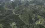
This project adds and updates all of the airports of Bhutan. Bathpalathang (VQBT) and Gelephu (VQGP) are added, Yongphulla (VQ10) is updated and recoded as VQTY, and Paro (VQPR) is fully updated to reflect current satellite imagery. These are all fully functioning AI airports as well. Special attention was given to the entire Paro Valley, and numerous road/river vectors were updated around Gelephu. Accurate coastlines, lakes, road and river data, as well as corrected landclass are provided based on the latest available satellite imagery. They are optimized to fit seamlessly with FTX Vector's roads/water, but they should be fully functional in all FSX configurations.
GA-encoded flight plans for the Buddha Air/Kathmandu charter are provided to enhance service to Paro. NASA SRTM Global 3 arc second terrain mesh is also included for all of Bhutan. Updates were created or rebuilt in a manner which carefully aligned airport data with current satellite imagery, when available. Scenery was created using Airport Design Editor X v1.61.5298, SBuilderX 3.13, and the FSX Object Placement Tool. Scenery objects were added and modified from stock FSX scenery to resemble as closely as possible the actual airports.
| Filename: | Bhutan_Airports_and_Paro_Valley.zip |
| License: | Freeware |
| Added: | 19th January 2015, 06:09:17 |
| Downloads: | 11,429 |
| Author: | Carlyle Sharpe |
| Size: | 21.4 MB |
| Category: Flight Simulator X - Scenery | |
| Goma Intl (FZNA) DRC and Gisenyi (HRYG) Rwanda |
|
Images related to this file:
File Description:
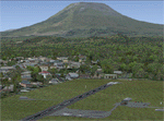
This project includes the neighboring Goma Intl (FZNA) and Gisenyi (HRYG) airports. After Goma's only runway was severely damaged by the eruption of Mount Nyiragongo in 2002, the runway, originally 3000m long, was reduced to 1800m of serviceable pavement after lava flowed onto the northern part runway and through the city center. In 2013, German NGO Welthungerhilfe ("World Hunger Aid") signed a contract to rehabilitate 500m of runway damaged by the lava flow. Goma resumed scheduled international flights in 2015, and this project reflects the airport as of March 2016, with runway 18/36 renumbered to 17/35. SRTMGL1 (30m) mesh brings the volcanoes in the area into much greater detail. This scenery is complimented by the Kigali Intl (HRYR) scenery (FSX_HRYR_Kigali_2016.zip).
Updates were created or rebuilt in a manner which carefully aligns airport data with current satellite imagery. Scenery was created using Airport Design Editor X v1.70.6042, SBuilderX 3.13, and the FSX Object Placement Tool. Scenery objects were added and modified from stock FSX scenery to resemble as closely as possible the actual airports. The FSX apron lights included are from the set created by Jim Dhaenens.
| Filename: | Goma_Intl_FZNA_DRC_and_Gisenyi_HRYG_Rwanda.zip |
| License: | Freeware |
| Added: | 4th August 2016, 21:11:20 |
| Downloads: | 2,279 |
| Author: | Carlyle Sharpe |
| Size: | 5.25 MB |
| Category: Flight Simulator X - Scenery | |
| 2016 Kigali Intl (HRYR) Rwanda |
|
Images related to this file:
File Description:
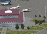
This sequel to the 2009 Kigali Intl (HRYR) Rwanda scenery (by Jacques Botha and Frits Beyer) brings it up to date with the current layout and enables full compliance with FTX Global/Vector and FSX. Buildings are added and adjusted to their real-world locations, and the new taxiway and south apron are added according to the May 2016 satellite imagery. In addition to real-world gate locations, custom apron markings are added along with apron lighting. The landclass around Kigali is also updated, and SRTMGL1 (30m) mesh is included. This scenery can be complemented by the Goma (FZNA) and Gisenyi (HRYG) scenery (FSX_FZNA-HRYG_CS.zip), and GA flightplans are included to supplement the commercial traffic at Kigali and provide more activity at FZNA and HRYG.
Updates were created or rebuilt in a manner which carefully aligns airport data with current satellite imagery. Scenery was created using Airport Design Editor X v1.70.6042, SBuilderX 3.13, and the FSX Object Placement Tool. Scenery objects were added and modified from stock FSX scenery to resemble as closely as possible the actual airports. The FSX apron lights included are from the set created by Jim Dhaenens.
| Filename: | 2016_Kigali_Intl_HRYR_Rwanda.zip |
| License: | Freeware |
| Added: | 4th August 2016, 21:10:09 |
| Downloads: | 3,385 |
| Author: | Carlyle Sharpe, Jacques Botha, and Frits Beyer |
| Size: | 17.12 MB |
| Category: Flight Simulator X - Scenery | |
| HALA - Hawassa Intl. - Hawassa, Ethiopia |
|
Images related to this file:
File Description:
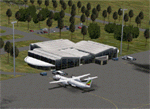
This project adds the booming city of Hawassa, Ethiopia, creates the new international airport (HALA), moves (and rebuilds) the downtown airport (recoded to HALX), and includes AI flight plans for the Ethiopian Airlines service that began April 2016. Tested in both the default FSX: Acceleration and with FTX Global/Vector, accurate coastlines, lakes, road data, and SRTMGL1 (30m) mesh, as well as corrected landclass are provided based on the latest available satellite imagery. The Hawassa International Airport was created using information from the current satellite footprint and the promotional video from Ethiopian Airports Enterprise (EAE). Although there is still very little published data on the airport, it is fully functional.
Updates were created or rebuilt in a manner which carefully aligns airport data with current satellite imagery. Scenery was created using Airport Design Editor X v1.70.6042, SBuilderX 3.13, and the FSX Object Placement Tool. Scenery objects were added and modified from stock FSX scenery to resemble as closely as possible the actual airports. The FSX apron lights included are from the set created by Jim Dhaenens. Thanks to Ron Blehm for bringing this part of the world to my attention.
| Filename: | HALA__Hawassa_Intl___Hawassa_Ethiopia.zip |
| License: | Freeware |
| Added: | 20th July 2016, 09:06:40 |
| Downloads: | 1,021 |
| Author: | Carlyle Sharpe |
| Size: | 10.41 MB |
| Category: Flight Simulator X - Scenery | |
| Mesh South America / MeSA B09 |
|
File Description:
FSX Mesh South America Project:
This terrain mesh file is a part of a whole project covering all the Continent of South America and some islands, divided in tiles identified in a map by its column (letters) and rows (numbers).
Those files were multi-LOD compiled from 90m SRTM2 source data, reprocessed with 3DEM to remove voids and spikes, providing a 76.4m (LOD9) horizontal resolution topography intended for use only in FSX updated with SP1.
Although not well documented, to improve performance, the updated FSX loads DEM files in threads and only the closer terrain (about 5-10 NM from the point of view) is rendered in high detail, while at far distances FSX shows up its default low resolution mesh, when there is not a third part terrain mesh compiled in all others intermediate level of details (multi-LOD).
THIS FILE:
FSX_MeSA_B09 (Column B x Row 09
covers the area inside the boundaries:
N = 33º 45' S; S = 39º 22,5' S;
W = 82º 30' W; E = 75º 0' W;
AUTHORS:
Hely Heck Junior - Magrao ( [email protected] )
and Jose Lobo ( [email protected] )
TerraBrasilis: www.terra-brasilis.org
| Filename: | Mesh_South_America__MeSA_B09.zip |
| License: | Freeware |
| Added: | 11th June 2007, 22:11:00 |
| Downloads: | 1,197 |
| Author: | Hely Heck Jr. and José Lôbo |
| Size: | 1.53 MB |
| Category: Flight Simulator X - Scenery | |
| Mesh South America / MeSA A01 |
|
File Description:
FSX Mesh South America Project:
This terrain mesh file is a part of a whole project covering all the Continent of South America and some islands, divided in tiles identified in a map by its column (letters) and rows (numbers).
Those files were multi-LOD compiled from 90m SRTM2 source data, reprocessed with 3DEM to remove voids and spikes, providing a 76.4m (LOD9) horizontal resolution topography intended for use only in FSX updated with SP1.
Although not well documented, to improve performance, the updated FSX loads DEM files in threads and only the closer terrain (about 5 NM from the point of view)is rendered in high detail, while at far distances FSX shows up its default low resolution mesh, when there is not a third part terrain mesh compiled in all others intermediate level of details (multi-LOD).
THIS FILE: FSX_MeSA_A01
(Column A x Row 01)
This file covers the area inside the boundaries:
N = 16º 52,5' N; S = 11º 15' N;
W = 90º 0' W; E = 82º 30' W;
AUTHORS:
Hely Heck Junior - Magrao ( [email protected] )
and Jose Lobo ( [email protected] )
TerraBrasilis: www.terra-brasilis.org
| Filename: | Mesh_South_America__MeSA_A01.zip |
| License: | Freeware |
| Added: | 11th June 2007, 00:03:00 |
| Downloads: | 1,960 |
| Author: | Hely Heck Jr. and José Lôbo |
| Size: | 49.55 MB |
| Category: Flight Simulator X - Scenery | |
| Mesh South America / MeSA B06 |
|
File Description:
FSX Mesh South America Project:
This terrain mesh file is a part of a whole project covering all the Continent of South America and some islands, divided in tiles identified in a map by its column (letters) and rows (numbers).
Those files were multi-LOD compiled from 90m SRTM2 source data, reprocessed with 3DEM to remove voids and spikes, providing a 76.4m (LOD9) horizontal resolution topography intended for use only in FSX updated with SP1.
Although not well documented, to improve performance, the updated FSX loads DEM files in threads and only the closer terrain (about 5-10 NM from the point of view) is rendered in high detail, while at far distances FSX shows up its default low resolution mesh, when there is not a third part terrain mesh compiled in all others intermediate level of details (multi-LOD).
THIS FILE:
FSX_MeSA_B06 (Column B x Row 06)
This file covers the area inside the boundaries:
N = 11º 15' S; S = 16º 52,5' S;
W = 82º 30' W; E = 75º 0' W;
AUTHORS:
Hely Heck Junior - Magrao ( [email protected] )
and Jose Lobo ( [email protected] )
TerraBrasilis: www.terra-brasilis.org
| Filename: | Mesh_South_America__MeSA_B06.zip |
| License: | Freeware |
| Added: | 11th June 2007, 22:10:10 |
| Downloads: | 1,425 |
| Author: | Hely Heck Jr. and José Lôbo |
| Size: | 12.99 MB |
| Category: Flight Simulator X - Scenery | |
| Mesh South America / MeSA B11 |
|
File Description:
FSX Mesh South America Project:
This terrain mesh file is a part of a whole project covering all the Continent
of South America and some islands, divided in tiles identified in a map by its
column (letters) and rows (numbers).
Those files were multi-LOD compiled from 90m SRTM2 source data, reprocessed
with 3DEM to remove voids and spikes, providing a 76.4m (LOD9) horizontal
resolution topography intended for use only in FSX updated with SP1.
Although not well documented, to improve performance, the updated FSX loads DEM
files in threads and only the closer terrain (about 5-10 NM from the point of view)
is rendered in high detail, while at far distances FSX shows up its default low
resolution mesh, when there is not a third part terrain mesh compiled in all
others intermediate level of details (multi-LOD).
THIS FILE:
FSX_MeSA_B11 (Column B x Row 11)
covers the area inside the boundaries:
N = 39º 22,5' S; S = 45º 0' S;
W = 82º 30' W; E = 75º 0' W;
AUTHORS:
Hely Heck Junior - Magrao ( [email protected] )
and Jose Lobo ( [email protected] )
TerraBrasilis: www.terra-brasilis.org
| Filename: | Mesh_South_America__MeSA_B11.zip |
| License: | Freeware |
| Added: | 11th June 2007, 22:11:28 |
| Downloads: | 1,157 |
| Author: | Hely Heck Jr. and José Lôbo |
| Size: | 1.55 MB |


© 2001-2026 AVSIM Online
All Rights Reserved
Privacy Policy |