
Where Flight Simulation Enthusiasts Gather from Around the World!
AVSIM Library - Search Results

| Category: Flight Simulator 2002 - Miscellaneous Files | |
| Phoenix Sectional Chart |

|
File Description:
Phoenix, Tucson, Tombstone... welcome to the wild west! Wether you want to fly from Los Angeles eastbound into Texas, or from Las Vegas southbound to Mexico, enjoy Arizona´s wilderness. Search the library for some third party terrain mesh and a screenshot utility and be prepared for spectacular sunsets. You may use this 5500*4200 pixel chart "as is" without any other software, but it will develop its full potential if used as moving map with SimSystem´s FSFlightMax or FSGarmin. It wouldn´t have been possible to offer this chart without Richard Harvey and his love to flightsimming, so please consider this file to be "donationware" and make a however small contribution to the Richard Harvey Endowed Scholarship.
| Filename: | Phoenix_Sectional_Chart.zip |
| License: | Check within download |
| Added: | 27th March 2003, 01:22:09 |
| Downloads: | 1,380 |
| Author: | Uwe Rademacher |
| Size: | 17.51 MB |
| Category: Fly! II - Scenery | |
| Bridge Models 1 |
|
File Description:
Hi fellow designers. I have always missed decent bridges for the Fly! series. Finally I have learnt how to make them. I am going to make more bridges for you, simple generic ones for spanning rivers in towns, etc. So here are my first two, one simple, modeled after Askøybrua in Bergen, and the more complicated Varoddbrua from Kristiansand. Both bridges are friendly on your frame rate still. Testing in Fly II, I had 50 fps with the simple model, and 40 with the complicated one. Most of the vertices are welded, and the bridge construction is almost hollow. You won`t find many hidden faces with a texture on these models.
| Filename: | Bridge_Models_1.zip |
| License: | Freeware |
| Added: | 28th February 2003, 16:52:22 |
| Downloads: | 312 |
| Author: | Andrew Thomsen |
| Size: | 761.04 KB |
| Category: Flight Simulator 2002 - AI Flight Plans | |
| Complete Flightplan for Winter (Go-Fly) |
|
File Description:
ALTITUDE has been a major factor for me, so i have made all altitudes in the "Reduced Vertical Separation Minima" system giving the flightplans it's reality. Go-Fly is has a fleet of 25 737-300's. Only on October they added 5 more. 2008 they promise to have in numbers of 80 planes. Well thats to far for me LOL. This winter they will fly to 39 counties using a fleet of 25, no standby's They operate only in Europe and fly about a 100 flights a day after looking trough it's timetables. Needs T-tools V1.3.2 (Lee Swordy). Valid till March 23-2003 All in here!!! True Time from Real timetable. Real flight numbers. Realism 99%.
| Filename: | Complete_Flightplan_for_Winter_GoFly.zip |
| License: | Freeware |
| Added: | 4th November 2002, 00:52:15 |
| Downloads: | 952 |
| Author: | The Gargoils Project (Vasilly Giffard) |
| Size: | 5.5 KB |
| Category: Flight Simulator 2004 - Aircraft Repaints, Textures and Modifications | |
| USAF/SAC Convair CV-240 VBF |
|
Images related to this file:
File Description:
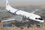
The Convair with cn 52-24, build as a Convair T-29D (240-52), entered the US Air Force in 1954. She later was converted to VT-29D standards and assigned to the Strategic Air Command where she got the typical blue band covered with white stars and SAC insignia on the rear fuselage. In January 1975 she was stored at Davis Monthan Air Force Base, Arizona. On November 23, 1977 the aircraft was bought by Allied Aircraft Sales and broken up. Textures and associated model file included only. Requires cv240VBFmilitary_basepack_010.ZIP. Original by Greg Pepper & Tom Gibson, upgraded by Georg Hauzenberger (model) and Hans Hermann (textures) Virtual Birds Factory, March 2011
| Filename: | USAFSAC_Convair_CV240_VBF.zip |
| License: | Freeware, limited distribution |
| Added: | 14th March 2011, 07:54:55 |
| Downloads: | 505 |
| Author: | Georg Hauzenberger and Hans Hermann |
| Size: | 4.28 MB |
| Category: Flight Simulator X - AFCAD Files | |
| Hackettstown Airport (N05), NJ |
|
File Description:
Located 03 miles SW of Hackettstown, New Jersey on 65 acres of land, Hackettstown Airport is a public asphalt strip 2200' in length. Fuel, tiedowns and hangars are all available for transient aircraft. For fuel, stop on the concrete pad next to the fuel tank northeast of the runway - 100LL only. Tiedowns are available both east and west of the runway - note that west parking faces the trees and if you start in one of the West Parking spots you will either need to pushback or slew to give yourself room to turn out - static aircraft collisions are off but vegetation is not. The one hangar north of the airport is open for parking, you can start there with the DOCK type parking location. This airport is not lit so daytime VFR operations only are recommended.
Scenery constructed with use of satellite images/streetview/aerial photos - the author has not been there in person.
This scenery is meant to be used in conjunction with MegaScenery Earth New York 007. It is not required, but apron use is minimized to allow satellite scenery to show through as much as possible, and objects are placed based on the MSE textures - lack of it may make scenery look out of place.
| Filename: | Hackettstown_Airport_N05_NJ.zip |
| License: | Freeware |
| Added: | 13th May 2011, 09:16:30 |
| Downloads: | 208 |
| Author: | Drew Sikora |
| Size: | 557.98 KB |
| Category: Flight Simulator 2004 - Scenery | |
| Cape Hooper CWFH and FOX-4 DEW Line Station in Nunavut, Canada |
|
Images related to this file:
File Description:
Cape Hooper is around 60 miles north of Kivitoo (FOX-D) and 140 miles south of Clyde River CYCY on the northeast-facing coast of Baffin Island. FOX-4 is still in use as a new and mostly-unmanned North Warning System site was established there in 1990 before the DEW line station was closed in 1991. Actually the DEW line station was not "closed" as such, they just stopped using it. The site of FOX-4 is on the top of a bump at the end of one of many long promontories that stick out into the Davis Strait between Baffin Island and Greenland, close to the far eastern end that is called Cape Hooper. There is a gravel runway to the west, down at 65' ASL; it is only just over 3,000' long and most material was delivered by sea to the beach at the southern end of the runway. The runway is signed as
"324T - 144T" as this is Northern Domestic Airspace where all runways are signed "true" and not "magnetic"; it is 013/193 magnetic with a huge magnetic variation of 48.9 degrees in this area where the magnetic field is mostly vertical, and so useless for navigation.
| Filename: | Cape_Hooper_CWFH_and_FOX4_DEW_Line_Station_in_Nuna.zip |
| License: | Freeware |
| Added: | 11th July 2011, 00:28:40 |
| Downloads: | 416 |
| Author: | Roger Wensley |
| Size: | 1.65 MB |
| Category: Flight Simulator 2004 - Scenery | |
| CYQU - Grande Prairie, Alberta, Canada |
|
Images related to this file:
File Description:
Grande Prairie is at 2,195 feet asl, 65 miles southeast of Dawsons Creek, 90 miles southwest of Peace River and around 60 miles east of the Rockies. The town has a population of 55,000 and growing. The airport is just to the west of the town and was originally a military base, built during WW2. The two runways are 07-25 and 11-29 and when one is the active runway then the other is used as a taxiway. AI in FS9 doesn't like this, and just stops at the first hold short without ever reaching the active runway. I have found a way to overcome this and AI will now use taxiway A and whichever runway is inactive to feed to and from both ends of the active runway. The vertical red tanks are for de-icing fluid; de-icing is carried out before take-off in the winter. The industrial area to the southeast is now larger than I have made it, but I kept it to this minimum size to keep frame rates down. All the buildings are modeled specifically for CYQU. The AI includes Westjet, Air Canada Jazz, and others as listed. The GA AI uses only FS9 standard aircraft.
| Filename: | CYQU__Grande_Prairie_Alberta_Canada.zip |
| License: | Freeware, limited distribution |
| Added: | 9th May 2014, 10:05:40 |
| Downloads: | 673 |
| Author: | Roger Wensley |
| Size: | 18.33 MB |
| Category: Flight Simulator 2004 - Scenery | |
| Rae Lakes CYRA at Gameti in the NW Territories Canada, corrected |
|
Images related to this file:
File Description:
This is a corrected version that rectifies the airfield elevation, which I forgot to include in the first post; 120 downloads and nobody tells me till now? The remainder of this is as first written, apart from the installation instructions: Gameti is a village in the Northwest Territories, around 65 miles north of Whati, which was recently posted. Until 2005 the village, which has a population of around 280, was known as Rae Lakes and the airfield is now renamed Gameti/Rae Lakes as shown in the 2010 version of the Nav Canada Flight Supplement, my standard reference year. Permanent settlement was established there in 1965 There is no all-weather road access and the village is reliant upon the airfield for supplies, along with an ice road in the winter months. The airfield is a mile or so east of the village, with a lit gravel runway of just over 3,000 feet aligned 14-32 and with PAPI at both ends. The airfield is served by Air Tindi from Yellowknife on an almost daily basis, included in the AI here along with some GA and a Friday delivery by a Buffalo DC3 that uses all of the runway. The runway has lake water at each end, ready for the unwary.
| Filename: | Rae_Lakes_CYRA_at_Gameti_in_the_NW_Territories_Can.zip |
| License: | Freeware, limited distribution |
| Added: | 30th November 2020, 18:04:00 |
| Downloads: | 139 |
| Author: | Roger Wensley |
| Size: | 3.9 MB |
| Category: Flight Simulator 2004 - Scenery | |
| Northern Canada Mining CYOA & CHB3 in Canada |
|
Images related to this file:
File Description:
These are two airfields in northern Canada, serving two mining operations. The furthest north is Hope Bay CHB3 in Nunavut. It is in a sheltered inlet less than 3 miles from the northern mainland coast and around 65 miles southwest of Cambridge Bay. The owner is Hope Bay Mining Ltd, and their operation mines gold out of a tunnel rather than open cast. The airfield is incorporated into the road that leads north to the sea; traffic is halted by traffic lights when a flight is expected. The runway is 3,000 feet of gravel aligned 01-19 and with PAPI at both ends.
The second airfield serves the Ekati diamond mine and is some 265 miles southwest of Hope Bay, in the Northwest Territories. Ekati was the first Canadian diamond mine and is 195 miles northeast of Yellowknife and less than 20 miles north of a later mine, Diavik (by Sid and Pete). CYOA reflects the relative value of the two mining operations and is far better equipped than Hope Bay. It can be described as an airport while Hope Bay remains an airfield. The runway is 6,400 feet of gravel aligned 36-18 with PAPI and strobe approach lights at both ends. The scale of the mining operation can only be described as huge.
| Filename: | Northern_Canada_Mining_CYOA__CHB3_in_Canada.zip |
| License: | Freeware, limited distribution |
| Added: | 11th August 2018, 22:59:06 |
| Downloads: | 219 |
| Author: | Roger Wensley |
| Size: | 8.24 MB |
| Category: Miscellaneous Files - Miscellaneous Files | |
| Al Pelletier's Round Robins - ASA Round Robin |
|
File Description:
This one touches down in New Orleans in the days prior to Katrina. It is a great and true to life route better done in a small jet commuter like the CRJ-200. It was written 4 years ago and can be flown in FS-X or FS2004.’ Please remember that some of the freeware addon files I refer to were for FS2002 at the time. You should be able to find newer ones to replace them.
| Filename: | Al_Pelletiers_Round_Robins__ASA_Round_Robin.zip |
| License: | Freeware, limited distribution |
| Added: | 3rd February 2007, 17:41:00 |
| Downloads: | 396 |
| Author: | Al Pelletier |
| Size: | 9.27 MB |


© 2001-2026 AVSIM Online
All Rights Reserved
Privacy Policy |