
Where Flight Simulation Enthusiasts Gather from Around the World!
AVSIM Library - Search Results

| Category: Flight Simulator X - Scenery | |
| Benina International Airport HLLB 2010 V.1 FS2004/FSX-sp2 |

|
File Description:
Benina International Scenery. located in the town of Benina, 19 km east of Benghazi, from which it takes its name. The airport is operated by the Civil Aviation and Meteorology Bureau of Libya and is the second largest in the country after Tripoli International Airport. Benina International is also the secondary hub of both Buraq Air and flag carrier, Libyan Airlines. During World War II, the airport was used by the United States Army Air Force Ninth Air Force during the Eastern Desert Campaign. Known as Soluch Airfield, it was used by the 376th Bombardment Group, which flew B-24 Liberator heavy bombers from the airfield between 22 February & 6 April 1943. Once the combat units moved west, it was used as a logistics hub by Air Transport Command. It functioned as a stopover en-route to Payne Field near Cairo or to Mellaha Field near Tripoli on the North African Cairo-Dakar transport route for cargo, transiting aircraft and personnel.
| Filename: | Benina_International_Airport_HLLB_2010_V1_FS2004FS.zip |
| License: | Freeware |
| Added: | 28th November 2010, 19:49:42 |
| Downloads: | 4,295 |
| Author: | Emad Qtiefan |
| Size: | 10.79 MB |
| Category: Flight Simulator 2004 - Scenery | |
| Chicago O'Hare International Airport circa 2018 (reupload) |
|
File Description:
This is a reupload of my Chicago O'Hare redevelopment (KORD). I apologize for the first time, but it appeared I had uploaded xml files into avsim instead of bgl files so it may not work at all.
Description from before: This is a complete makeover of the default O'Hare scenery. For a long time no freeware addon scenery existed for O'Hare, and the paywares that exist now are outdated by several years and, aren't free. I entirely used the default airport buildings utilized by the airport, but added lots of jetways and parking assignments to match the real world layout based on Google Maps. This will give you a March 2018 rendition of the airport. More about the airport in the readme file. Screenshots enclosed, however I recommend only looking at one or two of them first to evaluate, and to fly into the airport first from any other airport of your choice so you can see it for the first time flying in.
| Filename: | Chicago_OHare_International_Airport_circa_2018_reu.zip |
| License: | Freeware |
| Added: | 8th July 2020, 17:31:26 |
| Downloads: | 1,266 |
| Author: | Carlos Si |
| Size: | 37.44 MB |
| Category: Flight Simulator 2004 - Original Aircraft | |
| AI Lockheed Martin F-16C and F-16D |
|
File Description:
Low polygon version Lockheed Martin (General Dynamics) F-16C and F-16D by Henry Tomkiewicz. Features animated landing gear, flaps, air brakes, and LANTIRN navigation pod. Also features conditionally activated canopy and pilot(s) as well as a realistic afterburner effect along with customized lights. This package includes 20 different visual models ranging from 1975 to 3288 polygons (ACM). All models feature 10 levels of detail (LODs) and are designed for AI use. The F-16C has both standard and drag chute tails along with 7 different loadout options: Clean, Normal, Long Range, Air-to-Air, Mk.84, JDAM, and AGM-65. The F-16D has both standard and drag chute tails and 3 loadout options: Clean, Normal, and Long Range. Included textures kindy provided by Graham King. See readme file for more information. Dedicated to all the men and women of the U. S. Armed Forces serving around the world. Thank You!
| Filename: | AI_Lockheed_Martin_F16C_and_F16D.zip |
| License: | Freeware, limited distribution |
| Added: | 28th May 2005, 16:48:30 |
| Downloads: | 20,830 |
| Author: | Henry Tomkiewicz |
| Size: | 5.56 MB |
| Category: Prepar3D V1-4 - Scenery | |
| Benevento Italy N41.07.46 E14.46.55 and airport Olivola LIRB |
|
File Description:
Benevento Italy N41.07.46 E14.46.55 The foundation of city dates back to far. Founded according to legend by the Greek hero Diomedes, landed in Italy after the destruction and the fires of Troy. The modern city rises on a discreet plateau, known all over the world for its elixir "Strega" produced in liquorice premises. Benevento, also has a modest airmort by name "Olivola" with ICAO "LIRB" airport you will find in the scenery. It was built at the beginning of the 1930s by the troops of Regia Aeronautica as the Italian operating base and Luftwaffe. Since the end of the 1960s, the airport sedan has returned to the civilian democracies and has been abandoned for several years. Today the airport is used as aviosurface The city is an excellent VFR point for approaching airport Benevento LIRB.
Within the downloaded package you will find readme files for scenery installation. Good fly VFR. Pasquale Marrulli.
| Filename: | Benevento_Italy_N410746_E144655_and_airport_Olivol.zip |
| License: | Freeware |
| Added: | 23rd November 2017, 16:20:56 |
| Downloads: | 689 |
| Author: | Pasquale Marrulli |
| Size: | 4.99 KB |
| Category: Flight Simulator 2004 - Scenery | |
| Yellowknife CYZF, 2010 |
|
Images related to this file:
File Description:
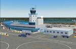
Founded as a gold town in 1936, Yellowknife is now the capital city of the Canadian Northwest Territories, and its airport, CYZF, is the busiest airport in northern Canada. Located only 250 miles south of the Arctic Circle, it is also subject to some of the harshest and most dangerous climate conditions in the world.
This version features:
*All ramps and taxiways completely redone to be more accurate
*All default buildings replaced
*Realistic Gmax models of the main terminal and tower, the First Air, CAF Squadron 440, and Buffalo Airways hangers
*Static aircraft for the First Air, CAF Squadron 440, Air Tindi and Buffalo Airways ramps
*Visual models of the arrestor cables on the main runway
*Fences, ramp lights, cargo, ground vehicles and all the other details that bring an airport to life
*Modular construction. The main buildings, ramp objects and static aircraft are in separate files and can be selectively deactivated to improve frame rates.
| Filename: | Yellowknife_CYZF_2010.zip |
| License: | Freeware |
| Added: | 16th January 2010, 10:31:02 |
| Downloads: | 6,895 |
| Author: | Sidney Schwartz, Peter Ham |
| Size: | 15.42 MB |
| Category: Flight Simulator X - Aircraft Repaints, Textures and Modifications | |
| Boeing 747 BDSF GE FlyMeta 9H-WFF operated by Air Atlanta |
|
Images related to this file:
File Description:
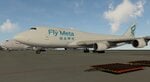
9H-WFF is a BDSF (Bedek Special Freighter) that started life in 1992 as a passenger variant with Japan Airlines on lease from Aersale. Was transferred to Asiana in 2012 under lease as a freighter after conversion by IAI (Israel Aerospace Industries), then leased to Air Atlanta who operate the airframe for FlyMeta, originally with an Icelandic registration of TF-WFF and as of 2026 under a Maltese registration 9H-WFF. As of January 2026 this machine (along with her two FlyMeta sister ships) can be seen operating cargo flights to Europe out of China from VHHH/Hong Kong and ZSHC/Hangzhou to EBLG/Liege and LHBP/Budapest and various central asian locations in between such as OMSJ/Sharjah and OMDW/Dubai World Central.
This repaint is for the Project Opensky (POSKY) 747-400BCF GE-CF6 model and the archive includes textures only, you will need a working copy of the model, sounds and panel, all of which can be found here at avsim.com
| Filename: | Boeing_747_BDSF_GE_FlyMeta_9HWFF_operated_by_Air_A.zip |
| License: | Freeware |
| Added: | 16th February 2026, 12:40:33 |
| Downloads: | 29 |
| Author: | Dean Stringer |
| Size: | 8.29 MB |
| Category: Flight Simulator 2004 - Aircraft Repaints, Textures and Modifications | |
| Aloha Airlines, Boeing 737-230, 60th Anniversary 'Funbird' RetroJet (N823AL) |
|
Images related to this file:
File Description:

As part of its 60th Anniversary commemoration, Aloha Airlines has brought the groovy looking "Funbird" livery of the late '60s to mid '70s to one of its B732s. Yeah baby! This is that B737-230, registration N823AL, named "Liholiho". It has been re-painted in these retro "Flower Power" colors. This aircraft started service halfway around the world in Germany, being delivered originally to Lufthansa in January of 1984. She wore the Aloha Airlines livery for the first time in December of 1996. This aircraft is highly detailed and all hand painted, right down to all the little flowers. If you want to light up your 'mouse' at night, I recommend Matthew Lue's Tinmouse II lighting effects (AVSIM DLID 89742).
This is a textures only package; you must have the Tinmouse 737-200adv v2 base package available here at AVSIM (tinmouse_ii_v1_25.zip). The textures in this repaint are 32-bit with no mips. NOTE: This is a re-upload due to the AVSIM site compromise.
| Filename: | Aloha_Airlines_Boeing_737230_60th_Anniversary_Funb.zip |
| License: | Freeware, limited distribution |
| Added: | 5th June 2010, 13:32:51 |
| Downloads: | 2,273 |
| Author: | Jeffrey S. Bryner, Tinmouse II Project |
| Size: | 5.46 MB |
| Category: Flight Simulator 2004 - Scenery | |
| Grande Prairie CYQU in Alberta, Canada, Updated |
|
Images related to this file:
File Description:
This is a new version of the original post from March 2014, made in 2018. It was made mainly to provide some missing textures, but has been modified to also add parked trucks and floodlights to the de-icing area (the floodlights are inoperative as they will not be on when there is no de-icing in progress) and also street and car parking lighting, a few more parked planes, and some further objects on the terminal apron area. The runway approach lighting was also corrected; moving the airport so that the ILS on 29 did not coincide with the roads would have been nice, but meant too many complications at this stage. The scenery is complete in itself and can be installed as-is if you do not have the original post. Grande Prairie is at 2,195 feet asl, 65 miles southeast of Dawsons Creek, 90 miles southwest of Peace River and around 60 miles east of the Rockies. The town has a population of around 55,000 and growing. The name comes from the wide expanse of prairies all around the town, and there is also a large forested area to the southwest leading up to the Rockies which supplies raw material for industries in the town. The airport is just to the west of the town. It was originally a military base, built during WW2. The two runways are 07-25 and 11-29 and 6,200 and 6,500 feet respectively, both 200 feet wide; runway headings had changed by 2010 in real life but take this as it was in 2008. When one is the active runway then the other is used as a taxiway. Taxiway A is very wide with in real life a repaired central section marked out for use.
| Filename: | Grande_Prairie_CYQU_in_Alberta_Canada_Updated.zip |
| License: | Freeware, limited distribution |
| Added: | 13th December 2018, 04:12:11 |
| Downloads: | 208 |
| Author: | Roger Wensley |
| Size: | 34.97 MB |
| Category: Flight Simulator X - Utilities | |
| FSTramp v8.84 for MSFS, FSX(-SE), Prepart3D, X-Plane (Win) |
|
Images related to this file:
File Description:
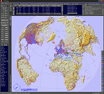
This add-on is an EXE application for Microsoft Flight Simulator and a DLL module for all other simulators. The DLL variant is activated via hotkeys or the simulator menu add-ons or plugins. Window size and layout are configurable for one or more screens. To avoid dazzling, the brightness of the entire application is customizable. Primarily it is a flight management system (FMS) with automatic control from start to landing. This also includes the observance of SID, STAR and Approaches in unmatched quality. The flight plan required for the FMS can be created manually or automatically, interactive changes and additions during the flight are possible. The basis of the flight planner is the 3D world map and the search function for airfields and navigation aids. The FMS by FSTramp relies on the autopilot of the aircraft. In case of incompatibility, the autopilot integrated in FSTramp will be used. This allows FSTramp to control almost all aircraft from airport to airport. The altitude profile of the flight plan, SID, STAR and approach is taken into account. This means that FSTramp extends the often incomplete airport procedures to and from the runway so that they can be flown completely automatically. During the fully automatic flight, the autopilot values ​​for HDG, ALT, VSPEED, SPD and MACH can be manually overridden. This is e.g. useful for being able to react to the instructions of the tower in the final approach without completely stopping the automatic flight. The rotating or north pointing 3D world map with numeric display of the terrain elevation under the mouse arrow is another special feature. It does not need an internet but is synthesized from included height profiles of the globe. The Data of continents, mountains and rivers are included in the setup. Airspaces, Airways, Waypoints and SID, STAR and Approaches are also included in the setup, but can be updated by installing additional AIRAC cycles. Airfields and navigation stations are taken from the simulator. NVIDIA: If the frame rate of the simulator drops sharply about 20 seconds after FSTramp's visibility, the power management of the GPU slows down prematurely. In the NVIDIA Control Panel, change the 'Manage 3D settings - Power management mode' option to 'Adaptive'.
| Filename: | FSTramp_v884_for_MSFS_FSXSE_Prepart3D_XPlane_Win.zip |
| License: | Shareware, time limited |
| Added: | 7th July 2023, 04:35:43 |
| Downloads: | 130 |
| Author: | Helge Schroeder |
| Size: | 358.21 MB |
| Category: Prepar3D V5 - Utilities | |
| FSTramp v8.84 for Prepart3D 2-6, MSFS, FSX(-SE), X-Plane (Win) |
|
Images related to this file:
File Description:
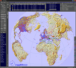
This add-on is an EXE application for Microsoft Flight Simulator and a DLL module for all other simulators. The DLL variant is activated via hotkeys or the simulator menu add-ons or plugins. Window size and layout are configurable for one or more screens. To avoid dazzling, the brightness of the entire application is customizable. Primarily it is a flight management system (FMS) with automatic control from start to landing. This also includes the observance of SID, STAR and Approaches in unmatched quality. The flight plan required for the FMS can be created manually or automatically, interactive changes and additions during the flight are possible. The basis of the flight planner is the 3D world map and the search function for airfields and navigation aids. The FMS by FSTramp relies on the autopilot of the aircraft. In case of incompatibility, the autopilot integrated in FSTramp will be used. This allows FSTramp to control almost all aircraft from airport to airport. The altitude profile of the flight plan, SID, STAR and approach is taken into account. This means that FSTramp extends the often incomplete airport procedures to and from the runway so that they can be flown completely automatically. During the fully automatic flight, the autopilot values ​​for HDG, ALT, VSPEED, SPD and MACH can be manually overridden. This is e.g. useful for being able to react to the instructions of the tower in the final approach without completely stopping the automatic flight. The rotating or north pointing 3D world map with numeric display of the terrain elevation under the mouse arrow is another special feature. It does not need an internet but is synthesized from included height profiles of the globe. The Data of continents, mountains and rivers are included in the setup. Airspaces, Airways, Waypoints and SID, STAR and Approaches are also included in the setup, but can be updated by installing additional AIRAC cycles. Airfields and navigation stations are taken from the simulator. NVIDIA: If the frame rate of the simulator drops sharply about 20 seconds after FSTramp's visibility, the power management of the GPU slows down prematurely. In the NVIDIA Control Panel, change the 'Manage 3D settings - Power management mode' option to 'Adaptive'.
| Filename: | FSTramp_v884_for_Prepart3D_26_MSFS_FSXSE_XPlane_Wi.zip |
| License: | Shareware, time limited |
| Added: | 7th July 2023, 04:35:26 |
| Downloads: | 42 |
| Author: | Helge Schroeder |
| Size: | 358.21 MB |


© 2001-2026 AVSIM Online
All Rights Reserved
Privacy Policy |