
Where Flight Simulation Enthusiasts Gather from Around the World!
AVSIM Library - Search Results

| Category: Flight Simulator 2004 - Scenery | |
| Johnson Creek 3U2 Forest Service airfield in Idaho USA |

|
Images related to this file:
File Description:
This airfield is in the mountains of Idaho, around 25 miles south of Big Creek U60, which was the second in the series to be posted. Johnson Creek is very regularly used for picnic fly-ins and overnight camping, as can be seen from the number of videos posted. Again, the creek does not appear in FS9 as it is only around 20 feet or so wide, plus within Ultimate Terrain I have streams turned off for the reasons given in the U60 post. The runway is at 4,933 feet ASL, 3,480 feet long, aligned 35-17, and in good condition. The shower facilities are south of the centre of the runway and on the eastern side; as a result planes mostly, but not all, park on the eastern side and towards the south. There are Forest Service workshop buildings on the east side of the runway near the centre. If you have a wind from the south then some AI planes will actually manage to land. I should have mentioned before that these are all made with only the default FS9 mesh, and that I will be reposting them again for use with the FSGenesis 19m mesh.
| Filename: | Johnson_Creek_3U2_Forest_Service_airfield_in_Idaho.zip |
| License: | Freeware, limited distribution |
| Added: | 25th May 2017, 17:54:06 |
| Downloads: | 172 |
| Author: | Roger Wensley |
| Size: | 4.81 MB |
| Category: Flight Simulator 2004 - Scenery | |
| Camden Field in Trinidad |
|
File Description:
Camden Field was once a wartime American airfield, which shows up in the wide east-west runway that has more recently been partly resurfaced. There are no runway markings beyond a centre line, and it just sort of tapers off at the sides and the eastern end into the bush. In contrast to the renovated hangar to the north of the western end of the runway the buildings to the south haven't been touched by any recent tender-loving-care. There is a wonderful patched-together shed and a small control tower, which was built on the edge of the existing runway. This makes it appear rather close to the edge of the resurfaced runway area. Do not be fooled, this is not an illusion; it IS close to the edge of the runway. Just take comfort in the thought that the prevailing southeast winds (for much of the year) will tend to blow you away from it as you approach for a landing from the west. And I kept the pre-renovation version of the old hangar when I found some old pics of the crop dusting operation from five years ago.
| Filename: | Camden_Field_in_Trinidad.zip |
| License: | Freeware |
| Added: | 14th December 2008, 01:32:05 |
| Downloads: | 537 |
| Author: | Roger Wensley |
| Size: | 2.73 MB |
| Category: Flight Simulator 2004 - Original Aircraft | |
| Mitsubishi F-2A (Beta Model, Version 2) |
|
Images related to this file:
File Description:
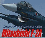
F-2A is a Japanese fighter aircraft and it has been developed with the United States based on the General Dynamics (post 1993, Lockheed Martin) F-16 Fighting Falcon. Its blue oceanic flight livery is referred to as "The most beautiful camouflage livery of the world". Its three divited canopy and big-wide wing is the most different part between the F-2 and F-16. This model is only for FS9, you can't use it with FSX. By Team FS KBT.
The Mitsubishi F-2 Fighter is manufactured by Mitsubishi Heavy Industries (MHI) and Lockheed Martin for the Japan Air Self-Defense Force, with a 60/40 split in manufacturing between Japan and the USA.
Some differences between the F-2 and the F-16A:
* a 25% larger wing area
* composite materials used to reduce overall weight and radar signature
* longer and wider nose to accommodate a phased-array radar
* larger tailplane
* larger air intake
* three-piece cockpit canopy
* capabilities for four ASM-1 or ASM-2 anti-ship missiles, four AAMs, and additional fuel tanks
| Filename: | Mitsubishi_F2A_Beta_Model_Version_2.zip |
| License: | Freeware |
| Added: | 3rd June 2010, 12:09:35 |
| Downloads: | 12,346 |
| Author: | Team FS KBT: Daisuke Yamamoto, Hiroaki Kubota, Shingo Katsumata with Friends |
| Size: | 72.93 MB |
| Category: Flight Simulator 2004 - Scenery | |
| Mackar Inlet CWMI in Nunavut, Canada |
|
Images related to this file:
File Description:
Mackar Inlet was a DEW line Auxiliary Station on the west shore of the Melville Peninsula, which is part of the northern Canadian mainland. The station was closed only in 1992, so it is relatively intact. Hall Beach is 120 miles to the east, on the eastern shore of the peninsula, and Kugaaruk is just over 100 miles to the west. The runway is still in good condition and is around 3,800 feet of gravel 110' wide, aligned 164T/344T and at 100 feet ASL. The station buildings are up on the hill at 1,350 feet ASL and 5 miles to the south. None of these DEW line stations are particularly impressive or even interesting. However, you can bet that any pilot flying regularly in the north along the coast knows where all these runways are, in case one of them suddenly becomes his favourite in the whole world just after the sudden silence. I should have mentioned a long time ago that to see the apron lights working (on my fields that HAVE apron lights) requires you to have the "lights_ss_v2" by Sidney Schwartz installed.
| Filename: | Mackar_Inlet_CWMI_in_Nunavut_Canada.zip |
| License: | Freeware, limited distribution |
| Added: | 2nd December 2012, 17:58:34 |
| Downloads: | 218 |
| Author: | Roger Wensley |
| Size: | 1.16 MB |
| Category: Flight Simulator 2004 - Original Aircraft | |
| Lockheed WP-3D NOAA's Hurricane hunter (N42RF) |
|
Images related to this file:
File Description:
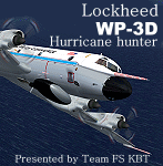
About the Aircraft.-----
Two of the world's premier research aircraft, the renowned NOAA WP-3D Orions, participate in a wide variety of national and international meteorological, oceanographic and environmental research programs in addition to their widely known use in hurricane research and reconnaissance. These versatile turboprop aircraft are equipped with an unprecedented variety of scientific instrumentation, radars and recording systems for both in-situ and remote sensing measurements of the atmosphere, the earth and its environment. Obtained as new aircraft from the Lockheed production line in the mid-70's, these robust and well maintained aircraft have led NOAA's continuing effort to monitor and study hurricanes and other severe storms, the quality of the atmosphere, the state of the ocean and its fish population, and climate trends.
About the Model.----
The sixth P3 series of Team FS KBT produced WP-3D.
This model was made with GMAX. It is FS2004 exclusive use, and it is not possible to use it with FS2002.
The sound file is not bundled. It is described that the data of p-3c_zip is used. By Team FS KBT.
| Filename: | Lockheed__WP3D_NOAAs_Hurricane_hunter_N42RF.zip |
| License: | Freeware |
| Added: | 23rd May 2010, 01:51:25 |
| Downloads: | 22,214 |
| Author: | Daisuke Yamamoto and Hiroaki kubota with Friends |
| Size: | 28.83 MB |
| Category: Flight Simulator X - AFCAD Files | |
| LQSA - Sarajevo Intl. Airport, Bosnia Herzegovina |
|
File Description:
Sarajevo International Airport (IATA: SJJ, ICAO: LQSA), also known as Butmir Airport, is the main international airport in Bosnia and Herzegovina, located 3.3 NM (6.1 km; 3.8 mi) southwest of the railway station in the capital city of Sarajevo in the suburb of Butmir. Since the Dayton Accord in 1996, the airport has welcomed a thriving commercial flight business which includes B&H Airlines, Austrian Airlines, Lufthansa, Jat Airways, Croatia Airlines, Turkish Airlines, Germanwings and others. In 2006, 466,186 passengers traveled through Sarajevo airport, compared to only 25,000 in 1996. In 2011 Sarajevo International Airport had 599,996 passengers which is more than all of the airports in Bosnia-Herzegovina had together and 6,5% more than in 2010. In 2012 the company has a slight decline in traffic. In 2005 the European branch of the Airports Council International awarded Sarajevo the award of Best Airport Under 1 Million Passengers. I just land in this airport, thank you to Sarajevo approach for a nice job. This file has the right coordinates, with runway 46 meters wide, apron and characteristics of the airport, airport vehicles and buildings.
| Filename: | LQSA__Sarajevo_Intl_Airport_Bosnia_Herzegovina.zip |
| License: | Freeware |
| Added: | 10th November 2012, 22:52:51 |
| Downloads: | 2,143 |
| Author: | Anwar Gonzalez |
| Size: | 4.44 MB |
| Category: Flight Simulator X - AFCAD Files | |
| ORER - Erbil International airport - Erbil, Iraq |
|
Images related to this file:
File Description:
ORER - Erbil International Airport, Kurdistan, Iraq. The new airport and terminal building opened on March 3, 2010 and is as such not known in FSX. The airport is built next to the old airport, previously a military field. With its short 2,800 meter runway and temporary terminal buildings, there was a great need for a new airport, not just a new terminal. The new airport has one of the world's longest runways. 4,800 meters long, 75 meters wide and equipped for ILS CAT II operations.
Using ADEx 1.51, aeronautical maps all these changes have been built into the default FSX airport now making it on par with the present situation on paper. Right, on paper! Google Earth's images are too old (2004) to offer any help regarding buildings, vegetation and surrounding areas like offices, parkings and roads. With the help of blurry pictures found on the internet this is the best rendition for now. 99% correct.
For those interested a complete technical overview of the airport including approach plates is included in this package. Please read the readme carefully for proper installation!
| Filename: | ORER__Erbil_International_airport__Erbil_Iraq.zip |
| License: | Freeware |
| Added: | 7th August 2012, 20:51:42 |
| Downloads: | 3,916 |
| Author: | Menno C. Robert |
| Size: | 8.28 MB |
| Category: Flight Simulator 2002 - Gauges | |
| Reality XP 737-500 ADI True Display XP Unlocked Demo |
|
File Description:
Not to be redistributed in any form without prior approval from Reality XP
Reality XP 737 ADI in True Display XP Demo Important information
This is the readme for the fully unlocked version 1.1
Dear Flight Simulator Enthusiast, we thank you for flying with Flight Line Avionics, and are pleased to offer an example of our unique technology: True Display XP.
As you might have been aware off, we are currently designing the overall systems and avionics of the upcoming Flight1’s Piper Meridian. This extraordinary aircraft features an advanced cockpit panel, with Glass Cockpit Meggitt Avionics EADI, EHSI and EDU, coupled with a state of the art S-TEC Autopilot System and a full featured Garmin Radio Stack and Navigation System. Rest assured that our rendition of the Meridian avionics far above the standards of the Flight Line Avionics depth and accuracy, and even more!
To let you prefigure what our unique technology brings to the overall simulated experience, we have especially designed this 737 ADI Demo to showcase a small fraction of the overall design techniques and tools we have built: True Display XP.
True Display XP is meant to provide enough visual cues and precision, while not sacrificing the accuracy at any resolution. This is achieved with both a high refresh rate and a highly sophisticated rendering engine, while virtually having no impact to the FS2002 Frame Rate. With this technology in any aircraft product, you’ll be able to precisely hand fly any ILS approach to a level of precision you’ve never been used to with any other FS2002 add-on. Seeing is believing!
Unlike the other “vector gauges”, our unique technology not only resembles and feels like a real CRT/LCD, but is more elaborate than an Anti Aliasing Line Drawing system. This prevent any “jitter” in effectively rendering all the display at a sub pixel resolution.
We are glad to let you share our excitement for the Flight1’s Meridian with this demo which showcases our unique technology.
We thank you for your fidelity to Reality XP.
Best Regards,
Reality XP
www.reality-xp.com
| Filename: | Reality_XP_737500_ADI_True_Display_XP_Unlocked_Dem.zip |
| License: | Freeware, limited distribution |
| Added: | 11th December 2002, 00:53:03 |
| Downloads: | 4,030 |
| Author: | Reality XP |
| Size: | 361.33 KB |
| Category: Flight Simulator 2004 - Scenery | |
| Frazier Lake Airpark (1C9) California Scenery |
|
File Description:
This is a scenery upgrade for Frazier Lake, California (1C9). This is part Eight of a series of small airstrip and minor airfield scenery enhancements which are based on real world data from Google Earth. The scenery mainly reflects the appearance of the airpark from directly above. If you are familiar with the place when on the ground, due to the limited number of buildings available it probably looks quite different. There is now however, a water strip for float planes which was missing from the default. It is proper FS9 water so you may land on it. Also, a few images from the net show that the ground varies from green grass to bare earth so I have made four .bgl files for the base texture. Note, I am using Flight1 Ground Environment; the default fields will look different. You must have rwy12 and EZ scenery libraries installed for the buildings to show. Both libraries of objects are free. EZ Library is available at http://www.abacuspub.com/pub/AbacusEZLibraries.exe. Rwy12 and additional EZ Custom libraries from Avsim. Search under Scenery design.
| Filename: | Frazier_Lake_Airpark_1C9_California_Scenery.zip |
| License: | Freeware |
| Added: | 31st March 2006, 01:00:25 |
| Downloads: | 501 |
| Author: | Kim Gowney |
| Size: | 400.27 KB |
| Category: Flight Simulator 2004 - Scenery | |
| Fort Nelson CYYE in British Columbia, Canada |
|
Images related to this file:
File Description:
Fort Nelson is close to the Peace River in the northeast corner of British Columbia, around 70 miles from the northern border, 90 from the eastern border, and 80 miles east of the Rockies. The wartime construction of the Alaska Highway actually started from Fort Nelson, as there was already a road from Fort St John (which is close to Dawson Creek) north to Fort Nelson. The airfield was part of this construction effort and after the wartime ferrying of planes to Russia it was used by the US Army Air Force and then by the Canadian Air Force. Fort Nelson flourished with the oil and gas exploration of the 1950's and the following years, and this continued to grow until the collapse of the oil price in 2014.
The town of Fort Nelson became the capital of the Northern Rockies Regional District when it was founded in 2009, and as a result the official name of the Fort Nelson airport is the Northern Rockies Regional Airport. The date for this scenery is around 2016, by which time the economic fortunes of the town were in decline. Five times per day flights by Central Mountain Air were starting to be reduced in number to the current (in 2022) one per day and none on Sunday; in the AI included here there are two flights per day. The main resident users of the airport are four helicopter companies, the helicopters presumably used for maintenance trips to whatever parts of the oil and gas fields that are still in use in the surrounding area.
There are two runways, the main one is aligned 03-21, 6,400 feet long and 200 feet wide, with ILS at the southern end and PAPI at the northern. The second runway (a narrower rebuild on a previously existing runway) is aligned 07-25 and 77 feet wide, and is without any lights. These are the alignments as per the original build of FS9 and not as per the approximate 2016 date of the buildings; I had a problem at a very late stage in making this scenery which prevented me from continuing with some final details.
On YouTube there is a series of posts by Angle of Attack showing the preparation and then the flight of an old Cessna 172 from Homer to Oshkosh for the installation of modern instruments. Interesting for me as they visit or fly over airfields I have made (Homer, Merrill, Tok Junction, Burwash, Silver City, Haines Junction, Watson Lake, Fort Nelson, and Grande Prairie) but in the winter so it all looks very different.
| Filename: | Fort_Nelson_CYYE_in_British_Columbia_Canada.zip |
| License: | Freeware, limited distribution |
| Added: | 23rd January 2022, 20:11:18 |
| Downloads: | 188 |
| Author: | Roger Wensley |
| Size: | 28.35 MB |


© 2001-2026 AVSIM Online
All Rights Reserved
Privacy Policy |