
Where Flight Simulation Enthusiasts Gather from Around the World!
AVSIM Library - Search Results

| Category: Prepar3D V1-4 - Scenery | |
| Loreto Marche Italy N 43.26.27 E 13.36.36 |

|
File Description:
Loreto Marche Italy (N 43.26.27 E 13.36.36) Loreto is an Italian town in the province of Ancona in the Marche region
and is famous for being the headquarters of the Basilica of the Santa Casa, one of the most important and ancient places
of Marian pilgrimage in the Catholic world. The city rises on the top of a gentle hill, with a wide countryside around
characterized by the cultivation of the olive tree. The shape of the dome and the bell tower of the Basilica, whose
top is the figure of the Madonna, stands out for its height and majesty. The Basilica houses the famous relic of the
"Holy House" of Nazareth where, according to tradition, the Virgin Mary was born and lived where he received the
announcement of the miraculous birth of Jesus. The panorama that can be enjoyed ranges from the Adriatic Sea to Monte
Conero, up to the Umbrian-Marche Apennines. Important VFR point for approaching airport Ancona Falconara. Within the
downloaded package you will find readme files for scenery installation. Good fly VFR. Pasquale Marrulli.
| Filename: | Loreto_Marche_Italy_N_432627_E_133636.zip |
| License: | Freeware |
| Added: | 4th May 2018, 04:42:54 |
| Downloads: | 165 |
| Author: | Pasquale Marrulli |
| Size: | 19.22 KB |
| Category: Flight Simulator 2004 - Scenery | |
| CYYH - Taloyoak - Nunavut, Canada |
|
Images related to this file:
File Description:
Taloyoak is on the coast of northern mainland Canada, on the west of the Boothia Peninsula, where it is at it's narrowest. Gjoa Haven is 80 miles southwest, and Hall Beach is 300 miles to the east. Taloyoak was established around a Hudson Bay trading post that was relocated from Fort Ross in 1948 because of poor ice conditions. There is now a clinic, school, church, recreation centre, two markets, two small hotels, and housing for the population of around 900. The airfield is to the west of the village on higher ground at 92 feet asl, and the 4,020 feet of 100 feet wide gravel runway is aligned 151T/331T where T stands for "true" as opposed to magnetic in the Northern Domestic Airspace. Only JETA-1 is available, unless there is some 100LL in drums. There are flights by First Air and Canadian North and the AI includes a daily flight of each, plus an afternoon cargo visit by a Buffalo C46; the closest large city is Yellowknife, 750 miles southwest.
| Filename: | CYYH__Taloyoak__Nunavut_Canada.zip |
| License: | Freeware, limited distribution |
| Added: | 18th November 2012, 09:23:20 |
| Downloads: | 379 |
| Author: | Roger Wensley |
| Size: | 3 MB |
| Category: Flight Simulator X - Scenery | |
| FSX: Enhanced Major Metro Autogen (requires FSX Enhanced Autogen World ) |
|
File Description:
This is the second and final part of our enhanced autogen release. This package repairs and upgrades 48 major city autogen building textures world-wide and RESTORES the light maps Aces missed in which large numbers of buildings (Paris, Berlin, London, etc) have been dark since the release of FSX. It includes North America, South America, Asia, Eurasia, Middle East, Europe, Africa and Australia. You MUST install PART ONE (fsx_enhanced_autogen.zip) before using this package. There are links included with the instructiions of this package to PART 1 should you need them along with instructions for FTX users. The included textures will add all the default missing light maps, blend perfectly with GEX Enhanced USA/Canada and are a great match for our upcoming GEX Europe release. Please note these are only textures for major metro auto-generated buildings and are not the city skyscrapers and landmarks. There is absolutely no performance loss -or- performance gain when using these textures which are ONLY for FSX and can not be used in FS9. Happy Holidays from Team GEX to the entire sim community!
| Filename: | FSX_Enhanced_Major_Metro_Autogen_requires_FSX_Enha.zip |
| License: | Freeware, limited distribution |
| Added: | 27th December 2008, 02:28:47 |
| Downloads: | 14,656 |
| Author: | Nick Needham and Anthony Vos of Ground Environment X |
| Size: | 14.21 MB |
| Category: Flight Simulator X - Aircraft Repaints, Textures and Modifications | |
| TUI Airlines Belgium Boeing 767-300ER WL (Fleet Package) |
|
Images related to this file:
File Description:

Jetairfly / TUI Airlines Belgium repaint for the LDS 767-300ER (Winglet model). This Belgian airline is part of the TUI group and uses two B767's for its long haul operations to various destinations in the Caribbean (Montego Bay, Varadero, Punta Cana, Puerto Plata, Cancun & Costa Rica), Africa (Mombasa & Zanzibar), Thailand (Bangkok & Phuket) and the Virgin Islands. Ex-Varig Boeing 767-341ER OO-TUC (cn 24844) joined the company in February 2005 and is configured with 257 seats in two classes. In April 2011 the OO-TUC has been retrofitted in Taipei with Aviation Partners Blended Winglets improving fuel economy by 5%. Ex-Skymark Airlines Boeing 767-38E/ER OO-JAP (cn 30840) joined the Jetairfly fleet in July 2009 and is configured with 260 seats in two classes. Note: Textures only, Level-D Simulations 767-300ER add-on with winglet update required. Easy install with the Flight1 767 Repaint Manager.
| Filename: | TUI_Airlines_Belgium_Boeing_767300ER_WL_Fleet_Pack.zip |
| License: | Freeware, limited distribution |
| Added: | 23rd October 2012, 18:35:00 |
| Downloads: | 1,039 |
| Author: | Sylvain Coolsaet - Level-D Simulations |
| Size: | 13.69 MB |
| Category: Flight Simulator X - Utilities | |
| NumberPad Control for FSX and P3D |
|
Images related to this file:
File Description:
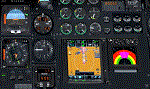
NpC4FSX&P3D (NumberPadControl for FSX and P3D) is a more efficient (and more convenient to set up)
version of a similar NpC program that I wrote a few years ago and which to
my surprise PC Pilot magazine included on their 100th Anniversary edition Freeware CD. With
NpC4FSX&P3D you assign keys to functions like Com, Nav, Heading, Course, Altitude, VS,
Autopilot functions, etc., and then can enter the associated values (like frequencies or headings) just by typing on the
keyboard’s numberpad instead of fiddling with elusive mouse click spots. NpC4FSX&P3D is
programmed primarily for aircraft with avionics that were developed within standard FSX
programming guidelines but also supports third party add-
on aircraft such as the Flysimware L35A and MU2, PMDG 737NGX / B777, Flight1 King Air
B200, A2A Cherokee 180, and also works with GPS units like the GTN750. Setup manual included.
A registered (payware) copy of FSUIPC is required.
| Filename: | NumberPad_Control_for_FSX_and_P3D.zip |
| License: | Freeware |
| Added: | 19th February 2018, 21:21:16 |
| Downloads: | 481 |
| Author: | Al Klayton |
| Size: | 683.59 KB |
| Category: Flight Simulator X - Scenery | |
| Bella Coola Valley Landscape Enhancements |
|
File Description:
One of the most spectacular watersheds of British Columbia's Midcoast, the Bella Coola Valley looks pretty boring in its default FSX rendition and the oddly shaped default Bella Coola River cuts deep into the terrain. These files provide a terrain mesh made from CDED1 0.75-arcsec data (multi-LOD, with maximum resolution of 38-m grid spacing), updated land class, water class, and seasons files, and accurate placements of lakes, rivers, streams, roads, and bridges. Also added are the glaciers of the Monarch Mountain Icefield as well as several forestry roads and clearcuts in the side valleys. Main roads have vehicle traffic moving in both directions. Coverage area is N51*45'-52*40' and W125*35'-127*25'. These files are fully compatible with other landscape enhancements for FSX, such as FS Genesis North America terrain mesh, Cloud 9's X-class, Adam Mill's ground texture replacements, or Flight1's Ultimate Terrain Canada/Alaska.
| Filename: | Bella_Coola_Valley_Landscape_Enhancements.zip |
| License: | Freeware, limited distribution |
| Added: | 24th February 2007, 08:27:54 |
| Downloads: | 12,654 |
| Author: | Holger Sandmann |
| Size: | 15.68 MB |
| Category: Flight Simulator X - Aircraft Repaints, Textures and Modifications | |
| Delta McDonnell Douglas Super 80 'New Colours' |
|
File Description:
With help from Zacherius who tested my textures time after time after time, I created my first repaint for Coolsky's Super 80 in Delta's New Colours, (or as it's also called 'Aeroflot') livery. As a long time professional photoshop user, I created a very realistic paint. As you might see at the screenshots, I used a dozen of different shades, and that was only for the bare metal part of the fuselage. For instance, not one of the cargo doors is alike. I also used my own created textures to create wing and fuselage bump map textures. This is my first go at a repaint, but as you can see from the screenshots, it worked out pretty fine and it is really cool to see my work 'moving in a 3d world'. These textures are intended for use on the Flight1/CoolSky Super 80. Installation is quick and easy. Thank Zacherius for packaging and prepping the repaint for you to download it. Enjoy it!
| Filename: | Delta_McDonnell_Douglas_Super_80_New_Colours.zip |
| License: | Freeware, limited distribution |
| Added: | 20th August 2007, 22:00:55 |
| Downloads: | 3,110 |
| Author: | Karen Romalta / McPhat Studios |
| Size: | 6.52 MB |
| Category: Flight Simulator 2004 - Scenery | |
| Pete & Sid's Viva Scenery Volume 4 |
|
File Description:
This is a collection of scenery enhancements for 81 airports, mostly smaller ones, located primarily in the Pacific Northwest, Alaska and Western Canada. (Yes, there's one in New Zealand.) It was not our intention to do anything fancy or particularly accurate, but simply to make the default scenery less boring and more fun. General aviation AI traffic (using default FS9 aircraft) is also included for some of these airports. The scenery for any individual airport may be removed without affecting the other airports. Some the airports we've done may also be included in Glacier Bay and other scenery add-ons; you'll need to remove one or the other to resolve any conflicts. This scenery was designed to work with Flight1's Ultimate Terrain and has not been tested with the default FS9 scenery. Most of the airports will probably work fine with the default scenery; those airports near water features (lakes, rivers, coastlines) are the ones most likely to have problems.
| Filename: | Pete__Sids_Viva_Scenery_Volume_4.zip |
| License: | Freeware |
| Added: | 12th July 2008, 13:22:06 |
| Downloads: | 2,257 |
| Author: | Sidney Schwartz & Peter Ham |
| Size: | 1.03 MB |
| Category: Flight Simulator 2004 - Scenery | |
| Ivujivik CYIK in Hudson Bay, Quebec, Canada |
|
Images related to this file:
File Description:
Ivujivik is a village of 350 or so inhabitants at N62 25 W78 on the northeastern corner of Hudson Bay. The village does not feature in FS9 but is included in this scenery with approximately the right shape (the coast, even with UT, is not exactly right) so just think of it as a hand-made auto-generated village which gives the airfield a reason. The runway is 3,500 feet of gravel 100 feet wide, which should be enough. I also added the roads, deleted the stock airfield background and added a new background, plus of course there is the scenery file and the AFCAD and AI. You may note that the terminal has the elevation written on the sign as 126', while on the winter photo it is written on the older & bigger sign as 130'. I thought this is because satellite radar has fixed the elevations of all airfields more accurately than before, as Rockcliffe too has gone from 192' to 188'; the alternative explanation is that global warming has raised sea level by 4'. Wow! That's a thought. I presume the new sign was made smaller as a cost saving.
| Filename: | Ivujivik_CYIK_in_Hudson_Bay_Quebec_Canada.zip |
| License: | Freeware, limited distribution |
| Added: | 31st October 2010, 07:41:20 |
| Downloads: | 458 |
| Author: | Roger Wensley |
| Size: | 2.07 MB |
| Category: Flight Simulator 2004 - Scenery | |
| Carp CYRP in Ontario Canada (updated October 2011) |
|
Images related to this file:
File Description:
This version further updates the post of 2006 and the 2009 update with more bespoke buildings for the west GA apron plus the revised fuelling area, and corrected surroundings with large forested areas and a modified airfield grass shape. This is a stand-alone version and does not require you to have downloaded and installed the previous posts; this REPLACES those versions. Carp airfield is fifteen miles west of Ottawa and two miles south of the town of Carp. There are two runways, 10/28 which is asphalt and almost 4,000 feet long and 100 feet wide, and 04/22 which is gravel and 2,000 feet long. The airfield has a fairly large population of general aviation residents and is slowly expanding under new ownership. This version models the large hangar beside the terminal, the "Touch'n Go" aviation warehouse that has opened more recently, and the ramshackle collection of hangars and sheds that make up Westair, the maintenance facility. The nearby pagoda-roof flight school building has in fact now been demolished, but I like it too much to do that, at least until something else has been built on that space.
| Filename: | Carp_CYRP_in_Ontario_Canada__updated_October_2011.zip |
| License: | Freeware, limited distribution |
| Added: | 25th November 2011, 09:25:34 |
| Downloads: | 587 |
| Author: | Roger Wensley |
| Size: | 7.59 MB |


© 2001-2026 AVSIM Online
All Rights Reserved
Privacy Policy |