
Where Flight Simulation Enthusiasts Gather from Around the World!
AVSIM Library - Search Results

| Category: Flight Simulator 2004 - Original Aircraft | |
| Noorduyn Norseman on Floats |

|
File Description:
The Noorduyn Norseman was built from 1935 until 1959. The have been used all over the world in both civil and military roles. The famous US Band Leader and composer Glen Miller disapeared in a Noresman over the English Channel durring WWII. They have been used primarily for bush planes on both wheels and floats. Most of them being used in Canada. The Noorduyn company continues to this day in Montreal building aircraft interiors. Made with FSDS 2.6. Includes custom panel bitmap by Ken Mitchel. Includes 3 paint schemes, Canadian, USAF and Bush Flying Unlimited. Full moving parts including Water rudders and opening doors. Features a fully funtional VC. Dynamics based on Fred Banting's DH Beaver.
| Filename: | Noorduyn_Norseman_on_Floats.zip |
| License: | Freeware, limited distribution |
| Added: | 7th October 2003, 17:36:24 |
| Downloads: | 7,982 |
| Author: | Brian Gladden |
| Size: | 2.17 MB |
| Category: Flight Simulator 2004 - Scenery | |
| Bush Flying Unlimited, Quebec |
|
File Description:
This scenery is located about 55 Nautical miles WNW of Quebec City on a nice lake. It has two gravel runways, a dock for floats, a main lodge and several small cabins. Also there is a barn with an old tractor to keep the grass mowed and the old Dodge Pickup to run errands in. A fuel tank is provided for fuel. There are lots of Gerrish's trees around too. An NDB is provided to help find the place. there is also a water runway with start locations. Runway 15-33 is 2000 feet long and 9-27 is 1800 feet long.
IMPORTANT NOTE!!! Requires Gerrish's Trees Library for FS2000/02/04 - Release 3/ trees_v3.zip... available at AVSIM.COM
| Filename: | Bush_Flying_Unlimited_Quebec.zip |
| License: | Freeware, limited distribution |
| Added: | 17th July 2004, 23:38:21 |
| Downloads: | 4,488 |
| Author: | Brian Gladden, Joe Binka |
| Size: | 3.49 MB |
| Category: Flight Simulator 2004 - Scenery Design | |
| Update of Turbigo's Power Station - VFR LIMC Malpensa, Italy |
|
Images related to this file:
File Description:
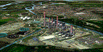
This scenery has been revised with complete new ground that solves the previous flickering problems; some objects, buildings and trees have been added. It DOES NOT INCLUDE any airport. Scenery requests Tree_v3 library; a special re-mesh file has been included, for users of special meshes (i/e Ragot Alps or Lod11)
Infos: the Turbigo's power station is placed approx 8 miles South LIMC Malpensa international airport of Milan, on the usual approach way for runways 35L and 35R.
content: new complete image of the ground; power station blocks 1, 2 & 3 with related 4 stacks with lights & smokes; boilers, esp, some ductworks & pipes, oil tanks, water treatment basins, bridges, some buildings and trees
| Filename: | Update_of_Turbigos_Power_Station__VFR_LIMC_Malpensa_Italy.zip |
| License: | Freeware |
| Added: | 25th September 2011, 14:39:16 |
| Downloads: | 1,801 |
| Author: | Aldo Della Vedova & Daniele Lanfranchi |
| Size: | 3.05 MB |
| Category: Flight Simulator 2004 - Scenery | |
| Europe SRTM mesh part 05: Poland |
|
File Description:
Europe SRTM LOD9 mesh part 5 of 13: Covers all parts of Poland north of 50'N. This Europe SRTM project was optimized for the lowest HDD space use: Each part matching exactly the boundaries of its neighbors, you'll have a complete coverage of Europe without gap or overlapping scenery.
Based on SRTM Data v1 and v2 (3 arcsec, 90m) and sampled to LOD9 resolution (90m). Each SRTM tile was carefully checked and repaired with Blackart v4.02: water areas are now flattened (lighter mesh), and SRTM voids were treated taking advantage of Blackart's sophisticated interpolation algorithm. When required, biggest voids were patched with oversampled SRTM 30 arcsec data and/or manual input.
| Filename: | Europe_SRTM_mesh_part_05_Poland.zip |
| License: | Freeware, limited distribution |
| Added: | 23rd December 2009, 10:34:50 |
| Downloads: | 17,176 |
| Author: | Yohann Baptiste |
| Size: | 35.01 MB |
| Category: Flight Simulator 2004 - Scenery | |
| Europe SRTM mesh Part 11: Southern Italy |
|
File Description:
Europe SRTM LOD9 mesh part 11 of 13: Covers southern Italy, Sardinia, Corsica and parts of Croatia and Bosnia.
This Europe SRTM project was optimized for the lowest HDD space use: Each part macthing exactly the boundaries of its neighbors, you'll have a complete corevage of Europe without gap or overlapping scenery. Based on SRTM Data v1 and v2 (3 arcsec, 90m) and sampled to LOD9 resolution (76m). Each SRTM tile was carefully checked and repaired with Blackart v4.02: water areas are now flattened (lighter mesh), and SRTM voids were treated taking advantage of Blackart's sophisticated interpolation algorithm. When required, biggest voids were patched with oversampled SRTM 30 arcsec data and/or manual input.
| Filename: | Europe_SRTM_mesh_Part_11_Southern_Italy.zip |
| License: | Freeware, limited distribution |
| Added: | 20th October 2005, 11:17:43 |
| Downloads: | 14,242 |
| Author: | Yohann Baptiste |
| Size: | 27.86 MB |
| Category: Flight Simulator 2004 - Scenery Design | |
| EZ Object Library Part1 |
|
File Description:
FS 2004 FlightLevel390 EZ-Object Library part1
Contains a mixture of 7 mini/strip malls,2 banks with drive up bays,Various Stores with seperate signage.
DXT3 day textures with night lighting.
These objects can be used in your own freeware scenery enhancements and will also be needed for FL390's upcoming KBTRv2 Scenery release.
A seperate 2nd part containing Inland River barges,Fast Food Resturants and a few other goodies will follow this upload soon.Part 2 will also be needed for our KBTRv2 Scenery and Galveston Bay/Houston Ship Channel Water Scenery as part 2 will contain the barges and other objects that will be needed.
Not tested in FS X....Use ZipDive to view more pics.
| Filename: | EZ_Object_Library_Part1.zip |
| License: | Freeware |
| Added: | 21st May 2007, 03:47:30 |
| Downloads: | 2,621 |
| Author: | FlightLevel390/Joe DeGregorio |
| Size: | 3.46 MB |
| Category: Flight Simulator 2004 - Scenery | |
| Canyonlands National Park South, Monticello (U43), Utah, Photo-Scenery (FSX too) |
|
Images related to this file:
File Description:
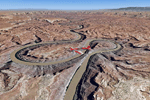
This scenery covers the southern part of Canyonlands National Park (Needles District) in Utah. The colorful layers of sand- and limestone that you can see today built over hundreds of millions years by advancing and retreating oceans as well as rivers that deposited huge amounts of sediment. About 15 million years ago these layers began to rise due to a colliding movement of plates in the earth's crust, forming what is today called the Colorado Plateau. As the land rose higher, erosion accelerated, resulting in countless canyons, mesas and buttes. The uplifting land caused the rivers to carve in even faster, resulting in the deep canyons of the Colorado and Green Rivers. The needles and fins in the Needles District have yet another story: First uplifts and later slides created a system of perpendicular cracks. Then he resulting crosshatched pattern of "joints" widened by erosion until only thin fins and needles of rock remained. The scenery extends my Arches National Park scenery to the south and brings you another 3.500 sq km in 4.7m/pix quality. To explore the scenery depart from Monticello (U43) and head north. YourDonation@Work: Dedicated to Nels, David and Michael. Thanks!
| Filename: | Canyonlands_National_Park_South_Monticello_U43_Uta.zip |
| License: | Freeware, limited distribution |
| Added: | 30th December 2009, 21:44:56 |
| Downloads: | 1,528 |
| Author: | Gottfried Razek - blueskyscenery.com |
| Size: | 95.76 MB |
| Category: Flight Simulator 2004 - Scenery | |
| Driftwood Bay AK23 near Dutch Harbor Alaska |
|
Images related to this file:
File Description:
This is Driftwood Bay, an Air Force field that is just 13 miles northwest of Dutch Harbor, and was once part of a DEW line station with a road heading up the hill.
In FS9 the stock runway is concrete and if you have a mesh with the hills correctly positioned then the runway sits in a deep hole on the hillside. In fact the runway is gravel, 3,500 feet long and aligned 32/14 next to the beach, which is where I moved it to. The beach, as configured by Ultimate Terrain (and contrary to my previous doubts, UT does cover the Aleutians) is incorrect, in that a marshy area just behind the beach is shown as sea with large indentations in what should be a fairly straight line of sand. However, this does not squeeze AK23 in any way so I left it; consider it to be a spring high tide. There is very little at AK23 beyond a gravel runway and a windsock and the AI is an Alaska State Troopers Piper Super Cub from Dutch Harbor, presumably monitoring the numerous Alaska Maritime National Wildlife Refuge areas.
| Filename: | Driftwood_Bay_AK23_near_Dutch_Harbor_Alaska.zip |
| License: | Freeware, limited distribution |
| Added: | 14th August 2012, 20:32:14 |
| Downloads: | 354 |
| Author: | Roger Wensley, Sidney Schwartz |
| Size: | 3.35 MB |
| Category: Flight Simulator X - Scenery | |
| RAF Scorton |
|
File Description:
RAF Scorton was opened in October 1939 as part of 13 Group Fighter Command and a satellite station of RAF Catterick. It was located near the village of Scorton in North Yorkshire. It was used by the Royal Air Force, the Royal Canadian Air Force, and the United States Army Air Forces Ninth Air Force during the war.
The location was chosen for its flat terrain and its situation close to the now disbanded Eryholme-Richmond branch line that had a sub branch line to Catterick Garrison and RAF Catterick.
The famous No. 56 Squadron RAF flew Spitfires from Scorton during the Second World War. Also the USAAF 422d and 425th Night Fighter Squadrons were stationed at Scorton flying the Northrup P-61 "Black Widow" fighter.
The Aerodrome closed in 1945 and most of the concreted areas have been extensively quarried away for sand and gravel extraction. Most of what was the airfield is now under a lake or a quarry. There are a few military pre-fab buildings remaining in the area – they were dismantled after the war and moved to local farms to be used as agricultural buildings.
Source:Wikipedia
| Filename: | RAF_Scorton.zip |
| License: | Freeware |
| Added: | 26th February 2017, 07:30:57 |
| Downloads: | 86 |
| Author: | Terry Boissel |
| Size: | 2.52 MB |
| Category: Flight Simulator 2002 - Miscellaneous Files | |
| Active Camera 2002 version 1.1 |
|
File Description:
Active Camera 2002. With this module you can enable additional views in Microsoft Flight Simulator 2002. Several new camera views are selectable from the FS2002 - Options menu. When activated this module replaces the original tower and virtual cockpit views of FS2002. Features: fly by, approach and spotter view, mouse driven spot plane view, allows mouse panning and zooming in the VC, walking in the cabin, walking outside of the aircraft (ambient sounds like steps, wind and aircraft stress sounds), head latency function, pre-stall buffeting effect, ground turbulence effect, ability to save and call up to 10 presets of views in the VC per aircraft for an unlimited number of aircraft. This version replaces Active Camera 2002 (AC2002.zip) uploaded to the AVSIM library on 20 June 2003. Some users encountered troubles to "handle" the spot plane view parameters, got a trembling image in Spot plane view and could not pan. To make things more simple we added : " Use mouse in spot view", a new option in the AC2002 menu that enables the Active Camera Spot Plane view. If "Use mouse in spot view" is unchecked, THE FS DEFAULT SPOT PLANE VIEW is active. Bug corrected : sometimes recycling views from 2D to 3D jumped over the virtual cockpit. Updated shortcut table.
| Filename: | Active_Camera_2002_version_11.zip |
| License: | Freeware, limited distribution |
| Added: | 24th June 2003, 00:35:57 |
| Downloads: | 34,402 |
| Author: | Guillaume Darier and Serge Baye |
| Size: | 1.77 MB |


© 2001-2026 AVSIM Online
All Rights Reserved
Privacy Policy |