
Where Flight Simulation Enthusiasts Gather from Around the World!
AVSIM Library - Search Results

| Category: Flight Simulator 2004 - Scenery | |
| Valdez Pioneer Field PAVD in Alaska |

|
Images related to this file:
File Description:
Pioneer Field is in Valdez Alaska, between the mountains to the north and the water of Valdez Arm to the south. It used to cater for a lot of the work for the Alaskan pipline and the nearby terminal and in the middle 1970's it was a very busy place. That is not the case now, and the tower is no longer manned though there is still an average of 35 flights a day and there are 30 planes (and helicopters) based at the field. There are three really odd hangars at the western end of the apron, with each of them having 6 "T" hangars which have been joined in a circle; this is the only place I have ever seen this. The recently resurfaced runway is 6,500 feet of 150 feet wide asphalt aligned 6/24 at 121 feet asl. There is also a wide and heavy duty asphalt and gravel surrounding runoff and base, probably because of drainage problems with water from the mountains. Fuel (both JetA and 100LL) is available from ERA Helicopters at the eastern end of the apron. All of the buildings on the field have been modelled specifically for this scenery, plus the nearby accomodation blocks. The AI flights are for the twice-daily ERA/Alaska Air flights using a Bombardier Dash 8-200.
| Filename: | Valdez_Pioneer_Field_PAVD_in_Alaska.zip |
| License: | Freeware, limited distribution |
| Added: | 21st January 2011, 03:29:51 |
| Downloads: | 1,201 |
| Author: | Roger Wensley |
| Size: | 3.97 MB |
| Category: Flight Simulator X - Scenery | |
| Thomas Hudner AFB |
|
File Description:
Thomas Hudner AFB is a fictitious Air Force Base located at Henderson Island, a member of the Pitcairn Islands in the Pacific. Located in a sheltered bay on the east side of the island, the airport features a 7500' x 120' paved runway, several hangars, barracks, and a fire dept. This airport also features a Delta V rocket and launch pad, a container ship being unloaded offshore by hovercrafts, and a small military ship. The default FSX scenery at this island has been completely replaced with custom scenery and terrain based on satellite photos.
This scenery requires the FSX Acceleration expansion pack for all of the objects to show up properly. Also, for some reason, Ground Environment X causes the sand textures to show up as rain forest. This is purely a visual quirk and the airport will still work, but it is up to you. This airport is not designed for FS2004, but you may try it at your own risk. Special thanks to Ashton Lawson for his invaluable help on this project.
| Filename: | Thomas_Hudner_AFB.zip |
| License: | Freeware, limited distribution |
| Added: | 31st January 2009, 01:29:20 |
| Downloads: | 543 |
| Author: | Daniel Otto |
| Size: | 1.57 MB |
| Category: Flight Simulator X - AFCAD Files | |
| Warren Grove Range Airport (NJ24), New Jersey |
|
File Description:
Located 03 miles SW of Burlington County, New Jersey, Warren Grove Range is a private concrete airfield 1800' in length. It is owned by the Department of Defense and exists in a restricted flight area. The bare sand of this area has washed out the satellite images tremendously from over-exposure thanks to reflected sunlight - you can't even make out the runway (which FSX places incorrectly over a mile away). Due to lack of ground definition and primary use as a military facility, this airport has not been developed by MSEAirports and the concrete runway has been removed.
Scenery constructed with use of satellite images/streetview/aerial photos - the author has not been there in person.
This scenery is meant to be used in conjunction with MegaScenery Earth New Jersey/Delaware 003. It is not required, but apron use is minimized to allow satellite scenery to show through as much as possible, and objects are placed based on the MSE textures - lack of it may make scenery look out of place.
| Filename: | Warren_Grove_Range_Airport_NJ24_New_Jersey.zip |
| License: | Freeware |
| Added: | 20th August 2011, 19:58:05 |
| Downloads: | 174 |
| Author: | Drew Sikora |
| Size: | 153.47 KB |
| Category: Flight Simulator X - Helicopters | |
| Fire Rescue Boeing CH-47D Chinook |
|
File Description:
This is a repaint of the Boeing CH-47D Chinook helicopter in U.S. Forest Service Fire Rescue livery N10HE. These are textures only and require the original model (available by downloading either the Hellenic Army Aviation or U.S. Armed Forces Chinook). In the U.S. Forest Service, the Chinook is often called upon for firefighting duties. These include transporting and para-dropping firefighters and equipment as well as using a large bucket to drop water directly onto forest fires. The Chinook is also used in search and rescue operations. Special thanks to Delizisis Thanasis and Delizisis Panagiots for their original textures used as paint templates.
| Filename: | Fire_Rescue_Boeing_CH47D_Chinook.zip |
| License: | Freeware, limited distribution |
| Added: | 24th January 2007, 15:50:28 |
| Downloads: | 2,925 |
| Author: | Mike Lanza |
| Size: | 1.17 MB |
| Category: Flight Simulator 2004 - Scenery Design | |
| EZ-Object Library Part 2 - Fast Food resturants |
|
File Description:
FS2004 FlightLevel390 EZ-Object Library part2
Contains a mixture of 4 low polygon Fast Food Resturants with seperate signage.Dominos Pizza,Sonic,Waffle House & Pizza Hut.
DXT3 day textures with night lighting.Optimized for good FPS.
These objects can be used in your own freeware scenery enhancements and will also be needed for FL390's upcoming KBTRv2 Scenery release.
A seperate 3rd part containing Inland River barges,and a few other goodies will follow this upload soon.Part 3 will also be needed for our KBTRv2 Scenery and Galveston Bay/Houston Ship Channel Water Scenery as part 3 will contain the barges and other objects that will be needed.
Not tested in FS X.
| Filename: | EZObject_Library_Part_2__Fast_Food_resturants.zip |
| License: | Freeware |
| Added: | 24th May 2007, 03:20:43 |
| Downloads: | 1,827 |
| Author: | FlightLevel390/Joe DeGregorio |
| Size: | 3.58 MB |
| Category: Flight Simulator X - Scenery | |
| Hawaii - Niihau |
|
Images related to this file:
File Description:
Niihau, the westernmost of the inhabited Hawaiian Islands, is privately owned and used primarily to raise cattle. It's small population works the ranch. Because it is so isolated, it is the last of the Hawaiian Islands where Hawaiian is the primary language.
Niihau has no airport of its own. You get there by taking off from Kauai and flying west. I'd recommend using Port Allen (PAK). Unless visibility is limited, you can see Niihau across the water from the airport. Just take off and fly a heading of 270 degrees. However, a saved flight which places you just off Niihau's shore is included in the package should you need it.
| Filename: | Hawaii__Niihau.zip |
| License: | Freeware |
| Added: | 15th December 2009, 23:19:34 |
| Downloads: | 2,526 |
| Author: | Richard Sorochak |
| Size: | 36.49 MB |
| Category: Flight Simulator X - Scenery | |
| Grand Forks Int'l Airport v1.1 |
|
Images related to this file:
File Description:
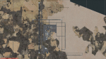
This scenery addon updates Grand Forks International Airport (KGFK) for FSX only. This is an updated version of the original scenery addon KGFK10 that contained the newly constructed runway. This update includes several bug fixes, such as removal of duplicate taxiway signs and other objects. It also includes updated local scenery to more closely match the actual airport. Local bodies of water used as visual checkpoints have also been added. All instrument approaches have been updated for currency, to include correct waypoint names and procedures. Several missing instrument approaches have also been added. The airport was updated using Airport Design Editor. By Raymond Mills.
| Filename: | Grand_Forks_Intl_Airport_v11.zip |
| License: | Freeware |
| Added: | 20th October 2010, 22:34:31 |
| Downloads: | 996 |
| Author: | Raymond Mills |
| Size: | 15.85 KB |
| Category: Flight Simulator X - Scenery | |
| The Dry Tortugas Photo Scenery |
|
Images related to this file:
File Description:
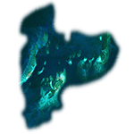
Where are the Dry Tortugas? Should you be wondering, at the western end of the Florida Keys. Located 68 miles west of Key West, they are accessible only by boat and of course via your favorite seaplane.
Source Data: National Agriculture Imagery Program (NAIP) Orthoimagery, 1 meter per pixel resolution. The scenery package also corrects the MS-FSX Island and Lighthouse position errors overlooked by UTX-USA and UTX-TAC.
For your finest virtual experience it is highly recommended you download, install and use with: South Florida and The Bahamas Water Class scenery. (S-FL_Bahamas_WC.zip)
Enjoy your flight and don't forget your Scuba Gear or the sunscreen! - Wally-Bob
| Filename: | The_Dry_Tortugas_Photo_Scenery.zip |
| License: | Freeware, limited distribution |
| Added: | 23rd August 2014, 11:08:17 |
| Downloads: | 918 |
| Author: | Walter Roberts |
| Size: | 50.9 MB |
| Category: Flight Simulator X - Scenery | |
| Aerodromo de Tela - MHTE |
|
Images related to this file:
File Description:
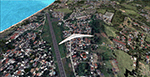
Tela Airport (Spanish: Aeropuerto de Tela) (IATA: TEA, ICAO: MHTE) is an airport serving Tela, a town in the Atlántida Department on the northern coast of Honduras. In 2009, plans were laid to lengthen the runway from 1,346 metres (4,416 ft) to 1,600 metres (5,200 ft) and possibly to construct a new terminal building. There are hills southeast of the runway. Northeast approach and departure are over the water. The La Mesa VOR-DME (Ident: LMS) is located 31.0 nautical miles (57.4 km) southwest of the airport. The Bonito VOR-DME (Ident: BTO)is located 35.4 nautical miles (65.6 km) east of the airport.
| Filename: | Aerodromo_de_Tela__MHTE.zip |
| License: | Freeware |
| Added: | 25th January 2021, 02:29:26 |
| Downloads: | 210 |
| Author: | Luis Flores |
| Size: | 87.71 MB |
| Category: Flight Simulator 2004 - Scenery Design | |
| Bird Collection, a Rwy12 Object Placer Library |
|
File Description:
For users of Rwy12 Object Placer only. The 5 static birds, in
20 different shapes and formations, are all done in 3D with
gmax and in a low polygon count for frame rate efficiency.
The idea to make the static birds came from the "AI Canada
Geese" by Joe Binka (many thanks to him), but contrary to his
V formation that moves as AI traffic, the static birds
give you a sense of movement by flying by at low speed. The
birds are crash sensitive, so don't try to hunt them with your
aircraft. Some of the birds can be placed on the ground or water
and others in the air.
| Filename: | Bird_Collection_a_Rwy12_Object_Placer_Library.zip |
| License: | Freeware |
| Added: | 31st January 2005, 14:25:29 |
| Downloads: | 7,467 |
| Author: | Seev Kahn |
| Size: | 1.56 MB |


© 2001-2026 AVSIM Online
All Rights Reserved
Privacy Policy |