
Where Flight Simulation Enthusiasts Gather from Around the World!
AVSIM Library - Search Results

| Category: Flight Simulator X - Scenery | |
| Toulouse Blagnac (LFBO) v1 update |

|
Images related to this file:
File Description:
FSX Toulouse Blagnac Airport v1 modification update. This is an update of the addon scenery for FSX of the Toulouse Blagnac Airport. For using it, you need first to install /Toulouse Blagnac (LFBO) v1/ available in the Avsim library from myself (lfbo_scenery_v1.zip).
On this update, I have included the following (this is not an exhaustive list): Correction of the position of the ILS glide for the runway 32R/14L, improvement of the taxiways and connecting roads, correction of their position with Google earth, taxiways are well aligned with runways and surrounding buildings now, improvement of some existing buildings (i.e. old terminal), addition of customized buildings with day and night photo texture, improvement of the land class surrounding the installations, inclusion of water polygons, new assignment of gates for the Air France fleet (now located in new terminal F like in reality)
| Filename: | Toulouse_Blagnac_LFBO_v1_update.zip |
| License: | Freeware |
| Added: | 17th July 2012, 18:50:28 |
| Downloads: | 11,963 |
| Author: | Jose Mauriz |
| Size: | 29.73 MB |
| Category: Flight Simulator X - Scenery | |
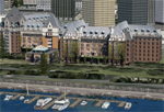
| Victoria, Canada including US Southern Gulf Islands and San Juan Islands - Part 2 of 2 |
|
Images related to this file:
File Description:

FSX-only version of Victoria, Canada area scenery including the Southern Gulf Islands and the San Juan Islands of the US. Includes automated installer and configurator by Scot Fraser.
Features:
-accurate shorelines, lakes and streams;
-landclass;
-FSX multi-LOD mesh with 10m maximum resolution;
-complete road network with moving traffic;
-railroads;
-utility corridors;
-marinas and ferry terminals;
-many static boats, including a custom model of the Canada Coast Guard ship Sir Wilfred Laurier;
-detailed models of major buildings and the Ogden Point Terminal;
-many bridges;
-nearly 300 marine lights; and corrected antennae locations.
Facilities include Don Grovestine's famous CYYJ (Victoria International Airport); 12 other Canadian land-based airports: Butler Field, Duncan (CAM3), Gaines, Hastings, Hudson Island, James Island, Thomas, Village Bay, Raven Field (CML2), Saltspring, Sidney Island, Whiskey Point; 20 US airports Blakely (38WA), Burden (61WA), Center Island (79WA), Clam Harbor (WA35), Crane Island, Decatur Shores (WN07), Decatur-Jones (WA18), Waldronaire (90WA), Orcas Island (KORS), Friday Harbour (KFHR), Lopez Island (S31), Pile Point, Roche Harbor (WA09), Shaw Island, Stuart Island Airpark (7WA5), Stuart Island West (2WA3), Wilding (6WA5), Windsock (4WA4); 12 floatplane facilities: Bedwell (CAB3), Fisherman's Bay (WA81), Friday Harbor (W33), Ganges (CAX6), Maple Bay, Mayne (CAW7), Port Washington (CAP8), Roche Harbor (W39), Rosario (W49), Shawnigan Lake (CAV8), Victoria Harbour (CYWH), Victoria International (CAP5) and Westsound, Orcas (WA83) - many with AI traffic; 9 heliports: Ganges (CAL7), Mayne (CBF5), Camel Point (CBF7), Jubilee (CBK8), Victoria General (CBW7) Madrona Bay (CBW9), Shoal Point (CBZ7), Mount Belcher (CMBH).
AI models include the DHC-2 floatplane in local liveries, a cruise ship model (by Mitsuya Hamaguchi) and two repaints, pilot boat, and small boats (by Larry Silsbee).
Ultimate Terrain X compatible (not required). Users of Vancouver+ for FSX will also get additional cruise ship traffic and additional floatplane and helicopter traffic. Full documentation. By Don Grovestine, Jon Patch and Holger Sandmann. Many other contributors: see documentation. Part 2 of 2 - you also need file vicenh7a.zip
| Filename: | Victoria_Canada_including_US_Southern_Gulf_Islands.zip |
| License: | Check within download |
| Added: | 29th January 2010, 21:21:49 |
| Downloads: | 23,161 |
| Author: | Don Grovestine, Jon Patch and Holger Sandmann |
| Size: | 59.08 MB |
| Category: Flight Simulator X - Scenery | |
| Victoria, Canada including US Southern Gulf Islands and San Juan Islands - Part 1 of 2 |
|
Images related to this file:
File Description:
FSX-only version of Victoria, Canada area scenery including the Southern Gulf Islands and the San Juan Islands of the US. Includes automated installer and configurator by Scot Fraser.
Features:
-accurate shorelines, lakes and streams;
-landclass;
-FSX multi-LOD mesh with 10m maximum resolution;
-complete road network with moving traffic;
-railroads;
-utility corridors;
-marinas and ferry terminals;
-many static boats, including a custom model of the Canada Coast Guard ship Sir Wilfred Laurier;
-detailed models of major buildings and the Ogden Point Terminal;
-many bridges;
-nearly 300 marine lights; and corrected antennae locations.
Facilities include Don Grovestine's famous CYYJ (Victoria International Airport); 12 other Canadian land-based airports: Butler Field, Duncan (CAM3), Gaines, Hastings, Hudson Island, James Island, Thomas, Village Bay, Raven Field (CML2), Saltspring, Sidney Island, Whiskey Point; 20 US airports Blakely (38WA), Burden (61WA), Center Island (79WA), Clam Harbor (WA35), Crane Island, Decatur Shores (WN07), Decatur-Jones (WA18), Waldronaire (90WA), Orcas Island (KORS), Friday Harbour (KFHR), Lopez Island (S31), Pile Point, Roche Harbor (WA09), Shaw Island, Stuart Island Airpark (7WA5), Stuart Island West (2WA3), Wilding (6WA5), Windsock (4WA4); 12 floatplane facilities: Bedwell (CAB3), Fisherman's Bay (WA81), Friday Harbor (W33), Ganges (CAX6), Maple Bay, Mayne (CAW7), Port Washington (CAP8), Roche Harbor (W39), Rosario (W49), Shawnigan Lake (CAV8), Victoria Harbour (CYWH), Victoria International (CAP5) and Westsound, Orcas (WA83) - many with AI traffic; 9 heliports: Ganges (CAL7), Mayne (CBF5), Camel Point (CBF7), Jubilee (CBK8), Victoria General (CBW7) Madrona Bay (CBW9), Shoal Point (CBZ7), Mount Belcher (CMBH).
AI models include the DHC-2 floatplane in local liveries, a cruise ship model (by Mitsuya Hamaguchi) and two repaints, pilot boat, and small boats (by Larry Silsbee).
Ultimate Terrain X compatible (not required). Users of Vancouver+ for FSX will also get additional cruise ship traffic and additional floatplane and helicopter traffic. Full documentation. By Don Grovestine, Jon Patch and Holger Sandmann. Many other contributors: see documentation. Part 1 of 2 - you also need file vicenh7b.zip
| Filename: | Victoria_Canada_including_US_Southern_Gulf_Islands.zip |
| License: | Check within download |
| Added: | 29th January 2010, 21:23:17 |
| Downloads: | 23,158 |
| Author: | Don Grovestine, Jon Patch and Holger Sandmann |
| Size: | 56.8 MB |
| Category: Flight Simulator 2004 - Scenery | |
| North and Middle Farallon Islands Version 3 Update |
|
File Description:
Beta version 3 update: Adds the North and Middle Farallon Islands to the chain. To be used in conjunction with the Southeast Farallon Island Version 3 download available separately. These islands were mysteriously absent from the FS2004 default scenery, probably owing to their small size. When I went to look for them I found a small mountain of water instead of the islands. Most people don't seem to be aware of the Farallon Islands. Located off the coast of California, near San Francisco, they are home to thousands of birds, seals, and some of the largest Great White sharks known to man. All of this is within a very short distance of the city. Today, it is a wildlife refuge and is off limits to visitation by the general public. Those of you interested in more info might check out "The Devil's Teeth" by Susan Casey. These islands were created as scenery objects instead of traditional terrain in order to preserve detail.
| Filename: | North_and_Middle_Farallon_Islands_Version_3_Update.zip |
| License: | Freeware, limited distribution |
| Added: | 24th November 2005, 14:48:25 |
| Downloads: | 851 |
| Author: | Glen Gordon (Prof K.) |
| Size: | 319.86 KB |
| Category: Flight Simulator 2004 - Scenery | |
| Caballococha, Peru FIx |
|
File Description:
This adds the missing AFCAD FILE ... I apologize for the inconvience.
Caballococha, Peru - Actually I have found only one photo of the town along the Amazon River and it was only of the Plaza. This is a total impressionistic file. Creates the town, riverside features (Piers, Ferry landing) and a few features to the default airport.
New AFCAD created offering parking and a taxiway, plus two water start locations. Again totally fictious. BUT enjoy.
One thing about Caballococha is that it is along a highly navagatable portion of the Amazon and with the fantastic array of Watercraft available offers, I believe, unlimited simming possibilities.
I included the .XML file for rwy12, if you are into enhancing your own scenery...please do feel free to modify or add as desired. This scenery DOES require both LAGO FSE (Payware) and RWY12 available here at avsim) to work.
questions or comments PLEASE do e-mail me ... I will respond as rapidly as possible.
[email protected]
| Filename: | Caballococha_Peru_FIx.zip |
| License: | Freeware |
| Added: | 9th April 2006, 23:24:04 |
| Downloads: | 602 |
| Author: | Dale Caruso |
| Size: | 1.84 KB |
| Category: Flight Simulator 2004 - Scenery | |
| Buffalo Narrows CYVT in Saskatchewan, Canada |
|
Images related to this file:
File Description:
Buffalo Narrows is a small town (around 1,400 folks) 130 miles west and a bit north of La Ronge in Saskatchewan, and I discovered that the Buffalo Narrows airfield, wrongly positioned in FS9, had been flooded out by Ultimate Terrain's lake; this is the rescue package. Actually that would be several lakes as the place is surrounded by water including Churchill Lake, Little Peter Pond Lake, and of course Big Peter Pond Lake.
There are two runways, the longest being 5,006' of 100' wide asphalt aligned 11/29, and the other 2,297 and 75' wide, also asphalt. Both runways are lit, and there is JetA and 100LL fuel available. I have placed taxiway lights, but I haven't made proper signage or placed runway lights, or a ton of other things, but it is now landable and with the buildings and fire chemical retarder tanks etc, and there is AI that includes a CL-415. The roads have also been modified to fit.
| Filename: | Buffalo_Narrows_CYVT_in_Saskatchewan_Canada.zip |
| License: | Freeware, limited distribution |
| Added: | 15th July 2012, 19:31:20 |
| Downloads: | 499 |
| Author: | Roger Wensley |
| Size: | 1.8 MB |
| Category: Flight Simulator 2004 - Scenery | |
| Southeast Farallon Islands Version 2 |
|
File Description:
SIGNIFICANTLY ENHANCED UPGRADE OF PRIOR VERSION. These islands were mysteriously absent from the FS2004 default scenery, probably owing to their small size. When I went to look for them I found a small mountain of water instead of the islands. Most people don't seem to be aware of the Farallon Islands. Located off the coast of California, near San Francisco, they are home to thousands of birds, seals, and some of the largest Great White sharks known to man. All of this is within a very short distance of the city. Today, it is a wildlife refuge and is off limits to visitation by the general public. Those of you interested in more info might check out "The Devil's Teeth" by Susan Casey. This island is actually a scenery object. As such it doesn't have a landable surface. Future versions will have a helicopter pad, a lighthouse, and the 100 year old houses used by researchers.
| Filename: | Southeast_Farallon_Islands_Version_2.zip |
| License: | Freeware, limited distribution |
| Added: | 19th November 2005, 23:35:28 |
| Downloads: | 793 |
| Author: | Glen Gordon (Prof K.) |
| Size: | 1.62 MB |
| Category: Flight Simulator 2004 - Scenery | |
| Hawk Logging, for Holger Sandmann's scenery |
|
Images related to this file:
File Description:
This is a logging camp, on Admiral Island at the northern end of Chatham Strait in southern Alaska, around 30 miles south of Juneau. It is marked on the chart of the area; if you are chartless then there is a section of the chart included here. This scenery is designed specifically for use in the Tongass Fjord scenery (or Glacier, or Misty? I don't remember now which area it is in!) and probably does not work with just Ultimate Terrain; I haven't tried it. The camp has an identifying code so it will show up on a gps as PELC but there is no interaction with atc as there are no designated water runways; PELC on the GPS just acts as a waypoint. There will be further posts for use with Tongass Fjords, Misty Fjords, and Glacier Bay, and I still find these scenery areas by Holger and his crew the most satisfying in FS9.
| Filename: | Hawk_Logging_for_Holger_Sandmanns_scenery.zip |
| License: | Freeware, limited distribution |
| Added: | 8th November 2014, 22:42:24 |
| Downloads: | 317 |
| Author: | Roger Wensley |
| Size: | 12.37 MB |
| Category: Flight Simulator 2004 - Scenery | |
| WAHR - Heathers Ranch |
|
File Description:
The other upload had checksum errors.
Heathers Ranch is located about 5 miles west of Port Angeles, Wa. Heather has made a lot of Virtual money from the BFU gang and others painting and re-furbishing their aircraft. This scenery was created for her because of her caring and unselfish attitude as well as her talents.
There are 2 runways, 18-36 is an oilsoaked dirt runway with oilsoaked taxiways. If you need your oil changed, Heather or her brother will change it free for the used oil. The other runway is a water runway and is in the sound adjacent to the ranch. There is a pier there that has fuel. For more service, climb the bank and taxi up to the hanger. “Easily accessed by air (STOL only), boat or road.”
You will need Gerrish Gray’s Trees_v3.zip installed. There are FSE file included but are not necessary for the enjoyment of this scenery.
| Filename: | WAHR__Heathers_Ranch.zip |
| License: | Freeware, limited distribution |
| Added: | 3rd July 2004, 19:53:57 |
| Downloads: | 3,279 |
| Author: | Joe Watson |
| Size: | 3.59 MB |
| Category: Flight Simulator 2004 - Aircraft Repaints, Textures and Modifications | |
| AFG YS-11 Combi v2.7 Aleutian Old Mod 1 |
|
File Description:
THIS IS TO RECTIFY AN AIRCRAFT.CFG FILE ERROR
YS-11 reeve aleutian old colour scheme textures only,for AFG`s YS-11 v2.7 ONLY,you must have the AFG YS-11combi.zip for the V2.7 in fs9,for these textures to work. also included is the aircraft config text that needs to be added to the aircraft config file,for the aircraft to show in fs9.
mods added to textures are:-
1)water methanhol fillercap top port wing
2)emergency cut panels 3 off top fuselage
3)red/blue/grey colour shades corrected
4)american flag on fin now correct way round with the stars to the fin LE
5)fwd cargo door realigned to v2.7 opening
FOR THOSE THAT HAVE ALREADY DOWNLOADED MY AFG_YS-11combi_V2.7_aleutian_old.zip dated 19/11/06
and you cannot see the aircraft in yor fs9,then use notepad to edit the aircraft.cfg file so the line
MODEL=C becomes MODEL= in the aleutian part of the cfg file.
Sorry for any inconvenience caused.
| Filename: | AFG_YS11_Combi_v27_Aleutian_Old_Mod_1.zip |
| License: | Freeware |
| Added: | 20th November 2006, 03:27:20 |
| Downloads: | 833 |
| Author: | Alan Cottrill |
| Size: | 4.87 MB |
© 2001-2026 AVSIM Online
All Rights Reserved
Privacy Policy |