
Where Flight Simulation Enthusiasts Gather from Around the World!
AVSIM Library - Search Results

| Category: Flight Simulator X - Aircraft Repaints, Textures and Modifications | |
| Grumman Goose Flight Dynamics v1.0.1 |

|
Images related to this file:
File Description:
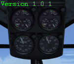
Version 1.0.1. Re-uploaded with revision. New flight dynamics for the FSX default and OZx Grumman Goose, incorporating multiple changes and improvements. Included are a new air file (FDE), a new aircraft.cfg file, and a fix for the fuel gauge. This package is intended to improve the "feel" and to simulate a more realistic operation and handling of the aircraft. In addition to improving how the FSX Goose flies, extensive work has gone into how the engines and propellers are simulated. Please read the readme and changelog files included in this package for details and important information. REVISION: Some users have reported that after installation of version 1.0, the Grumman Goose fails to initialize when FSX is started. This revision includes an installation note in the readme that addresses the issue. Please read the IMPORTANT NOTE in the INSTALLATION section of the GD README for details. If you previously installed v1.0 and the aircraft loaded successfully, then you do not need this revision.
| Filename: | Grumman_Goose_Flight_Dynamics_v101.zip |
| License: | Freeware, limited distribution |
| Added: | 31st May 2013, 22:39:47 |
| Downloads: | 2,156 |
| Author: | Lloyd Dixon |
| Size: | 1.62 MB |
| Category: Flight Simulator 2004 - Scenery | |
| Dallas, Texas - Helijet Shuttle Service - Scenery plus an AI Helicopter |
|
File Description:
Dallas, Texas - Helijet Shuttle service. This scenery adds the fictitious Helijet Shuttle service which
shuttles passengers from smaller local airports to Dallas-Ft. Worth International (KDFW) and back again.
The fine Sikorsky S-76C AI Helicopter by Chris 'Elvis' Jones (not included) will be seen departing and
arriving at Addison (KADS), Redbird (KRDB), Love (KDAL) and KDFW. At each location there is a small service area created with the EZ Scenery Object Placer program. All necessary files - other than the AI
Helicopter - are included. This scenery is presented not only as an interesting addition to the Dallas
area airports, but also as a “case study” to help you add the same type of service in other suitable
locations. By studying the Afcads I have created, you will quickly see how it is possible to include AI Helicopters in your sceneries using the "invisible” airport technique. Please unzip this package (using folders option) to a temporary folder and carefully follow the simple installation instructions.
| Filename: | Dallas_Texas__Helijet_Shuttle_Service__Scenery_plu.zip |
| License: | Freeware |
| Added: | 19th July 2006, 00:27:17 |
| Downloads: | 2,087 |
| Author: | David "Opa" Marshall |
| Size: | 1.72 MB |
| Category: Flight Simulator 2004 - Scenery | |
| "Himalayan Peaks" LOD10 Mesh, Volume 3 - Namcha Barwa |
|
File Description:
Highly detailed terrain mesh of the Namcha Barwa area, N29°-31° E94°-96°. The files in this package are based on Shuttle Radar (SRTM) Version 2 data but with many of the void areas, especially the most significant sections, filled with elevation data generated from topographic maps by Jonathan de Ferranti. While Jonathan's work is unrelated to flight simulation he kindly gave me permission to compile his data for use in FS. The result is a wonderful improvement in detail and accuracy over any existing mesh file, freeware or commercial, based on SRTM or DTED data alone. Due to the large area of the Himalayas I've compiled the source data as two separate series: the "Himalayan Peaks" series covers prominent mountains and ranges in higher detail and locally overrides any existing LOD9 terrain mesh. In addition, a LOD9 "base mesh" series covering the entire Himalayas will be available for those who do not yet have an add-on terrain mesh of these beautiful mountains.
| Filename: | Himalayan_Peaks_LOD10_Mesh_Volume_3__Namcha_Barwa.zip |
| License: | Freeware, limited distribution |
| Added: | 18th February 2006, 23:15:17 |
| Downloads: | 12,188 |
| Author: | Holger Sandmann and Jonathan de Ferranti |
| Size: | 15.09 MB |
| Category: Flight Simulator 2004 - Scenery | |
| "Himalayan Peaks" LOD10 Mesh, Volume 5 - Garhwal |
|
File Description:
Highly detailed terrain mesh of the Garhwal area, N30°-32° E78°-81°. The files in this package are based on Shuttle Radar (SRTM) Version 2 data but with many of the void areas, especially the most significant sections, filled with elevation data generated from topographic maps by Jonathan de Ferranti. While Jonathan's work is unrelated to flight simulation he kindly gave me permission to compile his data for use in FS. The result is a wonderful improvement in detail and accuracy over any existing mesh file, freeware or commercial, based on SRTM or DTED data alone. Due to the large area of the Himalayas I've compiled the source data as two separate series: the "Himalayan Peaks" series covers prominent mountains and ranges in higher detail and locally overrides any existing LOD9 terrain mesh. In addition, a LOD9 "base mesh" series covering the entire Himalayas will be available for those who do not yet have an add-on terrain mesh of these beautiful mountains.
| Filename: | Himalayan_Peaks_LOD10_Mesh_Volume_5__Garhwal.zip |
| License: | Freeware, limited distribution |
| Added: | 18th February 2006, 23:16:47 |
| Downloads: | 10,134 |
| Author: | Holger Sandmann and Jonathan de Ferranti |
| Size: | 27.72 MB |
| Category: Flight Simulator 2004 - Scenery | |
| "Himalayan Peaks" LOD10 Mesh, Volume 6 - Jammu and Kashmir |
|
Images related to this file:
File Description:
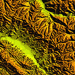
Highly detailed terrain mesh of the Jammu and Kashmir areas, N31-36 E76-78. The files in this package are based on Shuttle Radar (SRTM) Version 2 data but with many of the void areas, especially the most significant sections, filled with elevation data generated from topographic maps by Jonathan de Ferranti. While Jonathan's work is unrelated to flight simulation he kindly gave me permission to compile his data for use in FS. The result is a wonderful improvement in detail and accuracy over any existing mesh file, freeware or commercial, based on SRTM or DTED data alone.
Due to the large area of the Himalayas I've compiled the source data as two separate series: the "Himalayan Peaks" series covers prominent mountains and ranges in higher detail and locally overrides any existing LOD9 terrain mesh. In addition, a LOD9 "base mesh" series covering the entire Himalayas will be available for those who do not yet have an add-on terrain mesh of these beautiful mountains.
| Filename: | Himalayan_Peaks_LOD10_Mesh_Volume_6__Jammu_and_Kas.zip |
| License: | Freeware, limited distribution |
| Added: | 29th May 2010, 08:55:43 |
| Downloads: | 9,666 |
| Author: | Holger Sandmann, Jonathan de Ferranti |
| Size: | 52.19 MB |
| Category: Flight Simulator 2004 - Scenery | |
| "Himalayan Peaks" LOD10 Mesh, Volume 7 - K2 and Karakoram |
|
Images related to this file:
File Description:

Highly detailed terrain mesh of the Karakoram area, N35-37 E73-77. The files in this package are based on Shuttle Radar (SRTM) Version 2 data but with many of the void areas, especially the most significant sections, filled with elevation data generated from topographic maps by Jonathan de Ferranti. While Jonathan's work is unrelated to flight simulation he kindly gave me permission to compile his data for use in FS. The result is a wonderful improvement in detail and accuracy over any existing mesh file, freeware or commercial, based on SRTM or DTED data alone.
Due to the large area of the Himalayas I've compiled the source data as two separate series: the "Himalayan Peaks" series covers prominent mountains and ranges in higher detail and locally overrides any existing LOD9 terrain mesh. In addition, a LOD9 "base mesh" series covering the entire Himalayas will be available for those who do not yet have an add-on terrain mesh of these beautiful mountains.
| Filename: | Himalayan_Peaks_LOD10_Mesh_Volume_7__K2_and_Karako.zip |
| License: | Freeware, limited distribution |
| Added: | 30th May 2010, 09:56:27 |
| Downloads: | 9,480 |
| Author: | Holger Sandmann, Jonathan de Ferranti |
| Size: | 38.58 MB |
| Category: Flight Simulator 2004 - Scenery | |
| Himalayan Peaks LOD10 Mesh, Volume 1 - Mt. Everest and Kula Kangri |
|
File Description:
Highly detailed terrain mesh of the Mt. Everest and Kula Kangri areas, N26°-29° E85°-92°. The files in this package are based on Shuttle Radar (SRTM) Version 2 data but with many of the void areas, especially the most significant sections, filled with elevation data generated from topographic maps by Jonathan de Ferranti. While Jonathan's work is unrelated to flight simulation he kindly gave me permission to compile his data for use in FS. The result is a wonderful improvement in detail and accuracy over any existing mesh file, freeware or commercial, based on SRTM or DTED data alone. Due to the large area of the Himalayas I've compiled the source data as two separate series: the "Himalayan Peaks" series covers prominent mountains and ranges in higher detail and locally overrides any existing LOD9 terrain mesh. In addition, a LOD9 "base mesh" series covering the entire Himalayas will be available for those who do not yet have an add-on terrain mesh of these beautiful mountains.
| Filename: | Himalayan_Peaks_LOD10_Mesh_Volume_1__Mt_Everest_an.zip |
| License: | Freeware, limited distribution |
| Added: | 9th February 2006, 22:13:00 |
| Downloads: | 37,047 |
| Author: | Holger Sandmann and Jonathan de Ferranti |
| Size: | 52.01 MB |
| Category: Flight Simulator 2004 - Scenery | |
| Dallas, Texas Love Field (KDAL) - AI Greyhound Bus Shuttle amd Scenery |
|
File Description:
Dallas, Texas - Love Field (KDAL) Shuttle Bus Service. This package adds a fictional Shuttle Bus service (using an AI Greyhound Bus) from the GA side of the airport to the Main terminal. It is designed to compliment the Sikorsky S-76C Helijet Shuttle service - dallashj.zip and s76_dhj.zip - available from this site. At the Bus Shuttle starting location, and along the bus route, there are a few scenery enhancements created with the EZ Scenery Object Placer program. All necessary files - other than the AI Greyhound Bus - are included. This scenery is presented not only as an interesting addition to the KDAL airport, but also as a “case study” to help you add the same type of service in other suitable locations. By studying the Afcad I have created, you will quickly see how it is possible to include AI Bus service in your sceneries using the "invisible” airport technique. Please unzip this package (using folders option) to a temporary folder and carefully follow the simple installation instructions.
| Filename: | Dallas_Texas_Love_Field_KDAL___AI_Greyhound__Bus_S.zip |
| License: | Freeware |
| Added: | 24th July 2006, 20:54:37 |
| Downloads: | 1,570 |
| Author: | David "Opa" Marshall |
| Size: | 2.64 MB |
| Category: Flight Simulator 2004 - Scenery | |
| HAAB Bole Intl. Airport Addis Ababa Ethiopia |
|
File Description:
Since nobody decided to make HAAB scenery until now, I decided to share my HAAB scenery with you. In fact I've built
it for personal use only, because I was expecting someone who is interested in Addis Ababa Airport to build it, but I didn't
see any thing. The scenery is pretty nice and extremely close to real. You will note 2 new things in the scenery, the first
one is the new pax terminal building and the second one is the new cargo complex. I've assigned rwy 7L\25R for take-off
only and rwy 7R\25L for landing only in order to facilitate air traffic within the airport also to avoid any bug or delay in
departure or arrival time. Bole Airport is the main hub of Ethiopian Airlines, the national airline of Ethiopia, in addition it
is one of the main pilot training and aircraft maintenance centers in Africa. Airport layout designed by using Google
Earth.
| Filename: | HAAB__Bole_Intl_Airport__Addis_Ababa__Ethiopia.zip |
| License: | Freeware |
| Added: | 3rd December 2008, 17:55:08 |
| Downloads: | 8,700 |
| Author: | Nuhaid Abdulkhaleq |
| Size: | 2.35 MB |
| Category: Flight Simulator 2004 - Scenery | |
| High-resolution 76-m (LOD9) Terrain Mesh and Scenery Enhancements for the Southern Canadian Rockies |
|
File Description:
Not simply an add-on mesh, these files include many scenery enhancements for the southern Rockies of British Columbia and Alberta. Coverage extends from Cranbrook to Calgary, and Hinton to Edmonton (N48.9-53.4 W112.3-116.3). The mesh source data are 3-arcsec (~90-m) Shuttle Radar (SRTM) files, compiled at LOD9 (76-m) resolution. All lake elevations (!) have been adjusted to eliminate the problems with the default lake data and to better fit the new terrain mesh. In addition, the Transcanada Highway/Icefields Parkway corridor in Banff National Park, from Canmore to the Hwy 11 junction, has been completely re-made, with dozens of alpine lakes (including Lake Louise, Moraine Lake, and Lake O'Hara), accurate transportation network, and landclass/waterclass updates based on satellite imagery. Due to significant changes in FS2004 to vector layering and autogen features, the special scenery enhancements cannot be used with FS2002. However, terrain mesh, lake corrections and landclass replacements will work well in FS2002.
| Filename: | Highresolution_76m_LOD9_Terrain_Mesh_and_Scenery_E.zip |
| License: | Freeware, limited distribution |
| Added: | 29th October 2003, 03:01:22 |
| Downloads: | 15,468 |
| Author: | Holger Sandmann |
| Size: | 21.81 MB |


© 2001-2026 AVSIM Online
All Rights Reserved
Privacy Policy |