
Where Flight Simulation Enthusiasts Gather from Around the World!
AVSIM Library - Search Results

| Category: Flight Simulator 2004 - Gauges | |
| WindGauge |

|
File Description:
These gauge was written after a VFR ferryflight from Key West (Florida) to
St. Johann (Austria). Often I missed wind-informations for higher or lower
altitudes. Sometimes I have noticed, that if I will fly at an other altitude
I will have tail wind instead of head wind. But this informations i could only
got flying to this altitude and test it.
You will get following informations:
- Feet
- Speed (in Knots)
- Dir (Wind direction)
- Gust (max gust speed
- Turb ( Turbulence 0-4)
- Shear (0-3)
- Var (direction variability)
- Temp (temp in Celsuis and Fahrenheit)
- Var (temp variation Day/Night)
- DewPoint (dewpoint in Celsuis and Fahrenheit)
| Filename: | WindGauge.zip |
| License: | Freeware |
| Added: | 8th November 2004, 03:23:36 |
| Downloads: | 3,044 |
| Author: | Widmann Andreas |
| Size: | 41.38 KB |
| Category: Flight Simulator 2002 - Flight Plans | |
| 39RTWest |
|
File Description:
An FS2002 GPS flight Plan. The 39th in a series of Round the World flight plans for the FS2002 default scenery. Depart Kabul (OAKB) runway 29, Afghanistan and arrive 1 hour 10 minutes later at Herat (OAHR) runway 19, Afghanistan. A flight entirely within Afghanistan that skims mountain tops and travels through valleys. Set January textures and see for yourself the wild and rugged nature of this country. A VFR finals is featured (hand holding instructions given). The flight briefing (Word and text) is for a B737-400, it contains climb, cruise, top of descent and fuel loading details, waypoint timings and destination details.
| Filename: | 39RTWest.zip |
| License: | Freeware |
| Added: | 18th August 2002, 21:02:44 |
| Downloads: | 737 |
| Author: | The Ancient Brit |
| Size: | 25.02 KB |
| Category: Flight Simulator 2002 - Flight Plans | |
| 37RTWest |
|
File Description:
An FS2002 GPS flight Plan. The 37th in a series of Round the World flight plans for the FS2002 default scenery. Depart Nepalgunj (VNNG) runway 27, Nepal and arrive 1 hour 41 minutes later at Thoise (Z13Q) runway 29, India. Soon after takeoff you will be heading towards the hills and a climb into the snow capped peaks of the Himalayas. Vertical clearances are minimal; parts of this flight still scare me! A VFR finals is featured (hand holding instructions given). The flight briefing (Word and text) is for a B737-400, it contains climb, cruise, top of descent and fuel loading details, waypoint timings and destination details.
| Filename: | 37RTWest.zip |
| License: | Freeware |
| Added: | 30th July 2002, 21:50:57 |
| Downloads: | 808 |
| Author: | The Ancient Brit |
| Size: | 29.29 KB |
| Category: Flight Simulator 2002 - Panels | |
| Beech Baron 58 |
|
File Description:
A replacement for the default Baron panel. Hand drawn bitmap with crisp graphics, and a much more accurate layout. Suitable for both VFR and IFR flight, and offers good visibility, even during landings. Flight instruments and radios are all on the main panel, and the switches and ECU are available via a non-intrusive pop-up window. Uses both default and some new custom gauges including a new NAV/GPS switch and a static stormscope. Panel night lighting has been tweaked to offer night time visibility with out the abnoxious pink default color. VC has been left in tact, and will install right over the default panel.
| Filename: | Beech_Baron_58.zip |
| License: | Freeware, limited distribution |
| Added: | 3rd October 2002, 00:40:05 |
| Downloads: | 2,995 |
| Author: | Ian Grant |
| Size: | 1.39 MB |
| Category: Flight Simulator 2004 - Scenery | |
| Cardington Version 2 |
|
File Description:
Cardington (UK) Airship Station for FS2004 by John McKeon - Version 2 - 17/10/2005
Location correct to VFR photoreal scenery and compatible with default and Golden Wings scenery
The British hub for inter-continental airship travel in 1918-1935 and site of Short Brothers airship factory, which built R31- R38. The facilities are, a conventional grass strip for departure, a 300 ft mooring mast with docking device for arrival, two enormous sheds with pilot-controlled opening doors, static aircraft, vehicles, people, and equipment; refuelling and regassing station, smoking chimney, terminal buildings, repair and maintenance sheds. Package includes carrier operations "rcbp-20.zip" for docking device.
| Filename: | Cardington_Version_2.zip |
| License: | Freeware |
| Added: | 18th October 2005, 03:55:52 |
| Downloads: | 1,803 |
| Author: | John McKeon |
| Size: | 2.36 MB |
| Category: Flight Simulator X - AFCAD Files | |
| LYBR - Dolac airport - Berane, Montenegro |
|
File Description:
Dolac Airport (Serbian: Aerodrom Dolac) (IATA: IVG, ICAO: LYBR) is an airport located near Berane, Montenegro. Berane was known as Ivangrad from July 1949 to March 1992, hence the IATA code IVG.
It is one of the four Montenegrin airports to feature paved runway and one of three Montenegrin airports to have terminal building. Berane Airport was used for regular airline traffic during the SFRY era, but has since fell into disuse. Today is used mostly by general aviation.
You can select this airport in FSX as Serbia and Montenegro, then Berane, as this was one country when FSX was released.
VFR Charts included
| Filename: | LYBR__Dolac_airport__Berane_Montenegro.zip |
| License: | Freeware |
| Added: | 15th November 2016, 14:54:58 |
| Downloads: | 519 |
| Author: | Danilo Jankovic |
| Size: | 2.47 MB |
| Category: Flight Simulator X - Panels | |
| F111 Panel.V1.1 |
|
Images related to this file:
File Description:
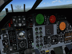
FSX Alphasim F111 Panel.V1.1 Features for FSX It includes a New VFR and IFR panel and updates to the virtual cockpit. New panel night lighting New virtual cockpit for the FB-111A cockpit with old Avionics package. I have cleaned up some of the gauge graphics. I have made improvements to the virtual cockpit cleaning up the graphics, and repositioned some gauges for a better fit to the panel. Terrain Following Radar added. Traffic Radar presented as Threat Warning Scope. More realistic afterbunner colors. Antenna graphics added to FB-111A nose side panels. New 'Sleepy Time Gal' and 'Spirit of the Seacoast' graphics. Now with install program.
| Filename: | F111_PanelV11.zip |
| License: | Freeware |
| Added: | 18th February 2007, 19:03:41 |
| Downloads: | 1,353 |
| Author: | Steve Hess |
| Size: | 7.52 MB |
| Category: Flight Simulator X - Scenery | |
| UK Air Navigation Obstacles |
|
File Description:
The objects covered in the FS9 scenery addons UK ANO and UK ANO Volume 2 have been re written, as a single volume, specifically for FSX. The scenery is intended to cover all masts, cooling towers, flares and chimneys, with heights in excess of 300'. The objects are those that were listed by the CAA, at the time the original photo scenery of England and Wales was published. Similar objects in Scotland and Northern Ireland have been included, although those areas are covered only by FSX Default land scenery.
The scenery, not compatible with FS9, is intended for use with the Horizon VFR Photoscenery, Volumes 1, 2 and 3.
| Filename: | UK_Air_Navigation_Obstacles.zip |
| License: | Freeware |
| Added: | 9th August 2007, 13:16:59 |
| Downloads: | 5,909 |
| Author: | Gerry Winskill |
| Size: | 324.75 KB |
| Category: Flight Simulator 2004 - Scenery Design | |
| Autotrees (automatic autogen file creation) beta v0.1 |
|
File Description:
Autotrees was created to automatically write any number of autogen files. It will only produce files containing trees, and I can't see a way to produce buildings the same way. It was written using UK VFR Photographic Scenery as a testbed, but should work with any photoreal ground textures. The accuracy of the output is very much dependant on the quality of the texture files used. The included jpegs are all "untouched" taken after a couple of seconds running Autotrees.
Autotrees can produce over 120 files per minute on an AMD 2.0 Ghz computer. Thats over a million trees an hour; how's that for global offsetting!
| Filename: | Autotrees_automatic_autogen_file_creation_beta_v01.zip |
| License: | Freeware, limited distribution |
| Added: | 2nd November 2007, 23:35:34 |
| Downloads: | 3,330 |
| Author: | David J Griffiths |
| Size: | 442.33 KB |
| Category: Flight Simulator X - Scenery | |
| Savannah, Georgia - USA |
|
Images related to this file:
File Description:
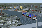
A large and detailed scenery of Savannah, Georgia. Includes downtown Savannah
and riverfront (with custom made buildings, hotels, convention center, gold domed
courthouse, and Talmadge Bridge), harbor with container terminal, AI ship traffic, and
a custom built streetcar to travel the downtown streets of Savannah.
KSAV Savannah/Hilton Head Intl Airport has a custom built terminal, Gulfstream factory, and Air National
Guard facility. KSVN Hunter AAF has a custom built US Coast Guard facility and AI helicopter
traffic. Coastal Tybee Island is represented with beachfront resorts and hotels, pier,
shopping district, and 2 functioning lighthouses. Great for the VFR flyer!
By Dan French.
| Filename: | Savannah_Georgia__USA.zip |
| License: | Freeware, limited distribution |
| Added: | 21st April 2014, 22:57:17 |
| Downloads: | 1,143 |
| Author: | Dan French |
| Size: | 11.51 MB |


© 2001-2026 AVSIM Online
All Rights Reserved
Privacy Policy |