
Where Flight Simulation Enthusiasts Gather from Around the World!
AVSIM Library - Search Results

| Category: Flight Simulator X - Scenery | |
| Praga City |

|
File Description:
I realized this scenery of the city of Prague with reference to the most important monuments for a VFR flight, in fact you will find the famous bridge, the cathedral, the castle and the citadel the lookout tower and also of small waterfalls on the river, as per the attached map where the monuments are added red-rimmed.
| Filename: | Praga_City.zip |
| License: | Freeware |
| Added: | 9th April 2015, 21:34:19 |
| Downloads: | 1,853 |
| Author: | Pasquale Marrulli |
| Size: | 2.57 KB |
| Category: Flight Simulator X - Scenery | |
| Non-Airport Scenery for Southern Africa, Update 1 |
|
Images related to this file:
File Description:
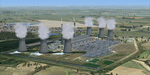
Non Airport Scenery update 1, will add a few more individual scenery enhancements, Arnot Power Station, SA Air Force Memorial designed by Kobus and a few default models Tutuka, Majuba and Lethabo Power Stations to act as reference points when flying VFR and enhance your Southern Africa scenery. Please install fsxWorx04.zip, fsxWorx01.zip, fsxWorx02.zip, and updates before this scenery.
| Filename: | NonAirport_Scenery_for_Southern_Africa_Update_1.zip |
| License: | Freeware |
| Added: | 10th February 2013, 14:30:08 |
| Downloads: | 3,562 |
| Author: | Kobus van Wyk, Hannes Steyn, Aeroworx |
| Size: | 37.12 MB |
| Category: Flight Simulator X - Scenery | |
| Landclass for Maui |
|
Images related to this file:
File Description:
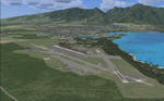
FSX Scenery--Landclass For Maui, Hawaii. This is a detailed landclass and scenery redesign of the entire Island of Maui. The changes that have been created will make for excellent VFR flying. Hundreds of objects have been added that reflect the real layout and scenery for this location. Maui's three airports have also been extensively modified to look like the real existing airports.
| Filename: | Landclass_for_Maui.zip |
| License: | Freeware |
| Added: | 5th April 2011, 07:41:07 |
| Downloads: | 4,110 |
| Author: | Charles Reid |
| Size: | 17.27 MB |
| Category: Flight Simulator 2004 - Scenery | |
| Humber Bridge and BAe Factory - Missing File |
|
File Description:
Apologies for ommiting this file from the main VFR file folder. Without it you would be missing the runway at Brough and all the included trees at the Humber bridge site. It is possible to use the same file from the NoVFR zip with just the loss of some trees that I had to remove from the river in the NoVFR version.
| Filename: | Humber_Bridge_and_BAe_Factory__Missing_File.zip |
| License: | Freeware |
| Added: | 26th February 2004, 03:58:40 |
| Downloads: | 2,652 |
| Author: | Barry Wells |
| Size: | 23.18 KB |
| Category: Flight Simulator 2004 - Scenery | |
| Italy, Liguria 1, La Spezia, Photo Real |
|
File Description:
Liguria, Italy, Photoreal Scenery Part 1 (La Spezia).
The photoreal scenery covers a great area of Liguria around the city of La Spezia. The airport of Luni-Sarzana (ICAO code LIQW) is found inside the scenery (see map). For the best results, use it in association with other parts of Liguria photoreal: Liguria 2 Savona, Liguria 3 Imperia, Genova VFR.
| Filename: | Italy_Liguria_1_La_Spezia_Photo_Real.zip |
| License: | Freeware |
| Added: | 20th October 2008, 02:18:20 |
| Downloads: | 9,317 |
| Author: | Fulvio Mazzokan |
| Size: | 67.03 MB |
| Category: Flight Simulator 2004 - Scenery | |
| Italy, Liguria 3, Imperia, Photo Real |
|
Images related to this file:
File Description:

Liguria, Italy, Photoreal Scenery Part 3 (Imperia).
The photoreal scenery covers a great area of Liguria around the city of Imperia. The airport of Cuneo-Levaldigi (ICAO code LIMZ) is found inside the scenery (see map). For the best results, use it in association with other parts of Liguria photoreal: Liguria 1 La Spezia, Liguria 2 Savona and Genova VFR.
| Filename: | Italy_Liguria_3_Imperia_Photo_Real.zip |
| License: | Freeware |
| Added: | 27th May 2010, 15:02:10 |
| Downloads: | 8,093 |
| Author: | Fulvio Mazzokan |
| Size: | 86.47 MB |
| Category: Flight Simulator 2004 - Utilities | |
| GPS to INS utility |
|
File Description:
This utility makes using CIVA INS add-on much easier. It will create waypoint "cards" (see Civa manual) for all your FS2004 IFR and VFR flight plans, so you can perform that "obscure" function of automatic loading of waypoint data.
It will also create template flight plans in the SquawkBox format, with filled out route, altitude, departure and arrival points.
No installation required.
| Filename: | GPS_to_INS_utility.zip |
| License: | Freeware |
| Added: | 7th February 2019, 17:37:35 |
| Downloads: | 202 |
| Author: | Raymond Peterson |
| Size: | 1.2 MB |
| Category: Flight Simulator 2002 - Original Aircraft | |
| 1930 Fleet Model 2 |
|
File Description:
The familiar 2-place biplane is my first upload of a complete aircraft. A bit poly-heavy, but is doing well on my 1.6ghz P-IV, 512 DDRAM, Geforce ti 4600 system. Original *.air file by Paul Clawson, used with permission. Includes a fair 2-D panel, acceptable VC and reflective textures. VFR only, no radios, definitely for the low and slow flyers.
| Filename: | 1930_Fleet_Model_2.zip |
| License: | Freeware, limited distribution |
| Added: | 24th March 2003, 18:15:09 |
| Downloads: | 5,462 |
| Author: | Steven D. Myers |
| Size: | 2.5 MB |
| Category: Flight Simulator X - Scenery | |
| Morocco VFR - Terrain Mesh SRTM 1 Arc/Sec version 3 - Volume 01 |
|
Images related to this file:
File Description:
Enhanced Terrain Mesh from data souce SRTM 1 Arc/Sec (30 meters) version 3 at LOD 11 (19mt meters/pixel). Coverage: Lat 31 to 37. Fully compatible also with P3D.
| Filename: | Morocco_VFR__Terrain_Mesh_SRTM_1_ArcSec_version_3_.zip |
| License: | Freeware |
| Added: | 22nd March 2015, 00:24:59 |
| Downloads: | 2,289 |
| Author: | Giovanni Miduri |
| Size: | 415.75 MB |
| Category: Flight Simulator X - Scenery | |
| Morocco VFR - Terrain Mesh SRTM 1 Arc/Sec version 3 - Volume 02 |
|
Images related to this file:
File Description:
Enhanced Terrain Mesh from data souce SRTM 1 Arc/Sec (30 meters) version 3 at LOD 11 (19mt meters/pixel). Coverage: Lat 27 to Lat 31. Fully compatible also with P3D.
| Filename: | Morocco_VFR__Terrain_Mesh_SRTM_1_ArcSec_version_3_.zip |
| License: | Freeware |
| Added: | 22nd March 2015, 17:54:09 |
| Downloads: | 1,664 |
| Author: | Giovanni Miduri |
| Size: | 279.12 MB |


© 2001-2026 AVSIM Online
All Rights Reserved
Privacy Policy |