
Where Flight Simulation Enthusiasts Gather from Around the World!
AVSIM Library - Search Results

| Category: Flight Simulator 2004 - Scenery | |
| RAF Cranwell 2007 |

|
File Description:
This is a new full Scenery based on my original Cranwell Part 1. It has many additions and has been renamed RAF Cranwell 2007. The Scenery is aligned with the UK VFR Photoscenery. See PDF at end of Installation for info on extra files need. This version is for FS2004 only it has not been tested in FSX.
| Filename: | RAF_Cranwell_2007.zip |
| License: | Freeware, limited distribution |
| Added: | 14th March 2007, 17:29:23 |
| Downloads: | 2,938 |
| Author: | Keith Steadman |
| Size: | 11.99 MB |
| Category: Flight Simulator 2002 - Scenery | |
| Alava (Basque Country, Spain) - Photorealistic |
|
Images related to this file:
File Description:
Re-upload. This is the Photorealistic Scenery of the Province of Alava (Basque Country, Spain) for FS2002. Also valid for FS2004. It includes the mesh (LOD9) of the Basque Country and surroundings. To enjoy VFR flights take off from Foronda (LEVT), which is included in a beta version; discover all the marvelous landscapes of my province!!
| Filename: | Alava_Basque_Country_Spain__Photorealistic.zip |
| License: | Freeware |
| Added: | 21st July 2010, 00:33:14 |
| Downloads: | 2,263 |
| Author: | Carlos Martinez de Guerenu |
| Size: | 97.81 MB |
| Category: Flight Simulator X - Scenery | |
| Garstang Wind Generator,England.For FSX |
|
File Description:
A new wind generator just gone live near the town of Garstang and is large enough to serve as a good landmark for pilots around the area.
Designed for my Northern-Microlights and VFR scenery from Horizon and Just-Flight but will work with the default scenery.
Should work with FS9 but I havent tried. it.
| Filename: | Garstang_Wind_GeneratorEnglandFor_FSX.zip |
| License: | Freeware |
| Added: | 17th October 2010, 22:22:09 |
| Downloads: | 377 |
| Author: | By Neil Birch and Stewart Haworth. |
| Size: | 1015.22 KB |
| Category: Flight Simulator 2004 - Scenery | |
| Brooklands 1938 |
|
File Description:
This represents Brooklands Aerodrome in about 1938. It is aligned to the Just Flight VFR scenery, and fits quite well into FS2004 default scenery, which does not have this airfield. It is an update to the Brooklands included in my Vintage London Airports package (VLA.ZIP); the racetrack has been cleared of vehicles, and the disappearing banks fixed.
| Filename: | Brooklands_1938.zip |
| License: | Freeware |
| Added: | 10th August 2005, 04:22:48 |
| Downloads: | 1,428 |
| Author: | John McKeon |
| Size: | 1.93 MB |
| Category: Flight Simulator X - Scenery | |
| CKG8 Kakabeka Falls |
|
Images related to this file:
File Description:
Kakabeka Falls in Ontario, Canada is a VFR airfield with a seaplane base on the Kaministiquia River and is home to the Kakabeka Falls Flying Club and the Lakehead Gliding Club. Located to the west of Thunder Bay, this airport was designed for use with Ultimate Terrain X - Canada (recommended), but a version for default terrain is also included.
| Filename: | CKG8_Kakabeka_Falls.zip |
| License: | Freeware, limited distribution |
| Added: | 13th January 2013, 01:00:07 |
| Downloads: | 851 |
| Author: | Robert Graf |
| Size: | 502.11 KB |
| Category: Flight Simulator 2004 - Scenery | |
| Caribbe North |
|
Images related to this file:
File Description:

Fully detailled scenery VFR of the Virgin Islands and the leeward Islands in the North Central Caribbean.
That includes:
Beef,Anegada, Gorda,Tortola,St Johns, St Thomas,St Croix, Anguilla,Sta Martin, Guadeloupe,St Bartelemy, Saba,St Eustatius,St Kitts, Nevis,Antigua and Montserrat
57 islands and Cays in totally. 6 airports reconstructed and rezized ad noumerous cities
| Filename: | Caribbe_North.zip |
| License: | Freeware |
| Added: | 14th March 2010, 20:17:48 |
| Downloads: | 11,462 |
| Author: | Toni Agramont |
| Size: | 14.18 MB |
| Category: Flight Simulator X - Flight Plans | |
| South African Intersections (Fixes) |
|
File Description:
For use with Plan-G flight planning utility:
This file contains 958 waypoint intersections (Fixes) in South Africa and some bordering countries that Plan-G could not find or extract out of my FS.
Although Plan-G is designed for VFR planning, with these intersections installed it makes IFR flight planning in South Africa easy.
by Johan Kotze.
| Filename: | South_African_Intersections_Fixes.zip |
| License: | Freeware |
| Added: | 21st October 2015, 20:29:44 |
| Downloads: | 99 |
| Author: | Johan Kotze |
| Size: | 13.52 KB |
| Category: Flight Simulator 2004 - Scenery | |
| Argentina ,Valle de Punilla/ Lago San Roque Area, v1.0 |
|
Images related to this file:
File Description:
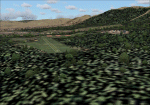
LOD 13 mesh and scenery of the Sierra de Cordoba, Argentina, area. Includes Santa Maria de Punilla and Villa Carlos Paz airstrips as well as a reconfiguration of La Cumbre(SACC) to fit the new mesh.
Roads, rivers and landmarks have been placed to aid VFR pilots
Includes Voicepack modifications for the ICAO identifiers (requires EditVoicepack).
| Filename: | Argentina_Valle_de_Punilla_Lago_San_Roque_Area_v10.zip |
| License: | Freeware, limited distribution |
| Added: | 16th May 2010, 09:57:58 |
| Downloads: | 609 |
| Author: | Alf B. Meier |
| Size: | 7.83 MB |
| Category: Flight Simulator 2004 - Scenery | |
| DBWsim: Pearl Harbor 2004 |
|
File Description:
This DBWsim scenery for Flightsim2004 covers Pearl Harbor and Ford Island. This scenery fully develops the Pearl Harbor naval bases as they appear today as well as completely revamping Ford Island and includes such significant landmarks as the USS Missouri and the historic Ford Island Control Tower. This Scenery vastly improves VFR approaches to Honolulu International.
| Filename: | DBWsim_Pearl_Harbor_2004.zip |
| License: | Freeware |
| Added: | 5th June 2004, 14:32:04 |
| Downloads: | 14,627 |
| Author: | Derek Webb, Brendan Webb |
| Size: | 3.47 MB |
| Category: Flight Simulator 2004 - Scenery | |
| Italy, Liguria 2, Savona, Photo Real |
|
Images related to this file:
File Description:

Liguria, Italy, Photoreal Scenery Part 2 (Savona).
The photoreal scenery covers a great area of Liguria around the city of Savona. The airport of Albenga (ICAO code LIMG) is found inside the scenery (see map). For the best results, use it in association with other parts of Liguria photoreal: Liguria 1 La Spezia, Liguria 3 Imperia and Genova VFR.
| Filename: | Italy_Liguria_2_Savona_Photo_Real.zip |
| License: | Freeware |
| Added: | 28th April 2010, 08:43:23 |
| Downloads: | 7,884 |
| Author: | Fulvio Mazzokan |
| Size: | 54.41 MB |
© 2001-2026 AVSIM Online
All Rights Reserved
Privacy Policy |