
Where Flight Simulation Enthusiasts Gather from Around the World!
AVSIM Library - Search Results

| Category: Flight Simulator 2002 - Flight Plans | |
| 49RTWest |

|
File Description:
An FS2002 GPS flight Plan by the Ancient Brit. The 49th in a series of Round the World flight plans for the FS2002 default scenery. Depart Southend (EGMC) runway 24, UK and arrive 1 hour 54 minutes later at Stornoway (EGPO) runway 36, Scotland. Following a low level pass over London Town to see the sights, Heathrow is viewed on the way to Windsor Castle where the climb to cruise begins. An early descent for a low level tour of the Inner Hebrides with a chance to see that most rare and endangered animal, The Lesser Spotted Haggis, finishes with a VFR finals (Handholding instructions given).. The flight briefing (Word and text) is for the default B737-400; it contains climb, cruise, top of descent and fuel loading details, waypoint timings and destination details.
| Filename: | 49RTWest.zip |
| License: | Freeware |
| Added: | 26th February 2003, 22:44:58 |
| Downloads: | 740 |
| Author: | Denis Egan |
| Size: | 28.27 KB |
| Category: Flight Simulator 2004 - AFCAD Files | |
| Dunsfold Park Industrial Estate (EGTD) |
|
File Description:
EDTD - Dunsfold Park Industrial Estate (formerly Dunsfold Aerodrome) for FS9 default scenery. Dunsfold is visible as you make you turn onto final approach course for runway 08R at London Gatwick. It is a private airfield, landing by prior permission only and not an airport of entry. As such, this is not intended for the user, or AI, to fly to, merely a visual reference point on the Gatwick approach. There is a space for the parked B747 and some token GA spaces if you'd like to send AI here anyway. Old runways, taxiways, ramps and indication of building positions are shown but positioning is very approximate. Users of photoreal VFR scenery do not need this file. Famous (in the UK) as BBC Top Gear's test track. Visual approach procedure only, no ILS.
| Filename: | Dunsfold_Park_Industrial_Estate_EGTD.zip |
| License: | Freeware, limited distribution |
| Added: | 12th May 2006, 21:14:10 |
| Downloads: | 695 |
| Author: | Mark S. Cherry |
| Size: | 8.52 KB |
| Category: Flight Simulator X - Flight Plans | |
| Current Low Altitude Military Training Route in the Southwesternl United States |
|
Images related to this file:
File Description:
FSX Flight Plans for current low altitude military training route in the Southwestern U.S. This package includes 142 individual flight plans for IFR, VFR and Slow Speed Routes. These are great routes for B-52, F-111, B-1B, B-2 A6, A4, Vulcan and any fighter or bomber enthusiasts. Of course you can fly the route with any aircraft of your choice. Also included in this package are two spectacular gauges by Karol Chlebowski for TFR flying and Pave Tack which includes many advanced features for bombing, navigation and reconnaissance. These two gauges will greatly enhance your ability to fly these challenging routes and are a great companion of the flight plans. Another option
is to download Version 2.1 of my mini panel which has all this functionality and more.
| Filename: | Current_Low_Altitude_Military_Training_Route_in_th.zip |
| License: | Freeware |
| Added: | 16th September 2011, 14:14:58 |
| Downloads: | 382 |
| Author: | Bill McClellan |
| Size: | 7.03 MB |
| Category: Flight Simulator X - Flight Plans | |
| Current Low Altitude Military Training Route in the Northhwestern United States |
|
Images related to this file:
File Description:
FSX Flight Plans for current low altitude military training route in the Northwestern U.S. This package includes 75 individual flight plans for IFR, VFR and Slow Speed Routes. These are great routes for B-52, F-111, B-1B, B-2 A6, A4, Vulcan and any fighter or bomber enthusiasts. Of course you can fly the route with any aircraft of your choice. Also included in this package are two spectacular gauges by Karol Chlebowski for TFR flying and Pave Tack which includes many advanced features for bombing, navigation and reconnaissance. These two gauges will greatly enhance
your ability to fly these challenging routes and are a great companion of the flight plans. Another option is to download Version 2.1 of my mini panel which has all this functionality and more.
| Filename: | Current_Low_Altitude_Military_Training_Route_in_th.zip |
| License: | Freeware |
| Added: | 16th September 2011, 14:15:22 |
| Downloads: | 426 |
| Author: | Bill McClellan |
| Size: | 5.37 MB |
| Category: Flight Simulator X - Flight Plans | |
| Current Low Altitude Military Training Route in the Northeastern United States |
|
Images related to this file:
File Description:
FSX Flight Plans for current low altitude military training route in the Northeastern U.S. This package includes 196 individual flight plans for IFR, VFR and Slow Speed Routes. These are great routes for B-52, F-111, B-1B, B-2 A6, A4, Vulcan and any fighter or bomber enthusiasts. Of course you can fly the route with any aircraft of your choice. Also included in this package are two spectacular gauges by Karol Chlebowski for TFR flying and Pave Tack which includes many advanced features for bombing, navigation and reconnaissance. These two gauges will greatly enhance your ability to fly these challenging routes and are a great companion of the flight plans. Another option is to download Version 2.1 of my mini panel which has all this functionality and more.
| Filename: | Current_Low_Altitude_Military_Training_Route_in_th.zip |
| License: | Freeware |
| Added: | 15th September 2011, 14:02:30 |
| Downloads: | 418 |
| Author: | Bill McClellan |
| Size: | 7.18 MB |
| Category: Flight Simulator X - Flight Plans | |
| Current Low Altitude Military Training Route in Alaska |
|
Images related to this file:
File Description:
FSX Flight Plans for current low altitude military training route in Alaska. This package includes 53 individual flight plans for IFR, VFR and Slow Speed Routes. These are great routes for B-52, F-111, B-1B, B-2 A6, A4, Vulcan and any fighter or bomber enthusiasts. Of course you can fly the route with any aircraft of your choice. Also included in this package are two spectacular gauges by Karol Chlebowski for TFR flying and Pave Tack which includes many advanced features for bombing, navigation and reconnaissance. These two gauges will greatly enhance your ability to fly these challenging routes and are a great companion of the flight plans. Another option is to download Version 2.1 of my mini panel which has all this functionality and more.
| Filename: | Current_Low_Altitude_Military_Training_Route_in_Al.zip |
| License: | Freeware |
| Added: | 16th September 2011, 14:15:58 |
| Downloads: | 566 |
| Author: | Bill McClellan |
| Size: | 1.71 MB |
| Category: Flight Simulator 2004 - Scenery | |
| Perrine Bridge, Twin Falls Idaho Updated |
|
Images related to this file:
File Description:
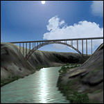
A prominent VFR landmark near Twin Falls Idaho, the Perrine Bridge spans over 1600' and stands 486 feet above the river below. At one time it was the tallest bridge in the world. Perrine Bridge is the only man-made structure in the USA were "base jumping" is allowed without a permit 365 days out of the year. Download includes gmax bridge object, a small photoscenery for the surrounding area, and two saved flight scenarios for exploring the scenery in the default J3 Cub. Bridge surface is landable and crash box has been removed allowing flight beneath the bridge. Scenery is compatible with, and nicely compliments John B. Loney's "Joslin-Magic Valley Regl" airport scenery (ktwf_v1.zip). Requires Ultimate Terrain and freeware mesh product, links provided in the readme.
| Filename: | Perrine_Bridge_Twin_Falls_Idaho_Updated.zip |
| License: | Freeware, limited distribution |
| Added: | 5th July 2011, 04:28:11 |
| Downloads: | 410 |
| Author: | Jim Robinson |
| Size: | 1.52 MB |
| Category: Flight Simulator 2004 - Scenery | |
| US North Cascades Mountains and Northwest Washington Coast |
|
File Description:
The files in this package completely replace the FS default landscape of the North Cascades Mountains and coastal areas of northwestern Washington State. Between Bellingham and Arlington (N-S), Orcas Island and Lake Chelan (W-E) you can now enjoy your VFR flights with accurate locations of coastlines, lakes, rivers, streams, roads, railroads, and power lines, as well as land use type (landclass) and terrain (add-on mesh). Also added are the larger glaciers of the majestic North Cascades volcanoes and peaks as well as several forestry roads and clearcuts outside the National Park and Wilderness areas. Made mostly with Christian Fumey's "Ground2K4" and Jim Keir's "Slartibartfast". Fully compatible with the recent freeware LOD10 add-on meshes of the western US. Mesh and landclass files will work in FS2002 but not the special scenery enhancements.
| Filename: | US_North_Cascades_Mountains_and_Northwest_Washingt.zip |
| License: | Freeware, limited distribution |
| Added: | 18th May 2004, 23:12:57 |
| Downloads: | 14,319 |
| Author: | Holger Sandmann |
| Size: | 12.72 MB |
| Category: Flight Simulator X - Scenery | |
| Bembridge X-HD |
|
Images related to this file:
File Description:

Bembridge is one of only two airports on the Isle of Wight, it is small but a very picturesque area. This scenery is provided with photo real surround to give you a smoother transition from HD to default scenery.
The airport offers pleasure flights for a small fee and of course a flight school operates at the airport.
This scenery is perfect for anyone with a love of GA flying, the surrounding photo scenery allows for VFR operations and the airport is accurately placed in the virtual world.Feature include:
High definition ground image.
High definition ground detailing.
Filler objects from "SFC Airfield Objects".
Precision placed trees and vehicles.
Fuel trucks hidden inside closed hangars.
Real water in the pond.
Hold short guards.
Many static vehicles and details.
Accurate BN Aviation hangars.
Very low frame impact.
| Filename: | Bembridge_XHD.zip |
| License: | Freeware, limited distribution |
| Added: | 8th January 2017, 23:55:14 |
| Downloads: | 1,565 |
| Author: | Mark Piccolo - Soarfly Concepts |
| Size: | 30.34 MB |
| Category: Flight Simulator 2004 - Scenery | |
| Even More Private Strips |
|
File Description:
Even more 'Private Strips' from around England and Wales. When combined with my previous "Private Strips Revisited" upload these will give a total of nearly 500 little airfields, which have been predominantly created to provide a source for GA and microlight ai traffic flights, without having to clutter up the more major airfields. All airfields have parking for (usually) two aircraft and associated taxiways to facilitate their coming and going.
Please note :- these sceneries have been designed for use in FS2004 with the original UK VFR Photographic scenery and mesh. They rely for details on the "usual" collections of library objects, specifically EZ-Scenery, UKVFR and Rwy12 libraries. Whilst other configurations will probably work, to a degree, you'll have to try them and see if they suit you. See the enclosed ReadMe for further details.
| Filename: | Even_More_Private_Strips.zip |
| License: | Freeware |
| Added: | 3rd August 2021, 00:59:25 |
| Downloads: | 139 |
| Author: | Chris Eve |
| Size: | 495.15 KB |
© 2001-2026 AVSIM Online
All Rights Reserved
Privacy Policy |