
Where Flight Simulation Enthusiasts Gather from Around the World!
AVSIM Library - Search Results

| Category: Prepar3D V1-4 - Aircraft Repaints, Textures and Modifications | |
| Supermarie Spitfire Mk.IIb No 249 Sqn T-I |

|
Images related to this file:
File Description:
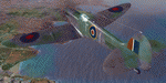
This folder contains a repaint for the A2A Spitfire in the colors of Spitfire Mk Vc BR290, one of the aircraft of 249 Sqn, based on Malta. It arrived on Malta with operation Bowery, when it was flown off USS Wasp on the 9th of May 1942. Lessons had been learned from an earlier delivery run, and all 61 aircraft that reached Malta were immediately refuelled and rearmed, to be ready to repell the axis airfleets that came to destroy them early on the 10th. In the resulting air battle, the Italian bombers were chased away, and 47 German fighters were shot down (for the loss of 3 British), marking the end of daylight raids on Malta. Repaint by Jan Kees Blom, based on the paintkit by A2A.
| Filename: | Supermarie_Spitfire_MkIIb_No_249_Sqn_TI.zip |
| License: | Freeware |
| Added: | 27th October 2018, 18:58:42 |
| Downloads: | 45 |
| Author: | Jan Kees Blom |
| Size: | 11.28 MB |
| Category: Prepar3D V1-4 - Aircraft Repaints, Textures and Modifications | |
| North American P-51 Mustang 'Paul 1' |
|
Images related to this file:
File Description:
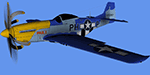
This P-51D-30NA came off the assembly line in 1944 with the USAAF S/N of 44-75007. In 1966, she was restored and converted to "Cavalier" by EAA Warbirds of America Hall of Fame inductee, David Lindsay, Cavalier Aircraft Corp. From 1973 to1976 44-75007 raced at Reno as Race #96, owned by Jerry Brassfield. The next owner was Robert Love, President of the Pacific Military Museum. Love donated the Mustang to EAA in 1977, painted as "PAUL I" in honor of EAA Founder Paul H. Poberezny. Paul flew the P-51 at many air shows and fly-ins over the years, including racing at Reno. In 2003 “Paul I" was retired to the EAA AirVenture Museum in Oshkosh, Wisconsin. Textures only for A2A's P-51 Mustang WoP2 (FSX & P3D)
| Filename: | North_American_P51_Mustang_Paul_1.zip |
| License: | Freeware |
| Added: | 18th October 2018, 22:28:27 |
| Downloads: | 45 |
| Author: | Ron Attwood |
| Size: | 9.47 MB |
| Category: Flight Simulator X - Aircraft Repaints, Textures and Modifications | |
| Northwest Orient Airlines Boeing 757-251's |
|
Images related to this file:
File Description:
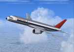
FS2004/FSX Northwest Orient Airlines Boeing 757-251's
2 livery pack featuring N504US-City of Los Angeles (Small Titles), and N513US-City of Orlando (Larger-Stretched Titles in 32 bit format.
These repaint's are specific for the time period and therefore no support for winglets is given.
In addition to the repaint I have created custom Northwest Orient 1980s Ground support equipment textures as well as ground crew all with the Northwest 1980s logo. The cabin entranceways all have custom textures designed by me and the doors are now the standard off white color. Catering textures are now Dobbs International. Customer correct window layout and includes my 757 enhancement textures for wings, Landing lights, e.t.c.
This is for the fantastic TDS - TENKUU DEVELOPER STUDIO 757-200 PW model.
| Filename: | Northwest_Orient_Airlines_Boeing_757251s.zip |
| License: | Freeware |
| Added: | 29th December 2019, 16:52:43 |
| Downloads: | 177 |
| Author: | Joe DeGregorio |
| Size: | 38.99 MB |
| Category: Flight Simulator 2004 - Scenery | |
| Washington D.C. - National Mall Update |
|
Images related to this file:
File Description:

This is my first attempt for scenery modification for FS2004 using Googgle Sketchup buildings. I developed this scenery project to add more prominate buildings to the Washington DC area that were missing from the default scenery. All new buildings have been created and/or modified using Google Sketchup, converted with ModelConvertX and placed in FS2004 with InstantScenery. MegaScenery Mid Atlantic was used as a guide for accurate placement and makes a great addition, but is not necessary.
I went through great links to minimize the drawcall on each individual item to help reduce framerate hits. For my system, I found that setting the display settings in FS2004 to Medium High and turning off AI traffic was optimal while using both D.C. files in concert with MegaScenery. You might need to experiment.
| Filename: | Washington_DC__National_Mall_Update.zip |
| License: | Freeware |
| Added: | 4th August 2010, 19:31:56 |
| Downloads: | 1,624 |
| Author: | Larry Robbins |
| Size: | 52.41 MB |
| Category: Flight Simulator 2004 - Scenery | |
| Whitefish 58S in Montana US |
|
Images related to this file:
File Description:
I have made this because I downloaded and tried the Glacier Park scenery by Blue Sky Scenery and then discovered that the runway for Whitefish was wrongly aligned and headed off across the adjacent railroad tracks. This would be inconvenient if you had to wait for a train to pass before landing so I fixed that and added a couple of buildings. That's it, nothing more complicated than that. If I find some more airfields in this area with similar problems then I'll do more of the same. Whitefish is 3 or so miles north of Glacier Park International at 3,066 feet ASL and around 35 miles south of the Canadian border. There are no large towns close by; the nearest would be Missoula, which is 90 miles further south.
| Filename: | Whitefish_58S_in_Montana_US.zip |
| License: | Freeware, limited distribution |
| Added: | 23rd May 2010, 02:05:52 |
| Downloads: | 194 |
| Author: | Roger Wensley |
| Size: | 826.52 KB |
| Category: Flight Simulator 2004 - AI Flight Plans | |
| RAF Wildenrath (Retro) V2 |
|
Images related to this file:
File Description:
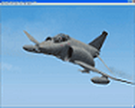
Retro AI package for RAF Wildenrath (EDUW) circa 1990, home of the following RAF Germany units:
- 19 Squadron, Phantom FGR2
- 92 Squadron, Phantom FGR2
- 60 Squadron, Andover (HS780) C.1 and CC.2 and the Hunting Percival Pembroke C.1.
Package includes weekly flightplans and repaints for all Phantoms, Andovers and the sole Pembroke. As well as scenery files for RAF Wildenrath (EDUW) and those other Afcads required for the attached flightplans. Also included are voicepacks for the airport, so aircraft will talk to Wildenrath Tower, in stead off just Tower.
This is an update from our previous release. New in this version is the scenery for RAF Wildenrath. It has been upgraded from a simple afcad to a real airport.
| Filename: | RAF_Wildenrath_Retro_V2.zip |
| License: | Freeware |
| Added: | 23rd February 2012, 18:57:39 |
| Downloads: | 1,263 |
| Author: | Chris A Brown, Menno van den Boogaard |
| Size: | 6.88 MB |
| Category: Flight Simulator 2004 - Aircraft Repaints, Textures and Modifications | |
| Boeing 757-200 - complete VC package |
|
File Description:
At first big thanks to POSKY for this great plane and Ken Mitchell for his
excellent 2D panel!
After an odyssey through incomplete and incorrect working files I finally got,
after some days, all working right with the virtual cockpit. So I decided to
make this complete package for the POSKY B757 winglet and normal model to make it
easier for you :-) . I've also added some texture tweaks and little changes to
the panel and VC cockpit. The config is ready for shockwave lights.
Do to the limitations of the VC the lights are linked with Taxi lights,
because the Landing lights are linked with Gauge lightning, so you
can't turn them off. I placed a switch on the middle eicas for them.
Screenshots inside! Mod by Wilhelm Hudetz - Enjoy!
| Filename: | Boeing_757200__complete_VC_package.zip |
| License: | Freeware |
| Added: | 7th December 2011, 08:05:24 |
| Downloads: | 2,266 |
| Author: | Wilhelm Hudetz, POSKY |
| Size: | 29.58 MB |
| Category: Flight Simulator 2004 - Scenery | |
| Jenny Lind Island CWJL in Nunavut, Canada |
|
Images related to this file:
File Description:
This was a DEW line Auxiliary Station on Jenny Lind Island; the island is about 14 miles by 12 miles and off the southeast corner of Victoria Island, 85 miles east of Cambridge Bay. The station was closed in 1992 but is still there as "closed" meant "shut the door and walk away". There has been some later removal of diesel tanks and other polluting items but the buildings are still intact, and the runway is 4,470 feet of gravel 150' wide. At the western end there is an apron and a large hangar. There are of course no lights, signage, or windsock. A North Warning System station was built in 1990, 6 miles inland to the northwest of the runway. This has a shorter (1,400'?) gravel runway (and named CWJX here).
| Filename: | Jenny_Lind_Island_CWJL_in_Nunavut_Canada.zip |
| License: | Freeware, limited distribution |
| Added: | 15th November 2012, 13:55:29 |
| Downloads: | 190 |
| Author: | Roger Wensley |
| Size: | 1.65 MB |
| Category: Flight Simulator 2004 - Gauges | |
| FS2004 GPS Map View Gauge v3.0 |
|
File Description:
The ultimate gauge. The Map will show: Airports details (Runways ID's, length & ILS), VOR's and NDB's frequencies,
Intersections and waypoints, Airspaces, Approaches and flight routes. You can toggle the view
you require for your flight. Also you can zoom in/out to see the nearest airports, vor's and
ndb's. The map will indicate A/C heading flightplan title and waypoints ID's.
Version 3 includes more enhancements such as the ability to input the ICAO code or name of any airport and the map will
show all the frequencies of that airport including ATIS, ILS, AND COM. In addition, the map will show the active
runway designations, length and width.
You can also input ICAO code of any VOR/NDB and the map will show their frequencies.
There was a bug in v2.0, in which if you enter ( click on ENT )the ICAO code of an airport, you will lose the flight
plan loaded. Now you can go back to the flight plan and with the NEXT/PREV buttons you have the choice of where to start
your FP.
The gauge will show Flight Plan Title, originating and destination airports, active waypoint, waypoint index and FP
crusing altitude.
I addition, the gauge will show various useful information, such as, Runway IDs, lenght, width and approach magnetic heading,
Airport name, city, and type. NAV1/2 names, codes, distances and ETA's, ADF1/2 names and codes.
Finally, the gaugee will show other information, such as, magvar, indicated airspeed, mach, ground velocity, ambient
wind velocity and direction, bank angle , and a/c altitude ( radio height ).
All the information above and much more on a single gauge window.
| Filename: | FS2004_GPS_Map_View_Gauge_v30.zip |
| License: | Freeware, limited distribution |
| Added: | 14th September 2005, 14:19:46 |
| Downloads: | 10,842 |
| Author: | Talal Alhaj |
| Size: | 710.05 KB |
| Category: Flight Simulator 2004 - Scenery | |
| Medicine Hat CYXH in Alberta Canada |
|
Images related to this file:
File Description:
Medicine Hat is a town in south Alberta, beside the South Saskatchewan River, and around 180 miles southeast of Calgary. Originally a railroad town, and in fact still served by the railway and now also by the Trans-Canada Highway, it is currently mainly known for the large natural gas fields in the area. As Rudyard Kipling said, Medicine Hat has "all hell for a basement". The name of the city is a translation of the Blackfoot tribal name for the eagle tail feather headdress worn by tribal medicine men, and it was curiosity about the name that first got my attention.
The date of this scenery is not 2010, as is usual for my scenery; it is more like 2015. The terminal building has been extended and improved, the apron around the two large southern hangars and the large rental hangars behind them is still visibly new, and the tie-down parking places on the grass accessed off one side of the old taxiway are in place and in use. The airport is now (2015) not in the busy usage that it experienced in the second half of the 1900's and old taxiways and a runway have been left to decay and large old hangars have been demolished. Hence the visible remains. The current runways were rebuilt (on top of the existing as foundations) and are 03-21 with 4,990 feet of lit asphalt 150 feet wide with PAPI at both ends, and 09-27 with 2,885 feet of lit asphalt 100 feet wide.
The two newish hangars to the south are a helicopter operating and maintenance company with a flight training school based in the adjoining offices (light grey buildings) and an FBO in hangar and offices (dark grey). Further buildings have been erected since then, and some existing ones have been reclad (eg. light grey now, in 2021, has a light blue roof).
I have cheated in one respect. In reality, the edges of the airport have been gradually utilised for various purposes, such as workshops, storage sheds, factories, etc, with access from the surrounding urban roads. As I have almost no information regarding their appearance I decided to leave the airport area as it was originally built, rather than incorporating buildings that I know are false. I admit that this was also the laziest solution.
The scenery includes a grass strip 3 miles to the south of Medicine Hat, namely Schlenker CFZ3. It is the only airfield I have come across where the fences are not around the edge of the airfield, they are instead around the runways and apron. I presume this is so animals can be left to feed off the grass in summer.
The AI includes flights by Air Canada Jazz.
| Filename: | Medicine_Hat_CYXH_in_Alberta_Canada.zip |
| License: | Freeware, limited distribution |
| Added: | 23rd January 2022, 20:11:10 |
| Downloads: | 142 |
| Author: | Roger Wensley |
| Size: | 19.15 MB |


© 2001-2026 AVSIM Online
All Rights Reserved
Privacy Policy |