
Where Flight Simulation Enthusiasts Gather from Around the World!
AVSIM Library - Search Results

| Category: Flight Simulator X - Scenery | |
| Dieuze - Gueblange V2 |

|
Images related to this file:
File Description:
This scenery depicts Dieuze-Gueblange aerodrome located in the north east of France. It is a very accurate rendition of this aerodrome made with photoreal textures for the ground and the objects. The ground is covered with volumetric grass. I have modelled an animated sock that indicates the wind direction and velocity. To see this windsock, Sode (Sim Objects Display Engine) module must be installed (module availabale here : http://sode.12bpilot.ch/?page_id=9). A user manual (pdf) is included.
The windsock library may be used in your own sceneries. If you share a scenery using this library, you must add the BJP_SOCKS folder without any modification in order to avoid duplicate files. Please include my name in any of your included documents. This new release is now compatible with a landclass environment: snowy ground and trees in the hard winter (from the first day of december to the last day of january). Please read the specific enclosed manual.
| Filename: | Dieuze__Gueblange_V2.zip |
| License: | Freeware, limited distribution |
| Added: | 1st February 2015, 23:14:45 |
| Downloads: | 1,453 |
| Author: | Jacques-Paul Bollard |
| Size: | 21.98 MB |
| Category: Flight Simulator 2004 - AFCAD Files | |
| Seattle-Tacoma International Airport UPGRADE (KSEA) |
|
File Description:
(SEE ZIPDIVE FOR SCREENSHOTS)
This is an upgrade of the default scenery using Airport Design Editor (ADE). I tried making this as close as possible to the real thing with the help of Google Earth and FlightAware, determining which gates are occupied by which airlines, and what aircraft types typically occupied the gate (i.e., having enough space for those jumbos).
You'll find the following additions in this afcad scenery:
-Expanded concourse A to hold up to 14 gates
-Jetways/gates added to concourse D
-The new third runway to the West (with an exclusion to keep trees out of the runway)
-Extra overnight parking
-Many of the default jetways too tall for most of the aircraft arriving at SEA replaced with shorter jetways for small narrowbodies
and 757s (rwy12 jetways I believe, hope there's no problem with using them)
-Updated location of airlines at each gate (to the best of my ability and resources...)
-That lounge building that sits on top of concourse A (using generic buildings).
| Filename: | SeattleTacoma_International_Airport_UPGRADE_KSEA.zip |
| License: | Freeware |
| Added: | 4th August 2017, 13:05:25 |
| Downloads: | 1,577 |
| Author: | Carlos Si |
| Size: | 12.6 MB |
| Category: Flight Simulator X - AFCAD Files | |
| SOCA - Felix Eboue Airport - Cayenne (Matoury), French Guiana |
|
Images related to this file:
File Description:
Cayenne - Felix Eboue Airport (French: Aeroport de Cayenne - Felix Eboue) (IATA: CAY, ICAO: SOCA) is French Guiana's main international airport. It is located in the commune of Matoury, 13 km (8 mi) southwest of French Guiana's capital city of Cayenne. Air Guyane Express has its head office on the airport property. The airport currently has service domestically and internationally to points in South America, the Caribbean and Paris via Air Caraibes, Air France, Air Guyane Express and Surinam Airways
Features:
*Expanded parking apron
*Taxiways properly desginated and aligned (included the closing off of most of taxiway Alpha per real world charts)
*Runway markings and lighting corrected
*Parking spots for commercial traffic
*Seperate parking areaa for GA traffic
*Misc airport buildings added
*Airport vehicles and objects throughout the airport
*Fuel service vehicles
*Palm trees added
*Military parking area on the west side of the airport
*Service roads leading to proper navaids
*Parking lot with static vehicles
*Static aircraft
*New control tower
| Filename: | SOCA__Felix_Eboue_Airport__Cayenne_Matoury_French_.zip |
| License: | Freeware |
| Added: | 30th July 2013, 05:37:44 |
| Downloads: | 1,825 |
| Author: | Jaison Diaz / Endeavour AI |
| Size: | 433.26 KB |
| Category: Flight Simulator 2004 - Scenery Design | |
| Library Object Manager with Scenery Maker Version 0.9.7 |
|
File Description:
Latest Beta Release of this FS2004 Scenery Utility to manage objects and create scenery. Several major new functions in this release include A 'Fencing Tool' which can accurately place a line of fence or wall sections in your scenery - no more disjointed fences, Scenery Maker places them end to end with no gaps. Line Maker, a tool which can place a selection of objects along a multi segemented line in your scenery; with variable object spacing; variable object scale; and variable offset from the line. Can place streets of buildings, rows of trees, cars in the street or billboards on the roadside in one pass. A Fill Area Tool - can place a one thosand tree (or more) 'wood' with as many different tree species as you can find, with different tree scales in less than a minute. Can place animals in a field or buildings across the landscape in one pass. Support available from http://www.scruffyduck.plus.com
| Filename: | Library_Object_Manager_with_Scenery_Maker_Version_.zip |
| License: | Freeware, limited distribution |
| Added: | 10th March 2006, 01:42:47 |
| Downloads: | 2,472 |
| Author: | Jon Masterson |
| Size: | 6.25 MB |
| Category: Flight Simulator 2004 - Scenery | |
| Rome Fiumicino Area 2013 |
|
Images related to this file:
File Description:
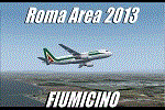
Dear Friends simmer, as always taking advantage of the beautiful objects bgl Gianluca Giovannini, I tried to improve with a symmetric pairing of autogen trees / towns / industrial buildings and grass in 3-D, the urban area near the Intercontinental Airport in Rome Fiumicino in the amazing scenery by the ISD project. "With the current integration I have created the town of Fiumicino located on the south west of the airport.The scenery is based videos of real landing and satellite photos availables on the web.
The purpose of visualization tasks is an overall improvement of the work of Leonardo da Vinci airport . The scenery is designed only for ISD project (even better with UTE by Flight one software), but i dont exclude that (which you should remove the file from the folder scenery the bgl Groups houses) or the more recent Payware published by Aerosoft. Most information inside the read me file. Best regards from Italy, Fafo !
| Filename: | Rome_Fiumicino_Area_2013.zip |
| License: | Freeware |
| Added: | 24th February 2013, 01:02:07 |
| Downloads: | 3,485 |
| Author: | Fabio Ferrari "fafo air" |
| Size: | 4.28 MB |
| Category: Flight Simulator X - AFCAD Files | |
| Central Jersey Regional Airport (47N), NJ |
|
File Description:
Located 01 miles S of Manville, New Jersey on 119 acres of land, Central Jersey Regional Airport is a public asphalt strip. Hangars and tiedowns are offered for transient craft. The open hangar at the north of the airport is available for parking - it can be a bit of a tight fit taxiing in so I have disabled collision with the two planes nearby. You can also select the DOCK parking space to start inside the hangar. Fuel is available on the north tarmac by the fuel truck in front of the hangar, and on the south tarmac by the fuel tank. Trees are summertime ONLY.
Scenery constructed with use of satellite images/streetview, the author has not been there in person.
This scenery is meant to be used in conjunction with MegaScenery Earth New Jersey/Delaware 001. It is not required, but apron use is minimized to allow satellite scenery to show through as much as possible, and objects are placed based on the MSE textures - lack of it may make scenery look out of place.
| Filename: | Central_Jersey_Regional_Airport_47N_NJ.zip |
| License: | Freeware |
| Added: | 25th November 2010, 14:15:25 |
| Downloads: | 295 |
| Author: | Drew Sikora |
| Size: | 1.92 MB |
| Category: Flight Simulator 2004 - Scenery | |
| Baker Lake CYBK in Nunavut, Canada |
|
Images related to this file:
File Description:
Baker Lake is the only Nunavut community that is not next to the sea. It is, as you might have guessed, on the shore of Baker Lake and 160 miles west and a bit north of Rankin Inlet on the shore of Hudson Bay (a recent post by Sid and Pete). The Hudson Bay Company opened a trading post there in 1916 and the town slowly developed, though as recently as 1946 the population was still only 32. These days the airfield is the support field for several nearby mines and there are now nearly 1,800 folks in Baker Lake using the stores, schools, churches, hospital, etc. The runway is almost 4,200' of 100' wide gravel and lighted; the alignment is 162T and 342T as this is in northern domestic airspace and bearings are given as 'true" and not "magnetic". Both JETA and 100LL fuel is available. The town is to the northeast of the airfield and is made up of a landclass without autogeneration, as this would mean a bunch of trees that would be, to say the least, unrealistic.
| Filename: | Baker_Lake_CYBK_in_Nunavut_Canada.zip |
| License: | Freeware, limited distribution |
| Added: | 23rd November 2011, 09:21:56 |
| Downloads: | 516 |
| Author: | Roger Wensley |
| Size: | 2.45 MB |
| Category: Flight Simulator X - AFCAD Files | |
| LGRX - Araxos Airforce Base, Greece |
|
File Description:
LGRX - Araxos AB is a large Hellenic Airforce base located near Araxos Cape, Achaea Prefecture and serves the city of Patras as well as the western part of the Peloponese region. It is the home of the 116 Combat Wing. It is used by a few civilian airlines, mainly for the tourist industry.
The stock airport shows three runways in use, however in reality only one runway is currently used the centre runway is now the main taxiway.
I have added the civilian apron and terminal buildings and various buildings and hangers throughout the base, all are Generic Buildings. Parking for Military and Civilian use, a cargo ramp and lots of trees. As usual I used the fantastic ADE (Airport Design Editor) to design this airport but you should download the great lights package by Jim Dhaenens as I have used some of his Apron Lights. I have provided ILS in one version for simmers who like to fly with it, although there is no ILS at Araxos.
| Filename: | LGRX__Araxos_Airforce_Base_Greece.zip |
| License: | Freeware |
| Added: | 1st July 2013, 18:04:18 |
| Downloads: | 622 |
| Author: | Mike Major |
| Size: | 31.04 KB |
| Category: Flight Simulator X - AFCAD Files | |
| TKPK - Robert L. Bradshaw International Airport / Saint Kitts and Nevis |
|
Images related to this file:
File Description:
This airport update was made with the latest version of ADE (Airport Design Editor) and made for FSX as a replacement for the stock (default) airport. I've made several changes to the airport which are listed below. All these enchancements are as close to the real airport as I can get with stock library objects. I've used satellite images, terminal photos and maps throughout the whole process so building locations are as accurate as possible. Happy landings in sunny Saint Kitts and Nevis!
Features:
*Expanded parking apron
*Main terminal building with parking area for commercial traffic (Gates 1-9)
*St. Kitts airport sign
*Seperate parking area for GA traffic
*Parking stand for cargo (Gate 9)
*Misc airport buildings added
*Airport vehicles and objects throughout the airport
*Fuel tanks and station
*Airport fire station
*Windsocks added
*Birds flying near runway (beware)
*Palm trees/vegitation added near terminal
*Taxiway signs
*Taxiways Bravo and Charlie properly assigned
*New taxiway Alpha added
(For more information about Endeavourai please visit our site at endeavourai.com)
| Filename: | TKPK__Robert_L_Bradshaw_International_Airport__Sai.zip |
| License: | Freeware |
| Added: | 1st September 2012, 21:23:20 |
| Downloads: | 819 |
| Author: | Jaison Diaz / Endeavour ai |
| Size: | 87.92 KB |
| Category: Flight Simulator 2004 - Scenery | |
| Minstrel Island CAX7 float base in British Columbia, Canada |
|
Images related to this file:
File Description:
This is the third in a series of new and renovated float bases in BC. Minstrel Island is on the south side of Knight Inlet and 25 miles west of Knight Inlet Lodge (the previous post in this series). There is a resort on the island, though it is hidden from the air by the trees. Fuel and oil are both available at the dock, and there is a 17 feet tidal range, which would be interesting of it could be replicated in FS. The AI is an adaptation of that for CF36 and involves a GA Cessna, and a Seair Beaver flying from Campbell River to Knight Inlet Lodge via Minstrel Island. Again, because of large hills the landing of the AI may or may not take place, depending on wind direction and whether or not they fly into solid rock before landing. Take off and departure will take place. Ultimate Terrain Alaska/Canada would be a definite plus to get the water in the right shape and place. This scenery will not work without it.
| Filename: | Minstrel_Island_CAX7_float_base_in_British_Columbi.zip |
| License: | Freeware, limited distribution |
| Added: | 3rd January 2017, 15:38:57 |
| Downloads: | 228 |
| Author: | Roger Wensley |
| Size: | 3.54 MB |


© 2001-2026 AVSIM Online
All Rights Reserved
Privacy Policy |