
Where Flight Simulation Enthusiasts Gather from Around the World!
AVSIM Library - Search Results

| Category: X-Plane - Scenery | |
| WZ38 Susi Air Kegata Airstrip v1.0.0 |

|
Images related to this file:
File Description:
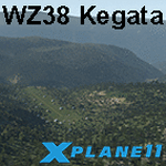
This is an X-Plane 11 scenery for Kegata Airstrip (WZ38) in Kegata, Papua, Indonesia. It is said to be home to the world shortest commercial flight, between Kegata Airstrip (WZ38) and Apowo Airstrip (WX15), duration of 1min and 15sec from take off to landing, and operated by Susi Air. This is one of the destinations for "PT ASI Pujiastuti Aviation", operating as Susi Air, an Indonesia airlines established in late 2004 by Mrs. Susi Pudjiastuti. This scenery was tested and is operational (as of January 07, 2017) in "X-Plane 11 Public Beta #5 64 bit", Windows 10 Home. It was also tested but is NOT operational (as of January 07, 2017) in "X-Plane 10.51 64 bit", Windows 10 Home (terrain mesh issues + exclusion areas from XP11 do not work in XP10 = scenery full of trees and quite bad mesh). Sorry, XP11 only.
| Filename: | WZ38_Susi_Air_Kegata_Airstrip_v100.zip |
| License: | Freeware |
| Added: | 8th January 2017, 23:38:06 |
| Downloads: | 68 |
| Author: | Rui Mesquita |
| Size: | 1.54 MB |
| Category: Flight Simulator 2002 - Scenery | |
| Maylands Aerodrome Western Australia v1 |
|
File Description:
Maylands (subject to flooding) remained Perth’s main airport until the end of WW2. Large aircraft moved to Dunreath which became Guildford and then Perth Airport. Maylands continued to be used by light aircraft and was finally closed when Jandacot opened in the Early 60's. It then became a golf course and a Police training complex. The Hangars have been heritage listed and the field is now covered with buildings and trees.
It includes a grass runway, hangars and enough of the Swan River to make the flying more fun. Maylands and Langley Park are within sight of Perth airport and can be used as a set or separately.
This scenery was made using freeware Airport 2.9 Build 26 and if installed as instructed will not alter your scenery.cfg. Thanks to Steve James for his advice.
Textures if required are included.
Made by Alan Blencowe January 2003.
| Filename: | Maylands_Aerodrome_Western_Australia_v1.zip |
| License: | Freeware |
| Added: | 23rd January 2003, 05:17:13 |
| Downloads: | 358 |
| Author: | Alan Blencowe |
| Size: | 455.6 KB |
| Category: Flight Simulator 2002 - Scenery | |
| British Columbia Bush Scenery: Grant Narrows & Rambo's Hideout |
|
File Description:
The larger runway at Grant Narrows has a 15 degree bend, and the shorter runway is on a slope that involves an unconventional downhill landing & an uphill take-off (STOL planes only!). Both strips are bumpy, and require Holger Sandmann's mesh of the Lower Mainland of Southern British Columbia (bcmesh9c.zip) for the required effect. A dock is provided down on the lake shore for visitors on floats. The landing strips are fictional, set in an area of wilderness on the shores of Pitt Lake - but only 20 miles from downtown Vancouver. The first Rambo movie was filmed in the hills just to the east in the Golden Ears Provincial Park: if you fly north from Grant Narrows you'll find Rambo's airstrip hideout just a couple of miles past the end of the lake - the real life location of a popular fishing lodge. Also requires Gerrish Gray's trees (trees_v3.zip).
| Filename: | British_Columbia_Bush_Scenery_Grant_Narrows__Rambo.zip |
| License: | Freeware, limited distribution |
| Added: | 13th March 2003, 21:26:06 |
| Downloads: | 946 |
| Author: | James Belk |
| Size: | 1.74 MB |
| Category: Flight Simulator 2004 - Scenery | |
| Omni Aviation School and PhilipinesAirlines Flight Trianning Center AFCAD and Scenery |
|
File Description:
Manny Aquino for the acacia and acacia tree textures
OMNI AVIATION- www.omni-aviation.com
Tonet, Mike B and Pecorino for identifying the trees in front of the omni barracks and for identifying a missing taxiway. :-)
My cousin Spike Acenas for taking pictures of the airport.
Ina Patrimonio for taking some of the PFSGers up in an aerial tour around Clark last Feb 17 2002. :-)
Dennis T. for more OMNI pics.
Capt's: Ina Patrimonio, Joy Roa, Jessica Horne & Rene Mapua.
Installation:
Copy the OMNI folder to your FS2002/scenery/ folder and activate the scenery in FS2002.
Happy flying!
Clark Intl Airport AFCAD with Omni Aviation School and Philipines Airlines Flight Trianning Center.They also use Clark Tower to make Communication when their Aircraft wanna take off and landing. Its Pattern is on Right Hand Side at 700ft and their Parking Ramps are just for Cessna,Piper or Beech Craft!
| Filename: | Omni_Aviation_School_and_PhilipinesAirlines_Flight.zip |
| License: | Freeware |
| Added: | 15th November 2003, 05:28:34 |
| Downloads: | 962 |
| Author: | Peter Binamira(Scenery) and Cadmus Lee( AFCAD ) |
| Size: | 1.14 MB |
| Category: Flight Simulator 2004 - Scenery | |
| EZ Scenery Cass Field (00CO) |
|
File Description:
FS2004 EZ Scenery CASS FIELD (00CO)
Briggsdale Colorado and surrounding parts of Eastern Co are well known for seeds. Seeds of almost any
kind imaginable like flowers, potatoes, bird seed and the list goes on and on. It is most always windy for there are no trees to slow the flow. Hot & windy in summer, cold and windy in winter and no natural enviromnent to harm plant growth. You can see the mountains to the west and more desolation to the east. A lonely place to drive through but rich in good people and seeds harvested for the world.
Area outside of airport's default flatten area require FS Global or Abasus extreme landscapes for elevation data. Download FREE library of RWY12 - EZ scenery objects (available on FlightSim.com or AVSIM) for objects. Ultimate Terrain USA for detailed landclass. FSX compatable.
Instructions inside.
jimmy R martin
| Filename: | EZ_Scenery_Cass_Field_00CO.zip |
| License: | Freeware |
| Added: | 6th June 2006, 01:54:47 |
| Downloads: | 619 |
| Author: | jimmy R martin |
| Size: | 255.55 KB |
| Category: Flight Simulator 2004 - Scenery | |
| CYQV Yorkton Municipal Airport Saskatchewan Version 2 |
|
Images related to this file:
File Description:
Yorkton Municipal Airport is situated approximately three kilometers north of the City of Yorkton, Saskatchewan, Canada. The airfield was built in 1940 for the Royal Canadian Air Force, as a British Commonwealth Air Training Plan station. Today, only a few of the wartime buildings remain and only two of the orginal four runways remain in operation. The airport continues, however, as the prinicipal hub of general aviation services for the east-central region of Saskatchewan.
CYQV was constructed using GMAX and represents the airport as it was in the Summer of 2008. It includes custom models of all the buildings at the airport, runway signs, refueling facilites,garages, weather station, fencing and trees, and a rotating beacon. CYQV includes custom ground textures to replicate the decommissioned runways and taxiways.
Version 2 replaces the original lost in the AVSIM hack and includes a number of improvements (see readme).
| Filename: | CYQV_Yorkton_Municipal_Airport_Saskatchewan_Versio.zip |
| License: | Freeware |
| Added: | 7th May 2010, 12:52:18 |
| Downloads: | 1,998 |
| Author: | Gregory Putz |
| Size: | 6.72 MB |
| Category: Flight Simulator X - Scenery | |
| WashDCX 1.0 |
|
Images related to this file:
File Description:
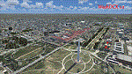
After more than 2000 downloads, I am pleased to announce a much anticipated UPDATE to WashDCX Beta. WashDCX 1.0 contains even more D.C. models and buildings, all of which have both Transparent and Night textures added. I have also expanded the Satellite Photo scenery around the National Mall area; added support for scenery complexity; added trees and more traffic; and corrected the destination bug within the installer program. You will also find many tourist among the more popular tourist destinations in Washington D.C. I hope that this addon will greatly enhance your flying experience around the D.C. Metro area. Be sure to check out both the Screen Shots and Video area on my website for a look at what is included in WashDCX 1.0. I encourage your comments either by email or on the forum for all others to see. Have fun and Happy Flying !!
www.myflightsimblog.com
| Filename: | WashDCX_10.zip |
| License: | Freeware |
| Added: | 5th February 2011, 03:14:09 |
| Downloads: | 3,606 |
| Author: | Larry Robbins |
| Size: | 86.69 MB |
| Category: Flight Simulator X - AFCAD Files | |
| KSTC - St. Cloud Rgnl - St. Cloud, MN, USA |
|
File Description:
Enhancements include:
-National Guard added to south end of the airport
-Jetway and west terminal extension added
-Aircraft parking updated
-General aviation area updated
-Runways and taxiways updated with asphalt edging
-Updated RWY 31 frequency to 111.9 and removed backcourse (I-STC ident)
-SIYON and OSACA terminal waypoints added (IAF and FAF respectively for ILS 13)
-Default ILS 13 backcourse approach replaced with ILS or LOC/DME RWY 13 approach with frequency 111.9 (I-BPM ident)
-LOC/DME antennea added
-Tower replaced and moved
-PAPI lights moved
-Asphalt and concrete aprons added/updated
-Asphalt, concrete, and gravel roads and parking lots added
-All applicable runway signs updated
-Added vehicles
-Airport perimeter fencing updated
-Flag and trees added
-Beacon adjusted
This is an update of the default FSX KSTC airport.
| Filename: | KSTC__St_Cloud_Rgnl__St_Cloud_MN_USA.zip |
| License: | Freeware |
| Added: | 4th December 2013, 07:13:36 |
| Downloads: | 344 |
| Author: | Jason Boche |
| Size: | 922.93 KB |
| Category: Flight Simulator 2004 - Scenery | |
| Dragon Peaks AFB, South Africa |
|
Images related to this file:
File Description:
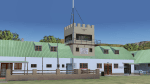
A Gmax representation of Dragon Peaks Air Force Base also referred to as CL van Wyngaard Airfield, South Africa with photoreal textures.
AFB Dragon Peaks is a small airfield nestled between the hills on the slopes of the Northern Drakensberg of South Africa. The airfield is situated only a few hundred meters from the Dragon Peaks Mountain resort as well as the home of the famous Drakensberg Boys Choir.
The grass runway is aligned 06/24 and 458m long and sits at an elevation of 3 986ft.
The scenery consists of 64 square kilometers of photoscenery with variants for all 4 seasons. Almost 1 100 hand placed autogen buildings and more than 32 000 (yes, thirty-two-thousand) hand placed autogen trees makes up the surrounding scenery. At the airfield itself you will find custom made Gmax models of the airfield buildings and structures with photoreal textures.
| Filename: | Dragon_Peaks_AFB_South_Africa.zip |
| License: | Freeware, limited distribution |
| Added: | 9th November 2017, 18:36:39 |
| Downloads: | 469 |
| Author: | kobus van wyk |
| Size: | 19.94 MB |
| Category: Prepar3D V1-4 - Scenery | |
| EPGY - Ostrow Mazowiecka-Grady 2020 |
|
File Description:
Prosta sceneria lotniska Ostrow Mazowiecka-Grady i landclass okolic.
EPGY:
- asfaltowy pas 09/27
- płyta postojowa przed hangarem
- dodane obiekty z domyślnej biblioteki
MIASTO I OKOLICE:
- dodano kilka lokalnych dróg w okolicy lotniska
- zaktualizowany landclass terenów wokół lotniska
- zaktualizowana linia drzew na lotnisku oraz kształt lasów i ich położenie w okolicy lotniska
Najlepsze wrażenia wizualne z ORBX Global + Vector i openLC Europe.
Simple scenery of the Ostrow Mazowiecka-Grady airport and surrounding landclass.
EPGY:
- asphalt runway 09/27
- apron in front of the hangar
- added objects from the default library
CITY AND VICINITY:
- several local roads around the airport have been added
- updated landclass of areas around the airport
- updated line of trees at the airport and the shape of forests and their location in the vicinity of the airport
The best visual experience with ORBX Global + Vector and openLC Europe.
| Filename: | EPGY__Ostrow_MazowieckaGrady_2020.zip |
| License: | Freeware |
| Added: | 27th April 2020, 18:02:14 |
| Downloads: | 139 |
| Author: | Åukasz Tyszkiewicz |
| Size: | 5.2 KB |


© 2001-2026 AVSIM Online
All Rights Reserved
Privacy Policy |