
Where Flight Simulation Enthusiasts Gather from Around the World!
AVSIM Library - Search Results

| Category: Flight Simulator 2004 - Aircraft Repaints, Textures and Modifications | |
| PenAir (N750PA) The Spirit of Iditirod for the Caravan |

|
Images related to this file:
File Description:
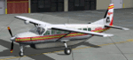
This is my rendention of PenAir N750PA The Spirit of Iditirod for the Feelthere Caravan. As a bonus I have also included my configs for RealityXP Gauges and Shockwave Lights. (Gauges and Lights NOT INCLUDED.)
| Filename: | PenAir_N750PA_The_Spirit_of_Iditirod_for_the_Carav.zip |
| License: | Freeware |
| Added: | 28th April 2012, 02:20:44 |
| Downloads: | 108 |
| Author: | Tommy Harris, Feelthere |
| Size: | 12.93 MB |
| Category: Miscellaneous Files - General Utilities | |
| The VA Administrator 2002 - The Pilot Log Book V3 |
|
File Description:
This Log Book is free to all, it comes with an auto pirep system using pop3 mail account and now has support for Hotmail users. We have added so much more to this version, it is the most current version available. Our Pilot Calculator has had a face lift, a very handy tool for any pilot. Keep track of all your flights do what real pilots do log it in a log book.
| Filename: | The_VA_Administrator_2002__The_Pilot_Log_Book_V3.zip |
| License: | Freeware |
| Added: | 26th April 2003, 12:55:11 |
| Downloads: | 836 |
| Author: | Ray Porteous |
| Size: | 3.39 MB |
| Category: Flight Simulator 2004 - Aircraft Repaints, Textures and Modifications | |
| Douglas DC-4 from The High and the Mighty |
|
File Description:
This is a repaint (textures only) of Jens Kristensen's fine DC-4. You need the original aircraft, dc4_v10.zip, to use these textures. I have attempted to replicate the DC-4 used in the film The High and the Mighty. It represents the aircraft used by the ficticious Trans-Orient Pacific Airlines for flight 420.
| Filename: | Douglas_DC4_from_The_High_and_the_Mighty.zip |
| License: | Freeware, limited distribution |
| Added: | 28th December 2005, 16:15:52 |
| Downloads: | 764 |
| Author: | Wayne Tudor |
| Size: | 1.94 MB |
| Category: Flight Simulator 2004 - Scenery | |
| The Victoria Falls of the Zambezi River, Zambia/Zimbabwe |
|
File Description:
One of the main landmarks of Africa, the spectacular Victoria Falls of the Zambezi River are missing in out-of-the-box FS. With a local SRTM LOD9 mesh as a base (included) and the help of satellite imagery, maps, Ground2K4, and GMax, we did our best to model a realistic representation of the falls, the river, and the gorge, complete with custom waterfall and spray effects. The portion of the Zambezi covered in this project extends from E25 to E26.5 (more than 100km), with the falls at its center. Also included is a replacement landclass file for an area of about 20km on either side of the Zambezi River and an optional AI boat (by Lynn and Bill Lyons) cruising on the Zambezi above the falls. Tested with FS2004 only but most scenery enhancements (not the AI boat) should work just as well in FS2002.
| Filename: | The_Victoria_Falls_of_the_Zambezi_River_ZambiaZimb.zip |
| License: | Freeware, limited distribution |
| Added: | 8th May 2004, 02:45:30 |
| Downloads: | 19,147 |
| Author: | Holger Sandmann and Johan van Wyk, Aeroworx |
| Size: | 3.5 MB |
| Category: Flight Simulator 2004 - Scenery | |
| Mountains for the West USA and the European Alps |
|
File Description:
No longer flying over green mountains in the West USA and the European Alps.
| Filename: | Mountains_for_the_West_USA_and_the_European_Alps.zip |
| License: | Freeware |
| Added: | 17th September 2010, 01:53:48 |
| Downloads: | 1,334 |
| Author: | markus balz |
| Size: | 1.86 MB |
| Category: Flight Simulator 2004 - Scenery | |
| Bydgoszcz Airport (EPBY2008) |
|
File Description:
Bydgoszcz Ignacy Jan Paderewski Airport (IATA: BZG, ICAO: EPBY) is a Polish regional airport in the city of Bydgoszcz, Poland. It lies only 3.5 km (2.2 nm) from the city center. It is the tenth airport in Poland in terms of passenger traffic. Currently the airport features one passenger terminal and four runways, the main being 08/26 which is 2,500 x 60 m (8,202 x 197 ft).
| Filename: | Bydgoszcz_Airport_EPBY2008.zip |
| License: | Freeware, limited distribution |
| Added: | 24th January 2011, 06:13:53 |
| Downloads: | 2,266 |
| Author: | Mateusz Stabryla - MK Studios |
| Size: | 55 MB |
| Category: Flight Simulator 2004 - Scenery | |
| Dunedin International Airport, New Zealand. NZDN. |
|
File Description:
Welcome to Dunedin International Airport, situated at Momona, 11 nautical miles west of the City of Dunedin, in the Otago region of the South Island of New Zealand.
This scenery will also perfectly fit into the freeware "Dunedin City" photoreal ground textures scenery by Ian Warren. The scenery contains a few small custom items (textures included), but also requires some EZ Scenery Object Sets (see INSTALL instructions for details).
| Filename: | Dunedin_International_Airport_New_Zealand__NZDN.zip |
| License: | Freeware, limited distribution |
| Added: | 10th April 2009, 22:23:11 |
| Downloads: | 1,353 |
| Author: | Lawrie Roache |
| Size: | 2.59 MB |
| Category: Flight Simulator 2004 - Scenery | |
| Altitude adjustment for Dawson City CYDA |
|
Images related to this file:
File Description:
I discovered that the Northern Canada Terrain Mesh that I installed a while back was dumping part of my Dawson City Airport CYDA into a deep hole. I tried making a flatten to reduce the height of the terrain mesh land but that did not look at all realistic. So, the solution is to raise CYDA to 1,457 feet above sea level instead of the correct (correct according to the Nav Canada Supplement) level of 1,215 feet so that it melts into the surrounding terrain. There are still some rocky faces but at least they are not in the airfield. Do you need it? Not if your version looks ok. If it doesn't look ok then try this, but save your current version so you can go back to it if you need to.
| Filename: | Altitude_adjustment_for_Dawson_City_CYDA.zip |
| License: | Freeware, limited distribution |
| Added: | 23rd July 2019, 17:24:26 |
| Downloads: | 104 |
| Author: | Roger Wensley |
| Size: | 855.58 KB |
| Category: Flight Simulator 2004 - Flight Plans | |
| OB-98 Rapid City South Dakota |
|
Images related to this file:
File Description:
FS2004 Flight Plan for OB-98 Rapid City South Dakota IFR high speed low altitude military training route. This is the seventeenth in a series of FS2004 flight plans I have uploaded. This route goes through both mountainous and flat and rolling terrain in South Dakota, Nebraska, Wyoming and Montana. This route has two different sets of targets. These are great routes for B-52, F-111, B-1B, B-2 A6, A4, Vulcan and any fighter or bomber enthusiasts. Of course you can fly the route with any aircraft of your choice. Included in this package is a gauge by Karol Chlebowski for TFR flying at very low altitude. This gauge will greatly enhance your ability to fly these challenging routes and is a great companion of the flight plans. Another option to download Version 2.0 of my FS2004 mini panel which has all this functionality and more.
| Filename: | OB98_Rapid_City_South_Dakota.zip |
| License: | Freeware |
| Added: | 28th July 2011, 09:23:26 |
| Downloads: | 76 |
| Author: | Bill McClellan |
| Size: | 360.49 KB |
| Category: Flight Simulator X - Flight Plans | |
| OB-98 Rapid City South Dakota |
|
Images related to this file:
File Description:
FSX Flight Plan for OB-98 Rapid City South Dakota IFR high speed low altitude military training route. This is the Twelfth in a series of flight plans I have uploaded. This route goes through both mountainous and flat and rolling terrain in South Dakota, Nebraska, Wyoming and Montana. This route has two different sets of targets. These are great routes for B-52, F-111, B-1B, B-2 A6, A4, Vulcan and any fighter or bomber enthusiasts. Of course you can fly the route with any aircraft of your choice. Included in this package are two spectacular gauges by Karol Chlebowski for TFR flying and Pave Tack which includes many advanced features for bombing, navigation and reconnaissance. These two gauges will greatly enhance your ability to fly these challenging routes and are a great companion of the flight plans. Another option to download Version 2.1 of my mini panel which has all this functionality and more.
| Filename: | OB98_Rapid_City_South_Dakota.zip |
| License: | Freeware, limited distribution |
| Added: | 12th July 2011, 02:26:18 |
| Downloads: | 169 |
| Author: | Bill McClellan |
| Size: | 942.19 KB |


© 2001-2026 AVSIM Online
All Rights Reserved
Privacy Policy |