
Where Flight Simulation Enthusiasts Gather from Around the World!
AVSIM Library - Search Results

| Category: Flight Simulator 2004 - Aircraft Repaints, Textures and Modifications | |
| KLM Aerocarto DH-89B Dominie (PH-OTA) * Fix * |

|
Images related to this file:
File Description:
The day after I uploaded my repaint for the KLM Aerocarto DH-89B Dominie, I was confronted with to me unknown close-up photos of this aircraft after her unfortunate but not too harmful nose-over when her blocked main wheels had touched the runway at Schiphol after a photo flight on 5 May 1959. (the poor pilot had pulled the handle for the wheelbrakes instead of the flap handle.) It turned out that I used an incorrect font for the name under the cockpit and that the rudder needed a bit more red paint. Luckily, the underside of the plane's fuselage had become perfectly visible, so the installation of the photocamera in the fuselage could be added to the repaint too. Hence this fix which makes this FS2004 version of PH-OTA just that bit more realistic. My apologies for anu inconvenience.
| Filename: | KLM_Aerocarto_DH89B_Dominie_PHOTA__Fix_.zip |
| License: | Freeware, limited distribution |
| Added: | 30th January 2014, 06:56:06 |
| Downloads: | 109 |
| Author: | Maarten Brouwer |
| Size: | 173.31 KB |
| Category: Prepar3D V1-4 - Scenery | |
| Bloukrans and Storms River (Paul Sauer) bridges – South Africa |
|
Images related to this file:
File Description:
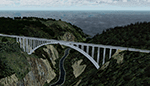
The Bloukrans and Paul Sauer (over the Storms river) bridges are on the N2 highway between Plettenberg Bay and Port Elizabeth on the scenic garden route in the Eastern Cape, South Africa. I made the custom scenery to try some Blender techniques using the P3D 4.5 SDK and tested it in P3D V5 using the ORBX Africa LC and Pilots NG2020 mesh products (I included a fix for the default V5 mesh). You will find the world's highest commercial bungee jump from the Bloukrans bridge, 216m above the river below. Take off from FAPG and fly a heading of 95 degrees for 32 km to get to the Bloukrans bridge (just off the coast). Follow the highway further east for another 26 km to get to the 120m high Paul Sauer bridge, where I included some additional eye candy.
| Filename: | Bloukrans_and_Storms_River_Paul_Sauer_bridges__Sou.zip |
| License: | Freeware |
| Added: | 14th July 2020, 19:15:53 |
| Downloads: | 179 |
| Author: | Johan Pienaar |
| Size: | 26.95 MB |
| Category: Prepar3D V5 - Scenery | |
| Victoria Falls Bridge – Southern Africa |
|
Images related to this file:
File Description:
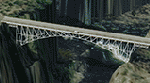
The Victoria falls bridge is located just below the spectacular Victoria water falls in the Zambezi River linking Zimbabwe and Zambia. The steel bridge was completed in 1905 and spans the 200m wide and 128 m wide gorge just below the 1708 m wide falls. This area seems to be a bit neglected in the sim despite the latest add-ons so I decided to spruce it up a little by adding a spray effect for the falls and making some changes to the surface to try to show the waterfall.
I used the P3D 5.3 SDK and tested it in P3D V5.3 using the ORBX Africa LC and Pilots NG2020 mesh products The falls and bridge is 10nm to the north of FVFA in Zimbabwe or 165 degrees from FLNH if you want to approach it from the Zambia side.
| Filename: | Victoria_Falls_Bridge___Southern_Africa.zip |
| License: | Freeware |
| Added: | 1st February 2022, 01:06:27 |
| Downloads: | 66 |
| Author: | Johan Pienaar |
| Size: | 12.78 MB |
| Category: Flight Simulator X - Scenery | |
| TNCC |
|
File Description:
Hato International Airport or Curacao International Airport (originally named Dr. Albert Plesman International Airport) (IATA: CUR, ICAO: TNCC) is the airport of Willemstad, Curacao. It has services to the Caribbean region, South America, North America and Europe. Hato Airport is a fairly large facility, with the third longest commercial runway in the Caribbean region (after Rafael Hern�¡ndez Airport and Pointe-a-Pitre International Airport). The airport was the hub of Air ALM and its successor Dutch Caribbean Airlines, the flag carriers of the former Netherlands Antilles until the latter ceased operations in 2004. The airport is now the home base of Dutch Antilles Express and Insel Air.
This file has the right coordinates, with the apron and characteristics of the airport, working jetways. The runways and runways were resized the gates placed on correct location.
| Filename: | TNCC.zip |
| License: | Freeware |
| Added: | 9th April 2011, 23:52:03 |
| Downloads: | 2,413 |
| Author: | Anwar Gonzalez |
| Size: | 22.3 KB |
| Category: Flight Simulator 2004 - Scenery | |
| Hope Field near Ottawa Ontario, Canada |
|
Images related to this file:
File Description:
The field is newly included in the Canada Flight Supplement. Unusually for a grass field the runway has the numbers marked out in white; given that this is a private airfield that does not invite unexpected guests and has only one plane based there, and presuming that the owner can remember his own runway headings, it is unlikely that these will still be there in a year's time. There is no hangar as yet. To the west is highway 416 and to the east is the Rideau River, both of which run north-south. Lke Rockcliffe (which is to the north) the airfield is right on the edge of the Ottawa control zone, so you should already be below 1,500 feet ASL when approaching from the south and talking to Ottawa tower when arriving from the north. The runway is 07/25 and 2,800 feet long, which should be enough for almost anybody, and the field is at 315 feet ASL. Manotick is a mile to the north east on the Rideau River and the Rideau Valley Airpark CPL3 is six miles south in the bend of the Rideau where it turns west.
| Filename: | Hope_Field_near_Ottawa_Ontario_Canada.zip |
| License: | Freeware, limited distribution |
| Added: | 10th July 2010, 19:34:51 |
| Downloads: | 200 |
| Author: | Roger Wensley |
| Size: | 3.15 MB |
| Category: Flight Simulator 2004 - Scenery | |
| Akulivik CYKO in northern Quebec Canada |
|
Images related to this file:
File Description:
This is another of the many airfields that are all around the coast of Hudson Bay, this one being on the eastern, Quebec side. Akulivik is around 110 miles south of Ivujivik, which is on the northeastern corner of the Bay, and some 60 miles north of Puvirnituq. The population is 630 or so and the village grew from a move back to the area by one family in 1973, followed by others in the following years; the closure of the Hudson Bay trading post post in 1952 had pushed all residents to move south to Puvirnituq. The village is unusual in that it has a built harbour instead of the usual beached storage of boats. The village is built on the central prong of a three pronged spear of headlands (from which the village name is derived) while the airfield is a mile or so further inland. I have no information regarding what I think may be a new terminal building, so this includes only the old original one. The runway is just under 3,500 feet of gravel aligned 09-27, and the ai includes the scheduled flight by an Air Inuit Dash 8-300, plus GA.
| Filename: | Akulivik_CYKO_in_northern_Quebec_Canada.zip |
| License: | Freeware, limited distribution |
| Added: | 9th September 2018, 03:43:25 |
| Downloads: | 162 |
| Author: | Roger Wensley |
| Size: | 4.69 MB |
| Category: X-Plane - Scenery | |
| RAF Gutersloh ETUO |
|
Images related to this file:
File Description:
File Description:
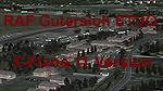
X-Plane 11 Scenery - RAF Gutersloh AB (ICAO: ETUO)
The scenery represents the former airbase of RAF Gutersloh, one of the most populated military bases in West Germany during the Cold War, due to its location near the former East/West border. This scenery reflects the era at the end of the 1980s/beginning of the 90s, when the Harrier GR3 was in operation there, along with Chinook helicopters.
The airfield was built in 1935 and was used by the German Air Force during WW2, flying the Junkers JU-86 and Heinkel H-111. The first British squadrons were stationed there from 1947, with Mosquitos, Vampires and then Canberras.
The first Harrier arrived at Gutersloh in January 1977 and 3 and 4 Squadrons became resident until their farewell in 1993, after the cold war had ended. The airfield is currently used by the British army, but they will leave in 2014 to relinquish the area to the Government of Gutersloh for civil usage.
High detailed scenery by Manfred Schyma and Pete Beeby, supported by the Airfield Construction Group. X-Plane Version designed by Dietmar Hanne
| Filename: | RAF_Gutersloh_ETUO.zip |
| License: | Freeware |
| Added: | 25th May 2018, 23:53:43 |
| Downloads: | 264 |
| Author: | Dietmar Hanne |
| Size: | 142.94 MB |
| Category: Flight Simulator X - Scenery | |
| X2AD - RAF Aston Down - Gloucestershire, England |
|
File Description:
Former RAF Aston Down (IACO X2AD) is located 2.5 miles (4.0 km) east of Minchinhampton, Gloucestershire, South West England and 6.9 miles (11.1 km) west of Cirencester, Gloucestershire.
The airfield was originally opened as RAF Minchinhampton and was first used in the First World War, serving as an aerodrome for the Australian Flying Corps with No. 2 Squadron AFC flying the Royal Aircraft Factory S.E.5a and the Sopwith Pup and No. 3 Squadron AFC flying the Avro 504. The airfield closed shortly afterwards.
In 1938 the airfield reopened under the new name of RAF Aston Down at the request of the residents of Minchinhampton village, which lies about 1 mile (1.6 km) to the west of the airfield, who feared not enemy attack, but a fall in the value of their houses.
During the Second World War the main unit present was No. 20 Maintenance Unit RAF (MU) which stored and prepared aircraft. The unit arrived during October 1938 and left in September 1960.
The airfield was used by the Royal Air Force from the First World War until 1967 when the Cotswold Gliding Club moved in from their previous base near Tetbury.
| Filename: | X2AD__RAF_Aston_Down__Gloucestershire_England.zip |
| License: | Freeware |
| Added: | 3rd May 2016, 13:55:23 |
| Downloads: | 175 |
| Author: | Terry Boissel |
| Size: | 1.97 MB |
| Category: Flight Simulator 2004 - Scenery | |
| CZFN - Tulita - Northwest Territories, Canada |
|
Images related to this file:
File Description:
Tulita (Fort Norman until 1996) is another in the series of airfields that follow (approximately) the Mackenzie River. At the far northern end of the river and on the eastern side of the delta there is Tuktoyaktuk, then Inuvik, Fort McPherson, Fort Good Hope, Deline, Wrigley, Fort Simpson Island and Fort Simpson, and then Fort Liard at the southern end of the list of those in the Northwest Territories. South of Fort Liard there are Peace River and Dawson Creek, both of which are already posted. Tulita is at the junction of the Mackenzie and Great Bear Rivers, on the east bank of the Mackenzie and the south bank of the Great Bear, around 40 miles southeast of Norman Wells. The town has a population of about 480 folks. The airport is above and to the east of the town, and has 3,000 feet of gravel runway. The scheduled flights are by North Wright and I have also added a Buffalo DC3 and GA. There is a mandatory radio frequency but in this case I have set the "tower" to "unmanned" so you will report position and intentions. There is no fuel available.
| Filename: | CZFN__Tulita__Northwest_Territories_Canada.zip |
| License: | Freeware, limited distribution |
| Added: | 12th July 2014, 08:05:54 |
| Downloads: | 272 |
| Author: | Roger Wensley |
| Size: | 2.66 MB |
| Category: Flight Simulator X - Aircraft Repaints, Textures and Modifications | |
| Boeing B-17G 91st BG (LL-Z) "Shamrock Special" |
|
Images related to this file:
File Description:
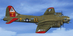
This folder contains a repaint for the A2A WoP2 B-17G in the colors of B-17F 42-29591 LL-Z "Tha Shamrock Special" of the 401st BS/ 91st BG based in Bassingbourne UK. Before being transferred to the 91st BG, this aircraft flew two missions with the 95th BG, as 'Easy Aces'. It came to the 91st in june 1943 and was assigned to the care of M.Sgt. Bob Dalton as crew chief. His assitent, Jack Gaffney named it 'The Shamrock Special', adnd painted two girls on either side of the nose, and later a third girl on the tail. This was probably the only aircraft in the 91st with three pieces of art on it. In november, the aircraft, while undergoing repairs, was hit by battle damaged Fort without brakes, ironically called 'the Careful Virgin'. The tail end was severely damaged during the collision, and the whole tail end was replaced with the tail of another aircraft that was damaged from the front. On 30 december 1943, she was back in action and completed another 12 missions, for a total of 26 with the 91st.
Repaint by Jan Kees Blom, based on the paintkit by A2A.
| Filename: | Boeing_B17G_91st_BG_LLZ_Shamrock_Special.zip |
| License: | Freeware |
| Added: | 7th October 2019, 18:21:48 |
| Downloads: | 84 |
| Author: | Jan Kees Blom |
| Size: | 18.09 MB |


© 2001-2026 AVSIM Online
All Rights Reserved
Privacy Policy |