
Where Flight Simulation Enthusiasts Gather from Around the World!
AVSIM Library - Search Results

| Category: Flight Simulator 2004 - Aircraft Repaints, Textures and Modifications | |
| Italian Air Force Tornado 3 Raduno 2006 update |

|
File Description:
New bmp that fix the color of the bottom surface of the wings of the Italian Air Force Tornado.
Special color for the 3rd meet of the 50 Stormo, 155 Gruppo.
You need the Lago Tornado and torn50st_rad2006.zip.
| Filename: | Italian_Air_Force_Tornado_3_Raduno_2006_update.zip |
| License: | Freeware |
| Added: | 29th April 2007, 13:27:26 |
| Downloads: | 236 |
| Author: | Andrea Arlotti |
| Size: | 798.57 KB |
| Category: Flight Simulator 2004 - Scenery | |
| Hollandia |
|
File Description:
Scenery of the Swiss Alpine Club’s Hollandia refuge. The refuge is situated 70 meters above the Lötschenlücke in the Jungfrau region, West of the Konkordia refuge. The scenery, designed with gmax, performs best on the basis of Swiss Professional.
| Filename: | Hollandia.zip |
| License: | Freeware |
| Added: | 6th September 2005, 21:10:58 |
| Downloads: | 1,377 |
| Author: | Michael Röthlisberger |
| Size: | 415.19 KB |
| Category: Flight Simulator X - Scenery | |
| EDUT Templin Groß Dölln |
|
File Description:
The Airport "Templin" first were used by the German "Luftwaffe". After the WW2 the Russian Airforce become home there. This Airport was the biggest Airport in the GDR. I have resized the Runway to orginal 3500 x 60 meters.
| Filename: | EDUT_Templin_Gro_Dlln.zip |
| License: | Freeware |
| Added: | 17th April 2009, 09:38:39 |
| Downloads: | 480 |
| Author: | Guido Weiß |
| Size: | 285.93 KB |
| Category: Flight Simulator X - Aircraft Repaints, Textures and Modifications | |
| DG-808s South Carolina |
|
File Description:
This is a repaint of the DG-808s glider, it has the S.C. state flag on the tail section and most of the wings and other areas are the same color of the flag, the tail number is SC.
| Filename: | DG808s_South_Carolina.zip |
| License: | Freeware |
| Added: | 2nd April 2012, 00:09:12 |
| Downloads: | 56 |
| Author: | Bobby Atkins |
| Size: | 1.79 MB |
| Category: Flight Simulator X - Scenery | |
| Paine Field for FSX |
|
Images related to this file:
File Description:
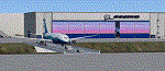
Welcome to Paine Field in Everett Washington. The majority of the Boeing Everett
production facility is rendered, including the bridge between the factory complex
and the field. The Future of Flight museum and the DreamLifter facility are also
included.
| Filename: | Paine_Field_for_FSX.zip |
| License: | Freeware, limited distribution |
| Added: | 18th February 2021, 22:34:34 |
| Downloads: | 486 |
| Author: | Brett Delana |
| Size: | 85.96 MB |
| Category: Flight Simulator X - Scenery | |
| Pagasa Island, Philippines |
|
Images related to this file:
File Description:
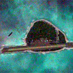
Pagasa Island is a jewel in the South China Sea. It is the one pictured - an emerald splash in an azure sea slashed by a coral runway - whenever new collisions or confrontations are reported in the news for the region. Occupied continuously by the Philippines since 1971, historical use dates back to the Han dynasty, which many believe forms the basis of the Chinese claim to the island. Each country has it's own interpretation of international law and the Filipinos are clearly banking on the precedence of continuous occupation, at no small expense, as Rancudo Field is the farthest airport from Manila within the Philippine sphere of control.
Surprisingly, the geography of the island serves to capture and retain rainwater, although the aquifer is stagnant and the water must be treated for consumption. Sea life remains abundant, poachers take coral heads and sea turtles. There is a solar farm and recently installed solar street lights, fuel for the generators is a precious commodity this far from the mainland.
Sadly, nature may solve the struggle for possession by withdrawing the island from the arena. It is believed that the construction of the runway may have compromised the islands basic integrity, allowing it to crumble into the sea. Whatever the cause, the evidence is clear. Bunkers built during the Japanese occupation in WWII are already slipping beneath the waves and the rate of salt water encroachment has been recorded at close to 6" per day.
There are some things to explore, the grounded BRP Laneo Del Norte to the west; over to the north near the resort grounds are a dugout fishing canoe and some authentic Philippine bangka boats; you may want to load up and head east to do some low warning passes over the Chinese fishing fleet. Standing at the east end of the field, you can just barely spot the China Coast Guard cutter's smoke on the horizon.
The tower is marked by a bright strobe that fires once every five seconds and at night it is bright enough to guide you back to the island from the distance of the fleet. There are no published procedures and the tower is not staffed. Airport ICAO is RPPN.
| Filename: | Pagasa_Island_Philippines.zip |
| License: | Freeware, limited distribution |
| Added: | 10th May 2014, 12:21:19 |
| Downloads: | 1,854 |
| Author: | Rick Keller |
| Size: | 16.17 MB |
| Category: Flight Simulator 2004 - Scenery | |
| Hazyview Airfield, Hazyview, South Africa |
|
Images related to this file:
File Description:
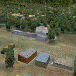
Hazyview is one of the gateway towns to the Kruger National Park and is located just to the West of Phabeni Gate, one of the main gates to use if you are travelling to Skukuza. The airfield in Hazyview is also called Numbi Airfield due to the location of the Numbi Hotel right next to the airfield.
Hazyview airfield is not included in the default scenery of FS2004. With this package, it has been faithfully produced in Gmax with photoreal textures on all the buildings and a photoreal ground as well. Even the Lowveld mall to the North of the airfield and right on the approach to Rwy 19 as well as the Building supplies store to the south and on approach to Rwy 01 is inlcuded with custom models and textures. Likewise, the buildings to the West of the runway (right at the edge of the runway) and the brickyard at the Northern end is modeled with custom models and textures. The two large cellphone antennas are also present in the airport scenery and custom made.
In real life, the runway is quite sloped and this was also recreated in the scenery under the limitations FS2004 presents with regards to non-flat airports.
The grass runway is aligned 01/19 and only 820m long. Take-off is on Rwy 01, with landings on Rwy 19.
| Filename: | Hazyview_Airfield_Hazyview_South_Africa.zip |
| License: | Freeware, limited distribution |
| Added: | 4th February 2022, 14:57:40 |
| Downloads: | 139 |
| Author: | Kobus van Wyk |
| Size: | 17.07 MB |
| Category: Flight Simulator X - Scenery | |
| Lelystad airport_EHLE_FSX_new_layout |
|
File Description:
Because the Netherlands 2000 Scenery Design Team no longer releases a new version for the FSX,
this version has been compiled based on nl2k_v4_EHLE_5 with the permission of the the Netherlands 2000 Scenery Design Team.
- Various buildings have been modelled and items from various sources have been added to the airport.
- The EHLElib.BGL file contains all the items that have been used and the textures are complete.
As a result, the airport can be installed without the use of the installation of the Netherlands 2000 Scenery Design Team.
- The airport is surrounded by more trees than the version nl2k_v4_EHLE_5.
- Lampposts have been added to the highway of the approach path of Runway 23 and parking places.
- By means of Airport Design Editor the airport can be changed.
- In the Effects folder, there are effects that should be added to the FSX (SE) folder.
- In the selection folder you will find two options. One is the choice where the new section is active and two where it is inactive.
By placing a copy of one of these in the scenery folder and deleting it already in the scenery.
It will become active after you restart the flight sim.
Enjoy and Happy flying
Jan Zijlstra from the Netherlands
| Filename: | Lelystad_airport_EHLE_FSX_new_layout.zip |
| License: | Freeware |
| Added: | 20th March 2024, 23:09:06 |
| Downloads: | 167 |
| Author: | Jan Zijlstra |
| Size: | 255.22 MB |
| Category: Flight Simulator 2004 - Scenery | |
| Attawapiskat CYAT in northern Ontario, Canada |
|
Images related to this file:
File Description:
Attawapiskat is on the north bank of the river of the same name, around 7 miles upstream from where the river meets the west shore of James Bay at its mid point. The top end of the Bay is around 140 miles north, Moosonee is around the same to the south, and the east shore 140 miles to the east. The town has a population of around 1,600, although this varies with the seasons as hunting and the traditional way of life on the land is still important to the Cree-speaking inhabitants. The airport is just to the north of the town with a gravel runway almost 3,500 feet long, and I have included the recently installed PAPI. The Canada Flight Supplement does not say anything about fuel being available so I presume the tanks beside the apron are no longer in use. There is also no apron lighting, unless it has been installed recently. There are flights by Air Creebec and by several other smaller airlines and I have included both Air Creebec and Wasaya; their textures are available for download and the planes are as listed in the AI folder.
| Filename: | Attawapiskat_CYAT_in_northern_Ontario_Canada.zip |
| License: | Freeware, limited distribution |
| Added: | 3rd January 2013, 01:37:50 |
| Downloads: | 376 |
| Author: | Roger Wensley |
| Size: | 3.54 MB |
| Category: Flight Simulator X - Aircraft Repaints, Textures and Modifications | |
| A2A Cherokee VLIEGCLUB FLEVO textures v2.0 and A2A Cherokee Panel in KNOTS |
|
File Description:
Since the end of March 2016 the fleet of Vliegclub Flevo changed. Vliegclub Flevo is based in Lelystad, the biggest GA Airport in the Netherlands.
The PH-VFA is replaced by the G-BJSV. This package contains the old colours of the PH-VFB and PH-VFC and the new livery of the PH-DRT and the G-BJSV.
The real life new livery is designed by me. I've converted the new livery to the A2A Piper Cherokee 180. In real the PH-VFB and the PH-VFC is a Piper PA28-161 Cadet. The G-BJSV is a Piper PA28-161 Arrow II and the PH-DRT is a PA28-181 Archer II. The textures have been tested with FSX only and are only made for the A2A Piper PA28-180 Cherokee.
As option you can change the A2A Cherokee Panel IAS indicator from Statute Miles to Nautical Miles.
| Filename: | A2A_Cherokee_VLIEGCLUB_FLEVO_textures_v20_and_A2A_.zip |
| License: | Freeware, limited distribution |
| Added: | 4th April 2016, 21:34:59 |
| Downloads: | 310 |
| Author: | Casper Meijer |
| Size: | 89.37 MB |


© 2001-2026 AVSIM Online
All Rights Reserved
Privacy Policy |