
Where Flight Simulation Enthusiasts Gather from Around the World!
AVSIM Library - Search Results

| Category: Flight Simulator 2004 - Scenery | |
| SWUY Coari/Urucu, Brazil |

|
File Description:
Googly scenery for SWUY Coari/Urucu, Brazil, a small domestic airport
located near Brazil's largest inshore gas source and serving the city
of Coari (some distance away), one of the largest cities in the Amazonas
state. The airport is served about four times daily by ATR aircraft of
Total Linhas Aereas on domestic flights, plus general aviation traffic.
Flight Simulator 2004 has made no provision for traffic with only a runway
provided and this scenery seeks to redress the situation.
The scenery does not purport to be ultra-accurate. Based on high quality
satellite imagery from Google Earth, the layout is proportionally correct but the
added airport features, such as buildings, are built from default Microsoft objects
and add-on libraries so will not look exactly like the real thing.
You are not obliged to download and install any additional scenery libraries,
but to enjoy this scenery in its entirety, you may wish to. It will work fine,
with or without.
| Filename: | SWUY_CoariUrucu_Brazil.zip |
| License: | Freeware |
| Added: | 16th April 2008, 19:26:04 |
| Downloads: | 1,206 |
| Author: | John Hinson |
| Size: | 61.58 KB |
| Category: Flight Simulator 2004 - Scenery | |
| Southeast Farallon Islands Version 3 |
|
File Description:
Complete download: Surf height fix. Also new island texture map. These islands were mysteriously absent from the FS2004 default scenery, probably owing to their small size. When I went to look for them I found a small mountain of water instead of the islands. Most people don't seem to be aware of the Farallon Islands. Located off the coast of California, near San Francisco, they are home to thousands of birds, seals, and some of the largest Great White sharks known to man. All of this is within a very short distance of the city. Today, it is a wildlife refuge and is off limits to visitation by the general public. Those of you interested in more info might check out "The Devil's Teeth" by Susan Casey. This island is actually a scenery object. As such it doesn't have a landable surface. Future versions will have a helicopter pad, a lighthouse, and the 100 year old houses used by researchers.
| Filename: | Southeast_Farallon_Islands_Version_3.zip |
| License: | Freeware, limited distribution |
| Added: | 22nd November 2005, 19:05:56 |
| Downloads: | 1,097 |
| Author: | Glen Gordon (Prof K.) |
| Size: | 1.38 MB |
| Category: Flight Simulator 2004 - Aircraft Repaints, Textures and Modifications | |
| Spirit Airlines "Bare Fare" Airbus A319-132 (N534NK) |
|
Images related to this file:
File Description:
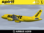
Spirit Airlines, a discount carrier in the US based in Atlantic City, New Jersey (KACY), started a marketing campaign in July of 2014 called the "Bare Fare" campaign. By some measures it was cheeky with obvious sexual overtones, including $69 fares and celebs that stripped to their underwear in their provocative online ad videos. It even drew the eire of the American Family Association (AFA) from a member group called "One Million Moms." All that aside, the campaign includes several A319s and most recently an A320 painted to promote the campaign. This is one of those A319s, reg N534NK, painted taxi cab yellow and adorned with the campaign logos. The repainted textures in this package are 32-bit with no mipmaps for best clarity and quality. This is a complete install package, the Project Airbus A319 V2.1 model and air files are included. Uses default 737-400 panel and sounds. Please see Readme.txt for more details.
| Filename: | Spirit_Airlines_Bare_Fare_Airbus_A319132_N534NK.zip |
| License: | Freeware, limited distribution |
| Added: | 28th May 2015, 13:55:24 |
| Downloads: | 1,969 |
| Author: | Jeffrey S. Bryner, Project Airbus |
| Size: | 8.18 MB |
| Category: X-Plane - Scenery | |
| BR PA SBCC - Cachimbo Air Base v1.0.0 |
|
Images related to this file:
File Description:
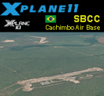
This is an X-Plane 11 and X-Plane 10 scenery package for Cachimbo Airport (ICAO: SBCC, no IATA code), which is the military airport serving "Campo de Provas Brigadeiro Velloso", a large testing and training complex of the Brazilian Armed Forces located in Serra do Cachimbo (English: Smoking pipe Mountains), in the southern part of the state of Pará, Brazil. It is operated by the Brazilian Air Force (FAB). It includes corrected aprons, ramps, gates, taxiways, lighting system, city buildings, ortho-photoscenery for the airfield area, the new apron 2, and (XP11 only) airport ground services (like push back). This scenery was tested and is operational (as of April 16, 2017) in "X-Plane 11.00 RC #1 64 bit", Windows 10 Home. It was also tested and is also operational (as of April 16, 2017) in "X-Plane 10.51 64 bit", Windows 10 Home. Only the default X-Plane 11 libraries, by Laminar Research, are needed. No third party libraries are used.
| Filename: | BR_PA_SBCC__Cachimbo_Air_Base_v100.zip |
| License: | Freeware |
| Added: | 17th April 2017, 06:12:35 |
| Downloads: | 87 |
| Author: | Rui Mesquita |
| Size: | 29.57 MB |
| Category: Flight Simulator 2002 - Miscellaneous Files | |
| Albuquerque Sectional Chart |
|
File Description:
Fly eastbound from Phoenix and visit Area 51 and Roswell (where SETI was "born"), Alamogordo, White Sands National Monument, Trinity Site (where the Manhattan Project tested the first nuclear device), Albuquerque (the state´s capital city), Lincoln County (where Billy the Kid was shot), the Mescalero Reservation (great skiing at Sierra Blanca south of the White Mountain Wilderness Area) and Capitan, Birthplace of Smokey the Bear. Flying VFR in this kind of countryside isn´t easy, as there aren´t all that many landmarks to rely on. Maybe this chart is of some assistance to you. You may use it "as is" without any other software, but it will develop its full potential if used as moving map with SimSystem´s FSFlightMax or FSGarmin. It wouldn´t have been possible to offer this chart without Richard Harvey and his love to flightsimming, so please consider this file to be "donationware" and make a however small contribution to the Richard Harvey Endowed Scholarship.
| Filename: | Albuquerque_Sectional_Chart.zip |
| License: | Check within download |
| Added: | 29th March 2003, 04:15:12 |
| Downloads: | 2,137 |
| Author: | Uwe Rademacher |
| Size: | 15.09 MB |
| Category: Flight Simulator 2004 - Scenery | |
| Canadian and Northern USA Winter Flying |
|
File Description:
This is an expanded version of a previous post a year ago, and stretches from east of Quebec City through Quebec, Ontario, and Manitoba, and now also through Saskatchewan, and into Alberta (past Calgary). There is also a northern area roughly centered on Hudson Bay. The exact coverages are given in the notes. All rivers and lakes within the area will "freeze" and allow ski planes to land, or even wheeled planes come to that. And it is not permanent, when you want to go back to floats just "untick" it in the FS library, and it will melt. The area covered crosses into the US too, down to around 45 degrees north, so that means most of Montana, all of North Dakota, half of Minnesota, and some of Wisconsin, Michigan etc. It seemed silly to stop at the border. Ultimate Terrain is highly recommended, so that there will actually be the right lakes and rivers ready to freeze.
| Filename: | Canadian_and_Northern_USA_Winter_Flying.zip |
| License: | Freeware |
| Added: | 26th May 2008, 13:24:29 |
| Downloads: | 669 |
| Author: | Roger Wensley |
| Size: | 354.86 KB |
| Category: Flight Simulator X - AFCAD Files | |
| SOCA - Felix Eboue Airport - Cayenne (Matoury), French Guiana |
|
Images related to this file:
File Description:
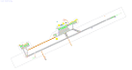
Cayenne - Felix Eboue Airport (French: Aeroport de Cayenne - Felix Eboue) (IATA: CAY, ICAO: SOCA) is French Guiana's main international airport. It is located in the commune of Matoury, 13 km (8 mi) southwest of French Guiana's capital city of Cayenne. Air Guyane Express has its head office on the airport property. The airport currently has service domestically and internationally to points in South America, the Caribbean and Paris via Air Caraibes, Air France, Air Guyane Express and Surinam Airways
Features:
*Expanded parking apron
*Taxiways properly desginated and aligned (included the closing off of most of taxiway Alpha per real world charts)
*Runway markings and lighting corrected
*Parking spots for commercial traffic
*Seperate parking areaa for GA traffic
*Misc airport buildings added
*Airport vehicles and objects throughout the airport
*Fuel service vehicles
*Palm trees added
*Military parking area on the west side of the airport
*Service roads leading to proper navaids
*Parking lot with static vehicles
*Static aircraft
*New control tower
| Filename: | SOCA__Felix_Eboue_Airport__Cayenne_Matoury_French_.zip |
| License: | Freeware |
| Added: | 30th July 2013, 05:37:44 |
| Downloads: | 1,817 |
| Author: | Jaison Diaz / Endeavour AI |
| Size: | 433.26 KB |
| Category: Flight Simulator X - Scenery | |
| Hawaiian Airports Part 1 |
|
Images related to this file:
File Description:
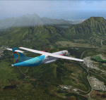
Hawaiian Airports Part 1
This scenery features accurate recreations of the airports at PHMK Molokai, PHNY Lanai City, PHHN Hana, PHLU Kalaupapa, and JHM Mauai West. All runways, aprons, taxiways and buildings have been repositioned to their correct locations, and include custom textures based on real photographs. The new hanger has been added to Hana and also the new fire stations at Lanai and Molokai. The scenery features effects, sound, many animated objects including people, flags, animals, waves, cars, trucks and many more. Full night textures with light maps are included.
The scenery also includes representative, and real interisland traffic schedules, and the HAL ATR is sporting the new OHana livery.
All the scenery files have been sub-divided so they can be switched on or off according to user preference. It has been designed for, and tested in DX9 and FSXA only.
Please enjoy, and I hope you like my scenery as much as I enjoyed building it.
| Filename: | Hawaiian_Airports_Part_1.zip |
| License: | Freeware, limited distribution |
| Added: | 15th January 2014, 11:11:37 |
| Downloads: | 12,329 |
| Author: | George Keogh |
| Size: | 231.29 MB |
| Category: Flight Simulator 2004 - Scenery | |
| Edinburgh Island, FOX-2, Horton River, Igloolik, & Kimmirut, adapted for the FSGenesis 76m North Canada Terrain Mesh |
|
Images related to this file:
File Description:
These are replacement bgl's to convert five northern Canada fields for use with the FSGenesis 76m terrain mesh for northern Canada. The five are Edinburgh Island CWEI, the FOX-2 DEW line station, Horton River CWHR, Igloolik CYGT, and Kimmirut CYLC. These are not stand-alone, and the presumption is that you have already downloaded and installed the previously posted sceneries. This installation consists solely of replacing the existing scenery bgl's with the new. There will be further posts of northern airfields in groups of five, alphabetically, and observations regarding the amendments and any further corrections that are required would be welcomed.
| Filename: | Edinburgh_Island_FOX2_Horton_River_Igloolik__Kimmi.zip |
| License: | Freeware, limited distribution |
| Added: | 10th September 2017, 19:29:57 |
| Downloads: | 86 |
| Author: | Roger Wensley |
| Size: | 3.55 MB |
| Category: Prepar3D V1-4 - Scenery | |
| Update for the FSX/P3D default GPS and maps - restricted, danger and Prohibited Areas in Israel V1.01 |
|
File Description:
This BGL files will add most(based on local AIP) the restricted, danger and Prohibited Areas in Israel to the default GPS and maps. Tested in FSX/ P3D V3/ P3D V4.
| Filename: | Update_for_the_FSXP3D_default_GPS_and_maps__restri.zip |
| License: | Freeware |
| Added: | 14th September 2017, 05:10:23 |
| Downloads: | 193 |
| Author: | Stas Harchuk |
| Size: | 1.37 MB |


© 2001-2026 AVSIM Online
All Rights Reserved
Privacy Policy |