
Where Flight Simulation Enthusiasts Gather from Around the World!
AVSIM Library - Search Results

| Category: Prepar3D V1-4 - Scenery | |
| Lokpriya Gopinath Bordoloi International Airport Guwahati VEGT P3Dv4 |

|
Images related to this file:
File Description:
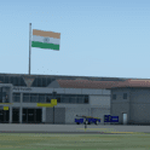
Lokpriya Gopinath Bordoloi Airport (IATA: GAU, ICAO: VEGT), also known as Guwahati Airport and formerly as 'Borjhar Airport', is the primary airport of the North-Eastern states of India. It is the 11th busiest airport in India. It is located at Borjhar, 26 km (16 mi) from Dispur, the capital city of the state of Assam and 28 km (18 mi) from Guwahati and is named after Late Gopinath Bordoloi, a freedom fighter and the first Chief Minister of Assam after India's independence. The airport is managed by Airports Authority of India and also serves as an Indian Air Force base.
Special Thanks to Ron Baruah for his VEGT Terminal Models, MFSG and MisterX for Vehicle Libs, Mayukh Deb for MD Libs and Taxi Lighting, Sriharsha K for Gate Signboards and Lightpoles and many more!
Compatible with Prepar3D v4.
| Filename: | Lokpriya_Gopinath_Bordoloi_International_Airport_G.zip |
| License: | Freeware |
| Added: | 15th June 2021, 18:55:10 |
| Downloads: | 603 |
| Author: | Saurabh Bansal |
| Size: | 257.15 MB |
| Category: Flight Simulator X - Scenery | |
| SL02 - Alcantari International - Sucre-Yamparaez - Bolivia |
|
File Description:
The Alcantari International Airport (96% completed) (Spanish: Aeropuerto Internacional Alcantari) (IATA: unknown yet, ICAO: SL02, accordingly with some information over the WEB, pending of confirmation) is a new airport under construction in Yamparaez municipality, Chuquisaca, Bolivia, around 35 Km to the south of Sucre City. Alcantari International Airport is being built to address a number of limitations of the Sucre s current airport, Juana Azurduy de Padilla Airport (ICAO: SLSU).
The airport resides at an elevation of 10.210 ft (3.112 m) above mean sea level. The new airport will have one runway designated 18/36 (pending of confirmation) with an asphalt surface measuring 11,811 by 147.63 ft (3,600 m by 45 m)and it is expected to be operational by the first quarter of 2016.
Compatible with both FSX and P3D.
| Filename: | SL02__Alcantari_International__SucreYamparaez__Bol.zip |
| License: | Freeware |
| Added: | 3rd November 2015, 00:21:08 |
| Downloads: | 665 |
| Author: | Marcos A. Rivas Torrez |
| Size: | 9.31 MB |
| Category: Flight Simulator X - AFCAD Files | |
| MROC - Juan Santamaria International Airport - San Jose, Costa Rica |
|
Images related to this file:
File Description:
Juan SantamariÂa International Airport (Spanish: Aeropuerto Internacional Juan Santamaria) (IATA: SJO, ICAO: MROC) is the primary airport serving San Jose, the capital of Costa Rica. It is the busiest airport in the country and the second busiest in Central America. The airport serves as a hub for Avianca Costa Rica(formerly TACA) and Sansa and a focus city for Copa Airlines.
Features:
*Taxiways properly designed and signs updated
*Expanded parking apron
*Redesigned terminal building to match most recent renovations
*Relocated control tower (old one was demolished)
*Accurate gate assignments
*Runway markings and lighting corrected
*Parking spots for commercial traffic
*Separate parking area for GA traffic
*Misc airport buildings added
*Cargo ramp
*Airport vehicles and objects throughout the airport
*Fuel service vehicles
*Static aircraft
| Filename: | MROC__Juan_Santamaria_International_Airport__San_J.zip |
| License: | Freeware |
| Added: | 8th July 2014, 03:40:05 |
| Downloads: | 1,522 |
| Author: | Jaison Diaz / Endeavour AI |
| Size: | 97.25 KB |
| Category: Prepar3D V5 - Scenery | |
| Lokpriya Gopinath Bordoloi International Airport Guwahati VEGT P3Dv5 |
|
Images related to this file:
File Description:
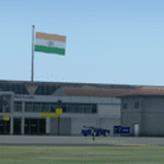
Lokpriya Gopinath Bordoloi Airport (IATA: GAU, ICAO: VEGT), also known as Guwahati Airport and formerly as 'Borjhar Airport', is the primary airport of the North-Eastern states of India. It is the 11th busiest airport in India. It is located at Borjhar, 26 km (16 mi) from Dispur, the capital city of the state of Assam and 28 km (18 mi) from Guwahati and is named after Late Gopinath Bordoloi, a freedom fighter and the first Chief Minister of Assam after India's independence. The airport is managed by Airports Authority of India and also serves as an Indian Air Force base.
Special Thanks to Ron Baruah for his VEGT Terminal Models, MFSG and MisterX for Vehicle Libs, Mayukh Deb for MD Libs and Taxi Lighting, Sriharsha K for Gate Signboards and Lightpoles and many more!
Compatible with Prepar3D v5.
| Filename: | Lokpriya_Gopinath_Bordoloi_International_Airport_G.zip |
| License: | Freeware |
| Added: | 15th June 2021, 18:55:37 |
| Downloads: | 271 |
| Author: | Saurabh Bansal |
| Size: | 257.18 MB |
| Category: Flight Simulator X - Scenery | |
| Termopoli Grecia |
|
File Description:
A flight in the history of ancient Greece have realized the scenario of Thermopylae where today you can see a monument that recalls the exploits of the Spartans against the Persian Empire The Battle of Thermopylae was fought by the Greek city-states, united in an alliance and guided by King Leonidas I of Sparta against the Persian empire ruled by Xerxes in September of 480 BC.
The VFR flight is to take off with a single propeller touring from LG53 (Lamia Greece) from the runway 13 and taking runway heading to reach 2500Ft coordinates N 38.47.15 E 22:30:37 to admire the scenery and return to the departure airport . In the package you will find a Termopoli.zip Termopoli_City.bgl files you will put in the folder scenery addon scenery folder and the scenario will be automatically activated. Good Flight
We accept criticism and advice [email protected]
| Filename: | Termopoli_Grecia.zip |
| License: | Freeware |
| Added: | 7th September 2016, 21:58:14 |
| Downloads: | 278 |
| Author: | Pasquale Marrulli |
| Size: | 1.67 KB |
| Category: Flight Simulator 2004 - Scenery | |
| Churchill Falls CZUM in Newfoundland and Labrador Canada |
|
Images related to this file:
File Description:
Churchill Falls is a small town on the Churchill River, around 230 miles north of the Gulf of St Lawrence coast and 120 miles east of Labrador City. It is a company-built town for the staff and families that work in the generating station associated with the falls. The falls were first discovered in the 1830's and work on the generating station commenced in 1967. The runway is 5,500 feet of asphalt aligned 13-31, with PAPI and approach lighting at both ends, and the apron at the eastern end. The buildings are well replicated here and the AI includes both GA flights and the daily flights by Provincial Airways, along with a medical transport service. There is a dock for float planes on a nearby lake that is no longer in regular use and officially listed as closed, but the dock remains there and is included here.
| Filename: | Churchill_Falls_CZUM_in_Newfoundland_and_Labrador_.zip |
| License: | Freeware, limited distribution |
| Added: | 25th August 2020, 18:16:40 |
| Downloads: | 180 |
| Author: | Roger Wensley |
| Size: | 11.92 MB |
| Category: Flight Simulator X - Scenery | |
| Clark International Airport RPLC - CRK |
|
Images related to this file:
File Description:

FSX scenery for Clark International Airport in Angeles city, Papamga Province , Philippines.
Clark International Airport, formerly the Diosdado Macapagal International Airport (IATA: CRK, ICAO: RPLC), is an airport that is an international gateway to the Philippines within Clark Freeport Zone located 80KM northwest of Manila. The airport is located along the border between the cities of Angeles and Mabalacat in the province of Pampanga and is accessible through the Subic-Clark-Tarlac Expressway, which is connected to the North Luzon Expressway.
Clark serves the general vicinity of central and northern Luzon. The name is derived from the former American Clark Air Force Base which was the largest overseas base of the United States Air Force until it was closed in 1991 and handed over to the Government of the Philippines.
Airlines serving CRK include Air Asia, Asiana, Cebu Pacific, Dragonair, Emirates, Jin Air, Qatar Airways, Tigerair, Fedex and Ups
| Filename: | Clark_International_Airport_RPLC__CRK.zip |
| License: | Freeware, limited distribution |
| Added: | 24th September 2016, 02:43:49 |
| Downloads: | 3,063 |
| Author: | Yann Martineau |
| Size: | 515.94 KB |
| Category: Flight Simulator 2004 - Scenery | |
| CYQV Yorkton Municipal Airport Saskatchewan Version 2 |
|
Images related to this file:
File Description:

Yorkton Municipal Airport is situated approximately three kilometers north of the City of Yorkton, Saskatchewan, Canada. The airfield was built in 1940 for the Royal Canadian Air Force, as a British Commonwealth Air Training Plan station. Today, only a few of the wartime buildings remain and only two of the orginal four runways remain in operation. The airport continues, however, as the prinicipal hub of general aviation services for the east-central region of Saskatchewan.
CYQV was constructed using GMAX and represents the airport as it was in the Summer of 2008. It includes custom models of all the buildings at the airport, runway signs, refueling facilites,garages, weather station, fencing and trees, and a rotating beacon. CYQV includes custom ground textures to replicate the decommissioned runways and taxiways.
Version 2 replaces the original lost in the AVSIM hack and includes a number of improvements (see readme).
| Filename: | CYQV_Yorkton_Municipal_Airport_Saskatchewan_Versio.zip |
| License: | Freeware |
| Added: | 7th May 2010, 12:52:18 |
| Downloads: | 1,997 |
| Author: | Gregory Putz |
| Size: | 6.72 MB |
| Category: X-Plane - Scenery | |
| ENNM - Namsos Airport - Namsos, Norway |
|
Images related to this file:
File Description:
This Namsos scenery corresponds to the current Airport Layout of ENNM. The near surroundings are designed based on a satellite photo so that VFR flights and VFR orientation should be very easy. The second bridge a bit far west of the airport is included, also the City of Namsos, a cruise ship dock and the marina south of the Namsos Bridge.
I used some parts of freeware libraries, which are already included in this package.
The airport buildings are converted from the famous FS2004 scenery from Kjell Arild Bersaas & Arne Sundsboe.
I did some small changes which were absolutely necessary to fit the new airport layout. Finally I only deleted a fence which blocked the new apron.
This scenery is converted from my ENNM-FSX scenery and the reworked with WED and OverlayEditor. The library "OpenSceneryX" must be installed first:
http://www.opensceneryx.com/
| Filename: | ENNM__Namsos_Airport__Namsos_Norway.zip |
| License: | Freeware |
| Added: | 17th May 2015, 08:59:30 |
| Downloads: | 140 |
| Author: | Wolfgang Allers |
| Size: | 16.75 MB |
| Category: Flight Simulator 2004 - Scenery | |
| Guaymaral Airport SKGY 2011 |
|
File Description:
Guaymaral Airport (IATA: GAA, ICAO: SKGY) is an airport located in Bogota, Colombia, in the area from which its name was taken, which is located to the north-west of the city, and limits with the towns of Cota and Chia. The airport handles primarily general aviation traffic, type A and B, only VFR. It's the base for private and commercial pilot training schools like Aeroandes and Aeroclub de Colombia.
This file has the right coordinates, with the apron and characteristics of the airport. The runways were reoriented to the correct direction, runway were resized the gates placed on correct location, Colombia National Police was
assigned a correct apron. All the airport charts required to navigate in and out of this airport which are courtesy of: Areonatica Civil de Colombia can be found at www.aerocivil.gov.co/ under Informacion Aeronautica click AIP; on AIP
click Aerodromos then click at SKGY.
| Filename: | Guaymaral_Airport__SKGY_2011.zip |
| License: | Freeware |
| Added: | 6th November 2011, 21:14:52 |
| Downloads: | 563 |
| Author: | Anwar Gonzalez |
| Size: | 12.07 KB |


© 2001-2026 AVSIM Online
All Rights Reserved
Privacy Policy |