
Where Flight Simulation Enthusiasts Gather from Around the World!
AVSIM Library - Search Results

| Category: Flight Simulator X - Scenery | |
| Odense Airport (EKOD), Funen, Denmark |

|
Images related to this file:
File Description:
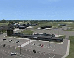
Odense Lufthavn (Odense Airport) is situated close the village of Beldringe, a few km north of Odense, the main city on the island of Funen, Denmark. Like several other Danish airports it was established as an airbase by the Germans during World War II. It was taken over by the Danish state after the war and owned by the state until 1998, at which time it was taken over by a consortium of local authorities, including the city of Odense.
Since the opening of the Great Belt Lin in 1997 there has been no regular passenger flights, apart from some charter traffic during the summer season. But there is a lot of traffic with one- and two-motor craft (including rotor craft) due to the many companies based in the airport.
The package is a complete scenery of the airport, including a few buildings around it. It includes approach lights, runway lights, taxiway lights and light on the apron, the car parking area and the surrounding roads. A traffic file with the (limited) charter traffic of the airport is also included.
| Filename: | Odense_Airport_EKOD_Funen_Denmark.zip |
| License: | Freeware, limited distribution |
| Added: | 31st October 2009, 10:29:34 |
| Downloads: | 3,730 |
| Author: | Peter H. Poulsen |
| Size: | 13.63 MB |
| Category: Flight Simulator X - Scenery | |
| Samos - Greece |
|
Images related to this file:
File Description:
Island of Samos Dn
This is a highly detailed photorealistic scenery of the beautiful island of
Samos WITH NIGHT TEXTURES.
The scenery contains many objects like cars, boats and buldings in the City
of Samos and around the island.
Default FSX airport of the island (LGSM) was corrected and repositioned to
the exact location and some buildings and trees were added in the airport
vicinity.
The scenery also includes autogen buildings, vegetation and road trafic near
the cities to enhance and animate the landscape.
| Filename: | Samos__Greece.zip |
| License: | Freeware |
| Added: | 24th November 2016, 17:42:21 |
| Downloads: | 1,369 |
| Author: | Angelo Tassoglou |
| Size: | 17.26 MB |
| Category: Prepar3D V1-4 - Scenery | |
| Udine Friuli Venezia Giulia Italy N46.3.85 E13.14.19. |
|
Images related to this file:
File Description:
Udine Friuli Venezia Giulia Italy N46.3.85 E13.14.19. The city is located in the center of the Friuli region. It is just over 20 km from Slovenia and about 54 km from Austria. This puts it in a strategic position, at the intersection of the East-West European Corridors (Corridor V or Mediterranean) and North-South (Via Iulia Augusta, now recognized by the European Union as part of the Baltic-Adriatic Corridor) , on the way to Austria and to Eastern Europe. It rises in the high plains, around an isolated hill (according to the legend built by Attila to admire the fire that he himself caused to the city of Aquileia, but in reality is formed by conglomeratic rocks more than 100,000 years old), on top of which the castle is located, a few kilometers from the hilly belt, and is bordered by the Cormor torrent to the west and the Torre torrent to the east. Important VFR point for approaching airport Trieste Ronchi dei Legionari (LIPQ) and airporto Udine Boscomantico (LIPD).
Within the downloaded package you will find readme files for scenery installation. Good fly VFR. Pasquale Marrulli.
| Filename: | Udine_Friuli_Venezia_Giulia_Italy_N46385_E131419.zip |
| License: | Freeware |
| Added: | 21st December 2017, 17:40:48 |
| Downloads: | 261 |
| Author: | Pasquale Marrulli |
| Size: | 3.11 KB |
| Category: Flight Simulator 2004 - AI Flight Plans | |
| VLM - Winter 2017-18 |
|
Images related to this file:
File Description:

These are the Winter 2017-18 flight plans for VLM, based on the actual rotations for the week 4-10 November 2017. Absolutely thrilled to see VLM back in the skies. City Airport was never quite the same without them.
This winter, the only schedule flown by VLM is ANR-LCY. It uses the alphanumeric callsigns WLM01A through WLM10A. Flight Simulator will not speak the leading zero or trailing alpha. Three Fokker 50s are based at ANR, but only two were operational during the week in question.
| Filename: | VLM__Winter_201718.zip |
| License: | Freeware |
| Added: | 19th November 2017, 15:47:33 |
| Downloads: | 297 |
| Author: | Alexander Michael |
| Size: | 5.51 KB |
| Category: Flight Simulator X - AFCAD Files | |
| KPSO - Stevens Field, Pagosa Springs, Colorado, USA - V2.0 |
|
Images related to this file:
File Description:

Updated scenery of Stevens Field, Pagosa Springs Airport nested in the high-altitude Rocky Mountains of Colorado. This scenery includes the airport and land class for surrounding areas to include the many small lakes, the city of Pagosa, and nearby inhabited areas. Airport features runway distance markers, new taxiways, taxiway signs, realistic parking, scenery objects, hangars, and FBO. How is your high-altitude flying? Enjoy! Version 2 includes updated taxiway structure circa 2013, signage, major roads added, and land class tweaks.
| Filename: | KPSO__Stevens_Field_Pagosa_Springs_Colorado_USA__V.zip |
| License: | Freeware |
| Added: | 30th May 2013, 06:10:06 |
| Downloads: | 536 |
| Author: | AJ Cook |
| Size: | 17.21 KB |
| Category: Flight Simulator 2004 - Scenery | |
| Hutchinson Municipal KHUT |
|
Images related to this file:
File Description:
FS2004 Scenery-Hutchinson Municipal Airport (KHUT), Ks serves Hutchinson and Reno County and is owned by the City Of Hutchinson. The airport has more than one runway. The longest is a paved runway extending 7001 feet. The facility is at an elevation of 1542 feet at a distance of about 3 miles from Hutchinson. Scenery Created with FSDS3, Lago's FSE, EZ Scenery and Rwy12. FSDS3 textures included. Must download EZ Scenery and Rwy12 libraries. AFCAD2 and Traffic Tools flight plans included.
| Filename: | Hutchinson_Municipal_KHUT.zip |
| License: | Freeware |
| Added: | 24th April 2006, 02:54:20 |
| Downloads: | 666 |
| Author: | John B. Loney, Jr. |
| Size: | 909.15 KB |
| Category: Civil Flight Simulators - Looking Glass Flight Unlimited 3 | |
| Big Red v2 |
|
File Description:
File Description:
Beech Baron "Big Red". This is a repaint / cockpit upgrade of Ansgar Avermeyer's new Baron model BaronAvm_V1_12.ZIP. The livery and the cockpit interior bitmaps are based entirely on photos kindly provided by Ed Weber of Lake Havasu City, Arizona--the owner and pilot of the real aircraft. Full aircraft, does not require any other files. This upload is based on my Big Red v1 and differs by having a modified panel and slightly altered textures, palette included.
| Filename: | Big_Red_v2.zip |
| License: | Freeware |
| Added: | 4th January 2006, 01:12:13 |
| Downloads: | 333 |
| Author: | Hans Petter Roverud |
| Size: | 6.54 MB |
| Category: Flight Simulator 2004 - AI Flight Plans | |
| CalSierra Airlines 1980 Package |
|
Images related to this file:
File Description:

This package contains a basic CalSierra repaint for the DWAI Convair 580 (link for model included) and flightplans for that aircraft. CalSierra was a short lived San Diego-based airline which linked the city with South Lake Tahoe with a single CV-580. The airline is best remembered for its flight attendants who wore furry boots on board. These retro flightplans represent the airline in 1980 with two daily flights from San Diego to South Lake Tahoe. Requires TTools. By Chasen Richardson.
| Filename: | CalSierra_Airlines_1980_Package.zip |
| License: | Freeware, limited distribution |
| Added: | 6th May 2010, 11:01:45 |
| Downloads: | 214 |
| Author: | Chasen Richardson |
| Size: | 149.71 KB |
| Category: Flight Simulator X - Scenery | |
| Sumter Municipal Airport KSMS |
|
Images related to this file:
File Description:
FSX Scenery - Sumter Municipal Airport (IATA: SMS, ICAO: KSMS, FAA LID: SMS) Sumter, South Carolina, United States, serves Sumter and Sumter County and is owned by the City & County Of Sumter. The airport has more than one runway. The longest is a paved runway extending 5500 feet. The facility is at an elevation of 183 feet at a distance of about 4 miles from Sumter. Created with Instant Scenery. For FS9 version, see ksms_fs9.zip. By John B. Loney, Jr.
| Filename: | Sumter_Municipal_Airport_KSMS.zip |
| License: | Freeware, limited distribution |
| Added: | 2nd November 2009, 20:05:22 |
| Downloads: | 351 |
| Author: | John B. Loney, Jr. |
| Size: | 439.12 KB |
| Category: Flight Simulator X - Scenery | |
| KCGS - College Park Airport - Maryland, USA |
|
Images related to this file:
File Description:
FSX Scenery - College Park Airport (IATA: CGS, ICAO: KCGS, FAA LID: CGS) is a public airport located in the City of College Park, in Prince George's County, Maryland, USA. It is the world's oldest continuously operated airport. College Park Airport was established in August 1909 by the United States Army Signal Corps to serve as a training location for Wilbur Wright to instruct two military officers to fly in the government's first airplane. For your flying pleasure by John B. Loney, Jr.
| Filename: | KCGS__College_Park_Airport__Maryland_USA.zip |
| License: | Freeware, limited distribution |
| Added: | 16th April 2016, 11:44:54 |
| Downloads: | 270 |
| Author: | John B. Loney, Jr. |
| Size: | 25.9 MB |


© 2001-2026 AVSIM Online
All Rights Reserved
Privacy Policy |