
Where Flight Simulation Enthusiasts Gather from Around the World!
AVSIM Library - Search Results

| Category: Flight Simulator X - Aircraft Repaints, Textures and Modifications | |
| Supermarine Spitfire Mk.XIV RM656 DL-F 91 Sqn |

|
Images related to this file:
File Description:

This folder contains a repaint for the Supermarine Spitfire Mk.XIV by Real Air. It shows Spitfire Mk.XIV RM656 DL-F, which was the aircraft that Captain Jean Maridor, of the Free French Air Force, was flying on the 3rd of August 1944, when he was killed while destroying a V1. Jean Maridor was born in Le Havre, France on the 24 November, 1920. He became interested in flying at a young age. He stopped his studies to focus of this new interest. Maridor began to take many courses in flying. He obtained his pilot's licence at 16, making him the youngest pilot in France. In 1939, he joined the French Air Force and received his pilot's wings in september 1939, continiuing his training on the Dewoitine D520. He joined a squadron just two days before the French Surrender, only to receive the order to burn his aircraft. After the French surrender, Maridor left to go to England with many other French pilots, where he joined the R.A.F. After training, he began flying with the 615 Squadron on Hurricanes. He scored his first kill on the 14th of October 1941. In february 1942, he transferrd to 91 squadron, flying Spitfires, where he scored a further 8 kills, one of which was Lt Paul Galland, the brother of Adolf Galland, in october 1942.
From june 1944, 91 squadron flew the Spitfire mk XIV and specialised in shooting down the V1's that the Germans started sending over to the UK. Capt Maridor was succesful at this too, shooting down 6 of the Doodlebugs before his final flight on the 3rd of August 1944.
On this day, Maridor intercepted a Doodlebug over Rolvenden around 12:33. Flying towards the bomb, he shot at it at 12:39. Although he hit it, the bomb was only damaged not destroyed. On his second attack, he saw the bomb was heading for Benenden School, which at the time was being used as a military hospital. Knowing that hundreds of lives would be lost if the bomb was to hit, Maridor launched a final attack at 12.43. He approached to less than 50 metres to ensure he would not miss a second time. The Doodlebug exploded this time, but the wing of his plane was caught in the explosion and ripped from the body. The plane crashed beside the lake on the school grounds, killing Maridor just 8 days before his wedding. His fiancée has been quoted as saying he would not have hesitated in his attack on the bomb. He knew that many lives would have been lost otherwise.
Repaint by Jan Kees Blom, based on the paintkit by RealAir.
| Filename: | Supermarine_Spitfire_MkXIV_RM656_DLF_91_Sqn.zip |
| License: | Freeware |
| Added: | 10th July 2018, 17:40:04 |
| Downloads: | 96 |
| Author: | Jan Kees Blom |
| Size: | 3.84 MB |
| Category: Flight Simulator 2004 - Scenery | |
| St. George (KSGU) / Mesquite (67L), Utah/Nevada, Photo-Scenery (FS9 & FSX) |
|
Images related to this file:
File Description:
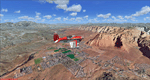
Covers the area between St. George, Utah and Mesquite, Nevada. To the north of St. George
the Pine Valley Mountains with their foothills of scenic red sandstone loom over the city.
St. George Municipal Airport (KSGU) is mostly used for general aviation but is also served by SkyWest Airlines
on behalf of Delta Connection. Because of it's location on a mesa this airport can't be expanded and so a new
airport is currently being built southeast of the city at the site of an abandoned airfield. The opening
is expected in 2011. To the south of the city make sure, you don't miss the Virgin River Gorge where the
Virgin River winds thru a long winding canyon in the transition zone between the red rocks of southern Utahs
Colorado Plateau and Nevadas Mojave Desert. Shortly afterwards you reach Mesquite which is situated just
west of the Arizona stateline. Like nearly all Nevada cities near the stateline Mesquite is home to several
Casinos. Mesquite Airport (67L) lies just north of the city.
High resolution versions of this scenery for FS9 and FSX (much sharper, but larger and multiple downloads)
are available at www.blueskyscenery.com/CNY_South3West6.html . The screenies are taken from the high-res versions,
so expect this version to be slightly more blurry. Thanks to Joop Mak for providing custom AFCADs that
correct airport layouts so that they align with the photo-textures! They are available at www.blueskyscenery.com/AFCADs.html .
YourDonation@Work: Dedicated to Werner, Ralf-Peter and Nels.
| Filename: | St_George_KSGU__Mesquite_67L_UtahNevada_PhotoScene.zip |
| License: | Freeware, limited distribution |
| Added: | 24th March 2010, 19:41:43 |
| Downloads: | 1,653 |
| Author: | Gottfried Razek - blueskyscenery.com |
| Size: | 95.58 MB |
| Category: Flight Simulator 2004 - Scenery | |
| CYVP - Kuujjuaq - Quebec, Canada |
|
Images related to this file:
File Description:
Kuujjuaq is in northern Quebec at the southern end of Ungava Bay, and 30 miles up the Koksoak River. Kuujjuaq has a population of around 2,400; it was previously called Fort Chimo and in 1830 there was a Hudson Bay trading post established close by, but on the other bank of the river. A nursing station and a school were established in 1948 and the Hudson Bay post moved across the river to the current location. The airport is to the south of the town and, unusally for northern airfields, has two runways. The asphalt runway is 6,000 feet long and aligned 07/25, and the gravel runway is 5,000 feet long and aligned 13/31; 07 has ILS. There is fuel available, both 100LL and JetA, but the 100LL will be in drums and you are required to have your own pump. There are numerous flights that stop at Kuujjuaq; the AI included here has Air Creebec, First Air, Wasaya Airways, and Air Inuit (Kuujjuaq is a maintenance centre for Air Inuit) plus private flights by various aircraft. There is also a flight by my poor representation of a Helicopter Transport Services chopper. There is a float base on the nearby Stewart Lake during the summer months. The base is within the Kuujjuaq control zone, and normally you would talk to the tower and inform them of your intentions, but in FS9 this cannot be replicated.
| Filename: | CYVP__Kuujjuaq__Quebec_Canada.zip |
| License: | Freeware, limited distribution |
| Added: | 11th February 2013, 06:22:50 |
| Downloads: | 813 |
| Author: | Roger Wensley |
| Size: | 5.92 MB |
| Category: Flight Simulator X - Aircraft Repaints, Textures and Modifications | |
| North American P-51D Mustang "Hell-er Bust" |
|
Images related to this file:
File Description:
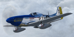
A repaint only for the payware Warbirdsim product 'Mustang Tales'. This repaint depicts the restored P-51D-20-NA 44-72438, "Hell-er Bust", registered N7551T. This specific aircraft is known to have been delivered to the 8th Air Force in England in late January 1945, however no available records indicate any combat time or what, if any, Fighter Group the aircraft was assigned. Following the end of WWII the aircraft served with the Swedish AF as Fv26131, and then with the Dominican AF as FAD 1920. After being imported back into the U.S. in the 1980's, the aircraft was purchased by Selby Burch and given a ground-up restoration. Finished in 118th TRS markings, the aircraft won the Grand Champion WWII Warbird award at Sun 'N Fun 1997. The aircraft was later purchased by Bob Jepson/Lady Alice Corporation and first repainted as 'Lady Alice' and then as 'Hell-er Bust'. In 2006 the aircraft was obtained by the Historic Aircraft Foundation and based at Paine Field, near Seattle, WA. Since 2009, the aircraft has been owned by Mark Peterson/Mustang High Flight LLC, based at Boise, Idaho, and remains finished as 'Hell-er Bust'. The markings depict an original wartime mount of Lt. Col. Edwin L. 'Ed' Heller, a P-51D-10-NA (44-14696) of the 486th FS, 352nd FG. This repaint features new bump maps, wheel well, gun bay, and cockpit textures.
| Filename: | North_American_P51D_Mustang_Heller_Bust.zip |
| License: | Freeware |
| Added: | 14th April 2013, 21:42:25 |
| Downloads: | 215 |
| Author: | John Terrell |
| Size: | 25.84 MB |
| Category: Flight Simulator X - Scenery | |
| Santa Cruz de la Sierra - Bolivia |
|
File Description:
Scenery Photoreal: Santa Cruz de la Sierra, Bolivia
Santa Cruz de la Sierra: (English: Holy Cross of the Mountain Range), commonly known as Santa Cruz, is the
capital of the Santa Cruz department in eastern Bolivia (17 45', South, 63 14', West)at 416 m above sea level.
The city of Santa Cruz is located not far from the easternmost extent of the Andes Mountains and they are
visible from some parts of the city its Situated too on the Pirai River.
The city of Santa Cruz and its metropolitan area are home to over 70% of the population of the department and
it is one of the fastest-growing cities in the world.
Airports: (NOT included in this package, just Scenery Photoreal of the city)
Viru Viru International Airport (IATA: VVI, ICAO: SLVR) in Santa Cruz de la Sierra, Bolivia is Bolivia's largest
international airport. Viru Viru handles domestic, regional, and international flights from Bolivia to
North America, South America and Europe and is the hub for Bolivia's biggest airline Boliviana de Aviacion (BoA).
The airport is able to handle the largest commercial jets.
El Trompillo Airport (IATA: SRZ, ICAO: SLET) is located in the south part of Santa Cruz, Bolivia, about 2 km
(1.25 miles) away from the central plaza. Airport type:(Public / Military).
Compatible with both FSX and P3D.
| Filename: | Santa_Cruz_de_la_Sierra__Bolivia.zip |
| License: | Freeware |
| Added: | 23rd June 2015, 17:09:33 |
| Downloads: | 1,713 |
| Author: | Marcos A. Rivas Torrez |
| Size: | 69.85 MB |
| Category: Flight Simulator X - Scenery | |
| Kopaida Airfield, Greece |
|
Images related to this file:
File Description:
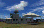
"Kopaida" airfield is a grass private strip, 105km NW of Athens located in the Kopaida drained lake plains between the towns of Aliartos, Kastro and Orchomenos and west of Yliki lake. It is a pure general aviation field and a hub of activity for numerous sport planes, gliders and motor gliders. The field includes a small tower and canteen and several owners of GA aircraft house them in the roomy hangar and also keep a mobile home or RV in the premises. The scenery includes a region and landclass bgl that will force a large area of the Kopaida plains around the airport to display US field textures. This was done because the US fields textures are rectangular and aligned N-E and W-E, in a similar way as the actual fields around the airport. A small photo background is used for the airfield itself. The photo background includes seasonal variations with slight colour variances as well as some autogen trees and shrubs. Custom GA traffic is also included. There is one trike doing circuits and TnGs and a Turbo Porter flying the circuit, simulating a skydiving sortie. The Turbo Porter used is the great freeware one created by Tim (Piglet) Conrad. I have also included a repaint for the F-GHVH, the Porter used by the GFFC, which sports a flashy "Alien" graffiti scheme.
*For FSX SP2 / Acceleration / P3D v1.00*
| Filename: | Kopaida_Airfield_Greece.zip |
| License: | Freeware |
| Added: | 3rd June 2014, 21:23:30 |
| Downloads: | 1,472 |
| Author: | Vassilios Dimoulas |
| Size: | 25.01 MB |
| Category: Flight Simulator X - Scenery | |
| Middle East Carrier Operations (MECOPS) |
|
Images related to this file:
File Description: This scenery has been developed for FSX Flight Simulator SP1 or SP2. It
has also been tested with Microsoft Acceleration , but compatibility is not
guaranteed by the author.
The scenery includes: Two carrier groups CVN68 and CVN69, ( carrier models from
Javier Fernandez ), two AI KC-135 tanker aircraft, AI F-18A aircraft approaching
the carrier, Navy destroyer and a Navy Cruiser as escort ships for the carrier,
a number of oil platforms and the ARS4 radar gauge which displays air targets
and boat targets.
The ARS4 radar gauge provides also a auto landing function for the carrier and a
auto tracking function for aircraft in order to support a A2A re-fueling. The
scenery package includes as well the program Arrcab, developed by Richard Hogan,
and the RCBCO gauge developed by Rob Barendregt. Arrcab or RCBCO are required to
support a catapult start from a carrier and the cable arrestor function for a
carrier landing.
This is not a load and fly package. Please take your time to read the included
documentation for the ARS4 gauge and the MECOPS scenery carefully. Do not skip
chapters because you may think, they are not important for you.
Do not start the installation of the scenery before you have finished the
reading of the documents.
For copyrights and credits please look at the documentation for this scenery.
| Filename: | Middle_East_Carrier_Operations_MECOPS.zip |
| License: | Freeware, limited distribution |
| Added: | 4th March 2013, 18:03:32 |
| Downloads: | 1,892 |
| Author: | Dietmar Loleit |
| Size: | 62.04 MB |
| Category: Prepar3D V1-4 - Aircraft Repaints, Textures and Modifications | |
| Pan Am L-049 Constellation |
|
Images related to this file:
File Description:

Pan American World Airways livery for the A2A COTS L049 Constellation. These textures will also work in FSX.
Pan American World Airways, known from its founding until 1950 as Pan American Airways[1] and commonly known as Pan Am, was the principal and largest international air carrier in the United States from 1927 until its collapse on December 4, 1991. Founded in 1927 as a scheduled air mail and passenger service operating between Key West, Florida, and Havana, Cuba, the airline became a major company credited with many innovations that shaped the international airline industry, including the widespread use of jet aircraft, jumbo jets, and computerized reservation systems. It was also a founding member of the International Air Transport Association (IATA), the global airline industry association.[3] Identified by its blue globe logo ("The Blue Meatball"), the use of the word "Clipper" in aircraft names and call signs, and the white pilot uniform caps, the airline was a cultural icon of the 20th century. In an era dominated by flag carriers that were wholly or majority government-owned, it was also the unofficial overseas flag carrier of the United States. During most of the jet era, Pan Am's flagship terminal was the Worldport located at John F. Kennedy International Airport in New York City.(Source: Wikipedia)
All logos and texts had to be recreated, since there was nothing usable on the net.
| Filename: | Pan_Am_L049_Constellation.zip |
| License: | Freeware, limited distribution |
| Added: | 6th January 2017, 08:29:29 |
| Downloads: | 1,175 |
| Author: | Eberhard Haberkorn / A2A |
| Size: | 65.23 MB |
| Category: Prepar3D V1-4 - Aircraft Repaints, Textures and Modifications | |
| Asiana Airlines 1998 AI Package |
|
File Description:
Asiana and Korean Air had full control of the Korean domestic market in 1998 as South Korea's only 2 scheduled airlines, making them appear at the vast majority of Korean airports. 737-500s were exiting the fleet, with only 3 remaining, and the first A321 had just come online. International routes were flown by 747-400 Combis or 767-300s, with several "tag on" routes onward from Seoul. Asiana served many commercial airports in Japan with 737-400s at the time, and is an important part of the Japanese traffic as well. The carrier had 2 737-500s and it's first A321 painted in a special "Experimental Color Scheme"(EC), and this is represented in the flightplans. One 737-500 also remained in a slightly different older livery dubbed as the "1994" colors, while the rest of the fleet had been modified to the "1998" colors. As a BONUS, ranmori has painted the 747-400, 747-400M and 737-400 in the 1994 livery for use with those flightplans, though there is no use for them in these 1998 plans. Repaints included for the FAIB 737-400, 737-500, 767-300, 747-400, and A321. All repaints were done by the very talented Ranmori Scythe, flightplans done by the not-so-talented Chasen Richardson. Part of the 1998 Flight Simulator Project. Follow us on Facebook at facebook.com/flightsim98 and on instagram as @bayviationsim. For more Retro AI, check out the forums at: http://retroai.proboards.com/
| Filename: | Asiana_Airlines_1998_AI_Package.zip |
| License: | Freeware, limited distribution |
| Added: | 21st November 2019, 19:17:55 |
| Downloads: | 233 |
| Author: | Ranmori Scythe, Chasen Richardson/Bayviation |
| Size: | 27.13 MB |
| Category: Flight Simulator 2004 - Scenery | |
| FS9 Allakaket 6A8 in Alaska |
|
Images related to this file:
File Description:
Allakaket is on the Koyukuk River in Alaska, 40 miles southwest of Bettles. The population is just over 100, with a school that was opened in 1957 for both Allakaket and the nearby Alatna on the other side of the river. There was a very serious flood in 1964 with almost all of the village being underwater, and this resulted in the establishment of an additional housing area further inland and explains the thinly scattered housing in the original village site. The airfield was established in 1978 and has a gravel runway aligned 5-23 (or 05-23 if you are not American) that is just over 4,500 feet in length. Both the runway and the taxiway are marked with lit cones. The village airfield is served by Wright Air and Warbelows Air, both of them being based in Fairbanks and included in the revised AI for PANN that is included here. There are occasional other larger freight flights as required as there is no road access to the village and the river is too shallow to allow large freight barges; hence the runway length.
A note here about my scenery making. There will not be many more to follow this as I am almost at the end of the photos I either took or found for scenery purposes, plus I expect to move on from FS9 at some point during next year.
| Filename: | FS9_Allakaket_6A8_in_Alaska.zip |
| License: | Freeware, limited distribution |
| Added: | 23rd November 2019, 20:29:35 |
| Downloads: | 123 |
| Author: | Roger Wensley |
| Size: | 3.78 MB |


© 2001-2026 AVSIM Online
All Rights Reserved
Privacy Policy |