
Where Flight Simulation Enthusiasts Gather from Around the World!
AVSIM Library - Search Results

| Category: Flight Simulator 2004 - Scenery | |
| Chelsea Dams on the Gatineau River |

|
Images related to this file:
File Description:
The Chelsea Dams are on the Gatineau River, just north of Rockcliffe airfield. I have used the plural as while there is only one dam as such, there is a second generating station just south of the dam; so "it" is more generally called "the Chelsea Dams". The dams mark the point where, if you are flying south down the Gatineau River towards Rockcliffe, you should be either below 1,500 feet or talking to the Ottawa control tower. While not a reporting point as noted in the supplement notes about flying vfr in the Ottawa area the dams are still the natural reporting point when approaching Rockcliffe and announcing landing intentions. Plus they are a visible landmark from way off, so here they are.
| Filename: | Chelsea_Dams_on_the_Gatineau_River.zip |
| License: | Freeware, limited distribution |
| Added: | 14th February 2010, 23:11:15 |
| Downloads: | 256 |
| Author: | Roger Wensley |
| Size: | 879.08 KB |
| Category: Flight Simulator X - AFCAD Files | |
| EHOW - Oostwold Airport, The Netherlands ( Default ) |
|
Images related to this file:
File Description:

This is part of the seventh round of airports issued by Alpha India Group. AIG Ground aims to create high quality Afcads for both FS2004 and for FSX default and Add On Scenery airports. Our airports are created drawing on the best available resources and aim to simulate the real world airport as closely as possible but also to ensure good levels of traffic with realistic parking and good flow of traffic around the airport.
Please read and follow installation instructions in the Readme file carefully, as these do vary.
Visit us at www.alpha-india.net for more information.
| Filename: | EHOW__Oostwold_Airport_The_Netherlands__Default_.zip |
| License: | Freeware |
| Added: | 12th December 2009, 16:09:53 |
| Downloads: | 546 |
| Author: | Joost de Wit & Alpha India Group |
| Size: | 144.3 KB |
| Category: Flight Simulator X - Miscellaneous Files | |
| Guidelines on Flying the Flight1 Mustang |
|
Images related to this file:
File Description:

This Guidelines document complements Flight1's Citation Mustang Pilot's Guide in two ways: (1) Explains how principal automated flight and navigation controls work in conjunction with one-another; and (2) Describes when a particular pilot procedure should be used--what is 'good practice'? This guide provides an overall orientation to Garmin's G1000 panel, including associated AFCS (autopilot) and MFD Controller (FMS) functions. Note: These guidelines are intended to be used in conjunction with Kurt Kalbfleisch's Mustang Tutorial also available in the Avsim Library.
| Filename: | Guidelines_on_Flying_the_Flight1_Mustang.zip |
| License: | Freeware |
| Added: | 19th February 2010, 02:54:31 |
| Downloads: | 1,865 |
| Author: | Maury Pratt |
| Size: | 2.06 MB |
| Category: Flight Simulator 2004 - Scenery | |
| EPGO Goraszka 2010 - The Airshow Challenge |
|
Images related to this file:
File Description:
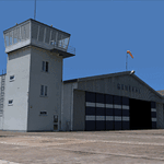
EPGO Goraszka 2010 - The Airshow Challenge is a freeware, extremely detailed scenery of a general aviation airport located 12nm (20km) south-east of Warsaw downtown and Warsaw Frederic Chopin International Airport, Poland. EPGO Goraszka airfield was built in 1994 and currently belongs to a General Aviation company, which offers aero-taxi flights, air transport and special flights (air photo, patrol) and airport services. The airport has a 800m-long runway and a lightened helipad, which can be used by helicopters of up to 5700kg weight. General Aviation's fleet includes Antonov AN-2, PZL-104 Wilga 80, Bell 407 and 427. Since 1996 the International Air Picnic Goraszka is organized every year by the "Polish Eagles" foundation created on initiative of Zbigniew Niemczycki.
The scenery is equipped with an automatic installer. Currently we support a safe, manual way of adding new sceneries to the Scenery Library in Flight Simulator. This is just one thing users need to do for themselves. Detailed instructions will be given during the installation process.
Scenery features:
-Compatible with FS2004 only
-Highest level of accuracy in geographic positioning, modeling and texturing
-Incredibly high quality photoreal textures of all airport buildings. Textures are based on over 300 real world -photographs made for this project.
-Hundreds of 3D objects like tents, exhibitions, airport buildings and surrounding buildings
-Life in the airport: people and cars will enhance your feelings
-AI traffic, animations and effects, designed specifically for FS2004
-Some buildings include interior (control tower)
-High quality aerial photos of the airport surroundings (5 seasons + night) with autogen and water mask
-Ultra high quality aerial photos of the airport (with seasons)
-Plain airport scenery with no airshow objects available too (details in the manual)
-Product includes manual and airport charts in PDF format
EPGO Goraszka 2010 - The Airshow Challenge scenery is compatible with almost every payware add-on, including Ultimate Terrain Eastern Europe and Warsaw Photo Scenery by Simdesign.
Scenery by Drzewiecki Design - www.drzewiecki-design.net
| Filename: | EPGO_Goraszka_2010__The_Airshow_Challenge.zip |
| License: | Freeware |
| Added: | 14th July 2010, 09:49:07 |
| Downloads: | 3,755 |
| Author: | Drzewiecki Design - Stanislaw Drzewiecki, Jakub Paczek |
| Size: | 132.03 MB |
| Category: Flight Simulator X - Scenery | |
| Arthur's Town Airport (MYCA) - The Bahamas |
|
Images related to this file:
File Description:
One of three airports on Cat Island, named after the pirate Arthur Catt and home to Bahamian rake and scrape music. Academy Award winning actor Sidney Poitier grew up just outside Arthur's Town. The scenery includes custom scenery objects, placement of library objects and landclass changes. Scenery is based on photos taken locally, and it is optimized for use with UTX-TAC.
| Filename: | Arthurs_Town_Airport_MYCA__The_Bahamas.zip |
| License: | Freeware |
| Added: | 22nd July 2013, 03:22:42 |
| Downloads: | 1,190 |
| Author: | Art Poole |
| Size: | 735.76 KB |
| Category: Flight Simulator X - Scenery | |
| MYLS - Stella Maris Airport - The Bahamas |
|
Images related to this file:
File Description:
Stella Maris is the northernmost of two airports on Long Island served by Bahamas Air, Southern Air, Pineapple Air and others. The scenery includes custom scenery objects; placement of library objects and landclass changes. Scenery is based on Bing Maps and photos taken locally, and it is optimized for use with UTX-TAC.
| Filename: | MYLS__Stella_Maris_Airport__The_Bahamas.zip |
| License: | Freeware |
| Added: | 8th May 2013, 21:16:44 |
| Downloads: | 1,064 |
| Author: | Art Poole |
| Size: | 1.38 MB |
| Category: Flight Simulator X - Scenery | |
| MYEH - North Eleuthera Airport - The Bahamas |
|
Images related to this file:
File Description:
Northernmost of three airports on Eleuthera Island in the Bahamas just east of Nassau. The scenery includes custom scenery objects; placement of library objects and landclass changes. Scenery is based on Bing Maps, Google Earth and photos taken locally, and it is optimized for use with UTX-TAC.
| Filename: | MYEH__North_Eleuthera_Airport__The_Bahamas.zip |
| License: | Freeware |
| Added: | 16th May 2013, 07:38:48 |
| Downloads: | 1,444 |
| Author: | Art Poole |
| Size: | 1.95 MB |
| Category: Flight Simulator X - Scenery | |
| Great Harbour Cay (MYBG) - The Bahamas |
|
Images related to this file:
File Description:

This airport is located in the Berry Islands north of Nassau, once a golf resort for the rich and famous. The scenery includes custom scenery objects, placement of library objects and landclass changes. Scenery is based on Google Earth, Bing Maps and photos taken locally, and it is optimized for use with UTX-TAC.
| Filename: | Great_Harbour_Cay_MYBG__The_Bahamas.zip |
| License: | Freeware |
| Added: | 26th October 2013, 23:52:07 |
| Downloads: | 627 |
| Author: | Art Poole |
| Size: | 1.17 MB |
| Category: Flight Simulator 2004 - Scenery | |
| Small Airports in the Chilean Patagonia |
|
File Description:
AIRDROMES TTE. JULIO GALLARDO AND TTE vIDAL, IN CHILE,
FOR FS2004 - ACOF
These are the regional airports of the cities of Coyahique and Puerto Natales in southern Chile. Pto. Natales is the center of operations for those visiting the famous national park Torres de Paine. Coyahique is a small city in the cattle region of Chile surrounded by mountains and lush vegetation; this airdrome is a lot of fun to fly to. Includes a very detailed reproduction of terminal buildings, grounds, and other installations. All the most important buildings and airport facilities are recreated with realistic Day/Night time effects. File 1 of 2 (Requieres Patagon3.zip).
By Cesar Carrasco; NYC
| Filename: | Small_Airports_in_the_Chilean_Patagonia.zip |
| License: | Freeware |
| Added: | 26th February 2006, 04:11:32 |
| Downloads: | 1,465 |
| Author: | César Carrasco |
| Size: | 225.44 KB |
| Category: Flight Simulator 2004 - Scenery | |
| Airports in the Republic of Georgia |
|
File Description:
Enhanced airports in the Republic of Georgia: taxiways, aprons and some standard buildings added to the airports in the default sceneries and two airports added which are missing in FS9.
| Filename: | Airports_in_the_Republic_of_Georgia.zip |
| License: | Freeware |
| Added: | 9th March 2006, 03:56:50 |
| Downloads: | 1,148 |
| Author: | Winfried Orthmann |
| Size: | 32.41 KB |


© 2001-2026 AVSIM Online
All Rights Reserved
Privacy Policy |