
Where Flight Simulation Enthusiasts Gather from Around the World!
AVSIM Library - Search Results

| Category: Flight Simulator X - Flight Plans | |
| The Pisa Trip revised version |

|
File Description:
This is a revised version of The Pisa Trip, which contains the complete contents of the_pisa_trip.zip and pisa_trip_flightplans.zip.
This version is uploaded for the use of people who have not got the flightplans, which were unfortunately omitted from the original upload but uploaded later. Many simmers appear to have downloaded the incomplete version without getting the flightplans.
The Pisa Trip is a reproduction of a real-world flight carried out by ten pilots in five aircraft, visiting eight countries in Europe over a period of eight days. The trip was admirably described by Dr Peter Baron, whose detailed description I have used with his permission.
Gordon ("Jock") Wilkinson
| Filename: | The_Pisa_Trip_revised_version.zip |
| License: | Freeware |
| Added: | 8th December 2011, 08:36:42 |
| Downloads: | 335 |
| Author: | Gordon Wilkinson and Dr Peter Baron |
| Size: | 5.78 MB |
| Category: Flight Simulator 2004 - Scenery | |
| Airstrips of the Czech Republic |
|
File Description:
Around 40 sceneries of small airfields in the Czech Republic, each enhanced with buildings, taxiways, parking spaces and aprons as appropriate, to further facilitate the generation of lightweight AI traffic in the area, without overloading the more major airfields.Inspired by a comprehensive selection of regional lightweight GA aircraft on FlightSim.CZ, all appropriately textured to suit the area, with a matching traffic file, these sceneries are all aligned with the roads, rivers and railways etc. in UT Europe, but should mostly be fine in a default installation or other configuration. These sceneries offer a little more generic detail than the AFCADS available on FlightSim.CZ, but often at the expense of fewer parking areas. As always, you can mix and match to suit your own preferences.
| Filename: | Airstrips_of_the_Czech_Republic.zip |
| License: | Freeware, limited distribution |
| Added: | 22nd May 2025, 22:56:49 |
| Downloads: | 46 |
| Author: | Chris Eve |
| Size: | 274.18 KB |
| Category: Flight Simulator 2004 - Scenery | |
| Airstrips east of the Alps |
|
File Description:
A collection of over 70 small airfields in Hungary, Slovakia, Slovenia and Croatia, many of which aren't featured in FS2004, each enhanced with taxiways, parking spaces, buildings etc. and aprons as appropriate, to fill in a few gaps to the north-east of Italy and to allow the generation of lightweight GA AI traffic in this area and into the adjacent countries.Again, there's no photo-realism here, just a selection of basic 'generic' buildings, more or less accurately sized and placed to reflect the airfield layout as seen on on-line satellite imagery and aerial photography. These buildings have minimal effect on frame-rates, so are ideal for this kind of job. The airfields are aligned as well as possible with the roads etc. in UT Europe, where applicable, and the Genesis Europe mesh, but should mostly be fine in a default installation or other configuration.
| Filename: | Airstrips_east_of_the_Alps.zip |
| License: | Freeware |
| Added: | 12th September 2025, 13:29:14 |
| Downloads: | 58 |
| Author: | Chris Eve |
| Size: | 785.49 KB |
| Category: Flight Simulator 2004 - Scenery | |
| Airstrips East of the Adriatic |
|
Images related to this file:
File Description:
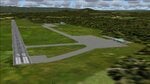
A collection of about 60 small airfields in Albania, Bosnia & Herzegovina, Kosovo, North Macedonia and Serbia & Montenegro, many of which aren't featured in FS2004, each enhanced with taxiways, parking spaces, buildings etc. and aprons as appropriate, to fill in a few gaps to the east of Italy. Most of these airfields are relatively "rural", often little more than a shed and a grass runway in a field, but they allow the generation of lightweight GA AI traffic in this area and into the adjacent countries.Again, there's no photo-realism here, just a selection of basic 'generic' buildings, more or less accurately sized and placed to reflect the airfield layout as seen on on-line satellite imagery and aerial photography. These buildings have minimal effect on frame-rates, so are ideal for this kind of job. The airfields are aligned as well as possible with the default roads etc. and the Genesis Europe mesh, but should mostly be fine in a default installation or other configuration.As before, the files for each airfield can be easily identified by the ICAO code, even if the airfield names vary slightly, so you can pick and choose and mix and match to suit any sceneries you already have, should you so wish. There is no requirement for any other download. Each airfield will exist as a stand-alone entity should you only want a few of them. A few default airfields have had new ICAO codes allocated, in these instances I've provided files to remove the default scenery from the landscape, though the original airfield will still appear on the maps and menu.
| Filename: | Airstrips_East_of_the_Adriatic.zip |
| License: | Freeware |
| Added: | 20th October 2025, 11:48:25 |
| Downloads: | 57 |
| Author: | Chris Eve |
| Size: | 525.71 KB |
| Category: Flight Simulator 2004 - Scenery | |
| Airstrips of the Iberian Peninsular |
|
Images related to this file:
File Description:
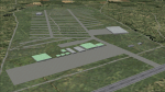
Third in my ongoing "Airstrips of Western Europe" project for FS2004, herewith about fifty sceneries of small, mostly default airfields in Spain and Portugal, each enhanced with taxiways, parking spaces and aprons as appropriate, to further facilitate the generation of lightweight AI traffic in the area without overloading the more major airfields.
Again, there's no photo-realism here, just a selection of basic 'generic' buildings, more or less accurately sized and placed to reflect the airfield layout as seen on on-line satellite imagery and aerial photography. These buildings have minimal effect on frame-rates, so are ideal for this kind of job. The airfields are aligned as well as possible with the roads etc. in UT Europe and the Genesis Europe mesh, but should mostly be fine in a default installation or other configuration.
| Filename: | Airstrips_of_the_Iberian_Peninsular.zip |
| License: | Freeware |
| Added: | 8th August 2024, 12:56:49 |
| Downloads: | 91 |
| Author: | Chris Eve |
| Size: | 1.3 MB |
| Category: Flight Simulator 2004 - Scenery | |
| Airstrips of the Falkland Islands |
|
Images related to this file:
File Description:
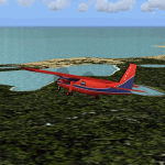
Inspired by Jim Keir's Falkland Islands mesh, coastlines and landclass, herewith a couple of dozen little strips from around the area, to give the opportunity to generate a bit of GA AI (and possibly a few scheduled flights) in an otherwise relatively ignored area in the South Atlantic. Please do note, other than Stanley, most of these airstrips are just that, a cleared strip of land in an otherwise empty landscape, (just as they are in real life), simply to provide a variety of destinations for the occasional aircraft to or from Stanley.
Most of the airfield locations are listed on WikiPedia and the layout confirmed using on-line satellite imagery. Other than the two main airports, none of these airstrips seem to have "official" ICAO codes, so I've generated a selection of alpha-numeric codes in the SF0* configuration, (as Stanley Airport has the ICAO code of SFAL), so the FS9 AI engine has some codes to work with and the airfields can be found on the map. Hopefully these pseudo-codes won't clash with anything else.
As with my other sceneries, the files for each airstrip can be easily identified by the ICAO code, even if the airfield names vary slightly, so you can pick and choose and mix and match to suit any sceneries you already have, should you so wish. There is no requirement for any other download. Each airstrip will exist as a stand-alone entity should you only want a few of them.
Having said that, Paul Denton's AFCAD and scenery for EGYP Mount Pleasant (available on AVSIM and possibly elsewhere) might be considered a worthwhile addition, especially if you want to see the twice-weekly scheduled RAF flights from Brize Norton (via Ascension Island), and the Saturday LATAM flight from Chile. Suitable AFCADs for EGVN Brize Norton and SCCI Punta Arenas may also be required. Appropriate traffic files and aircraft/texture suggestions are provided.
Please read the remainder of this "blurb" in the included text file, there may be a couple of details of interest.
| Filename: | Airstrips_of_the_Falkland_Islands.zip |
| License: | Freeware |
| Added: | 30th March 2025, 18:55:33 |
| Downloads: | 91 |
| Author: | Chris Eve |
| Size: | 295.87 KB |
| Category: Flight Simulator 2004 - Scenery | |
| Mustique TVSM in the Grenadines |
|
Images related to this file:
File Description:
Mustique island is one of the northernmost of the group of islands known as the Grenadines, just south of Bequia. Mustique is a small island, less than 3 miles long and even at its widest less than a mile wide; as a result the resident population is less than 500. The island is unique in that it is owned by a company. The company is owned, in its turn, by the owners of the 100 or so private villas on the island. The Queen of England is one owner; her participation is balanced out by Jeremy Clarkson.
The airport is at the northern end of the island; the runway is around 3,240 feet long, aligned 09 (and with the southeast trade winds it is most unlikely that you will ever find yourself using 27) and with a steep and displaced threshold of over 900 feet. The displaced threshold is shown but unfortunately FS9 is not capable of coping with anything other than a prefectly flat airport. The terminal is a steel-framed shed with cladding, but is "quaintly" transformed with a palm frond roof etc. There are connecting flights by SVG to Barbados and the other islands and these are reflected in the AI. The airport has no lighting, and flights are obliged to land and depart in daylight hours only, outside of which the airport is closed.
| Filename: | Mustique_TVSM_in_the_Grenadines.zip |
| License: | Freeware, limited distribution |
| Added: | 11th June 2013, 22:57:37 |
| Downloads: | 512 |
| Author: | Roger Wensley |
| Size: | 2.07 MB |
| Category: Flight Simulator 2004 - Scenery | |
| Canouan TVSC in the Grenadines |
|
Images related to this file:
File Description:
Canouan Island is the one of the middle islands in the chain known as St Vincent and the Grenadines, between Mustique and Union Island. Canouan is around 5 miles long and shaped like a hook, with a resident population of 1,200. There has been major touristic development on the island since the early 1990's and the island now has paved roads, electricity, and desalinated water along with a golf course.
The airport is at the southern end of the island and the runway has been extended to 5,875 feet on reclaimed land, making Canouan the jet airport for the Grenadines with flights from North and South America. There are connecting flights to the other islands by SVG and LIAT. The airport apron has been extended to accomodate larger planes and I have shown the airport with this apron work still in progress and during the expansion of the terminal building. The AI has two international flights, on Wednesday and Saturday, and both by American.
| Filename: | Canouan_TVSC_in_the_Grenadines.zip |
| License: | Freeware, limited distribution |
| Added: | 11th June 2013, 22:59:04 |
| Downloads: | 656 |
| Author: | Roger Wensley |
| Size: | 3.6 MB |
| Category: Flight Simulator X - Missions | |
| Biggles In The Desert v1.0.3 |
|
File Description:
This is a fix to the original mission. In the original one I used a scenery object (tent) that is a non "stock" FSX tent. Since most end users don't have that tent, the mission will fail entirely. This fixed version has been tested in a clean FSX install, and works as intended...now with a stock FSX tent. Please uninstall the original mission (if you installed it) and use this one. Sorry for the inconvenience. If this is the first time you are downloading this, it should work just fine. So here's the description again:
Finally! Biggles and Co. (Algy, Bertie, and Ginger) fly the skies of FSX. Their boss, Col. Raymond, has disappeared while visiting the Interpol Air Operations hangar in Aden. They fear he has been kidnapped. They must find him! Their French counterpart, Marcel Brissac is there to assist them. Perils await, including ruthless tent-dwellers, and frightful haboobs.
| Filename: | Biggles_In_The_Desert_v103.zip |
| License: | Freeware |
| Added: | 13th August 2013, 20:56:24 |
| Downloads: | 875 |
| Author: | Dan Cowan |
| Size: | 28.02 MB |
| Category: Flight Simulator X - Scenery | |
| The Dry Tortugas Photo Scenery |
|
Images related to this file:
File Description:
Where are the Dry Tortugas? Should you be wondering, at the western end of the Florida Keys. Located 68 miles west of Key West, they are accessible only by boat and of course via your favorite seaplane.
Source Data: National Agriculture Imagery Program (NAIP) Orthoimagery, 1 meter per pixel resolution. The scenery package also corrects the MS-FSX Island and Lighthouse position errors overlooked by UTX-USA and UTX-TAC.
For your finest virtual experience it is highly recommended you download, install and use with: South Florida and The Bahamas Water Class scenery. (S-FL_Bahamas_WC.zip)
Enjoy your flight and don't forget your Scuba Gear or the sunscreen! - Wally-Bob
| Filename: | The_Dry_Tortugas_Photo_Scenery.zip |
| License: | Freeware, limited distribution |
| Added: | 23rd August 2014, 11:08:17 |
| Downloads: | 918 |
| Author: | Walter Roberts |
| Size: | 50.9 MB |


© 2001-2026 AVSIM Online
All Rights Reserved
Privacy Policy |