
Where Flight Simulation Enthusiasts Gather from Around the World!
AVSIM Library - Search Results

| Category: Flight Simulator 2004 - Scenery | |
| NZ Rural Airstrips, v3 |

|
Images related to this file:
File Description:
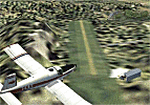
Replaces my previous versions. 9 more strips included. Gisborne area. Requires Christian Stock's payware NZ mesh in the form of "Mountains of New Zealand" and topo in the form of "Lakes and Rivers of New Zealand".
| Filename: | NZ_Rural_Airstrips_v3.zip |
| License: | Freeware |
| Added: | 17th April 2010, 16:18:18 |
| Downloads: | 147 |
| Author: | Godfrey Tier |
| Size: | 2.37 MB |
| Category: Flight Simulator 2004 - Scenery | |
| La Tortuga Island - SyDesigns |
|
File Description:
La Tortuga Island Scenery for Flight Simulator 2004: It is an accurate depiction of this paradise located near Margarita Island in Venezuela. It includes two airfields, new coastlines, mesh, landclass, visual details for VFR flying, and animated scenery.
| Filename: | La_Tortuga_Island__SyDesigns.zip |
| License: | Freeware, limited distribution |
| Added: | 3rd August 2006, 03:52:22 |
| Downloads: | 4,329 |
| Author: | Sabino Yacobone & Arnoldo Perdomo |
| Size: | 6.72 MB |
| Category: Flight Simulator 2002 - Scenery | |
| Baguio City Airport , Baguio City, Philippines |
|
File Description:
LOAKAN AIRPORT SCENERY, BAGUIO CITY,PHILIPPINES
Version 1.0
July 2,2003
Baguio City is the SUMMER CAPITAL OF THE PHILIPPINES.Baguio City is known for its Tourist spots like:Camp John Hay,Mines View Park,Lourdes Grotto,Daniel Burnham Park,Philippine Military Academy,The Marcos Mansion,Wright Park,and so much more attractions.
This Baguio City scenery has a specially designed terrain,totally different from the default FS2002 terrain for Baguio City Airport.
Baguio City Airport has an elevation of 4,251 feet.This is my third Philippine Scenery design.
| Filename: | Baguio_City_Airport__Baguio_City_Philippines.zip |
| License: | Freeware |
| Added: | 2nd July 2003, 13:10:38 |
| Downloads: | 1,379 |
| Author: | Ver Walter L. Gulfan |
| Size: | 1.4 MB |
| Category: Flight Simulator 2004 - Scenery | |
| Flattens for use at PANC Anchorage, Alaska Airport |
|
Images related to this file:
File Description:
Flattens for use at PANC Anchorage, Alaska Airport - for FS2004 only.
While flying into PANC recently, I noticed the water was encroaching on the land near Runways 14 and 6 in a most unrealistic manner. This package provides two flattens which will eliminate that problem. Tested with the default scenery and with the Frame Rate Friendly Studio version of PANC. It has not been tested with any terrain enhancement such as Ultimate Terrain. Please unzip to a temporary folder and follow the very simple installation instructions. Compiled for your flying enjoyment by David "Opa" Marshall.
| Filename: | Flattens_for_use_at_PANC_Anchorage_Alaska_Airport.zip |
| License: | Freeware |
| Added: | 20th June 2010, 02:16:27 |
| Downloads: | 1,936 |
| Author: | David "Opa" Marshall |
| Size: | 765.25 KB |
| Category: Flight Simulator X - AFCAD Files | |
| Wide Sky Airpark Airport (JY31), NJ |
|
File Description:
Located 03 miles NW of Bridgeton, New Jersey on 23 acres of land, Wide Sky Airpark Airport is a private turf field 2550' in length. There is no fuel available, but there is tiedown space by the main hangar in the middle of the field to the west. You can start in the parking spot there if you have a plane with 40' or less wingspan (collision with static aircraft is disabled so you can put a bigger plane there if you wish with no trouble). The windsock is not lit at night and is located atop the south end of then main hangar's roof. The field is hedged in to the east with bushes but they do not cause aircraft collisions. The runway is lit for night VFR operations. There is no hard surfaced runway so set your terrain mesh settings as high as possible to enjoy rolling around on bare bumpy terrain.
Scenery constructed with use of satellite images/streetview/aerial photos - the author has not been there in person.
This scenery is meant to be used in conjunction with MegaScenery Earth New Jersey/Delaware 004. It is not required, but apron use is minimized to allow satellite scenery to show through as much as possible, and objects are placed based on the MSE textures - lack of it may make scenery look out of place.
| Filename: | Wide_Sky_Airpark_Airport_JY31_NJ.zip |
| License: | Freeware |
| Added: | 10th May 2011, 13:40:36 |
| Downloads: | 157 |
| Author: | Drew Sikora |
| Size: | 1.27 MB |
| Category: Flight Simulator X - AFCAD Files | |
| Fly-N-D Landing Strip Airport (92NJ), NJ |
|
File Description:
Located 01 miles E of Kingwood Township, New Jersey on 121 acres of land, Fly-N-D Landing Strip Airport is a private turf field with a 2200' runway. There is no hard surface runway so setting your mesh as high as possible will lead to the best effects of landing on terrain. No transient storage or services are offered, and the airfield is not lit, so daytime VFR operations are recommended only.
Scenery constructed with use of satellite images/streetview/aerial photos - the author has not been there in person.
This scenery is meant to be used in conjunction with MegaScenery Earth New Jersey/Delaware 001. It is not required, but apron use is minimized to allow satellite scenery to show through as much as possible, and objects are placed based on the MSE textures - lack of it may make scenery look out of place.
| Filename: | FlyND_Landing_Strip_Airport_92NJ_NJ.zip |
| License: | Freeware |
| Added: | 23rd March 2011, 13:33:27 |
| Downloads: | 174 |
| Author: | Drew Sikora |
| Size: | 474.94 KB |
| Category: Flight Simulator X - AFCAD Files | |
| Woodcrest Farms Airstrip Airport (JY17), NJ |
|
File Description:
Located 02 miles NE of Shiloh, New Jersey, Woodcrest Farms Airstrip Airport is a private turf field 2303' in length. There are no services offered for transient aircraft and the field is not lit, so daytime VFR operations only are recommended. There is no hard-surfaced runway so make sure your terrain mesh is set as high as possible. You can start on the runway or parked next to the hangar east of the field
Scenery constructed with use of satellite images/streetview/aerial photos - the author has not been there in person.
This scenery is meant to be used in conjunction with MegaScenery Earth New Jersey/Delaware 004. It is not required, but apron use is minimized to allow satellite scenery to show through as much as possible, and objects are placed based on the MSE textures - lack of it may make scenery look out of place.
| Filename: | Woodcrest_Farms_Airstrip_Airport_JY17_NJ.zip |
| License: | Freeware |
| Added: | 11th May 2011, 03:29:54 |
| Downloads: | 170 |
| Author: | Drew Sikora |
| Size: | 443.09 KB |
| Category: X-Plane - Scenery | |
| WXPN Susi Air Pulau Nurseen Airstrip v1.0.0 |
|
Images related to this file:
File Description:
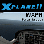
This is an X-Plane 11 scenery for Pulau Nurseen Airstrip (WXPN) in the Island of Nurseen, Indonesia. This is a fictitious airfield, located in a tiny isolated island. This fictitious airfield may serve as a stopover for flights between Java and Papua, for the Susi Air scenery package. This is one of the destinations for "PT ASI Pujiastuti Aviation", operating as Susi Air, an Indonesia airlines established in late 2004 by Mrs. Susi Pudjiastuti. This scenery was tested and is operational (as of January 17, 2017) in "X-Plane 11 Public Beta #5 64 bit", Windows 10 Home. It was also tested and is not really operational (as of January 17, 2017) in "X-Plane 10.51 64 bit", Windows 10 Home. XP10's mesh is different, and presents problems in placing the runway over the water, instead of the land, plus some terrain elevations issues as well. Sorry, XP11 only.
| Filename: | WXPN_Susi_Air_Pulau_Nurseen_Airstrip_v100.zip |
| License: | Freeware |
| Added: | 18th January 2017, 05:00:53 |
| Downloads: | 45 |
| Author: | Rui Mesquita |
| Size: | 2.65 MB |
| Category: Flight Simulator X - Scenery | |
| Airport Kassel EDVK |
|
Images related to this file:
File Description:
The 5th version of this Add-On for FSX approaches the reality with photo-realistic ground textures, accurate buildings, runways, taxiways and the official approaches with waypoints, localizers and glide paths. More than 1200 objects, 60 individual scenery-models, approx. 100 custom ground polygons and lines have been created. One big problem was to adopt the terrain mesh to fit the new airport. The actual state of January 2019 has been adapted to the scenery. Photorealistic ground textures have been reworked. High resolution textures you find at the aprons and the vehicle parking areas at the General Aviation and Business Terminals. Accurate Night Lighting and winter textures have been added. All buildings, Hangars and a lot of objects have been designed individually (no library objects). Even the taxiway and apron markings are hand-made. For P3D a different version can be downloaded. Works with VFR Germany and ORBX Northern Germany.
| Filename: | Airport_Kassel_EDVK.zip |
| License: | Freeware, limited distribution |
| Added: | 30th June 2019, 16:37:37 |
| Downloads: | 11,925 |
| Author: | Albert Claudi |
| Size: | 105.46 MB |
| Category: Flight Simulator 2002 - Adventures | |
| IFR - Approach to Kathmandu |
|
File Description:
Kathmandu VOR/DME RWY02 Approach
Make one of the world's most challenging
non-precision approaches into a high altitude
airfield with a steep approach path and high
terrain all around. Re-release of the FS2000
version (ktm02app.zip).
| Filename: | IFR___Approach_to_Kathmandu.zip |
| License: | Freeware, limited distribution |
| Added: | 16th May 2003, 07:32:58 |
| Downloads: | 2,299 |
| Author: | Fermin Fernandez |
| Size: | 1.95 MB |


© 2001-2026 AVSIM Online
All Rights Reserved
Privacy Policy |