
Where Flight Simulation Enthusiasts Gather from Around the World!
AVSIM Library - Search Results

| Category: Orbiter - Spaceships | |
| USS Voyager NCC 74656 |

|
File Description:
This addon is based on the mesh created by Ed Giddings (http://www.quantumss.freeserve.co.uk). It works fine with Orbiter version 031105.
Just unzip the archive into your Orbiter-folder, explore deep space and have fun...
| Filename: | USS_Voyager_NCC_74656.zip |
| License: | Freeware |
| Added: | 30th November 2003, 04:21:19 |
| Downloads: | 1,637 |
| Author: | Uli Klapp |
| Size: | 3.31 MB |
| Category: Flight Simulator X - Scenery | |
| EGDC - RAF Chivenor |
|
File Description:
RAF Chivenor for FSX. File blended to Horizon GenX Scenery and Mesh to remove cliff effect Scenery is default and items from Runway12 Libraries.
Open the hangar doors to find what is located inside.
| Filename: | EGDC__RAF_Chivenor.zip |
| License: | Freeware, limited distribution |
| Added: | 9th October 2007, 19:47:31 |
| Downloads: | 1,851 |
| Author: | Tony Meredith |
| Size: | 630.24 KB |
| Category: Flight Simulator 2004 - Scenery | |
| NZMJ Martins Bay, New Zealand |
|
Images related to this file:
File Description:
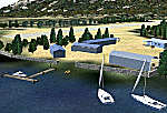
Fiordland, New Zealand. 19nm from Milford Sound. You must have Christian Stock's NZ mesh in the form of "Mountains of New Zealand"
and topo in the form of "Lakes and Rivers of New Zealand".
| Filename: | NZMJ_Martins_Bay_New_Zealand.zip |
| License: | Freeware |
| Added: | 13th July 2010, 09:19:02 |
| Downloads: | 359 |
| Author: | Godfrey Tier |
| Size: | 855.99 KB |
| Category: Flight Simulator 2004 - Scenery | |
| NZCG - Centennial Park Aerodrome |
|
Images related to this file:
File Description:
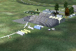
Small New Zealand aerodrome 5nm NE of Taupo, New Zealand. Horse Racing and Motosport Park. Taupo Gliding Club. Watch for radio mast 6.3nm NW of aerodrome. Made to fit Christian Stock's NZ 20m mesh.
| Filename: | NZCG__Centennial_Park_Aerodrome.zip |
| License: | Freeware |
| Added: | 13th August 2012, 09:27:58 |
| Downloads: | 362 |
| Author: | Godfrey Tier |
| Size: | 2.83 MB |
| Category: Flight Simulator X - Scenery | |
| LFFD - Saint-Andre-de-l'Eure Airport - Normandy, France |
|
File Description:
A forgotten airfield in FSX, near Evreux in Normandy(France). Activity: Microlight (ULM) and light aviation
Realized with the software ADE.
Tested with UTX Europe + Gex + TrueLandscape on a mesh of 38 m.FPS friendly.
| Filename: | LFFD__SaintAndredelEure_Airport__Normandy_France.zip |
| License: | Freeware, limited distribution |
| Added: | 11th August 2013, 16:48:16 |
| Downloads: | 873 |
| Author: | Christian Davi |
| Size: | 4.23 MB |
| Category: Flight Simulator 2004 - Scenery | |
| Colorado Lakes Project I |
|
File Description:
These files ADD 15 highly detailed lakes to Colorado. Although these lakes are specifically designed to show off their photo realistic detail when used in combination with 38.2m mesh, they work equally as well with the default mesh. All lake information was derived from detailed map data.
Included lakes are: the Antero, Eleven Mile, Spinney, Paonia, Lemon, Vallecito, Ruedi and Taylor Reservoirs, Cheesman Lake, Lake Grant, Peanut Lake, Meridian Lake, Nicholson Lake, Lake Irwin, and McPhee Reservoir, which is the second largest reservoir in the state.
| Filename: | Colorado_Lakes_Project_I.zip |
| License: | Freeware |
| Added: | 8th February 2004, 23:33:51 |
| Downloads: | 5,278 |
| Author: | Carlyle Sharpe |
| Size: | 253.36 KB |
| Category: Orbiter - Miscellaneous Files | |
| Moonport Apollo Facilities/Scenario Package |
|
File Description:
This package accurately simulates the apollo era facilities of LC 34, LC 37 and LC 39. Included is:
LC39 in apollo and skylab config.
LC39 pad areas
Driveable crawler (nassp mesh modifacation)
Driveable mobile service strucutre (LC39)
Vechicle Assembly Building interior for stacking ops.
Meshed Crawlerway
LC34
LC34 mobile service structure
LC37
Earth 1965 and 1973 configurations to support mesh combination
Scenarios for all manned US Space missions with apollo hardware (lunar program, skylab and ASTP)
(unmanned to be released in updated Early Saturns package)
| Filename: | Moonport_Apollo_FacilitiesScenario_Package.zip |
| License: | Freeware, limited distribution |
| Added: | 11th January 2003, 04:54:16 |
| Downloads: | 4,739 |
| Author: | John Graves (lc34 tower only by Brad Hodges, Skylab Scenarios by Ronald) |
| Size: | 2.76 MB |
| Category: Orbiter - Miscellaneous Files | |
| Apollo 11 Meshpack for NASSPv4.2 |
|
File Description:
This add-on simply changes the default NASSP v4.2 LM meshes, the astronaut (lunar EVA) mesh, and the US Flag mesh with some detailed and Apollo 11 specific meshes. July 16, 2003, marks the 34th anniversary of the Apollo 11 launch, and I wanted those Orbiter and NASSP fans who are currently simulating the AP11 flight and lunar landing to have a more or less accurate 3D-representation of the AP11 LM and astronaul Neil Armstrong, when he took is first step on the lunar surface.
| Filename: | Apollo_11_Meshpack_for_NASSPv42.zip |
| License: | Freeware |
| Added: | 28th July 2003, 06:31:02 |
| Downloads: | 3,505 |
| Author: | Rodion M. Herrera |
| Size: | 4.02 MB |
| Category: Flight Simulator X - Scenery | |
| France Vendee (86) - LF8523 Atlantic Airpark |
|
Images related to this file:
File Description:
A french scenery just for fun = Atlantic Aeropark near Chasnais and Lucon towns in Vendee country in France.
There are few aeropark in France. I created airport and some houses with planes for 4.75 precision mesh. Perhaps it would be fun for all mesh.
See http://www.atlanticairpark.com/ for map and details on real world.
For installation, you just unzip in addon scenery path and you have to declare in parameters of fsx the scenery repertory (as usual).
Vladimir Corre, contact:
| Filename: | France_Vendee_86__LF8523_Atlantic_Airpark.zip |
| License: | Freeware |
| Added: | 10th September 2015, 23:35:32 |
| Downloads: | 290 |
| Author: | Vladimir Corre |
| Size: | 1.41 MB |
| Category: Flight Simulator 2002 - Miscellaneous Files | |
| FSGarmin/FSFlightMax - TERRAIN ELEVATION MAP - THE ALPS AND ITALLY |
|
File Description:
This is an elevation map that approximately covers the area between N49, E4.5 and N36.5, E19 to be used with FSGarmin/FSFlightMax.
| Filename: | FSGarminFSFlightMax__TERRAIN_ELEVATION_MAP___THE_A.zip |
| License: | Check within download |
| Added: | 14th October 2003, 22:42:21 |
| Downloads: | 726 |
| Author: | Aleksey Sudakov |
| Size: | 7.46 MB |


© 2001-2026 AVSIM Online
All Rights Reserved
Privacy Policy |