
Where Flight Simulation Enthusiasts Gather from Around the World!
AVSIM Library - Search Results

| Category: Prepar3D V1-4 - Scenery | |
| ETM12m Crimea - Enhanced Terrain Mesh 12m for Crimea Peninsula |

|
Images related to this file:
File Description:
This is an Enhanced Terrain Mesh (ETM) 0,41 arc sec (12,50 meters) resampled at LOD 11 (FSX/P3D SDK). Mainly the area covered by this terrain mesh is related to the Crimea Peninsula. This is a project for FSX/P3D (All versions). Dataset ALOS PALSAR Global Radar Imagery (2006-2011)
Radiometric Terrain Corrected (RTC) High Resolution DEM 12.5mt by Alaska Satellite Facility (ASF).
| Filename: | ETM12m_Crimea__Enhanced_Terrain_Mesh_12m_for_Crime.zip |
| License: | Freeware |
| Added: | 12th May 2020, 18:10:42 |
| Downloads: | 160 |
| Author: | Giovanni Miduri |
| Size: | 47.17 MB |
| Category: Flight Simulator 2002 - Scenery | |
| Croatia, Slovenia, Bosnia & Herzegovina 76m Mesh |
|
File Description:
Terrain mesh file for Croatia, Slovenia, Bosnia & Herzegovina at LOD9 or 76.4 m resolution. Resampled from 39 SRTM 3arc second DEMs. Mesh covers from N42 E13 - N47 E21.
| Filename: | Croatia_Slovenia_Bosnia__Herzegovina_76m_Mesh.zip |
| License: | Freeware |
| Added: | 21st November 2003, 15:59:43 |
| Downloads: | 2,762 |
| Author: | Hrvoje Kruhek |
| Size: | 28.03 MB |
| Category: Flight Simulator X - Scenery | |
| Northeast New Jersey 5 Meter Mesh Terrain |
|
Images related to this file:
File Description:
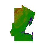
High Resolution Northeast New Jersey 5 Meter Mesh Terrain by Wally-Bob represents a significant improvement over FSX default 38 meter mesh terrain. The results are also dramatic compared to 10 meter compressed payware mesh as lossless compression compilation (read no data loss) is used. Lossless compiling produces renderings that have the Crispness of the Real World Terrain. Fly the Hudson River and view the Palisades as they are in real life, see the screen shots enclosed. High Quality 5 meter mesh terrain is a must have for mountainous areas especially where photo scenery is also used to render the virtual world. Manual includes FSX configuration and scenery installation tips. USGS LiDAR 1/9 Arc-Second source data.
| Filename: | Northeast_New_Jersey_5_Meter_Mesh_Terrain.zip |
| License: | Freeware, limited distribution |
| Added: | 26th February 2011, 21:35:52 |
| Downloads: | 1,100 |
| Author: | Walter Roberts |
| Size: | 135.89 MB |
| Category: Flight Simulator 2002 - Scenery | |
| Seattle, WA - High Resolution Terrain Mesh |
|
File Description:
Seattle, Washington area. The modest terrain in the Seattle area provides a nice example of a less obvious benefit of high resolution terrain mesh. The rendering of many small features missing entirely in the default mesh provides much richer detail and a greater sense of realism. (30m source -> 38.2m final).
| Filename: | Seattle_WA__High_Resolution_Terrain_Mesh.zip |
| License: | Freeware, limited distribution |
| Added: | 4th July 2002, 13:32:39 |
| Downloads: | 3,621 |
| Author: | Steve Greenwood |
| Size: | 3.75 MB |
| Category: Flight Simulator 2002 - Scenery | |
| Venezuelan Andes 3-Arc Sec Terrain for FS2002 |
|
File Description:
This freeware add-on file will enhance your VFR Mountain flying experience with Microsoft FS2002. You will enjoy amazing elevation details for the Venezuelan Andes. Please see enclosed picture comparison with actual photograph and terrain mesh coverage. The terrain mesh was created using 3-Arc Second Digital Elevation Model (90 meters/pixel).
| Filename: | Venezuelan_Andes_3Arc_Sec_Terrain_for_FS2002.zip |
| License: | Freeware |
| Added: | 20th January 2023, 01:16:05 |
| Downloads: | 22 |
| Author: | P.Miliani |
| Size: | 3.72 MB |
| Category: Prepar3D V1-4 - Scenery | |
| ITALY ETM20m - Enhanced Terrain Mesh vol. 00 ver 1.10 |
|
Images related to this file:
File Description:
File Description:
Italy - ETM Enhanced Terrain Mesh 0.73 arc sec (20 meters). This Terrain Mesh is fully compatible with FSX/P3D (all versions). This is a work in progress. Volume 00 - Sicily, Aeolian Islands, Egadi Islands, Ustica Island and Pelagie Islands.
----------------------
MIND OUT THERE! THIS VERSION REPLACE THE PREVIOUS (vers. 1.00). BECAUSE THERE WAS AN ERROR IN THE MESH MAP; THE MALTESE ARCHIPELAGO WAS FLATTENED. THIS VERSION FIXES IT.
| Filename: | ITALY_ETM20m__Enhanced_Terrain_Mesh_vol_00_ver_110.zip |
| License: | Freeware |
| Added: | 11th January 2019, 22:39:17 |
| Downloads: | 459 |
| Author: | Giovanni Miduri |
| Size: | 52.04 MB |
| Category: Flight Simulator 2004 - Scenery | |
| Scotts Bluff, Nebraska 19m Terrain Mesh |
|
File Description:
LOD 11 (19 m resolution) terrain mesh of Scotts Bluff National Monument in the panhandle of Nebraska and surrounding area. Compiled from NED 1/3" (10 m) elevation data. Proprietary software was used to smooth the terrain near KBFF and KIBM airports to eliminate the "runway plateau" side effects induced by high-resolution mesh.
| Filename: | Scotts_Bluff_Nebraska_19m_Terrain_Mesh.zip |
| License: | Freeware, limited distribution |
| Added: | 22nd April 2004, 18:16:00 |
| Downloads: | 1,332 |
| Author: | John K. Taylor |
| Size: | 6.69 MB |
| Category: Flight Simulator X - AFCAD Files | |
| VQPR - Paro Intl Airport,Tibet |
|
Images related to this file:
File Description:
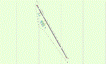
A modification of default Paro Intl Airport, Tibet for FSX using ADE with information from google earth. Addon terrain mesh is required as default FSX mesh is incorrect and makes the airport unusable.
| Filename: | VQPR__Paro_Intl_AirportTibet.zip |
| License: | Freeware |
| Added: | 2nd September 2013, 13:29:20 |
| Downloads: | 553 |
| Author: | Himanshu Singh |
| Size: | 3.05 KB |
| Category: Flight Simulator X - Scenery | |
| Quebec Mesh (Lod10), between N56°-N57° and W66°-W77°, Prov. of Quebec (Canada) |
|
File Description:
FSX 38m (Lod10) terrain mesh files of territory included between N56°-N57° and W66°-W77°, province of Quebec, Canada.
| Filename: | Quebec_Mesh_Lod10_between_N56N57_and_W66W77_Prov_o.zip |
| License: | Freeware, limited distribution |
| Added: | 1st March 2008, 14:37:15 |
| Downloads: | 3,040 |
| Author: | Gilles Gauthier |
| Size: | 21.6 MB |
| Category: Flight Simulator X - Scenery | |
| Flattening Patch for FSX Tarija (SLTJ), Bolivia When Used with FreeMeshX |
|
Images related to this file:
File Description:
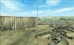
That is a flattening patch for the airport of Tarija (SLTJ), Bolivia when using FreeMeshX terrain by NineTwo Production, a freeware global terrain mesh for FSX. Comes with a French readme too. Freeware
| Filename: | Flattening_Patch_for_FSX_Tarija_SLTJ_Bolivia_When_.zip |
| License: | Freeware |
| Added: | 18th January 2017, 17:11:39 |
| Downloads: | 225 |
| Author: | G. Guichard |
| Size: | 125.39 KB |


© 2001-2026 AVSIM Online
All Rights Reserved
Privacy Policy |