
Where Flight Simulation Enthusiasts Gather from Around the World!
AVSIM Library - Search Results

| Category: Flight Simulator 2004 - Scenery | |
| Lanterna di Genova |

|
File Description:
Scenery of the "Lanterna di Genova".For the best results is useful Ultimate Terrain Europe.
| Filename: | Lanterna_di_Genova.zip |
| License: | Freeware, limited distribution |
| Added: | 28th October 2008, 14:19:29 |
| Downloads: | 738 |
| Author: | Claudio "Werwolf" Carra |
| Size: | 1.16 MB |
| Category: Flight Simulator X - AFCAD Files | |
| Reggio Calabria Airport (LICR) AFCAD |
|
File Description:
Reggio Calabria Airport (LICR) Afcad, for flight simulator x. Optimized for Ultimate Terrain Europe X.
| Filename: | Reggio_Calabria_Airport_LICR_AFCAD.zip |
| License: | Freeware |
| Added: | 25th February 2009, 21:14:55 |
| Downloads: | 556 |
| Author: | Fabio Iaria |
| Size: | 5.34 KB |
| Category: Flight Simulator 2004 - Scenery | |
| Masterton, New Zealand vs.2 |
|
File Description:
Version 2. 07July 08. Added windsocks, radio-controllers meet, aerial & shack, holding points,lights on main taxiway, fence by aero club. This replaces previous version.
Made to fit Christian Stock's NZ 20-mesh and Topo. Don't know what it would be like with the 75-mesh - probably hopeless with default scenery.
| Filename: | Masterton_New_Zealand__vs2.zip |
| License: | Freeware |
| Added: | 6th July 2008, 20:24:15 |
| Downloads: | 557 |
| Author: | Godfrey Tier |
| Size: | 3.54 MB |
| Category: Flight Simulator 2004 - Scenery | |
| Brazil MESH Flatten Correction SBBH |
|
File Description:
Mesh correction at Pampulha Lake at Belo Horizonte SBBH. This Flatten BGL correct aproach at Runway 13, a big slope in front of runway 13. Now you can land safe. Just for use with Brazil Mesh Scenery. Don't use with FS default scenery! Enjoy your VFR flight. By Cesar Marinho
| Filename: | Brazil_MESH_Flatten_Correction_SBBH.zip |
| License: | Freeware |
| Added: | 25th October 2005, 14:03:49 |
| Downloads: | 2,087 |
| Author: | Cesar Marinho |
| Size: | 2.62 KB |
| Category: Flight Simulator 2004 - Scenery | |
| Centre Bush Aerodrome - NZCB |
|
Images related to this file:
File Description:
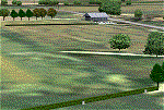
Small New Zealand aerodrome, 22nm north of Invercargill, Southland. Made to fit Christian Stock's NZ 20m mesh.
| Filename: | Centre_Bush_Aerodrome__NZCB.zip |
| License: | Freeware |
| Added: | 17th April 2012, 22:13:32 |
| Downloads: | 161 |
| Author: | Godfrey Tier |
| Size: | 476.1 KB |
| Category: Flight Simulator X - Scenery | |
| Stewart b.c. Canada czst |
|
File Description:
Stewart, b.c. Canada czst scenery for use with ultimate terrain canada FSX. Freeware by Doug Keech.
| Filename: | Stewart_bc_Canada__czst.zip |
| License: | Freeware |
| Added: | 24th January 2009, 19:39:04 |
| Downloads: | 1,276 |
| Author: | Doug Keech |
| Size: | 155.96 KB |
| Category: Flight Simulator X - AFCAD Files | |
| CFQ5 - Silver City (Kluane Lake) - Yukon, Canada |
|
Images related to this file:
File Description:

This is a patch that should correct and brush-up the airport Silver City (CFQ5) in Yukon, Canada and furthermore some severe scenery discrepancies around the south-western shore of Kluane Lake close to it that are caused by elevation differences of the surface on both sides of Latitude N61.0 in the context with UTX Canada in combination with high resolution mesh like "FSGenesis" (tested by myself) or "FS Global Ultimate" (as reported by others). It may work in other configurations, too. However, the Microsoft standard scenery will likely be disturbed as the corrected shorelines are depending on Scenery Solutions Ultimate Terrain Canada X" (payware).
| Filename: | CFQ5__Silver_City_Kluane_Lake__Yukon_Canada.zip |
| License: | Freeware |
| Added: | 25th September 2013, 21:35:59 |
| Downloads: | 199 |
| Author: | Axel Birsul |
| Size: | 682.43 KB |
| Category: Flight Simulator X - Scenery | |
| White Island Photoreal Scenery (2nd of 4 releases) |
|
File Description:
This is the second of four photoreal scenery releases covering the main offshore islands in the Bay of Plenty, New Zealand.
This scenery was created from a scanned aerial photograph owned by Environment Bay of Plenty (The Bay of Plenty Regional Council). The imagery has been de-sampled for use in Flight Simulator X and utilizes the default terrain mesh. The textures are intended for summer daylight flying only, although due to the sparse nature of White Islands’ vegetation, the Islands appearance remains relatively consistent throughout the year.
It includes Steam, autogen objects (including a library object which vaguely resembles the abandoned Sulphur works) and animated birds.
| Filename: | White_Island_Photoreal_Scenery_2nd_of_4_releases.zip |
| License: | Freeware, limited distribution |
| Added: | 30th April 2007, 23:46:45 |
| Downloads: | 2,930 |
| Author: | Tim Barnes |
| Size: | 4.77 MB |
| Category: Flight Simulator X - Scenery | |
| Tonopah Test Range - TNX |
|
File Description:
This file contains several BGL's which enhance the default FSX Tonopah Test Range (TNX).
Parking, scenery objects, and roads are added to the bland stock airport.
The "mesa" created by the stock airport backgound flatten is blended into the
surrounding terrain using "sloped flattens". The surrounding "city" was removed
and a better landclass substituted.
This scenery is not intended to re-create a perfect match to the real world but
to enhance the visual experience of flying into and out of the airport.
The files were tested with FSX-Acceleration\SP2 on WinXP Pro, DX9.
I used 10M mesh from the "FSX Usa 10 M terrains Project" when blending
| Filename: | Tonopah_Test_Range__TNX.zip |
| License: | Freeware |
| Added: | 21st December 2007, 04:35:03 |
| Downloads: | 1,236 |
| Author: | Paul Strogen |
| Size: | 843.73 KB |
| Category: Flight Simulator 2004 - Scenery | |
| Project Mexico Real LOD9 File 4 of 4 |
|
Images related to this file:
File Description:
File 4th of 4 of a Terrain Mesh that covers the entirety of Mexican Territory and related bordering U.S., Guatemala and Belice areas, part of the "Proyecto M�©xico Real" project, compiled at LOD9 (2.48 arcseconds in latitude and 3.3 arcseconds in longitude) resolution from INEGI data. Intended to enhance the virtual flying experience with the more detailed LOD10 version and complement the LOD8 version compiled from the same data. Compatible backwards with Flight Simulator 2000, Flight Simulator 2002 and Combat Flight Simulator 2. Refer to the file contents about the cover area to this compressed file. (Re-upload due to AVSIM hack)
| Filename: | Project_Mexico_Real_LOD9_File_4_of_4.zip |
| License: | Check within download |
| Added: | 6th June 2010, 08:50:44 |
| Downloads: | 2,726 |
| Author: | Juan Jose Galvan Bautista |
| Size: | 54.82 MB |


© 2001-2026 AVSIM Online
All Rights Reserved
Privacy Policy |