
Where Flight Simulation Enthusiasts Gather from Around the World!
AVSIM Library - Search Results

| Category: Civil Flight Simulators - Looking Glass Flight Unlimited 3 | |
| FU3 Outer Terrain Tag File Information |

|
File Description:
These Excel spreadsheets contain information about the contents of the outer terrain's 3 tag files:
- outtaga.tag
- outtagb.tag
- outtagc.tag
The file outer_tag_offsets.xls contains a complete list of the file offsets of each file within the three tag files, i.e. the starting position (as byte number) of the level 0, level 2, level 5 .geo files and corresponding gtl files within each tag file. The last three columns of each worksheet contain the relevant information: filename, file position, and file size.
The file outer_tag_x&y.xls lists all the L0 .geo megatiles within each tag file and provides the position of each megatile within the OT region as an X and Y co-ordinate. Columns K, T, U and V provide the relevant information.
These spreadsheets may be of use to anyone wishing to develop the outer terrain region.
| Filename: | FU3_Outer_Terrain_Tag_File_Information.zip |
| License: | Freeware |
| Added: | 21st November 2009, 23:24:58 |
| Downloads: | 29 |
| Author: | Jonathan Stonehouse |
| Size: | 1.08 MB |
| Category: Civil Flight Simulators - Looking Glass Flight Unlimited 3 | |
| New Outer Terrain Textures (Beta version) |
|
File Description:
New outer terrain textures for FU3. Zip contents are as follows:
GENTILES.TAG: 19 new textures, a total of 754 individual .tga files containing the base texture tiles, variation tiles and transition tiles. This is a BETA version and does not contain any water transitions. Copy and paste this file into your Flight3\gentiles folder. This file also includes 7 extra base textures: the intention is to expand the set at some point so that we have a full set of 26, the maximum number permitted by FU3. At the moment, no variation or transition tiles are provided for these 7 additional textures, and as no rules are provided for them they do not yet appear in the OT.
RULES.TXT: a rules file for the 19 new textures. Even if you use the GTL tiles provided you MUST copy and paste this file into your \Flight3\gentiles folder as it also defines the texture types, rotation and mapping.
GTLs.ZIP: 2460 GTL tiles as created by the new RULES.TXT file. Generating your own GTL tiles using the RULES.TXT file is likely to take an hour. You might prefer to copy and paste the GTL tiles provided into your \Flight3\outterr folder instead.
| Filename: | New_Outer_Terrain_Textures_Beta_version.zip |
| License: | Freeware |
| Added: | 7th February 2010, 07:58:26 |
| Downloads: | 54 |
| Author: | Jonathan Stonehouse |
| Size: | 10.85 MB |
| Category: Civil Flight Simulators - Looking Glass Flight Unlimited 3 | |
| Grant County International outer terrain airport |
|
Images related to this file:
File Description:
Tower-controlled outer terrain airport for FU3. Grant County International MWH lies in the outer terrain east of the Seattle region. It's in the Columbia River Basin, a few miles from Ephrata and at the north end of Moses Lake. Full comms, AI, ambient sounds, airport buildings, paved taxiways et c. as usual. Works best with a full installation of FU3's Seattle and outer terrain with FU2's Sanfran region. For best effect use also various 3d object libraries all available in the Avsim Library as otherwise this airport will lack a lot of 3d objects.
| Filename: | Grant_County_International_outer_terrain_airport.zip |
| License: | Freeware |
| Added: | 8th April 2011, 10:04:29 |
| Downloads: | 85 |
| Author: | Dave Morgan |
| Size: | 29.31 MB |
| Category: Flight Simulator 2004 - Scenery | |
| Lake St. John for Ultimate Terrain |
|
File Description:
Located in vicinity of Casino Rama, seventy miles north of our Greater Toronto Area release, Lake St John CNJ4 is in the heart of Ontario’s cottage country. This is the home airport of Flight Ontario’s producer Jim Kanold. A must for the seaplane enthusiast.
This scenery must have Ultimate Terrain installed.
www.flightontario.com
| Filename: | Lake_St_John_for_Ultimate_Terrain.zip |
| License: | Freeware |
| Added: | 8th January 2006, 04:20:14 |
| Downloads: | 2,882 |
| Author: | Jim Kanold - Flight Ontario |
| Size: | 12.36 MB |
| Category: Flight Simulator 2004 - Scenery | |
| Lake Simcoe Regional for Ultimate Terrain |
|
File Description:
Located sixty miles north of Toronto equidistant between the Cities of Barrie and Orillia, Lake Simcoe Regional CNB9 is situated adjacent to Lake Simcoe in one of the fastest growing areas in Canada. Welcome to the gateway to “Cottage Country”
www.flightontario.com
| Filename: | Lake_Simcoe_Regional_for_Ultimate_Terrain.zip |
| License: | Freeware |
| Added: | 8th January 2006, 04:19:49 |
| Downloads: | 3,454 |
| Author: | Jim Kanold - Flight Ontario |
| Size: | 12.35 MB |
| Category: Flight Simulator 2004 - Scenery | |
| Update SDJD-Jundiaí Terrain bug fix |
|
File Description:
Update for my other file.
| Filename: | Update_SDJDJundia_Terrain_bug_fix.zip |
| License: | Freeware |
| Added: | 21st August 2007, 21:51:21 |
| Downloads: | 2,129 |
| Author: | João Mateus Lobo Guerra |
| Size: | 3.38 KB |
| Category: Flight Simulator 2004 - Scenery | |
| Replacement Landclass for Atlanta / Ultimate Terrain |
|
File Description:
Landclass adjustment for the Atlanta metro area, primarily for use with Ultimate Terrain. This will change the majority of the "grid" urban and suburban tiles to "non-grid" versions, resulting in a much more realistic look around Atlanta, as most roads twist and turn in a seemingly random fashion. The core downtown / midtown areas are transparent to allow the original UT grid landclass to show through.
| Filename: | Replacement_Landclass_for_Atlanta__Ultimate_Terrai.zip |
| License: | Freeware |
| Added: | 7th August 2006, 03:02:04 |
| Downloads: | 1,181 |
| Author: | Guy Elden Jr. |
| Size: | 1.38 MB |
| Category: Flight Simulator X - Scenery | |
| Detailed Terrain Features for Southern Africa |
|
Images related to this file:
File Description:

Scenery consist of coastlines, rivers, dams, streams, roads, traffic, railroads, power lines and extrusion bridges for Southern Africa countries South of the Equator. The scenery was design by utilizing Satellite image backgrounds.
This scenery is important and will be needed with release of future scenery by Aeroworx.
| Filename: | Detailed_Terrain_Features_for_Southern_Africa.zip |
| License: | Freeware |
| Added: | 25th August 2012, 18:43:04 |
| Downloads: | 8,902 |
| Author: | Hannes Steyn, Aeroworx |
| Size: | 27.79 MB |
| Category: Flight Simulator 2004 - Scenery | |
| RAF Woodvale, EGOW |
|
File Description:
Back in January 2001 Danny Rowland of the AI Scenery Club released a freeware scenery of RAF Woodvale for use in FS2000. The files included in this zip will enable users to install this fine piece of scenery within FS2004 with all facilties working for AI traffic to inhabit RAF Woodvale.
This zip includes; AF2 file for Woodvale, fully tested flightplans, amended FS2004 default bgl file to prevent AI Traffic floating above ground level, especially for for users of Eddie Denney's freeware UK SRTM Mesh Scenery, I have not tested the scenery with the FS2004 default terrain mesh which I don't use.
Also included are screenshots of RAF UAS Bulldog aircraft "thrashing" the circuit at Woodvale, and full instructions of how to set this up for yourself, with locations of freeware aircraft and zip file names for you to download to achieve this.
Thanks once more to Danny Rowland for his Woodvale scenery, which incidentally does not show it's age when used in FS2004.
| Filename: | RAF_Woodvale_EGOW.zip |
| License: | Freeware, limited distribution |
| Added: | 11th March 2004, 20:45:52 |
| Downloads: | 1,425 |
| Author: | Bill Hughes |
| Size: | 202.42 KB |
| Category: Flight Simulator X - Scenery | |
| Chatham Islands for Vector Land Class New Zealand |
|
Images related to this file:
File Description:
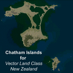
This project is a modified version of the Chatham_Islands.zip project which allows my landclass and airports to work seamlessly with the free Chatham Islands scenery available from Vector Land Class New Zealand. This package allows the user to switch back and forth easily between the different scenery combinations and also provides standalone Chatham and Pitt Island airports which can be used with the Vector Land Class (VLC) scenery on its own. It also allows the user to take advantage of the 15m terrain mesh and added water detail that comes with the VLC scenery. A modified Pitt Island AI runway is also included that is compatible with the 15m mesh. Chatham Islands/Tuuta Airport (NZCI), Napier (NZNR), and the Pitt Island Airstrip (NZPI) are included here. Scenery was created using Airport Design Editor X v1.47.07, SBuilderX 3.13, and the FSX Object Placement Tool. Scenery objects were added and modified from stock FSX scenery to resemble as closely as possible the actual airports.
| Filename: | Chatham_Islands_for_Vector_Land_Class_New_Zealand.zip |
| License: | Freeware |
| Added: | 15th July 2011, 21:54:43 |
| Downloads: | 931 |
| Author: | Carlyle Sharpe |
| Size: | 3.78 MB |


© 2001-2026 AVSIM Online
All Rights Reserved
Privacy Policy |