
Where Flight Simulation Enthusiasts Gather from Around the World!
AVSIM Library - Search Results

| Category: Flight Simulator 2004 - Scenery | |
| South Africa (Johannesburg(Transvaal)/Swasiland/Lesotho/Orange Freestate- 76M SRTM TERRAIN MESH) Part 2 |

|
File Description:
This mesh of South Africa includes beautiful areas of Transvaal(Johannesburg), Swasiland, Orange Freestate and Lesotho.It comes in 3 files. Part 2 of 3.
All the 3 files cover the area from S25 E26(!) to S30 E31.
| Filename: | South_Africa_JohannesburgTransvaalSwasilandLesotho.zip |
| License: | Freeware, limited distribution |
| Added: | 24th April 2004, 02:25:21 |
| Downloads: | 4,208 |
| Author: | Michael Speck |
| Size: | 15.87 MB |
| Category: Flight Simulator 2004 - Scenery | |
| South Africa (Johannesburg(Transvaal)/Swasiland/Lesotho/Orange Freestate- 76M SRTM TERRAIN MESH) Part 1 |
|
File Description:
This mesh of South Africa includes beautiful areas of Transvaal(Johannesburg), Swasiland, Orange Freestate and Lesotho.It comes in 3 files. Part 1 of 3.
All the 3 files cover the area from S25 E31 to S30 E31.
| Filename: | South_Africa_JohannesburgTransvaalSwasilandLesotho.zip |
| License: | Freeware, limited distribution |
| Added: | 24th April 2004, 02:06:43 |
| Downloads: | 5,024 |
| Author: | Michael Speck |
| Size: | 4.84 MB |
| Category: Flight Simulator 2004 - Scenery | |
| Northern Oman SRTM mesh |
|
File Description:
This terrain mesh scenery covers northern of Oman emirate as well as some parts of United Arab Emirates (Dubai, Sharjah, Ras Al Khaima, Fujiarah...). The southern and western boundaries are approx 22°N / 54°E.
No part of Iran has been included.
Based on SRTM Data (3 arcsec, 90m) and sampled to LOD9 resolution (76m) using Matthew Styles's program "SRTM To BGL v1.04". While only tested with Fs2004, this mesh should also run with FS2002.
SRTM 3 arcsec dataset has numerous void areas in this part of the world. But thanks to John Child's beautiful and powerful "Blackart" utility it's now easy to patch these areas with lower resolution dataset: I took the coupled interpolation method to merge SRTM 3-arcsec with SRTM 30-arcsec dataset when needed. This gives the best results, as patched areas with 30-arcsec data are blending naturally with surrounding 3-arcsec mesh. Of course the resolution of patched areas is quite poor, but still a bit better than the default LOD5 mesh.
| Filename: | Northern_Oman_SRTM_mesh.zip |
| License: | Freeware, limited distribution |
| Added: | 20th June 2004, 14:11:59 |
| Downloads: | 8,221 |
| Author: | Yohann Baptiste |
| Size: | 16.44 MB |
| Category: Flight Simulator 2004 - Scenery | |
| MESH 2010 SurAmerica - Peru |
|
Images related to this file:
File Description:
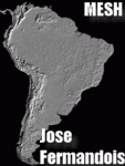
MESH FERMANDOIS 2010 V1.0 / Peru (index PE1,PE2,PE3) / A highly detailed 30m SRTM mesh for South America
| Filename: | MESH_2010_SurAmerica__Peru.zip |
| License: | Freeware |
| Added: | 7th December 2009, 10:12:19 |
| Downloads: | 2,671 |
| Author: | Jose Fermandois |
| Size: | 93.24 MB |
| Category: Flight Simulator X - Scenery | |
| Mesh Correction |
|
File Description:
These files correct wrong shape of FSX mesh at Lagoa Santa and Governador Valadares, Minas Gerais, Brazil, fixing the elevation to the real height level.
| Filename: | Mesh_Correction.zip |
| License: | Freeware, limited distribution |
| Added: | 16th March 2007, 01:55:24 |
| Downloads: | 942 |
| Author: | Cesar Marinho |
| Size: | 134.9 KB |
| Category: Combat Flight Simulator 1 and 2 - Scenery | |
| Libya Mesh |
|
File Description:
Mesh of Libya for Cfs2 and FS2002
3 Arc-Second, LOD 10 mesh for the whole of Libya. Second Release. File 7 of 7
| Filename: | Libya_Mesh.zip |
| License: | Freeware, limited distribution |
| Added: | 13th May 2003, 12:25:28 |
| Downloads: | 349 |
| Author: | Josiah Haut |
| Size: | 20 MB |
| Category: Combat Flight Simulator 1 and 2 - Scenery | |
| Libya Mesh |
|
File Description:
Mesh of Libya for Cfs2 and FS2002
3 Arc-Second, LOD 10 mesh for the whole of Libya. Second Release. File 6 of 7
| Filename: | Libya_Mesh.zip |
| License: | Freeware, limited distribution |
| Added: | 13th May 2003, 12:25:04 |
| Downloads: | 367 |
| Author: | Josiah Haut |
| Size: | 19.39 MB |
| Category: Flight Simulator 2004 - Scenery | |
| Antique Mesh |
|
File Description:
This mesh scenery covers the town of Bugasong in Antique,Panay Island,Philippines. Based on SRTM Data (3 arc/ sec), generated with Matthew Styles' program "SRTM To BGL v1.04", sampled to LOD9 resolution with 20 interpolation passes.
This mesh scenery compliments Jacques Marie's Philippine Scenery Mesh for FS2004.The only thing is that Jacques forgot to compile a large rectangular area mesh in Antique particularly in the town of Bugasong.This file will complete the Panay Island Mesh.
| Filename: | Antique_Mesh.zip |
| License: | Freeware |
| Added: | 4th January 2004, 04:44:18 |
| Downloads: | 3,215 |
| Author: | Ver Walter L. Gulfan |
| Size: | 2.65 MB |
| Category: Flight Simulator X - Scenery | |
| Açores Mesh |
|
File Description:
Açores Island Mesh, basead on SRTM elevation files, This mesh cover entire Açores Island, Portugal. Works on FS2002, 2004 and FSX.
Freeware by Cesar Marinho.
| Filename: | Aores_Mesh.zip |
| License: | Freeware |
| Added: | 22nd April 2007, 04:50:37 |
| Downloads: | 5,533 |
| Author: | Cesar Marinho |
| Size: | 567.5 KB |
| Category: Flight Simulator 2004 - Scenery | |
| Philippines Mesh |
|
File Description:
This is the third version of the LOD9 Philippines mesh made by Jacques MARIE from the new SRTM V2 data. The voids were filled with interpolated DTED0 data ( Blackart) or just interpolated (FSDEM).
| Filename: | Philippines_Mesh.zip |
| License: | Freeware |
| Added: | 15th December 2005, 17:41:04 |
| Downloads: | 6,741 |
| Author: | Jacques MARIE |
| Size: | 29.42 MB |


© 2001-2026 AVSIM Online
All Rights Reserved
Privacy Policy |