
Where Flight Simulation Enthusiasts Gather from Around the World!
AVSIM Library - Search Results

| Category: Flight Simulator 2002 - Scenery | |
| Patches for LOD7/LOD9 Terrain Meshes of British Columbia and Southeast Alaska |

|
File Description:
Patches (flatten files) for 108 lakes in British Columbia and Southeast Alaska that were either sunken below or raised above the terrain surface due to discrepancies between my add-on LOD7 and LOD9 mesh files and FS2002's default scenery. In some areas, such as the Prince George/Burns Lake region, the effect of the patches is obvious even from a great distance; in other areas, you'll have to be close to the lake to notice the difference. Also included are flatten files for nine airfields that had problems with sloping terrain or texture "bleed-through".
| Filename: | Patches_for_LOD7LOD9_Terrain_Meshes_of_British_Col.zip |
| License: | Freeware, limited distribution |
| Added: | 18th February 2003, 22:28:49 |
| Downloads: | 2,831 |
| Author: | Holger Sandmann |
| Size: | 613.45 KB |
| Category: X-Plane - Scenery | |
| Hawaii Photoreal - Niihau, Lehua and Kaula |
|
File Description:
The Hawaii Photoreal project from FSX is proud to bring a gorgeous island to X-Plane, Niihau! This is the first Hawaii Photoreal Scenery available with HD Mesh for X-Plane 10! Installation instructions are included. You must download both files for full HD Mesh experience. This scenery will not align correctly with default terrain and coastlines or those available with AlpilotX's HD Mesh 2. It should also be noted that this scenery will explode upon decompression - the true size of the folder is 341MB, whereas the download size is only 88MB. Make sure you aren't almost out of space. Niihau for X-Plane 10 includes customized HD Mesh for the entire island, including Lehua and Kaula. This isn't just processed DEM data - we have reviewed and perfected the coastlines and cliffs for ideal appearance. Please show support for this project by considering donating to the Hawaii Photoreal Project through the website.
| Filename: | Hawaii_Photoreal__Niihau_Lehua_and_Kaula.zip |
| License: | Freeware, limited distribution |
| Added: | 27th March 2016, 19:27:43 |
| Downloads: | 149 |
| Author: | Colin Stepney |
| Size: | 86.31 MB |
| Category: Flight Simulator 2002 - Scenery | |
| Italy Altiports Chamois and Tonal |
|
File Description:
Chamois and Tonal Passo are two Italian altisurfaces with sharp sloped bush runways. Chamois is located in the Valley of Aoste, NE of Aosta LIMW airport, in the valley which goes back vis-a-vis to the MT Cervin. Tonale Passo is located at the pass of Tonale in Dolomites, in the West of Bolzano LIPB. Best enjoyed with shareware mesh terrain by Thierry Pignot, pictures included.
| Filename: | Italy_Altiports_Chamois_and_Tonal.zip |
| License: | Freeware |
| Added: | 23rd November 2002, 19:31:52 |
| Downloads: | 2,495 |
| Author: | Guy Menoz |
| Size: | 2.33 MB |
| Category: Flight Simulator 2002 - Scenery | |
| The Cornwall China Clay Pits |
|
File Description:
This scenery represents the China clay pits at St Austell, Cornwall UK
It features the huge white clay tips and deep open cast mines in that area.
Know as the white mountains in Cornwall it is a very visible VFR object, excellent
for lining up for StMawgan AB.
Designed for use with addon mesh terrain such as Visual Flight's UKie2a and Lago's Terramesh
for the UK.
| Filename: | The_Cornwall_China_Clay_Pits.zip |
| License: | Freeware |
| Added: | 20th November 2002, 13:07:34 |
| Downloads: | 747 |
| Author: | Nick Ryall |
| Size: | 25.85 KB |
| Category: Flight Simulator 2002 - Scenery | |
| Tamar Suspension Bridges |
|
File Description:
This scenery represents the 2 Suspension Bridges between Plymouth in Devon and Saltash in Cornwall UK, The rail bridge was built by the famous engineer Isambard Kingdom Brunel and the model has an animated regional railways train crossing back and forth. The road bridge was built in 1961 and recently strengthened to take 2 more lanes of traffic Designed for use with addon mesh terrain.
| Filename: | Tamar_Suspension_Bridges.zip |
| License: | Freeware |
| Added: | 29th October 2002, 15:37:01 |
| Downloads: | 2,109 |
| Author: | Nick Ryall |
| Size: | 464.93 KB |
| Category: Flight Simulator 2004 - Scenery | |
| Vance W. Amory International Airport, St Kitss and Nevis (TKPN), Update to version 1.1 |
|
Images related to this file:
File Description:
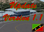
This zip-file contains a update to version 1.1 of my scenery for the Vance W. Amory International Airport in St. Kitts and Nevis. Original version 1.0 is required. Update contains:
- Removed flatten-area which conflicted with default FS9 mesh terrain settings.
- Corrected AFCAD file
- Fixed some small bugs
- New displaced threshold markings
- Modified windsocks
- Added working marshalers on parking spot 1 & 2 (front of the terminal)
| Filename: | Vance_W_Amory_International_Airport_St_Kitss_and_N.zip |
| License: | Freeware, limited distribution |
| Added: | 2nd April 2010, 01:24:50 |
| Downloads: | 1,828 |
| Author: | Marcel Ritzema |
| Size: | 57.77 KB |
| Category: Flight Simulator 2002 - Scenery | |
| Innsbruck (LOWI) Landclass, part 1 |
|
File Description:
Landclass files for Innsbruck, Austria (LOWI)and the state of Tyrol. Covered areas are Innsbruck Airport, the city of Innsbruck, 100 km of the Inn valley, the Wipptal Valley, the Stubaital Valley, the Zillertal Valley, the Gurgltal, seefelder Plateau, Mieminger Plateau, St. Johann Airport, Zell am See Airport (Salzburg) and some minor areas. Tested with FS2002 default terrain mesh. Created with John Cillis' fantastic Landclass Assistant.
| Filename: | Innsbruck_LOWI_Landclass_part_1.zip |
| License: | Freeware, limited distribution |
| Added: | 3rd June 2003, 01:22:04 |
| Downloads: | 3,907 |
| Author: | Wolfgang Kopp |
| Size: | 490.04 KB |
| Category: Flight Simulator 2004 - Scenery | |
| Northern Venezuela SRTM Mesh Part 1 |
|
File Description:
This terrain mesh scenery covers north of Venezuela (southern boundary is 8°48'N) and Dutch caribeans: Aruba, Curacao & Bonaire islands.
Based on SRTM Data (3 arcsec, 90m), generated with Matthew Styles's program "SRTM To BGL v1.04", sampled to LOD9 resolution (76m) with 5 interpolation passes.
This part contains Venezuela-NE.bgl, Venezuela-N.bgl plus all islands. See venezuela_n_mesh_pt1-1.jpg for the .BGL files coverage.
| Filename: | Northern_Venezuela_SRTM_Mesh_Part_1.zip |
| License: | Freeware |
| Added: | 7th October 2003, 18:15:30 |
| Downloads: | 8,986 |
| Author: | Yohann Baptiste |
| Size: | 13.93 MB |
| Category: Flight Simulator X - Scenery | |
| Lord howe Island and Balls Pyramid |
|
File Description:
This is a complete replacement for the default Lord Howe Island in Flight Simulator X and provides the following: Accurate coastlines, beaches, roads etc. - Accurate placement of settlements, golf course, etc. - Terrain mesh based on SRTM 90m data - Updated Lord Howe Island airport (YLHI) - GMax model of the Balls Pyramid rock outcrop - Updated landclass and waterclass - Boat traffic in the waters around the island
| Filename: | Lord_howe_Island_and_Balls_Pyramid.zip |
| License: | Freeware, limited distribution |
| Added: | 10th June 2007, 23:57:49 |
| Downloads: | 3,339 |
| Author: | Don Bush |
| Size: | 603.88 KB |
| Category: Flight Simulator 2002 - Scenery | |
| 76.4 Mesh Colombia File 2 to 7 |
|
File Description:
This new mesh in 76.4 M for Colombia is part of the newly freeware mesh Package for all Latin america mesh (Southamerica, caribean and Central america. This Package covers all colombia. For more Mesh Scenery details contact http://colombiamesh.tripod.com/.
| Filename: | 764_Mesh_Colombia_File_2_to_7.zip |
| License: | Freeware, limited distribution |
| Added: | 21st June 2003, 15:04:31 |
| Downloads: | 4,198 |
| Author: | Alvaro Romero Vargas |
| Size: | 26.41 MB |


© 2001-2026 AVSIM Online
All Rights Reserved
Privacy Policy |