
Where Flight Simulation Enthusiasts Gather from Around the World!
AVSIM Library - Search Results

| Category: Flight Simulator 2004 - Scenery | |
| Altitude adjustment for Dawson City CYDA |

|
Images related to this file:
File Description:
I discovered that the Northern Canada Terrain Mesh that I installed a while back was dumping part of my Dawson City Airport CYDA into a deep hole. I tried making a flatten to reduce the height of the terrain mesh land but that did not look at all realistic. So, the solution is to raise CYDA to 1,457 feet above sea level instead of the correct (correct according to the Nav Canada Supplement) level of 1,215 feet so that it melts into the surrounding terrain. There are still some rocky faces but at least they are not in the airfield. Do you need it? Not if your version looks ok. If it doesn't look ok then try this, but save your current version so you can go back to it if you need to.
| Filename: | Altitude_adjustment_for_Dawson_City_CYDA.zip |
| License: | Freeware, limited distribution |
| Added: | 23rd July 2019, 17:24:26 |
| Downloads: | 104 |
| Author: | Roger Wensley |
| Size: | 855.58 KB |
| Category: Flight Simulator 2004 - Scenery | |
| High-resolution 76-m (LOD9) Terrain Mesh and Scenery Enhancements for the Southern Canadian Rockies |
|
File Description:
Not simply an add-on mesh, these files include many scenery enhancements for the southern Rockies of British Columbia and Alberta. Coverage extends from Cranbrook to Calgary, and Hinton to Edmonton (N48.9-53.4 W112.3-116.3). The mesh source data are 3-arcsec (~90-m) Shuttle Radar (SRTM) files, compiled at LOD9 (76-m) resolution. All lake elevations (!) have been adjusted to eliminate the problems with the default lake data and to better fit the new terrain mesh. In addition, the Transcanada Highway/Icefields Parkway corridor in Banff National Park, from Canmore to the Hwy 11 junction, has been completely re-made, with dozens of alpine lakes (including Lake Louise, Moraine Lake, and Lake O'Hara), accurate transportation network, and landclass/waterclass updates based on satellite imagery. Due to significant changes in FS2004 to vector layering and autogen features, the special scenery enhancements cannot be used with FS2002. However, terrain mesh, lake corrections and landclass replacements will work well in FS2002.
| Filename: | Highresolution_76m_LOD9_Terrain_Mesh_and_Scenery_E.zip |
| License: | Freeware, limited distribution |
| Added: | 29th October 2003, 03:01:22 |
| Downloads: | 15,465 |
| Author: | Holger Sandmann |
| Size: | 21.81 MB |
| Category: Orbiter - Miscellaneous Files | |
| Descartes Enhancement Pack |
|
File Description:
These files are meant to compliment the previously released Descartes Highlands: Apollo 16 Landing Site lunar terrain mesh. The highlight of the Descarted Enhancement Pack is the A7LB EMU or "Lunar Spacesuit", worn by Commander John Young and LMP Charlie Duke on the moon. Additionally, there is an A7L EMU Ken Mattingly model that replaces the stock CMP mesh for use during the deep-space EVA trans-earth procedure.
| Filename: | Descartes_Enhancement_Pack.zip |
| License: | Freeware, limited distribution |
| Added: | 23rd October 2002, 15:51:24 |
| Downloads: | 2,304 |
| Author: | Rodion M. Herrera |
| Size: | 3.43 MB |
| Category: Flight Simulator X - Scenery | |
| Bella Coola Valley Landscape Enhancements |
|
File Description:
One of the most spectacular watersheds of British Columbia's Midcoast, the Bella Coola Valley looks pretty boring in its default FSX rendition and the oddly shaped default Bella Coola River cuts deep into the terrain. These files provide a terrain mesh made from CDED1 0.75-arcsec data (multi-LOD, with maximum resolution of 38-m grid spacing), updated land class, water class, and seasons files, and accurate placements of lakes, rivers, streams, roads, and bridges. Also added are the glaciers of the Monarch Mountain Icefield as well as several forestry roads and clearcuts in the side valleys. Main roads have vehicle traffic moving in both directions. Coverage area is N51*45'-52*40' and W125*35'-127*25'. These files are fully compatible with other landscape enhancements for FSX, such as FS Genesis North America terrain mesh, Cloud 9's X-class, Adam Mill's ground texture replacements, or Flight1's Ultimate Terrain Canada/Alaska.
| Filename: | Bella_Coola_Valley_Landscape_Enhancements.zip |
| License: | Freeware, limited distribution |
| Added: | 24th February 2007, 08:27:54 |
| Downloads: | 12,654 |
| Author: | Holger Sandmann |
| Size: | 15.68 MB |
| Category: Flight Simulator 2004 - Scenery | |
| Fort Fisher - Kure Beach Long Range Radar Complex |
|
File Description:
Today we are at the beach! Well, almost. The Fort Fisher - Kure Beach LRR [QGV] sits on a slight hill just 15 ft above the blue Atlantic. Just 1,500 feet to your east the surf is rolling up onto Kure Beach. This part of southern North Carolina is beautiful, and I suspect quite crowded with sun worshippers when the weather is appropriate. Start from Wilmington International [KILM] and wander 17 nm down the peninsula to the site. A helipad and terminal VOR [108.00] are included in the scenery. Scenery sets are provided for the FSGenesis 38m terrain mesh, and the standard fs9 terrain mesh.
| Filename: | Fort_Fisher__Kure_Beach_Long_Range_Radar_Complex.zip |
| License: | Freeware |
| Added: | 14th November 2007, 21:33:29 |
| Downloads: | 496 |
| Author: | Brett Delana |
| Size: | 292.64 KB |
| Category: Flight Simulator 2002 - Scenery | |
| New Lake Elevation Corrections |
|
File Description:
The files in this package contain an update correcting some new lake elevations for Quebec terrain mesh (FS2002) created from SRTM-3 : about 100 lakes in Laurentides Park and Charlevoix regions, 80 in Bas-Saint-Laurent and 86 in Beauce, Megantic and Eastern Townships.
| Filename: | New_Lake_Elevation_Corrections.zip |
| License: | Freeware, limited distribution |
| Added: | 17th May 2003, 18:30:57 |
| Downloads: | 1,321 |
| Author: | Gilles Gauthier |
| Size: | 428.59 KB |
| Category: Flight Simulator 2004 - Scenery | |
| Sierra Nevada Mesh. |
|
File Description:
Terrain mesh from SRTM 3 arc second (90m) data for Sierra Nevada Mountains.
This file covers the area of latitude N35-39 and longitude W117-119. Its lenght roughly from Bakersfield California to Reno Nevada, and width from the edge of Death Valley to Fresno.
| Filename: | Sierra_Nevada_Mesh.zip |
| License: | Freeware |
| Added: | 4th January 2004, 20:54:47 |
| Downloads: | 5,677 |
| Author: | Bart Dylkiewicz |
| Size: | 15.86 MB |
| Category: Flight Simulator 2004 - Scenery | |
| Puerto Rico, Isla de la Culebra, Benjamin Rivera Airport (CPX) v1.0 |
|
Images related to this file:
File Description:
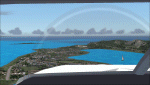
The Benjamin Rivera airport on Culebra Island in Puerto Rico. Added taxiways, terminals gate and parking. Works with the standard terrain or with the enhanced mesh by Jorge Robles (available here - puertoricomesh.zip).
Also includes a voice modification for the airport callsign (requires EditVoicepack to work)
| Filename: | Puerto_Rico_Isla_de_la_Culebra_Benjamin_Rivera_Air.zip |
| License: | Freeware, limited distribution |
| Added: | 6th June 2011, 18:23:04 |
| Downloads: | 483 |
| Author: | Alf B. Meier |
| Size: | 86.54 KB |
| Category: Flight Simulator 2002 - Scenery | |
| NY-New York City, Central Park Area Terrain Mesh (10m) |
|
File Description: Take a break and enjoy Sunday afternoon in the park. This high resolution mesh demonstrates the amount of detail FS2002 is able to display. But you will not see any improvement in the park if you are still using the default value of TERRAIN_MAX_VERTEX_LEVEL=19 (in the [TERRAIN] section) of your fs2002.cfg file! This value is adequate for the default mesh, but will not display all the additional detail available in mesh constructed from 30m or better source data. I recommend a value of 21 for the most detail, but a value of 20 may be preferable if FPS is a serious problem. Hop in your favorite helicopter, depart from La Guardia (KLGA) airport, and head west toward the city. (If you are new to helicopters, set your Aircraft realism to Easy and turn off Crash Detection while getting started - and relax in this scenic park!)
| Filename: | NYNew_York_City_Central_Park_Area_Terrain_Mesh_10m.zip |
| License: | Freeware, limited distribution |
| Added: | 21st July 2002, 17:35:04 |
| Downloads: | 2,845 |
| Author: | Steve Greenwood |
| Size: | 1017.33 KB |
| Category: Flight Simulator 2004 - Scenery | |
| Terrain Mesh (LOD08) for Nunavut, Canada (File 1 of 4) |
|
File Description:
The files in this package contain a new 153m (LOD08) terrain mesh for Nunavut, Canada ( and northern part of Northwest Territories) to use with FS2002 and FS2004. The source data is GeoBase (CDED – 1 : 250 000). All data were compiled and edited in MicroDEM 7.01 alpha and resampled to LOD08 (Level of Details), or 152.88 meters horizontal resolution, with the Microsoft Terrain Software Developer's Kit (SDK) utilities.
(Nunavut8a.zip, Nunavut8b.zip Nunavut8c.zip Nunavut8d.zip - 4 Parts).
| Filename: | Terrain_Mesh_LOD08_for_Nunavut_Canada_File_1_of_4.zip |
| License: | Freeware, limited distribution |
| Added: | 30th December 2003, 23:41:21 |
| Downloads: | 4,791 |
| Author: | Gilles Gauthier |
| Size: | 32.24 MB |


© 2001-2026 AVSIM Online
All Rights Reserved
Privacy Policy |