
Where Flight Simulation Enthusiasts Gather from Around the World!
AVSIM Library - Search Results

| Category: Flight Simulator 2004 - AFCAD Files | |
| MHTG Tegucigalpa / Toncontin |

|
File Description:
AFCAD2 file for MHTG, corrected runway length, up-to date parking positions, both based on actual airport charts as well as local reports. Suitable for real-world AI-traffic.
Recommended but not required: Central America terrain mesh by Josef Kusters.
| Filename: | MHTG_Tegucigalpa__Toncontin.zip |
| License: | Freeware, limited distribution |
| Added: | 9th March 2004, 23:56:43 |
| Downloads: | 1,098 |
| Author: | Karl F. Hajek |
| Size: | 4.33 KB |
| Category: Flight Simulator 2004 - Scenery | |
| Greece SRTM Mesh Part 1 |
|
File Description:
This terrain mesh scenery covers Greece, including all Aegean sea islands, plus most parts of Albania and Macedonia up to 41°50'N. Some parts of Bulgaria and Turkey are also included in northern and eastern boundaries of the mesh. The greek island of Crete isn't part of this mesh because SRTM data isn't yet released for the whole island.
Based on SRTM Data (3 arcsec, 90m), generated with Matthew Styles's program "SRTM To BGL v1.04", sampled to LOD9 resolution (76m). While only tested with Fs2004, this mesh should also run with FS2002.
This part contains northern parts of the mesh: Greece-N.bgl, Greece-NE1.bgl and Greece-NE2.bgl. See Greece_Mesh_Part1-1.jpg for exact bgl coverage.
| Filename: | Greece_SRTM_Mesh_Part_1.zip |
| License: | Freeware |
| Added: | 10th November 2003, 02:08:20 |
| Downloads: | 10,987 |
| Author: | Yohann Baptiste |
| Size: | 17.75 MB |
| Category: Flight Simulator 2002 - Scenery | |
| BC2003 |
|
File Description:
BC2003 is a combination of all my previous BC Bush creations. It has been edited to be compatible with Holger Sandmann's BC Mesh Terrain. It is also compatible with Ray Hallocks creations. This package also works fine if you do not want to install BC Mesh. After downloading, you must extract into a temp folder and read the installation document. This is a must. Please enjoy.
| Filename: | BC2003.zip |
| License: | Freeware |
| Added: | 27th April 2003, 16:02:33 |
| Downloads: | 1,137 |
| Author: | Paul Jensen |
| Size: | 13.87 MB |
| Category: Flight Simulator 2004 - Scenery | |
| Alaska Perry Island - PYL Small Floatplane |
|
File Description:
Small scenery in Alaska of a flatplane outpost at Perry Island. You need Lago's FS Enhancer 2004 program to use this scenery. This is a fairly short flight away from some of my other Alaska sceneries. Made on top of FS Genesis terrain mesh but it's so near the shore and there isn't much ground change I think it's alright for use with any other mesh.
| Filename: | Alaska_Perry_Island__PYL_Small_Floatplane.zip |
| License: | Freeware |
| Added: | 7th July 2004, 23:50:10 |
| Downloads: | 1,772 |
| Author: | David King |
| Size: | 47.32 KB |
| Category: Flight Simulator 2004 - Scenery | |
| Southern California Mesh |
|
File Description:
Terrain mesh from SRTM 3 arc second (90m) data for Southern California.
This file covers the area of latitude N32-34 and longitude W116-118.
Its length roughly from Tijuana Mexico to Barstow in Mojave Desert,
and width from the edge of Salton Sea to Malibu.
This file connects with the "SierraNevadaMesh.Zip", both files
offer a continuous mesh coverage from San Diego California to Reno Nevada.
| Filename: | Southern_California_Mesh.zip |
| License: | Freeware |
| Added: | 5th January 2004, 17:58:40 |
| Downloads: | 6,136 |
| Author: | Bart Dylkiewicz |
| Size: | 7.76 MB |
| Category: Flight Simulator 2004 - Scenery | |
| Alps LOD10 Topo Mesh - Austria and Italy |
|
Images related to this file:
File Description:
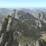
Yet another terrain mesh package of the European Alps? Well, this one is different in that it is NOT primarily based on the Shuttle Radar (SRTM) data with their incomplete coverage of prominent peaks and ridges. Instead, most of the source data for this project were developed over many months by Jonathan de Ferranti using detailed topographic maps. While Jonathan's work is unrelated to flight simulation he kindly gave me permission to compile his data for use in FS. The result is a wonderful improvement in detail and accuracy over any existing SRTM- or DTED-based mesh file, freeware or commercial (a link to an extensive set of screenshot comparisons is included in the read-me file).
I've compiled the source data at LOD10 (38-m) grid resolution because the coverage area is smaller than most existing mesh files. Thus, anyone can use these files without having to first uninstall their current mesh set. Also included are LOD9 and LO8 buffer mesh files. Note: if you own Austria Professional 2004 with its 1:50,000 scale terrain mesh then you don't need this package!
| Filename: | Alps_LOD10_Topo_Mesh__Austria_and_Italy.zip |
| License: | Freeware, limited distribution |
| Added: | 30th May 2010, 09:46:58 |
| Downloads: | 62,954 |
| Author: | Holger Sandmann, Jonathan de Ferranti |
| Size: | 73.32 MB |
| Category: Flight Simulator 2004 - Scenery | |
| Alps LOD10 Topo Mesh - Switzerland and France |
|
Images related to this file:
File Description:
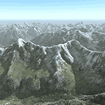
Yet another terrain mesh package of the European Alps? Well, this one is different in that it is NOT primarily based on the Shuttle Radar (SRTM) data with their incomplete coverage of prominent peaks and ridges. Instead, most of the source data for this project were developed over many months by Jonathan de Ferranti using detailed topographic maps. While Jonathan's work is unrelated to flight simulation he kindly gave me permission to compile his data for use in FS. The result is a wonderful improvement in detail and accuracy over any existing SRTM- or DTED-based mesh file, freeware or commercial (a link to an extensive set of screenshot comparisons is included in the read-me file).
I've compiled the source data at LOD10 (38-m) grid resolution because the coverage area is smaller than most existing mesh files. Thus, anyone can use these files without having to first uninstall their current mesh set. Also included are LOD9 and LO8 buffer mesh files. Note: if you own Switzerland Professional with its high-resolution terrain mesh then you don't need this package, at least not the Switzerland files!
| Filename: | Alps_LOD10_Topo_Mesh__Switzerland_and_France.zip |
| License: | Freeware, limited distribution |
| Added: | 30th May 2010, 09:51:03 |
| Downloads: | 58,994 |
| Author: | Holger Sandmann, Jonathan de Ferranti |
| Size: | 50.03 MB |
| Category: Flight Simulator X - Scenery | |
| Mesh-South America MeSA_G04 |
|
File Description:
FSX Mesh South America Project:
This terrain mesh file is a part of a whole project covering all the Continent
of South America and some islands, divided in tiles identified in a map by its
column (letters) and rows (numbers).
Those files were multi-LOD compiled from 90m SRTM2 source data, reprocessed
with 3DEM to remove voids and spikes, providing a 76.4m (LOD9) horizontal
resolution topography intended for use only in FSX updated with SP1.
Although not well documented, to improve performance, the updated FSX loads DEM
files in threads and only the closer terrain (about 5-10 NM from the point of view)
is rendered in high detail, while at far distances FSX shows up its default low
resolution mesh, when there is not a third part terrain mesh compiled in all
others intermediate level of details (multi-LOD).
THIS FILE:
FSX_MeSA_G04 (Column G x Row 04)
covers the area inside the boundaries:
N = 0º 0' S; S = 5º 37.5' S;
W = 45º 0' W; E = 37º 30' W;
AUTHORS:
Hely Heck Junior - Magrao ( [email protected] )
and Jose Lobo ( [email protected] )
TerraBrasilis: www.terra-brasilis.org
| Filename: | MeshSouth_America_MeSA_G04.zip |
| License: | Freeware |
| Added: | 15th June 2007, 00:10:58 |
| Downloads: | 867 |
| Author: | Hely Heck Jr. and José Lôbo |
| Size: | 35.9 MB |
| Category: Flight Simulator X - Scenery | |
| Mesh South America / MeSA B11 |
|
File Description:
FSX Mesh South America Project:
This terrain mesh file is a part of a whole project covering all the Continent
of South America and some islands, divided in tiles identified in a map by its
column (letters) and rows (numbers).
Those files were multi-LOD compiled from 90m SRTM2 source data, reprocessed
with 3DEM to remove voids and spikes, providing a 76.4m (LOD9) horizontal
resolution topography intended for use only in FSX updated with SP1.
Although not well documented, to improve performance, the updated FSX loads DEM
files in threads and only the closer terrain (about 5-10 NM from the point of view)
is rendered in high detail, while at far distances FSX shows up its default low
resolution mesh, when there is not a third part terrain mesh compiled in all
others intermediate level of details (multi-LOD).
THIS FILE:
FSX_MeSA_B11 (Column B x Row 11)
covers the area inside the boundaries:
N = 39º 22,5' S; S = 45º 0' S;
W = 82º 30' W; E = 75º 0' W;
AUTHORS:
Hely Heck Junior - Magrao ( [email protected] )
and Jose Lobo ( [email protected] )
TerraBrasilis: www.terra-brasilis.org
| Filename: | Mesh_South_America__MeSA_B11.zip |
| License: | Freeware |
| Added: | 11th June 2007, 22:11:28 |
| Downloads: | 1,154 |
| Author: | Hely Heck Jr. and José Lôbo |
| Size: | 1.55 MB |
| Category: Flight Simulator X - Scenery | |
| Mesh South America / MeSA B13 |
|
File Description:
FSX Mesh South America Project:
This terrain mesh file is a part of a whole project covering all the Continent
of South America and some islands, divided in tiles identified in a map by its
column (letters) and rows (numbers).
Those files were multi-LOD compiled from 90m SRTM2 source data, reprocessed
with 3DEM to remove voids and spikes, providing a 76.4m (LOD9) horizontal
resolution topography intended for use only in FSX updated with SP1.
Although not well documented, to improve performance, the updated FSX loads DEM
files in threads and only the closer terrain (about 5-10 NM from the point of view)
is rendered in high detail, while at far distances FSX shows up its default low
resolution mesh, when there is not a third part terrain mesh compiled in all
others intermediate level of details (multi-LOD).
THIS FILE:
FSX_MeSA_B13 (Column B x Row 13)
covers the area inside the boundaries:
N = 50º 37,5' S; S = 56º 15' S;
W = 82º 30' W; E = 75º 0' W;
AUTHORS:
Hely Heck Junior - Magrao ( [email protected] )
and Jose Lobo ( [email protected] )
TerraBrasilis: www.terra-brasilis.org
| Filename: | Mesh_South_America__MeSA_B13.zip |
| License: | Freeware |
| Added: | 11th June 2007, 22:12:07 |
| Downloads: | 1,160 |
| Author: | Hely Heck Jr. and José Lôbo |
| Size: | 1.82 MB |


© 2001-2026 AVSIM Online
All Rights Reserved
Privacy Policy |