
Where Flight Simulation Enthusiasts Gather from Around the World!
AVSIM Library - Search Results

| Category: Flight Simulator 2004 - Scenery | |
| Popocatepetl Volcano |

|
File Description:
This scenery will bring to life Popocatepetl volcano in Mexico, this volcano is just 70km from Mexico city. I have used terrain mesh by FSGenesis, but should work with any good 76.4m mesh. Sound package included by Lou Frost, you will need FSEnhancer by Lago to hear sounds. Scenery can be used with or without sound package. See readme instructions for full details.
| Filename: | Popocatepetl_Volcano.zip |
| License: | Freeware, limited distribution |
| Added: | 18th July 2005, 04:15:08 |
| Downloads: | 1,391 |
| Author: | Kym Burton, Lou Frost |
| Size: | 636.76 KB |
| Category: Flight Simulator 2002 - Scenery | |
| Lundy Island UK |
|
File Description:
This scenery represents Lundy Island in the Bristol Channel UK it features a small village with a church, a revolving wind turbine, 3 lighthouses and the 400 metre grass strip, designed primarily for use with addon mesh terrain.
| Filename: | Lundy_Island_UK.zip |
| License: | Freeware |
| Added: | 22nd October 2002, 15:20:47 |
| Downloads: | 1,218 |
| Author: | Nick Ryall and Steve Mullen |
| Size: | 1020.92 KB |
| Category: Flight Simulator X - Miscellaneous Files | |
| Morocco Vectors VFR |
|
Images related to this file:
File Description:
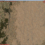
This project add and update vectors for Morocco and Western Sahara. Accurate coastline, lakes, roads, railways and river/streams. This vectors are optimized with Terrain Mesh SRTM 1 arc sec (LOD11). Scenery for FSX//P3Dv1/2/3/4.
| Filename: | Morocco_Vectors_VFR.zip |
| License: | Freeware |
| Added: | 9th June 2017, 21:04:48 |
| Downloads: | 773 |
| Author: | Giovanni Miduri |
| Size: | 20.49 MB |
| Category: Flight Simulator 2004 - Scenery | |
| Guadalupe Mountains National Park (Version 2) SRTM30_1ArcSec Terrain Mesh |
|
File Description:
This 38m terrain mesh is centered in the 'Panhandle' region of Western Texas.
Coverage area: From West 104.5° to West 105° and North 31.7° to North 32.2°.
It includes Guadalupe Mountains National Park and the surrounding mountains
of Lincoln National Forest. Version 2 replaces my former release of 'Guadalupe_Mountains_SRTM30.zip' which covered a too large area and had some scenery anomalies (craters). The new version now fixes these errors.
| Filename: | Guadalupe_Mountains_National_Park_Version_2_SRTM30.zip |
| License: | Freeware, limited distribution |
| Added: | 28th December 2003, 18:33:52 |
| Downloads: | 2,062 |
| Author: | Andreas Trawny |
| Size: | 1.27 MB |
| Category: Flight Simulator 2004 - Scenery | |
| Backcountry USFS fields for 19m terrain mesh in Idaho |
|
Images related to this file:
File Description:
These backcountry airfields are for use with the FSGenesis 19m mesh of Idaho; they almost certainly do not work without it. I also have Ultimate Terrain installed, with the settings as noted. The 15 airfields included here are almost all United States Forestry Service fields: 1U1 Moose Creek, 2ID7 Cayuse Creek, 2U5 Shearer, 3U1 Warren, 12ID Flying B Ranch, 24K Krassel, 75c Orogrande, I08 Cabin Creek, ID67 Lower Loon Creek, ID76 Wilson Bar, S81 Indian Creek, S92 Fish Lake, U54 Bernard, U79 Chamberlain, U81 Cold Meadows. There is also a 85U bgl included to remove the remnants of Soldier Bar which is impossible to make into a scenery with the terrain mesh, and spoiled the surroundings if left untouched and intact. The screenshots are typical examples giving a good impression of the terrain.
| Filename: | Backcountry_USFS_fields_for_19m_terrain_mesh_in_Id.zip |
| License: | Freeware, limited distribution |
| Added: | 22nd July 2019, 16:38:48 |
| Downloads: | 100 |
| Author: | Roger Wensley |
| Size: | 22.2 MB |
| Category: Flight Simulator 2004 - Scenery | |
| Central Volcanic Belt, Mexico 76m SRTM Terrain Mesh & Landclass |
|
File Description:
USGS SRTM 3 arc-second, resampled to LOD9 (76 meters). This is a terrain mesh & landclass scenery of the Central Volcanic Belt in Mexico. The following volcanoes can be found in this area: Popocatepetl, Iztaccihuatl, La Malinche, Pico de Orizaba and Cofre de Perote. Also included are some volcanic eruption effects.
| Filename: | Central_Volcanic_Belt_Mexico_76m_SRTM_Terrain_Mesh.zip |
| License: | Freeware, limited distribution |
| Added: | 11th April 2004, 06:32:55 |
| Downloads: | 7,629 |
| Author: | Andreas Trawny |
| Size: | 2.9 MB |
| Category: Flight Simulator 2004 - Scenery | |
| Joshua Tree + San Bernardino Mountains, California 38m Terrain Mesh |
|
File Description:
USGS SRTM30 1 arc-second, resampled to LOD10 (38.2 meters). This terrain mesh is centered at Joshua Tree National Park in southern California. Coverage area: From West 115.1° to West 117.4° and North 33.7° to North 34.3°. It includes the National Park, the Palm Springs area with Mount San Jacinto and the San Bernardino Mountains.
| Filename: | Joshua_Tree__San_Bernardino_Mountains_California_3.zip |
| License: | Freeware, limited distribution |
| Added: | 4th January 2004, 21:05:58 |
| Downloads: | 3,715 |
| Author: | Andreas Trawny |
| Size: | 4.57 MB |
| Category: Flight Simulator 2004 - Scenery | |
| Azores Islands, North Atlantic Ocean 76m SRTM Terrain Mesh |
|
File Description:
USGS SRTM 3 arc-second, resampled to LOD9 (76 meters). This is a terrain mesh scenery of the Azores Islands in the North Atlantic Ocean. It includes the following islands: Flores, Corvo, Faial, Pico with 7,711 feet (2,351m) high Pico Volcano, Sao Jorge, Graciosa, Terceira, Sao Miguel and Santa Maria.
| Filename: | Azores_Islands_North_Atlantic_Ocean_76m_SRTM_Terra.zip |
| License: | Freeware, limited distribution |
| Added: | 8th April 2004, 03:20:23 |
| Downloads: | 7,989 |
| Author: | Andreas Trawny |
| Size: | 1.81 MB |
| Category: Flight Simulator 2004 - Scenery | |
| Guatemala & Honduras SRTM Mesh Part 1 |
|
File Description:
This terrain mesh scenery was made to fit Jozef Kusters' Nicaragua mesh on its south-eastern edges. It covers Guatemala, western & northern Honduras (including Isl de la Bahia - Roatan), Belize and Salvador. Based on SRTM Data (3 arc/sec), generated with Matthew Styles's program "SRTM To BGL v1.04", sampled to LOD9 resolution (76m) with 5 interpolation passes. While tested under Fs2004, this mesh should also run in FS2002.
This part contains Guatemala-S.BGL. See guatemala_honduras_mesh_pt1.jpg for .BGL files coverage.
| Filename: | Guatemala__Honduras_SRTM_Mesh_Part_1.zip |
| License: | Freeware |
| Added: | 30th September 2003, 15:19:59 |
| Downloads: | 6,991 |
| Author: | Yohann Baptiste |
| Size: | 16.92 MB |
| Category: Flight Simulator 2004 - Scenery | |
| FYKT, J. G. H. Van Der Wath airport, Keetmanshoop, Namibia for FS9 |
|
File Description:
Based on googleEarth picture. Ez-scenery and rwy12 objects included. Compatible with Holger Sandmann's Namibia LOD9 Terrain mesh (namibia_ne.zip, namibia_nw.zip, namibia_se.zip, namibia_sw.zip, namibia_cp.zip) as well as his namibia_scenery_updates.zip, all found at avsim.com. (re-upload, originally uploaded 23rd November 2008)
| Filename: | FYKT_J_G_H_Van_Der_Wath_airport_Keetmanshoop_Namib.zip |
| License: | Freeware |
| Added: | 16th May 2010, 23:59:11 |
| Downloads: | 1,081 |
| Author: | Detlev J. Rohmer |
| Size: | 5.88 MB |


© 2001-2026 AVSIM Online
All Rights Reserved
Privacy Policy |